
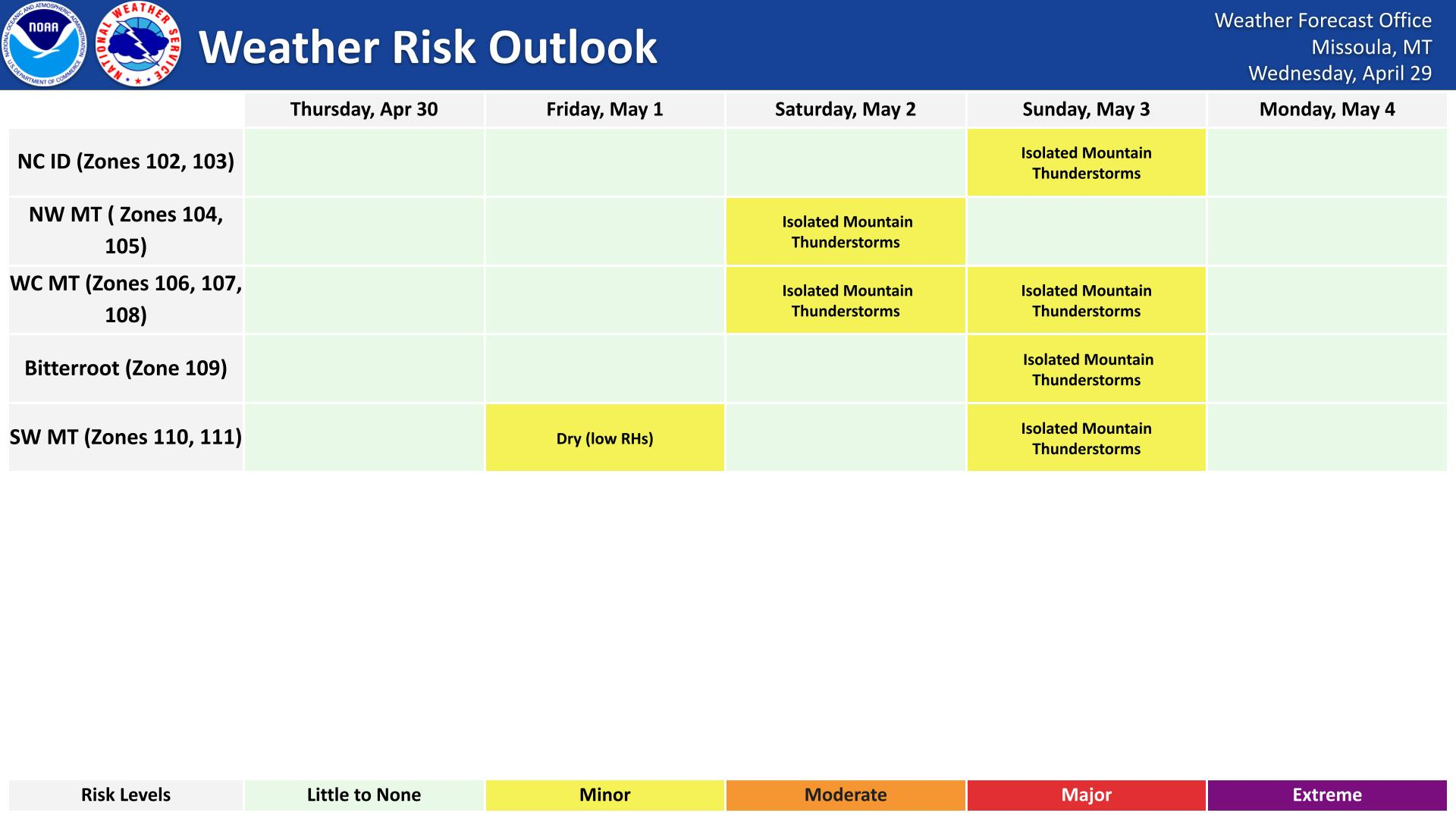
Dangerous heat expands across the Desert Southwest, Plains, Mississippi Valley and Midwest. Critical fire weather for portions of the Intermountain West. Risk for severe thunderstorms and flash flooding across the Upper Midwest/Great Lakes, Ohio Valley, and portions of the mid-Atlantic. Active monsoonal moisture fuels thunderstorms over the Southwest. Hurricane Fausto in the Pacific, should weaken Read More >
 |
 |
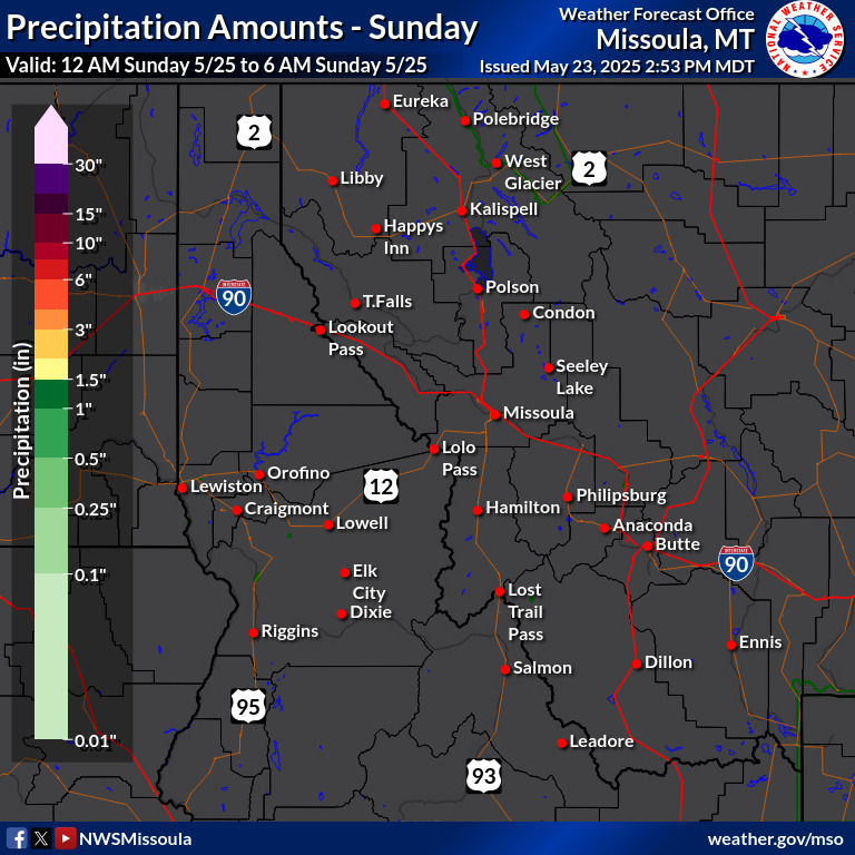
| Temperature | Precipitation |
 |
 |
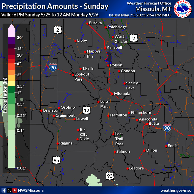
| Temperature | Precipitation |
 |
 |
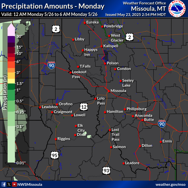
| Temperature | Precipitation |
 |
 |
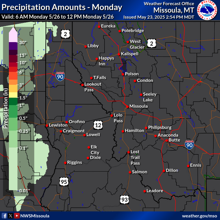
| Temperature | Precipitation |
This Morning |
This Afternoon |
 |
 |
This Evening |
Tonight |
 |
 |
Tomorrow Morning |
Tomorrow Afternoon |
 |
 |
Tomorrow Evening |
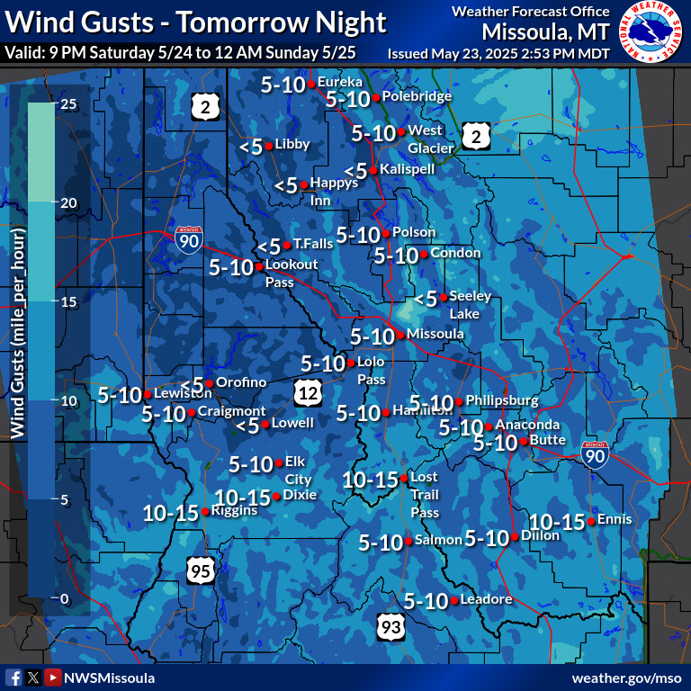
Tomorrow Night |
 |
 |
Day 3 Morning |
Day 3 Afternoon |
 |
 |
Day 3 Evening |
Day 3 Night |
 |
 |
Day 4 Morning |
Day 4 Afternoon |
 |
 |
Day 4 Evening |
Day 4 Night |
 |
 |
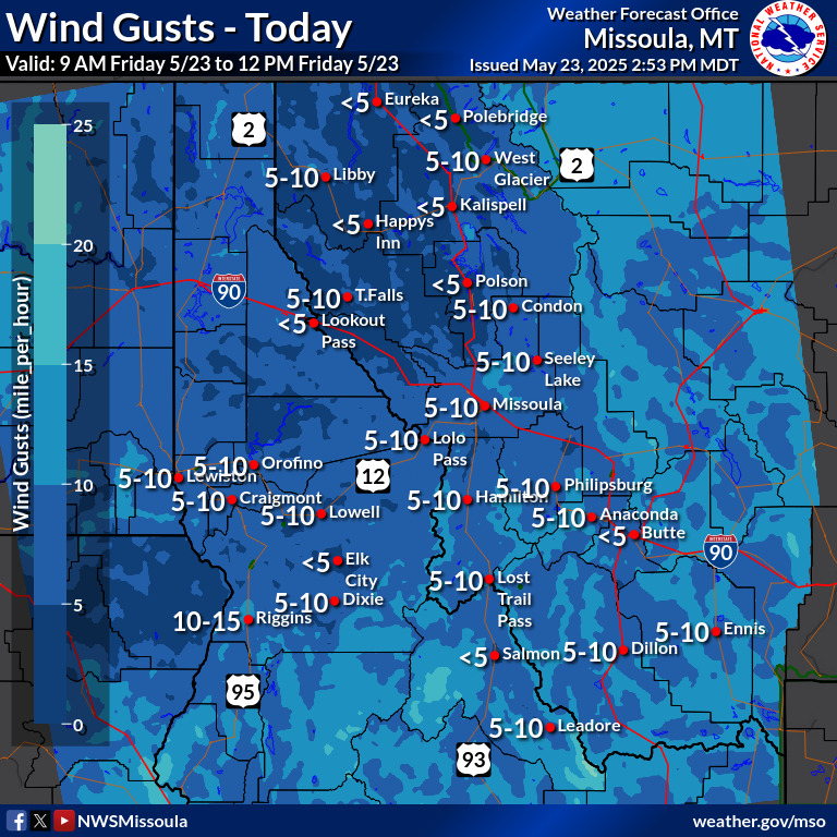
Wind Gusts This Morning |
Wind Gusts Late This Morning |
 |
 |
Wind Gusts Early This Afternoon |
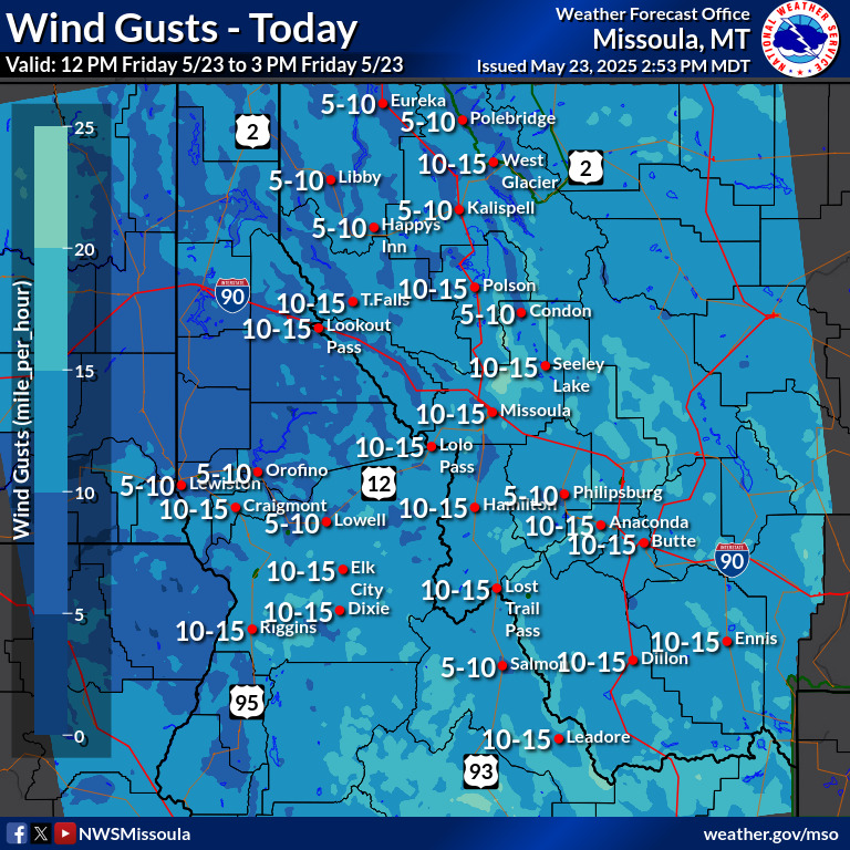
Wind Gusts This Afternoon |
 |
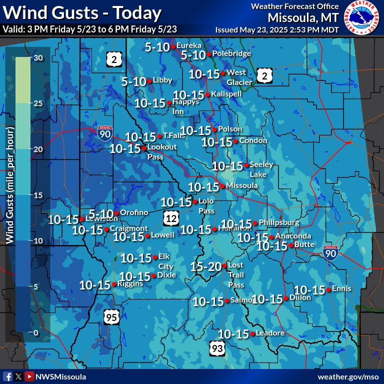 |
Wind Gusts This Evening |
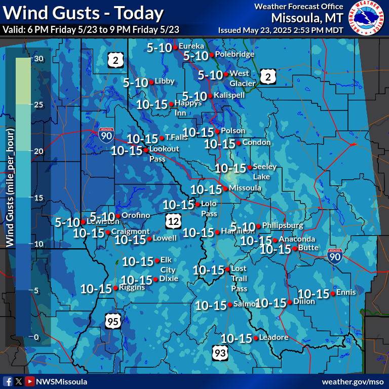
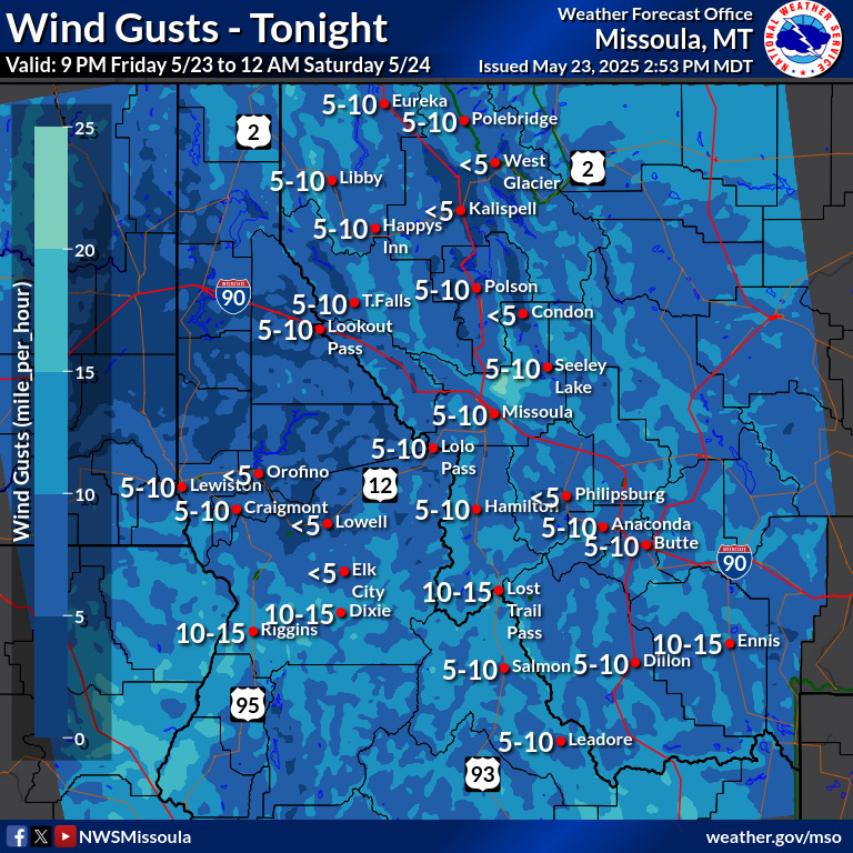
Wind Gusts Tonight |
 |
 |
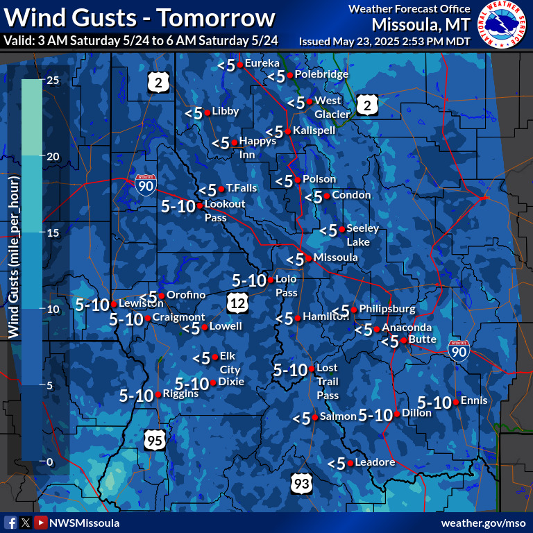
Wind Gusts Overnight |
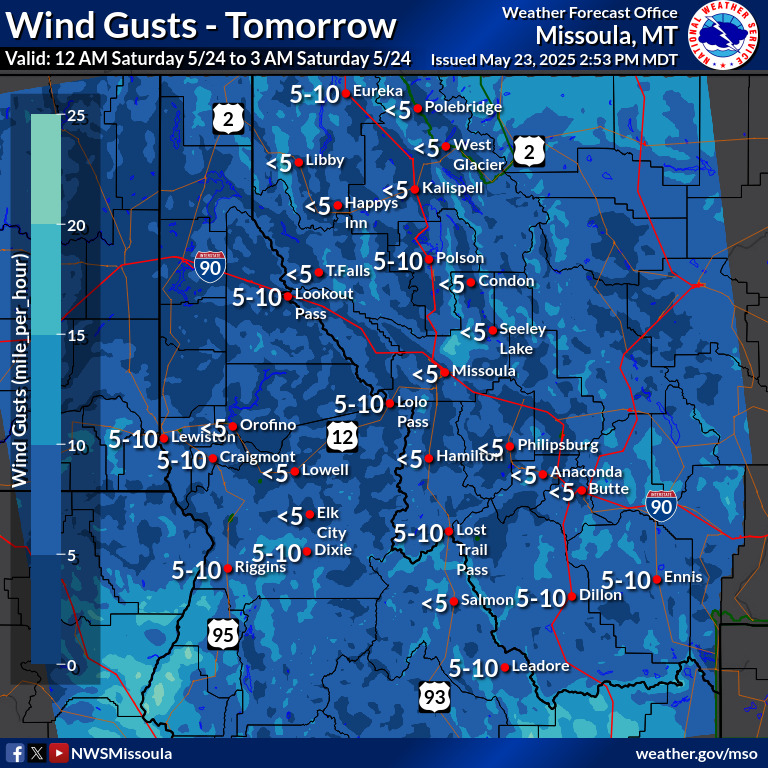
Wind Gusts Early Tomorrow Morning |
 |
 |
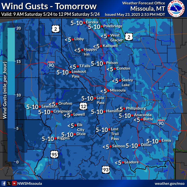
Wind Gusts Tomorrow Morning |
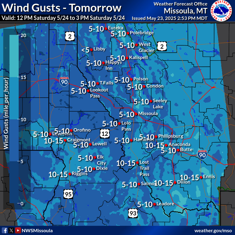
Wind Gusts Late Tomorrow Morning |
 |
 |
Wind Gusts Early Tomorrow Afternoon |
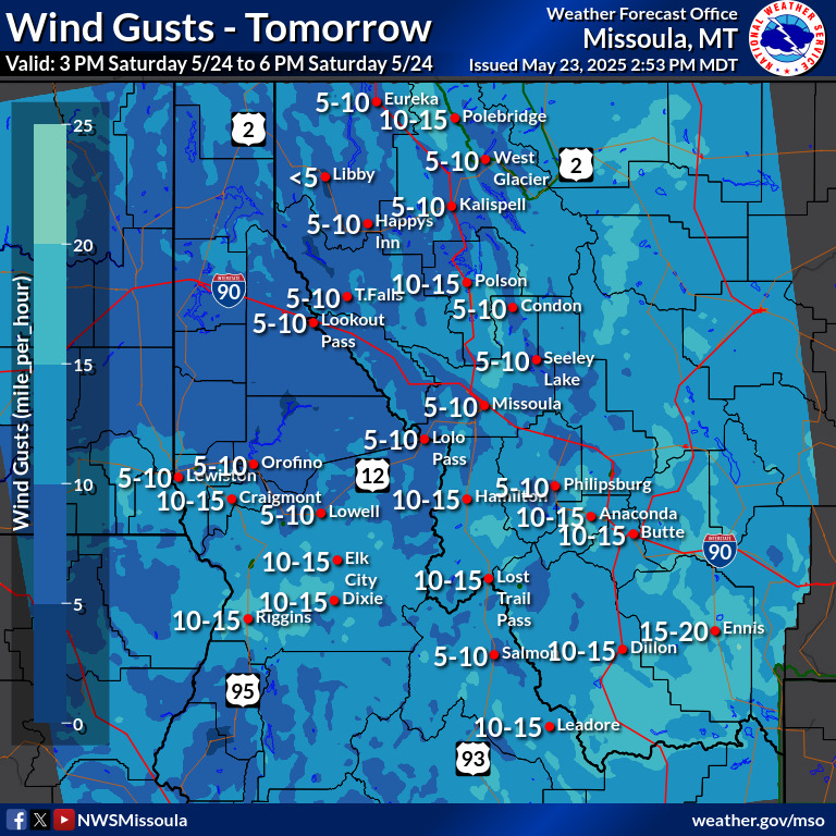
Wind Gusts Tomorrow Afternoon |
 |
 |
Wind Gusts Tomorrow Evening |
Wind Gusts Tomorrow Night |
 |
 |
| GEOCOLOR | VISIBLE |
 |
 |
| Small | Loop | Large | Small | Loop | Large |
| IR/Hot Spot | Water Vapor |
 |
 |
| Small | Loop | Large | Small | Loop | Large |
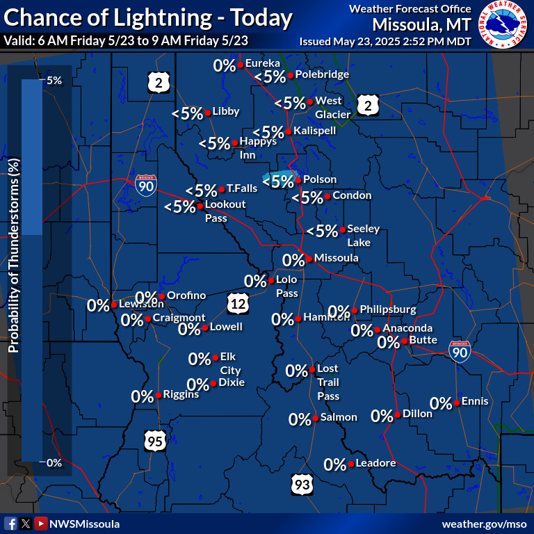
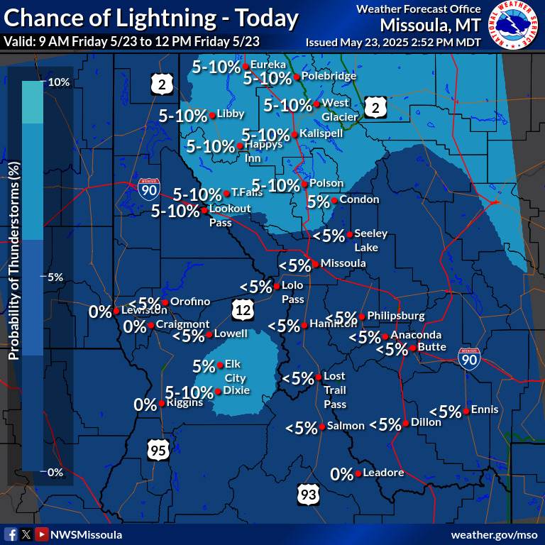
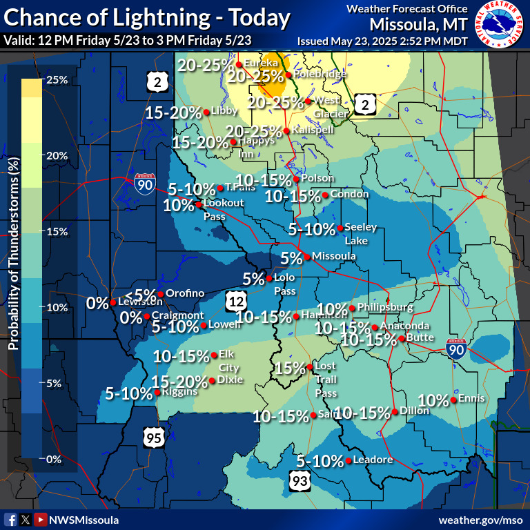
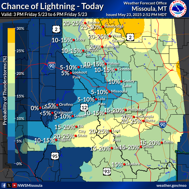
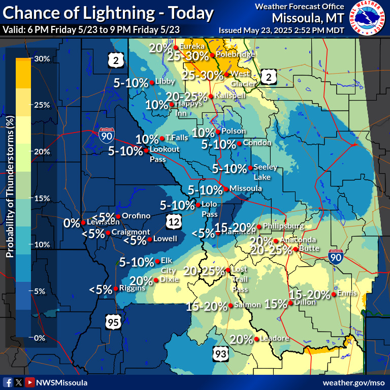
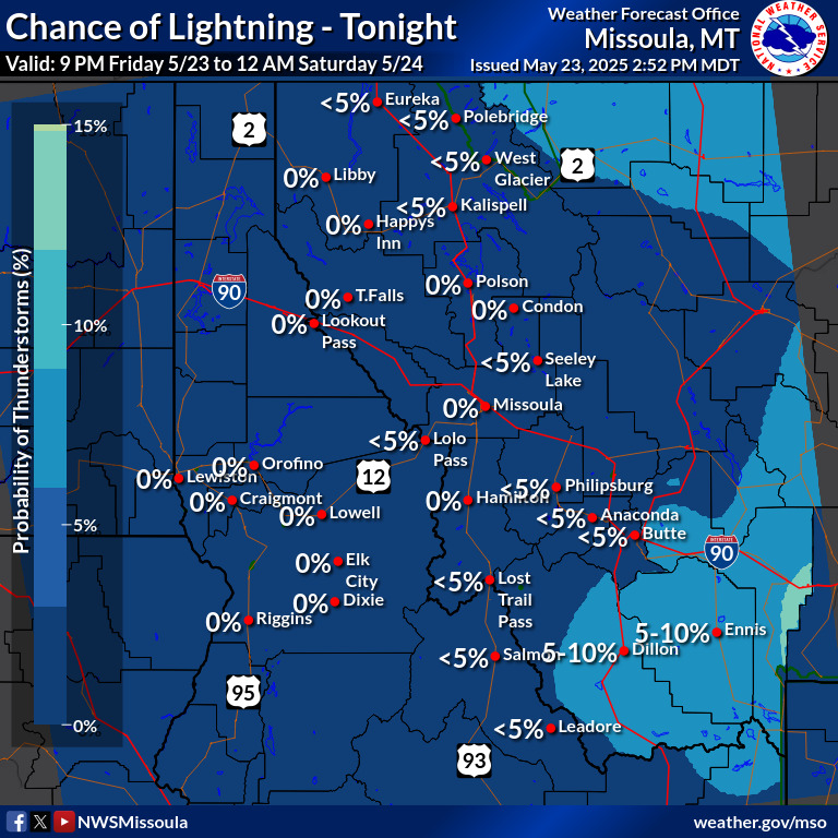
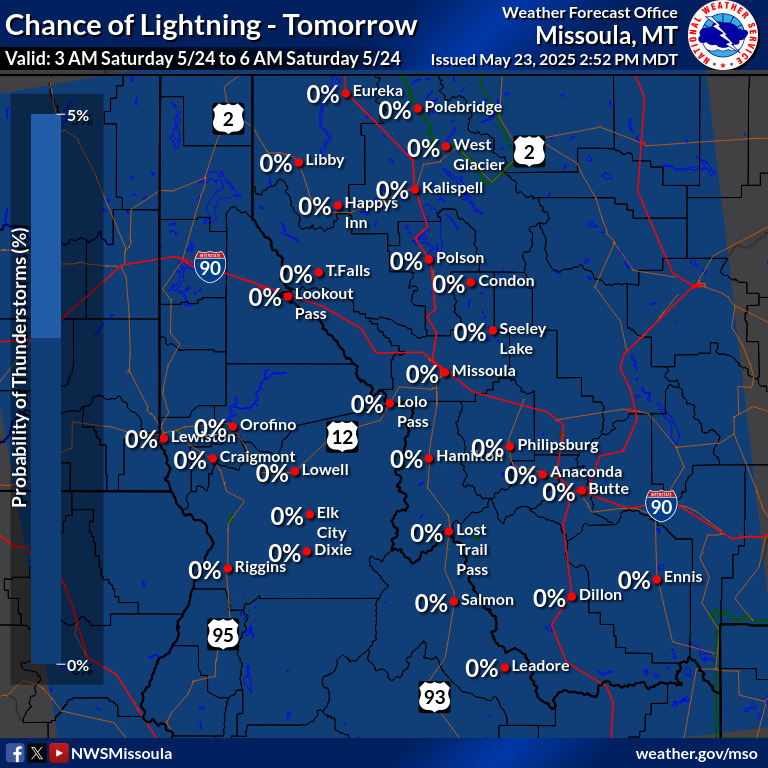
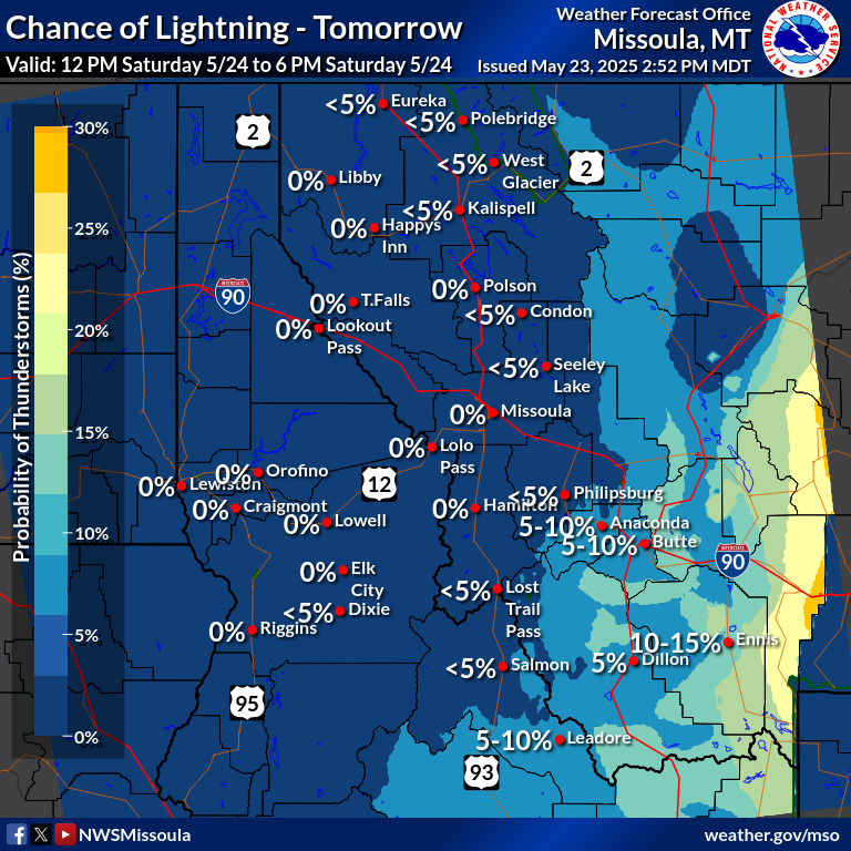
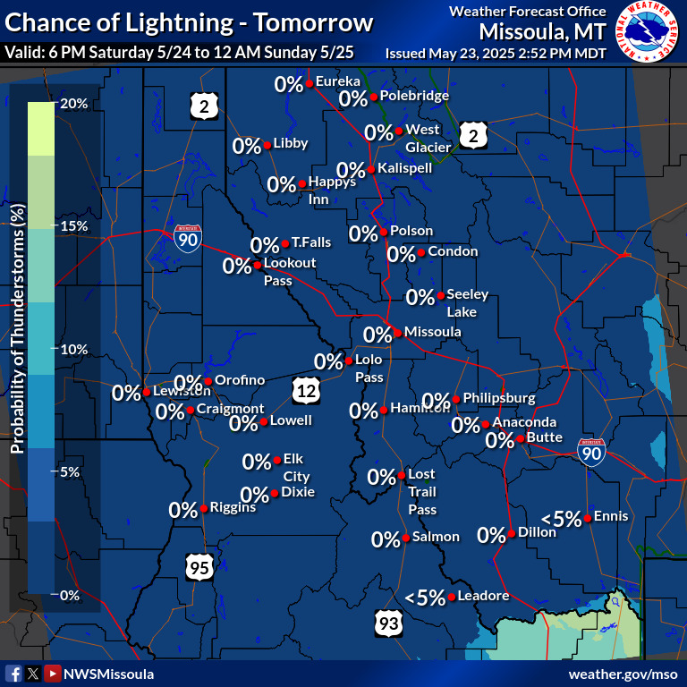
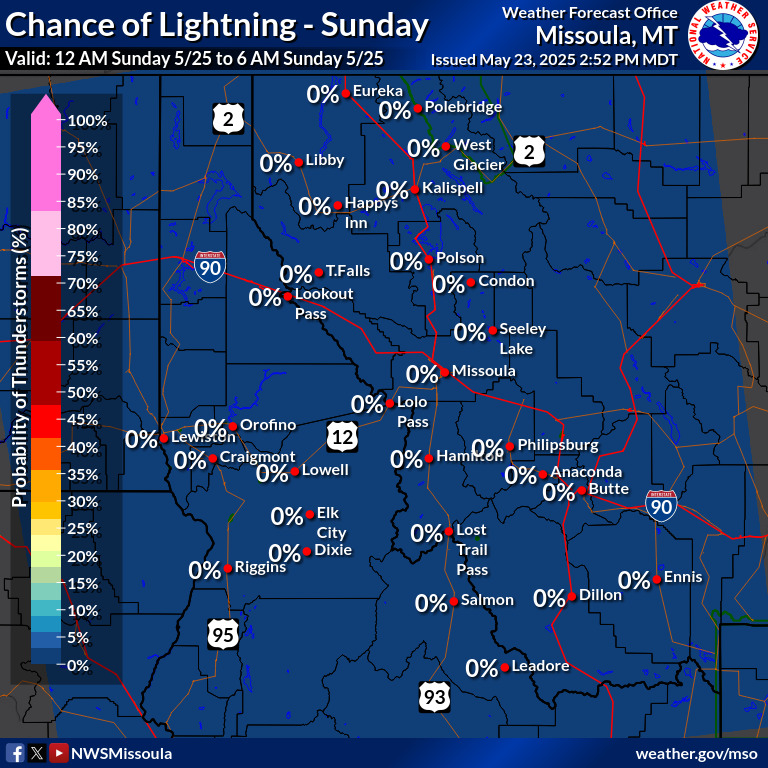
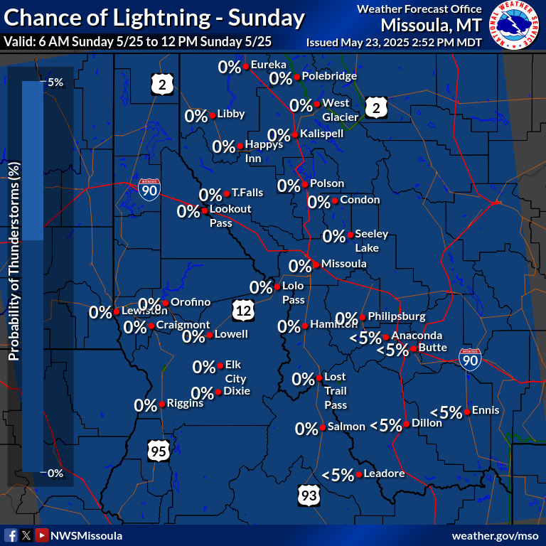
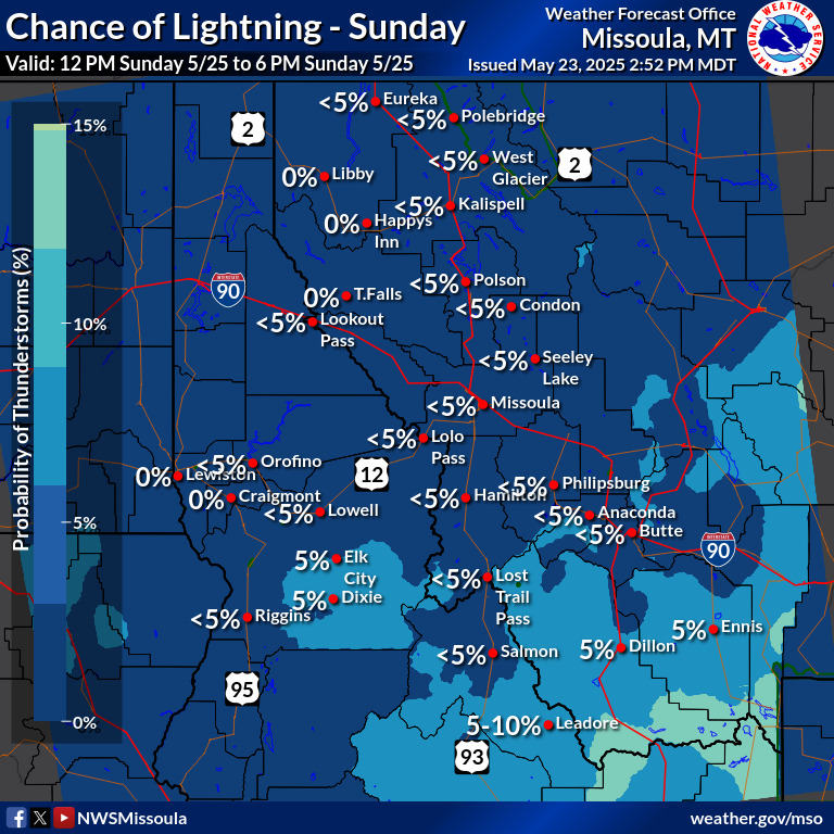
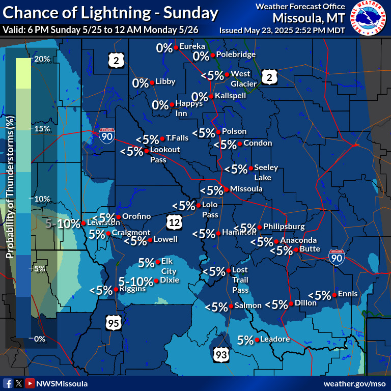
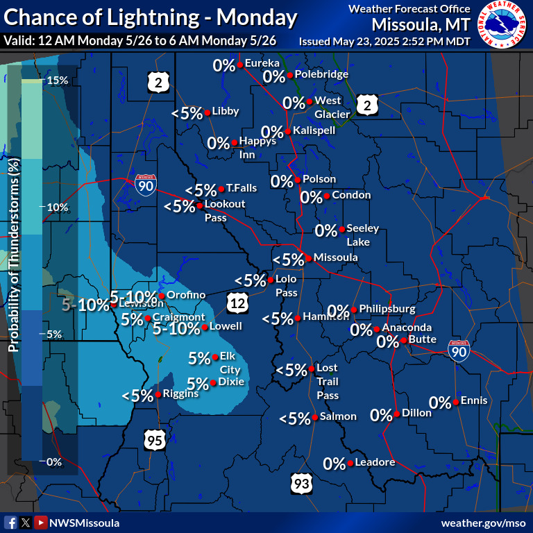
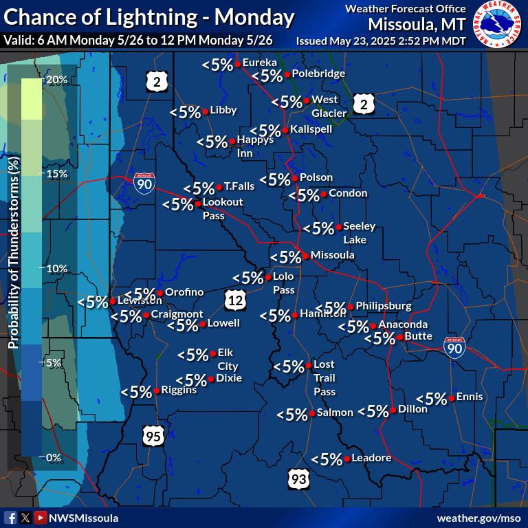
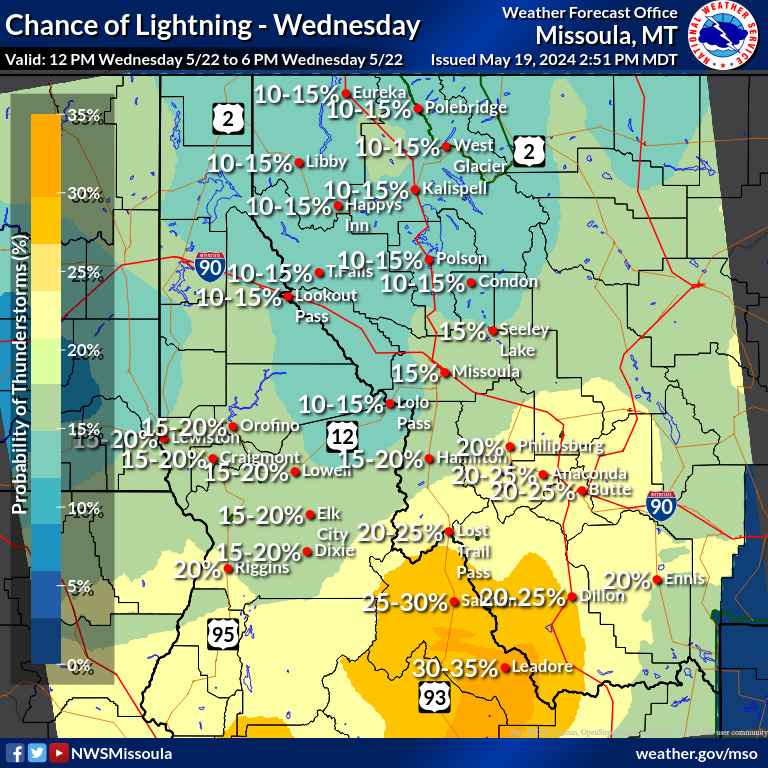
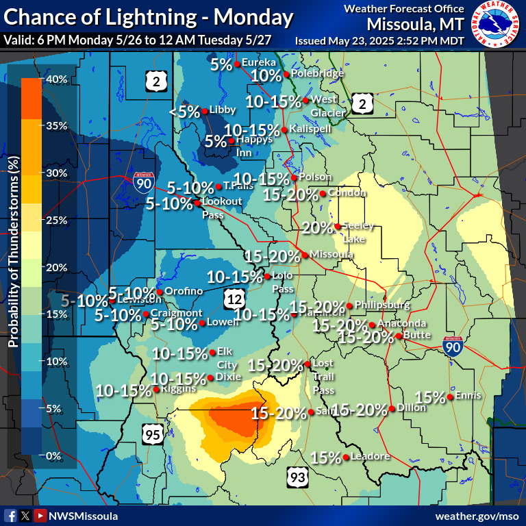
Chance of Lightning represents the probability of a cloud-to-ground lightning strike being observed within 20 km (roughly 10 miles) of the forecast point.
This product is calibrated with cloud-to-ground lightning strike data, so it may miss intra-cloud lightning that causes thunder.
 |
 |
|
|
|
 |
 |
|
|
|
 |
 |
|
|
|
 |
 |
|
|
|
 |
 |
|
|
|
 |
 |
|
|
|
 |
 |
|
|
|
 |
 |
|
|
|
 |
 |
|
|
|
 |
 |


