
Widespread life-threatening flash and urban flooding continues in south-central Texas, with considerable flooding impacts possible across central Texas. Wildfire smoke is impacting air quality across much of the Great Lakes region into southern New England and the Mid-Atlantic. Monsoonal thunderstorms may produce isolated to scattered flash flooding across the Southwest into the Great Basin. Read More >
San Francisco Bay Area, CA
Weather Forecast Office
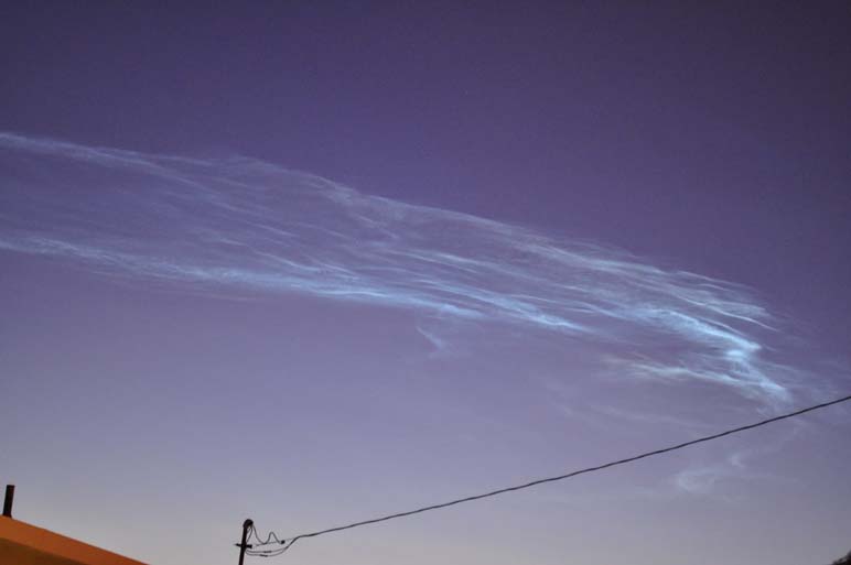
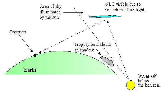
On the morning of October 28th,rare noctilucent clouds were visible over Monterey. Noctilucent clouds are thin silvery-blue cirrus-like clouds frequently seen during summer twilight conditions at high latitudes (above 50°) in both hemispheres. These clouds are primarily composed of ice crystals at heights 50-70 miles above the earth's surface. (source) However, the clouds seen this morning were formed by the launch of the NPOESS Preparatory Project spacecraft from Vandenberg Air Force Base, Calif.
Below are two images of the noctilucent clouds.

US Dept of Commerce
National Oceanic and Atmospheric Administration
National Weather Service
San Francisco Bay Area, CA
21 Grace Hopper Ave, Stop 5
Monterey, CA 93943-5505
(831) 656-1725
Comments? Questions? Please Contact Us.

