Paducah, KY
Weather Forecast Office
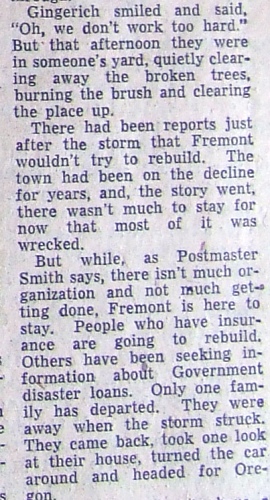
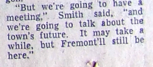
AFTERMATH OF TOWN HIT BY TWISTER
WHAT'S AHEAD FOR LITTLE COMMUNITY OF FREMONT, DOWN IN CARTER COUNTY, ALL BUT LEVELED BY TORNADO?
ST. LOUIS POST DISPATCH JUNE 2ND, 1957

FORECASTS
Forecast Discussion
User Defined Area Forecast
Hourly Forecasts
Fire Weather
Activity Planner
LOCAL INFORMATION
Aviation Weather
Our Office
SKYWARN
Items of Interest
Hazardous Weather Support
Local Observations
Weather History
NWS Paducah KY Weekly Partner Briefing
US Dept of Commerce
National Oceanic and Atmospheric Administration
National Weather Service
Paducah, KY
8250 Kentucky Highway 3520
West Paducah, KY 42086-9762
270-744-6440
Comments? Questions? Please Contact Us.

