Scattered severe storms capable of large to very large hail, severe wind gusts, and a few tornadoes will be possible across the central Plains. Heavy rain will pose a flash flood threat across portions of the Mississippi Valley into the Tennessee and Ohio Valleys. Hot, dry and windy conditions will continue to bring a critical fire weather threat from the Southwest into the Great Basin. Read More >
Overview
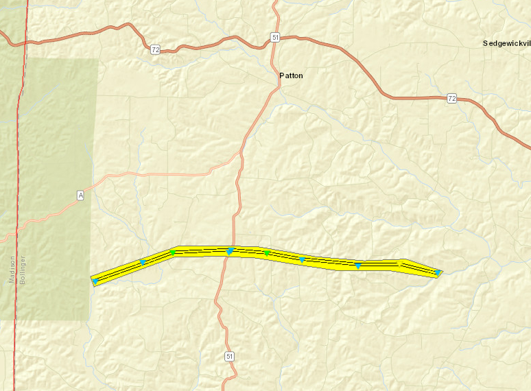
Thunderstorms impacted the region during the evening hours of Sunday March 24th. Some damaging winds and hail were observed over portions of southeast Missouri and southwest Illinois. The most significant damage occurred in Bollinger County, Missouri where an EF-2 tornado touched down. The storms tended to weaken as they progressed further east across the region later in the evening hours.Tornadoes:
|
|
||||||||||
|
||||||||||
|
Tornado - South of Patton, Missouri
|
||||||||||||||||
The Enhanced Fujita (EF) Scale classifies tornadoes into the following categories:
| EF0 Weak 65-85 mph |
EF1 Moderate 86-110 mph |
EF2 Significant 111-135 mph |
EF3 Severe 136-165 mph |
EF4 Extreme 166-200 mph |
EF5 Catastrophic 200+ mph |
 |
|||||
 |
Media use of NWS Web News Stories is encouraged! Please acknowledge the NWS as the source of any news information accessed from this site. |
|