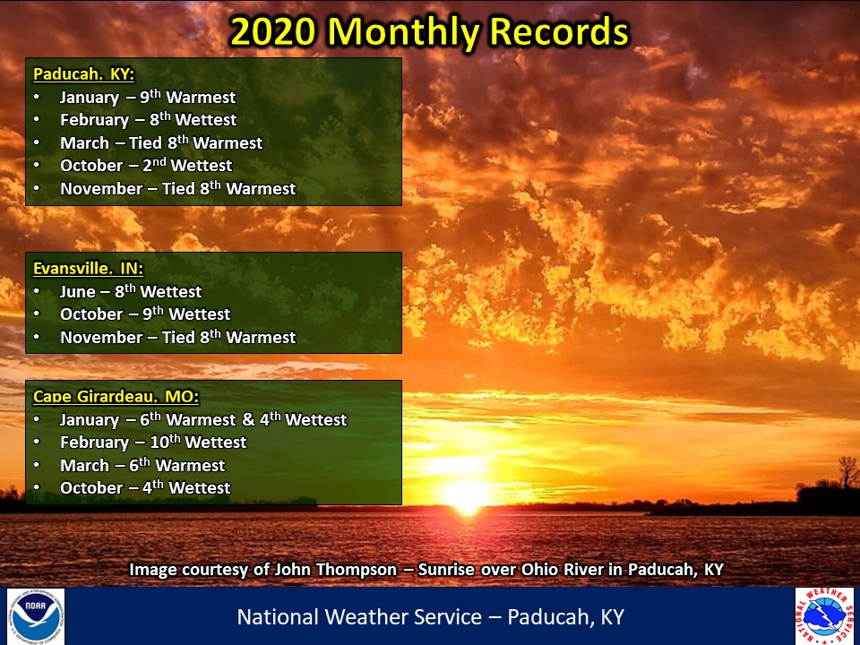
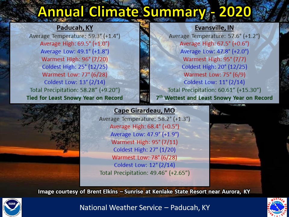
Now that 2020 is officially in the books, let's take a look back on the yearly review. Temperatures finished above normal by around 1 to 1.5 degrees across the region. The most abnormally warm months compared to normal were January, March, and November. On the flip side, the coldest months compared to normal were April and May.
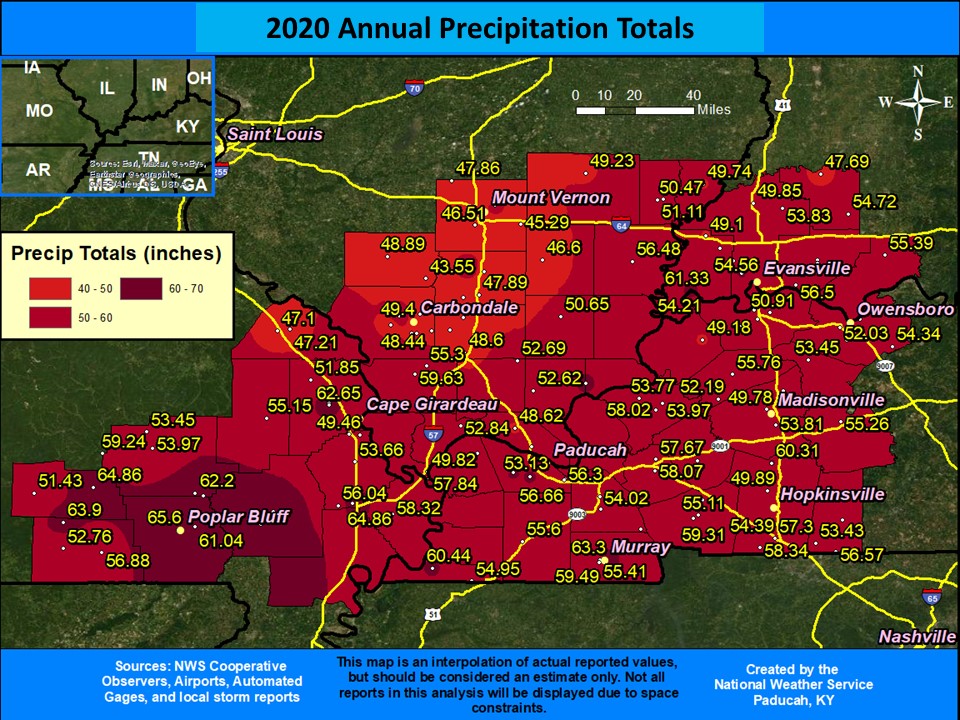
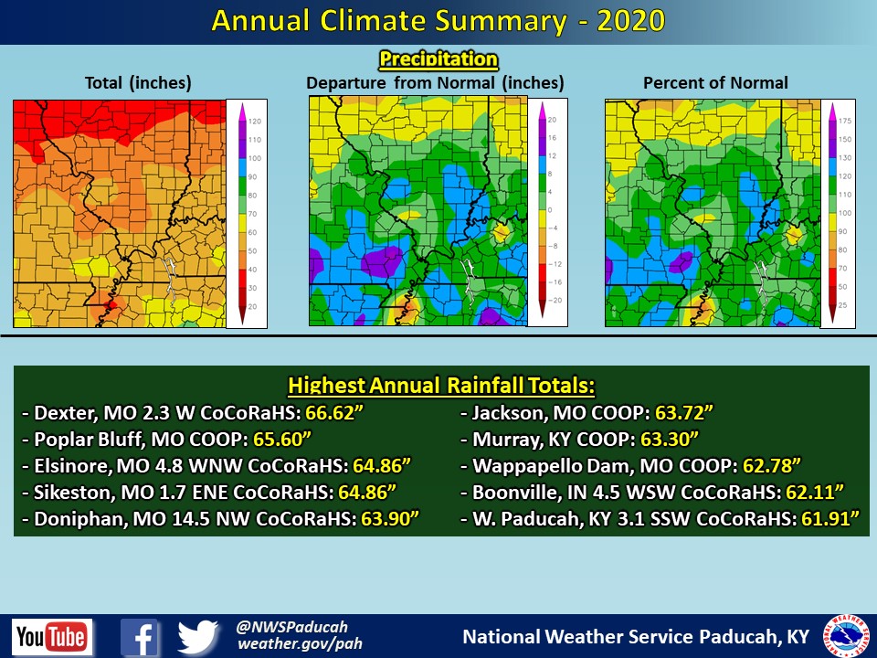
The year finished wetter than normal across the region. Most locations picked up between 48 and 64 inches of precipitation for the year, which was generally 3 to 12 inches above normal. Some localized higher amounts occurred with the highest observed amount of 66.62" at a CoCoRaHS station 2.3 miles west of Dexter, MO. Evansville finished as their 7th wettest year on record with 60.61". The wettest months compared to normal were January, February, and October. June featured excessive rainfall amounts over the Evansville Tri-state region, but it was much drier across the rest of the area. The driest months compared to normal were April, November, and December.
Snow was non-existent for most of the area throughout 2020. In Evansville, Indiana this was the first calendar year on record that no measurable snow occurred. Snowfall records date back to 1948 in Evansville. In Paducah, no measurable snow occurred either, which tied 1957 and 1953 as the only calendar years on record with such an occurrence. For a look back on some notable events from the year take a look at our Top 10 events of 2020 webpage
Here is to hoping everyone has a great 2021!
| 2020 Annual Review: Precipitation Maps |
 |
| Climate Maps are from the Northeast Regional Climate Center |