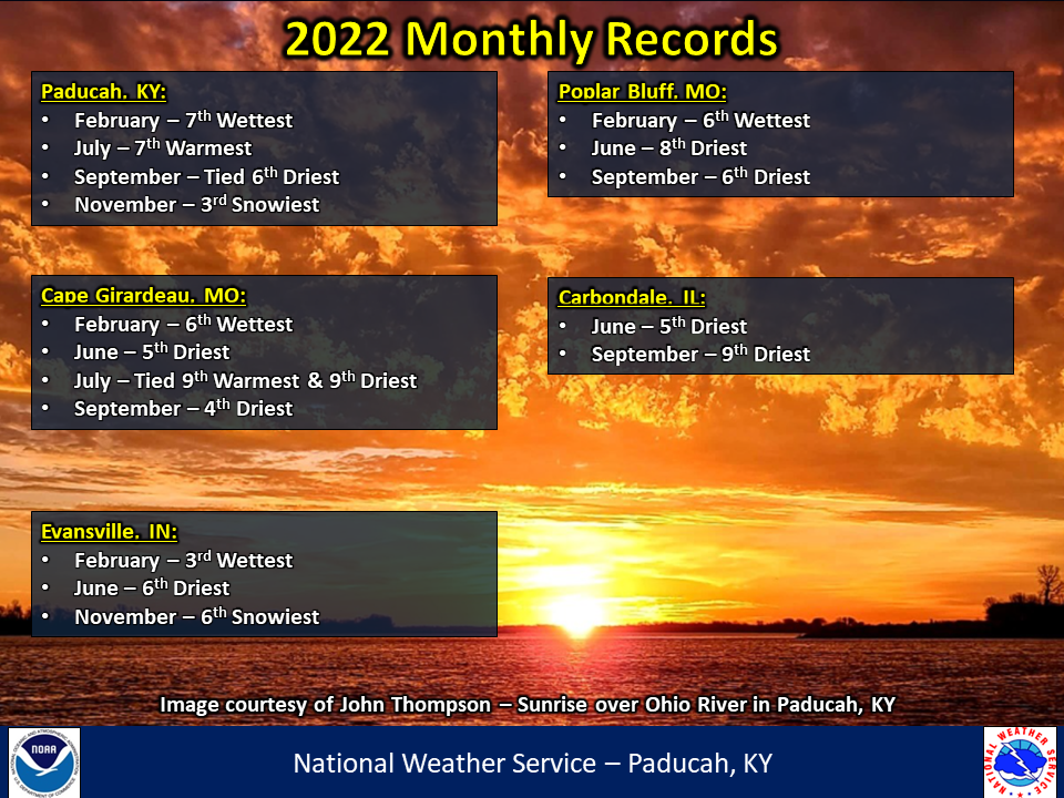
2022 Annual Climate Review:
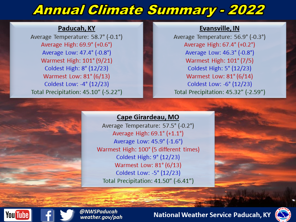
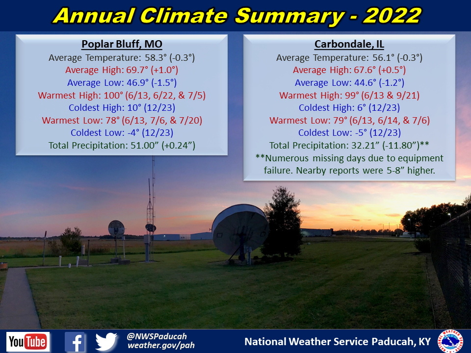
Temperatures finished near normal to slightly below. The most abnormally warm months compared to normal were March, May, and July. On the flip side, the coldest months compared to normal were January, February, April, and October. The only month that finished in the top 10 warmest or coldest was July, which was 7th warmest in Paducah and 9th warmest in Cape Girardeau. One noteworthy aspect is that "feels like" temperatures observed a 150 degree spread in a few locations. This included Cape Girardeau, which tied their all-time warmest heat index of 123 in July and then experienced a -27 wind chill in December (tied for 8th coldest on record).
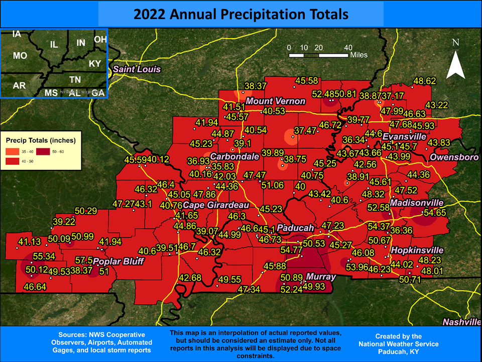
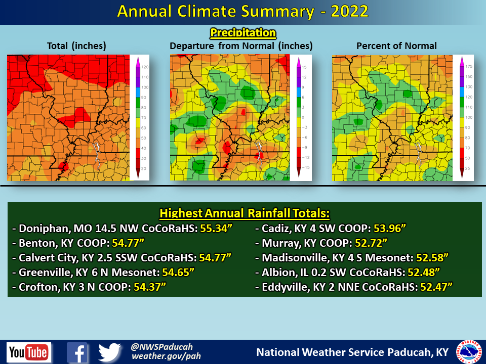
Precipitation finished drier than normal across a large swath of the region. Most locations picked up anywhere from 40 to 50 inches, which was generally 3 to 7 inches below normal. A few exceptions were primarily focused across pockets of southeast Missouri and western Kentucky where localized totals approached 55”. The highest amount observed in our forecast area was 55.34” at a CoCoRaHS station in far northwest Ripley County Missouri (Doniphan 14.5 NW). The wettest month compared to normal was February, which finished in the top 10 wettest across much of the area. The driest months compared to normal were June and September, which finished in the top 10 driest for many locations.
Snowfall was above normal in Paducah and several other locations across the region. 5 different months produced measurable snow in Paducah, which was the first time since 2014. There were several notable snow events: January 6, February 3-4, November 12, and December 22. The first two events produced a swath of 4 to 6 inches across parts of the region.
The graphic below is an interpolated rainfall map using actual observations. Please note that there are likely discrepancies in between observations, since the values are estimated based on nearest reports.
| 2022 Annual Review: Precipitation and Temperature Maps (Click on image to enlarge) |
 |
| Climate Maps are from the Northeast Regional Climate Center |
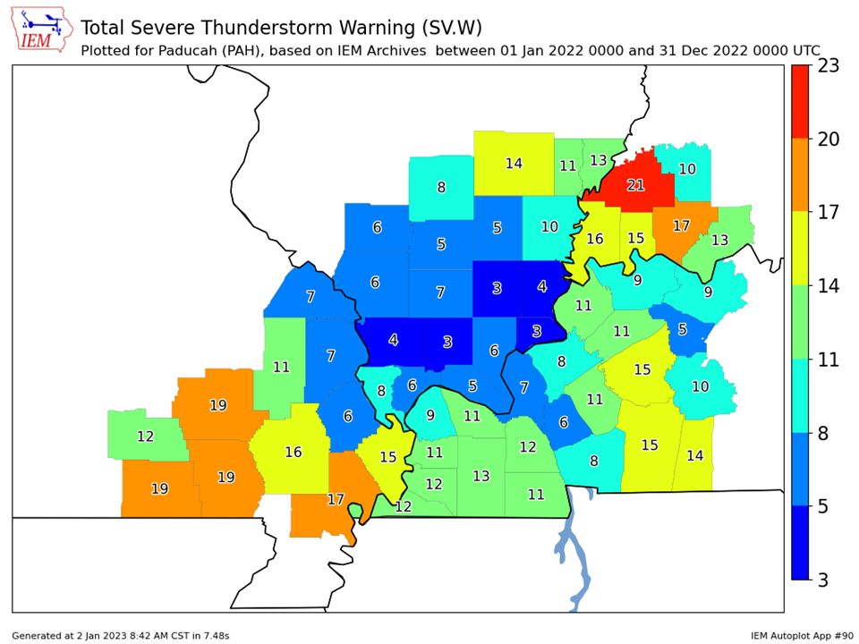
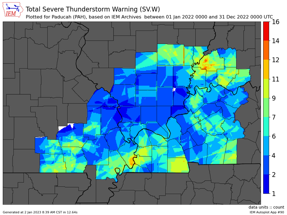
| Severe Thunderstorm Warnings - County Based | Severe Thunderstorm Warnings - Polygon Based |
 |
 |
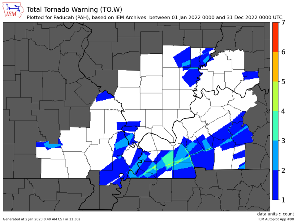
| Tornado Warnings - County Based | Tornado Warnings - Polygon Based |
 |
 |

