Overview
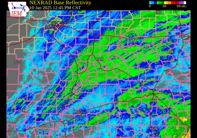
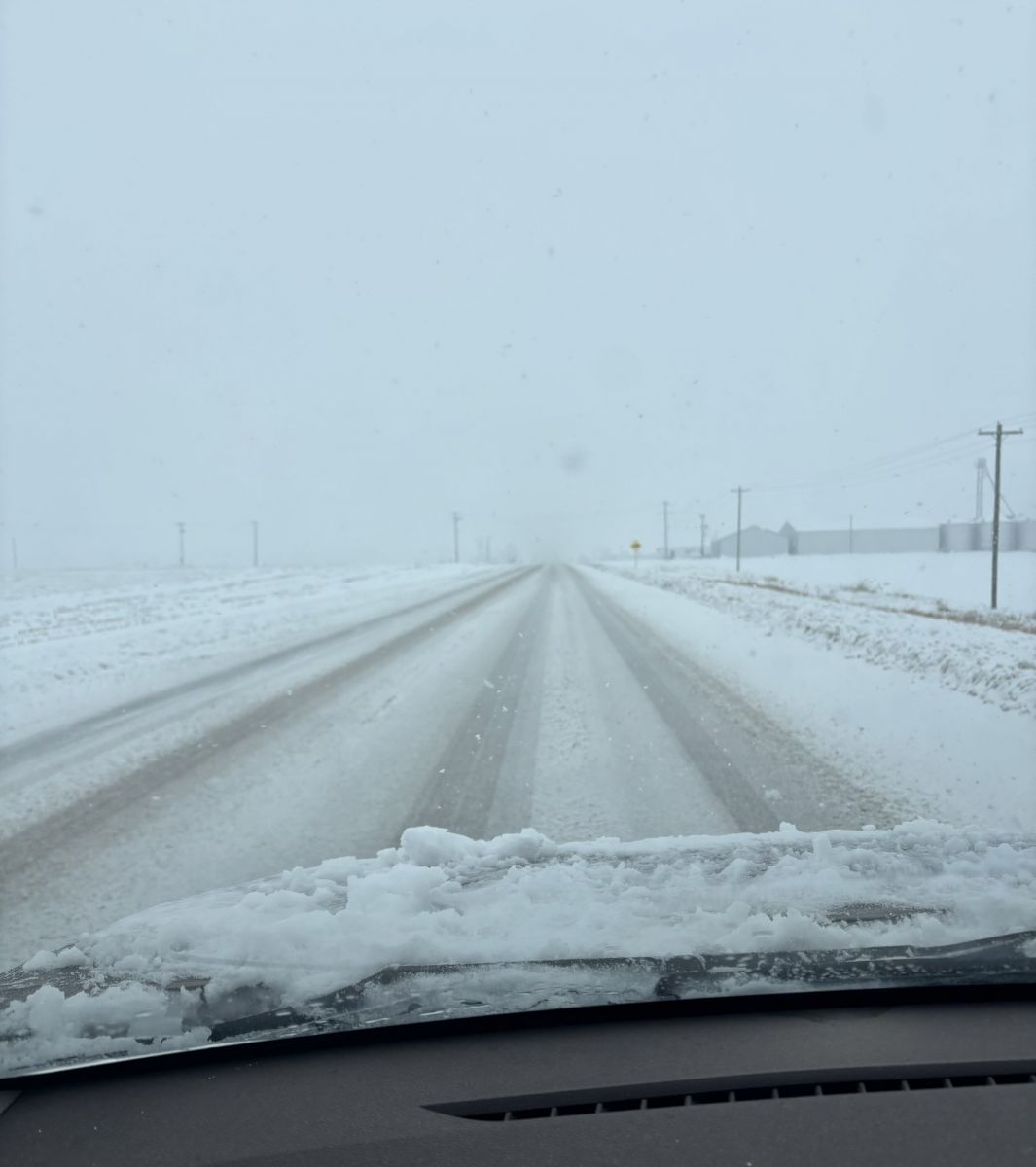
Snow impacted the entire region during the early morning and late afternoon hours on January 10th. The initial round brought a period of light to moderate snow, followed by a heavier burst of snow with wrap around moisture associated with an area of low pressure. Temperatures remained near to below freezing, allowing for snow to quickly accumulate on all surfaces. During the daylight hours, lighter intervals of snow combined with the sunlight allowed for snow melt on treated roadways. Schools were cancelled in most counties, with a few closings lingering into the following week mainly across portions of Southern Illinois.
Snow
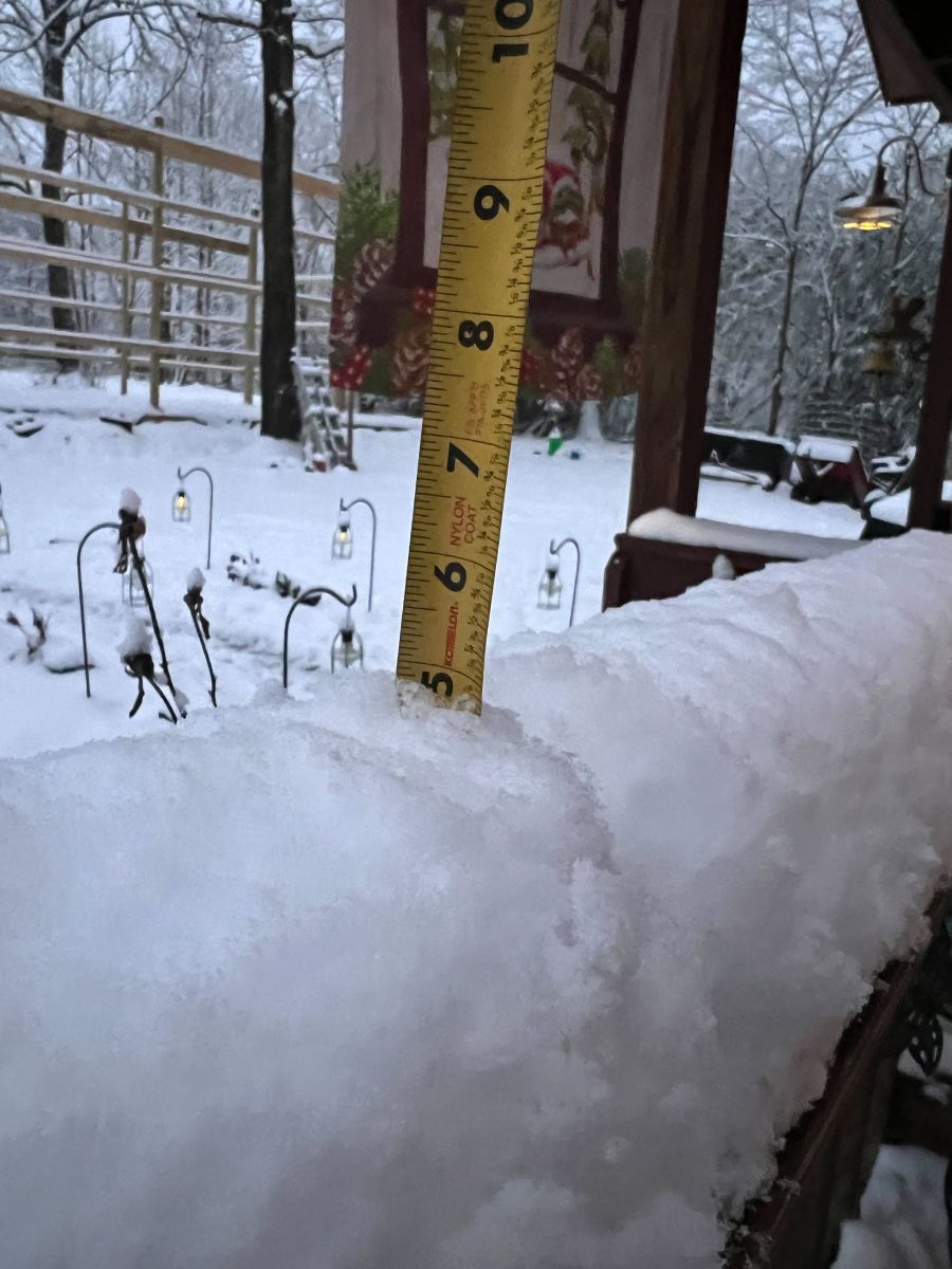
Highest snowfall amounts from this system were across the Mark Twain National Forest in Southeast Missouri into extreme Southwest Illinois. Amounts of 5 to 8 inches occurred from Doniphan to Piedmont and Perryville, MO into the Murphysboro and Du Quoin, IL areas. The rest of the region including Western Kentucky and Southwest Indiana picked up between 2 to 5 inches of snow. The official snowfall measurement for Paducah, KY was 3.7 inches at our office in West Paducah, KY, but other portions of the city observed between 4 to 6 inches of snow due to a sharp cutoff in heavier snow bands. Here is a listing of some of the amounts along with a map of the entire area:
| Ellsinore, MO | 8.0" |
| Poplar Bluff, MO | 6.5" |
| Belle Rive, IL | 6.0" |
| Dahlgren, IL | 5.9" |
| Paducah, KY | 5.6" |
| Murray, KY | 5.0" |
| Benton, KY | 4.2" |
| Evansville, IN | 4.1" |
| Newburgh, IN | 3.5" |
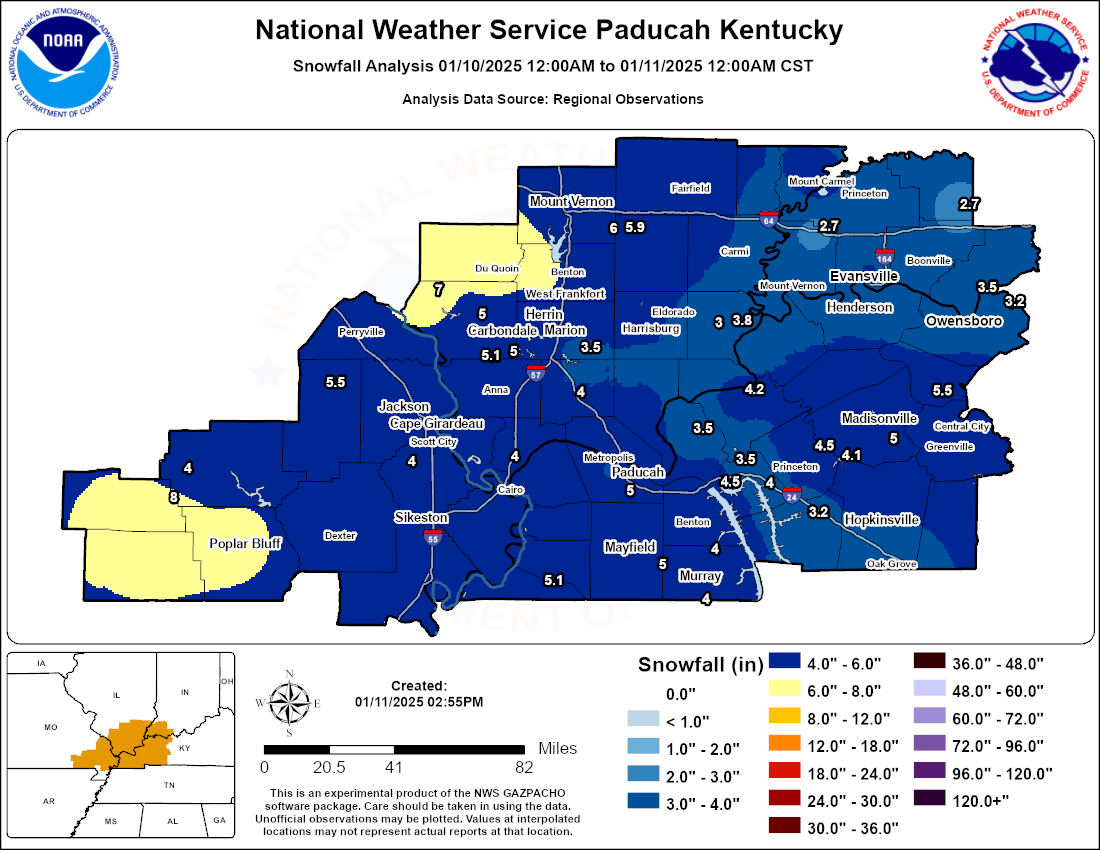
Observed interpolated snowfall totals for this event.
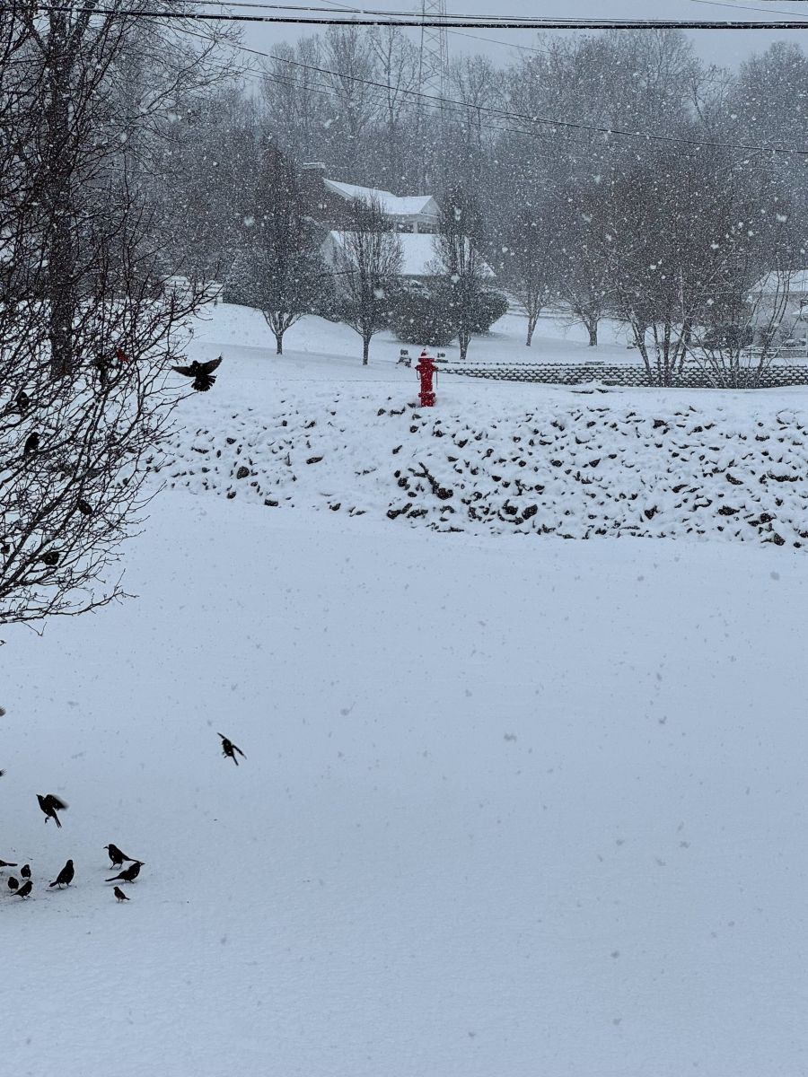
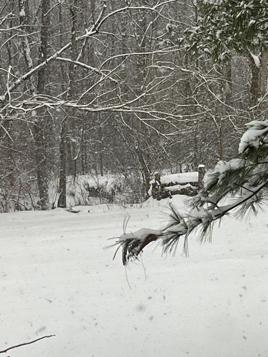
Photos (Click to Enlarge)
 |
 |
 |
 |
| Hickman, KY (Ben Rudy) |
Melody Hill, IN (David Skau) |
Perryville, MO (Jeremy Mantz) |
Mount Carmel, IL (Jeff Blair) |
 |
 |
 |
 |
| Central City, KY (Ricky King) |
Benton, KY (Curt Curtner) |
North Gibson County, IN (Jeremy Mantz) |
Paducah, KY (Mark Daniels - WPSD) |
Storm Reports
Public Information Statement
National Weather Service Paducah KY
957 AM CST Sun Jan 12 2025

...SNOWFALL REPORTS...

Location                     Amount    Time/Date       Provider

...Illinois...

...Edwards County...
Albion                       5.0 in    0809 PM 01/10   Public

...Franklin County...
Buckner                      7.0 in    0800 AM 01/10   Public
Christopher                  6.4 in    0445 PM 01/10   Public
Sesser                       6.0 in    0700 PM 01/10   Public
Sesser                       5.0 in    0100 PM 01/10   Public
Thompsonville                5.0 in    0230 PM 01/10   Public
Christopher                  4.2 in    1143 AM 01/10   Emergency Mngr

...Gallatin County...
2 NNW Shawneetown            3.8 in    0431 PM 01/10   Trained Spotter
Junction                     3.0 in    0800 PM 01/10   CO-OP Observer

...Hamilton County...
Dahlgren                     5.9 in    0800 PM 01/10   Trained Spotter
Mcleansboro                  4.0 in    1222 PM 01/10   Emergency Mngr

...Jackson County...
Vergennes                    7.5 in    0500 PM 01/10   Public
Vergennes                    7.0 in    0115 PM 01/10   Public
2 WSW Ava                    7.0 in    0600 PM 01/10   Public
1 S Elkville                 6.3 in    0300 PM 01/10   Public
Murphysboro                  5.0 in    0333 PM 01/10   Emergency Mngr
Carbondale                   5.0 in    0400 PM 01/10   Trained Spotter
2 ENE Makanda                5.0 in    0626 PM 01/10   Public
Murphysboro                  4.0 in    1210 PM 01/10   Emergency Mngr
Makanda                      4.0 in    0225 PM 01/10   Trained Spotter
Carbondale                   1.5 in    0729 AM 01/10   Trained Spotter

...Jefferson County...
Belle Rive                   6.0 in    0800 PM 01/10   CO-OP Observer
1 WSW Mount Vernon           4.7 in    0753 PM 01/10   Public
Mount Vernon                 4.7 in    0800 PM 01/10   CO-OP Observer

...Johnson County...
1 N Goreville                4.0 in    0200 PM 01/10   Trained Spotter
Vienna                       4.0 in    0800 PM 01/10   Public

...Massac County...
1 NW Metropolis              4.3 in    0430 PM 01/10   Trained Spotter
3 NNE Brookport              4.1 in    0800 PM 01/10   CO-OP Observer
New Columbia                 3.2 in    0100 PM 01/10   Public

...Perry County...
1 NNE Du Quoin               8.0 in    0800 PM 01/10   Public
Du Quoin                     7.0 in    0103 PM 01/10   Emergency Mngr
Du Quoin                     7.0 in    0500 PM 01/10   Emergency Mngr

...Pulaski County...
1 NE Mounds                  4.0 in    0800 PM 01/10   Public

...Union County...
Alto Pass                    5.1 in    1100 PM 01/10   Trained Spotter
Jonesboro                    4.0 in    0303 PM 01/10   Trained Spotter

...Wabash County...
Mount Carmel                 4.5 in    0430 PM 01/10   Public

...Wayne County...
Fairfield                    5.5 in    0205 PM 01/10   Emergency Mngr

...Williamson County...
Herrin                       5.0 in    0231 PM 01/10   Fire Dept/Rescue
1 NNW Carterville            4.5 in    0113 PM 01/10   Public
1 NNW Cambria                4.0 in    0800 PM 01/10   Public
2 W Creal Springs            3.5 in    0500 PM 01/10   CO-OP Observer
2 W Creal Springs            2.8 in    0210 PM 01/10   Emergency Mngr

...Indiana...

...Gibson County...
Francisco                    3.0 in    0800 PM 01/10   CO-OP Observer
Fort Branch                  2.0 in    0114 PM 01/10   Trained Spotter
Fort Branch                  1.5 in    1100 AM 01/10   Trained Spotter
Fort Branch                  1.5 in    1108 AM 01/10   Trained Spotter

...Pike County...
6 E Spurgeon                 2.7 in    0800 PM 01/10   CO-OP Observer

...Posey County...
Poseyville                   2.7 in    0800 PM 01/10   Public

...Spencer County...
1 NW Rockport                3.5 in    0800 PM 01/10   CO-OP Observer

...Vanderburgh County...
1 N Evansville               4.1 in    0800 PM 01/10   Trained Spotter
Evansville                   4.0 in    0559 PM 01/10   CO-OP Observer
Evansville                   3.3 in    0455 PM 01/10   Emergency Mngr
3 W Evansville               2.0 in    1210 PM 01/10   Broadcast Media
Evansville                   2.0 in    1212 PM 01/10   Broadcast Media

...Warrick County...
Newburgh                     3.5 in    0800 PM 01/10   CO-OP Observer
Newburgh                     3.0 in    0400 PM 01/10   Public

...Kentucky...

...Calloway County...
Murray                       5.0 in    0500 PM 01/10   Public
Murray                       4.0 in    0337 PM 01/10   CO-OP Observer
Hazel                        4.0 in    0808 PM 01/10   Public
3 SSE Dexter                 4.0 in    0819 PM 01/10   Public
1 E Murray                   1.0 in    0741 AM 01/10   Trained Spotter

...Christian County...
2 NW Oak Grove               3.0 in    0800 PM 01/10   CO-OP Observer
1 NNE Pembroke               2.0 in    1230 PM 01/10   Trained Spotter
2 NNE Pembroke               1.5 in    1111 AM 01/10   Trained Spotter
1 N Pembroke                 0.8 in    0910 AM 01/10   Trained Spotter

...Crittenden County...
7 E Tolu                     4.3 in    0800 PM 01/10   Trained Spotter

...Daviess County...
5 S Stanley                  3.3 in    0700 PM 01/10   Trained Spotter
3 E Macio                    3.2 in    0400 PM 01/10   Trained Spotter
5 S Stanley                  2.8 in    0327 PM 01/10   Trained Spotter

...Fulton County...
Cayce                        5.1 in    0435 PM 01/10   Trained Spotter
Cayce                        4.0 in    1051 AM 01/10   Trained Spotter
Fulton                       1.0 in    0729 AM 01/10   Trained Spotter

...Graves County...
5 ENE Sedalia                5.0 in    0800 PM 01/10   CO-OP Observer
1 NNE Mayfield               5.0 in    0808 PM 01/10   Public
3 W Sedalia                  4.0 in    1120 AM 01/10   Public
2 NE Lynnville               4.0 in    1251 PM 01/10

...Henderson County...
Henderson                    3.2 in    0329 PM 01/10   Broadcast Media

...Hopkins County...
3 NE Earlington              5.3 in    0417 PM 01/10   Public
Mortons Gap                  5.0 in    0542 PM 01/10   Public
3 NE Earlington              4.5 in    0211 PM 01/10   Public
1 S Dawson Springs           4.5 in    0526 PM 01/10   Public
Madisonville                 4.5 in    0800 PM 01/10   Public
Dawson Springs               4.5 in    0800 PM 01/10   CO-OP Observer
1 S Dawson Springs           4.1 in    0352 PM 01/10   Public
Madisonville                 4.0 in    0200 PM 01/10   Trained Spotter
Mortons Gap                  4.0 in    0255 PM 01/10   Trained Spotter
Madisonville                 2.0 in    1148 AM 01/10   Trained Spotter

...Livingston County...
8 W Salem                    4.5 in    0800 AM 01/10   Public
1 ENE Ledbetter              4.5 in    0804 AM 01/10   Trained Spotter
Grand Rivers                 4.5 in    0400 PM 01/10   Trained Spotter
7 W Salem                    3.5 in    0800 PM 01/10   Public

...Lyon County...
3 E Eddyville                4.0 in    0800 PM 01/10   CO-OP Observer
3 NW Eddyville               3.5 in    0309 PM 01/10   Trained Spotter

...Marshall County...
Benton                       4.2 in    0519 PM 01/10   Trained Spotter
1 NE Benton                  4.0 in    0305 PM 01/10   Emergency Mngr
4 S Grand Rivers             3.2 in    0200 PM 01/10   Trained Spotter
Benton                       2.8 in    0200 PM 01/10   Emergency Mngr
4 S Grand Rivers             2.0 in    1111 AM 01/10   Trained Spotter
4 ESE Reidland               1.8 in    0719 AM 01/10   Trained Spotter

...McCracken County...
Paducah                      5.6 in    0435 PM 01/10   NWS Employee
Lone Oak                     5.0 in    0648 PM 01/10   NWS Employee
3 SSE Lone Oak               4.2 in    0239 PM 01/10   NWS Employee
4 ESE Grahamville            3.5 in    0437 PM 01/10   Public
1 NE Lone Oak                3.0 in    0112 PM 01/10   NWS Employee
3 SSE Lone Oak               2.0 in    1000 AM 01/10   NWS Employee

...McLean County...
Sacramento                   5.5 in    0800 PM 01/10   Public

...Muhlenberg County...
Central City                 5.5 in    0630 PM 01/10   Emergency Mngr
Central City                 3.5 in    0325 PM 01/10   Trained Spotter
Central City                 2.5 in    1229 PM 01/10   Emergency Mngr

...Trigg County...
1 WSW Cadiz                  3.2 in    0800 PM 01/10   CO-OP Observer

...Union County...
Morganfield                  3.0 in    0228 PM 01/10   Fire Dept/Rescue

...Missouri...

...Bollinger County...
3 SSW Patton                 5.5 in    0547 PM 01/10   Public

...Butler County...
Poplar Bluff                 6.5 in    0800 PM 01/10   Trained Spotter
Poplar Bluff                 4.0 in    0807 AM 01/10   Trained Spotter
3 SSE Poplar Bluff           4.0 in    0506 PM 01/10   Public
Fisk                         2.0 in    0756 AM 01/10   Public

...Cape Girardeau County...
Jackson                      5.5 in    0836 PM 01/10   Trained Spotter
Cape Girardeau               4.5 in    0113 PM 01/10   Broadcast Media
Jackson                      3.5 in    1154 AM 01/10   Trained Spotter
1 N Jackson                  3.3 in    0138 PM 01/10   Trained Spotter
1 S Cape Girardeau           3.0 in    1037 AM 01/10   Trained Spotter

...Carter County...
Ellsinore                    8.0 in    0333 PM 01/10   Emergency Mngr
7 SSW Chicopee               7.0 in    1108 AM 01/10   Emergency Mngr
Ellsinore                    6.5 in    0230 PM 01/10   Emergency Mngr
Hunter                       4.5 in    1019 AM 01/10   Trained Spotter

...Mississippi County...
East Prairie                 6.0 in    1158 AM 01/10   Trained Spotter

...Perry County...
Perryville                   5.5 in    0215 PM 01/10   County Official
Perryville                   4.5 in    1138 AM 01/10   Trained Spotter

...Ripley County...
Doniphan                     5.0 in    0850 AM 01/10   Public

...Scott County...
1 ESE Scott City             5.0 in    0800 PM 01/10   CO-OP Observer
3 S Chaffee                  4.0 in    0500 PM 01/10   Public
Sikeston                     3.0 in    0900 AM 01/10   Trained Spotter

...Stoddard County...
Dexter                       4.0 in    0259 PM 01/10   Public

...Wayne County...
2 N Piedmont                 7.0 in    1123 AM 01/10   Public
Piedmont                     4.5 in    0830 AM 01/10   Storm Chaser
Mill Spring                  4.0 in    0800 PM 01/10   CO-OP Observer
 |
Media use of NWS Web News Stories is encouraged! Please acknowledge the NWS as the source of any news information accessed from this site. |
|