Overview
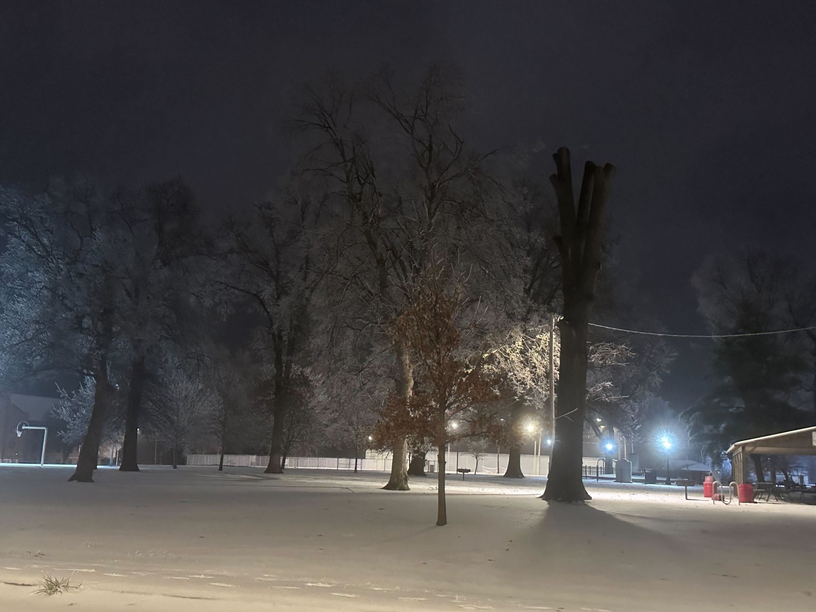
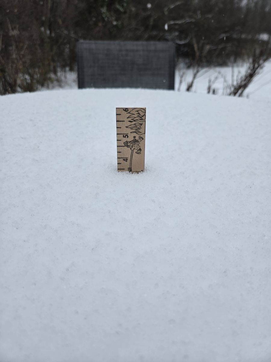
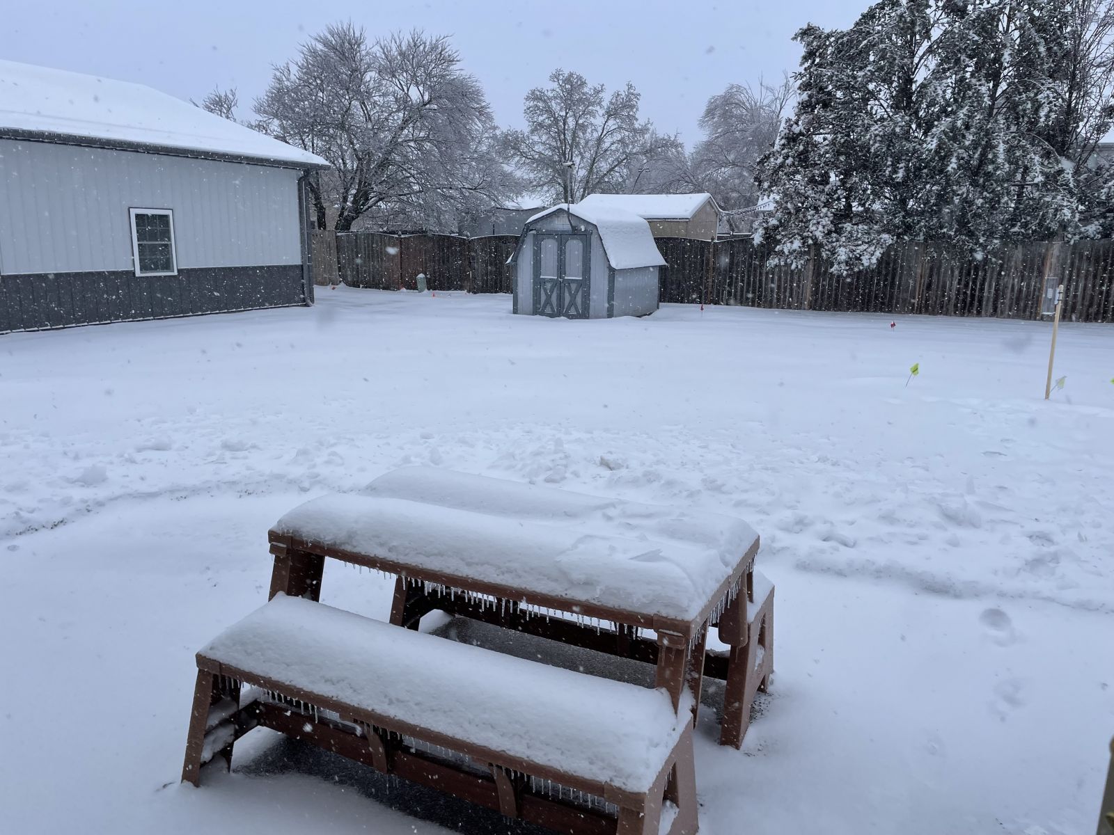
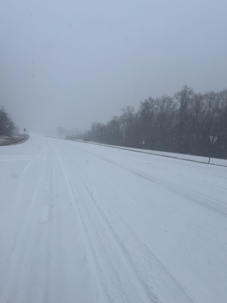
A major winter storm impacted the region on January 5, 2025. Impacts ranged from heavy snow and sleet accumulations to locations along and north of Interstate 64 in southern Illinois and southwest Indiana, to a major ice storm across parts of southeast Missouri, southern Illinois, and northwest Kentucky. Peak snow and sleet accumulations ranged from four to eight inches. In the hardest hit areas of the ice storm, widespread ice totals of 0.25 to 0.75 inch were reported. The heavy snow and ice, combined with persistent gusty winds, led to widespread power outages over much of southeast Missouri, southern Illinois, southwest Indiana, and northwest Kentucky. At its peak, over 100,000 residents were without power on the night of January 5th and the morning of January 6th.
 |
 |
 |
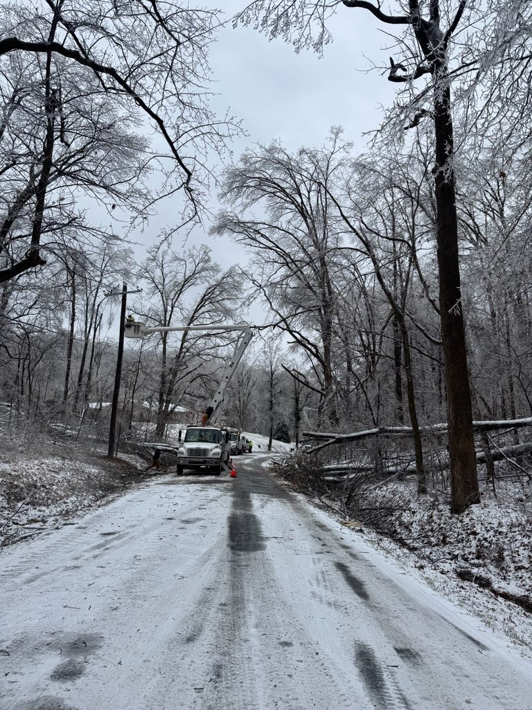
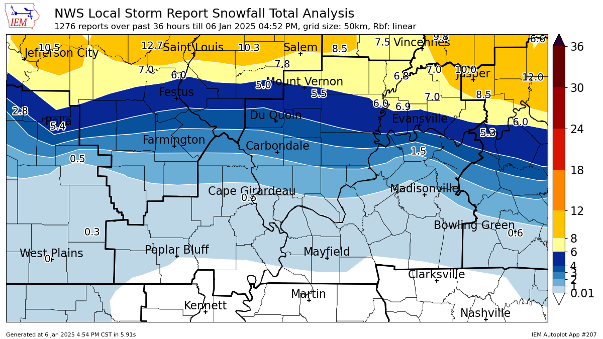
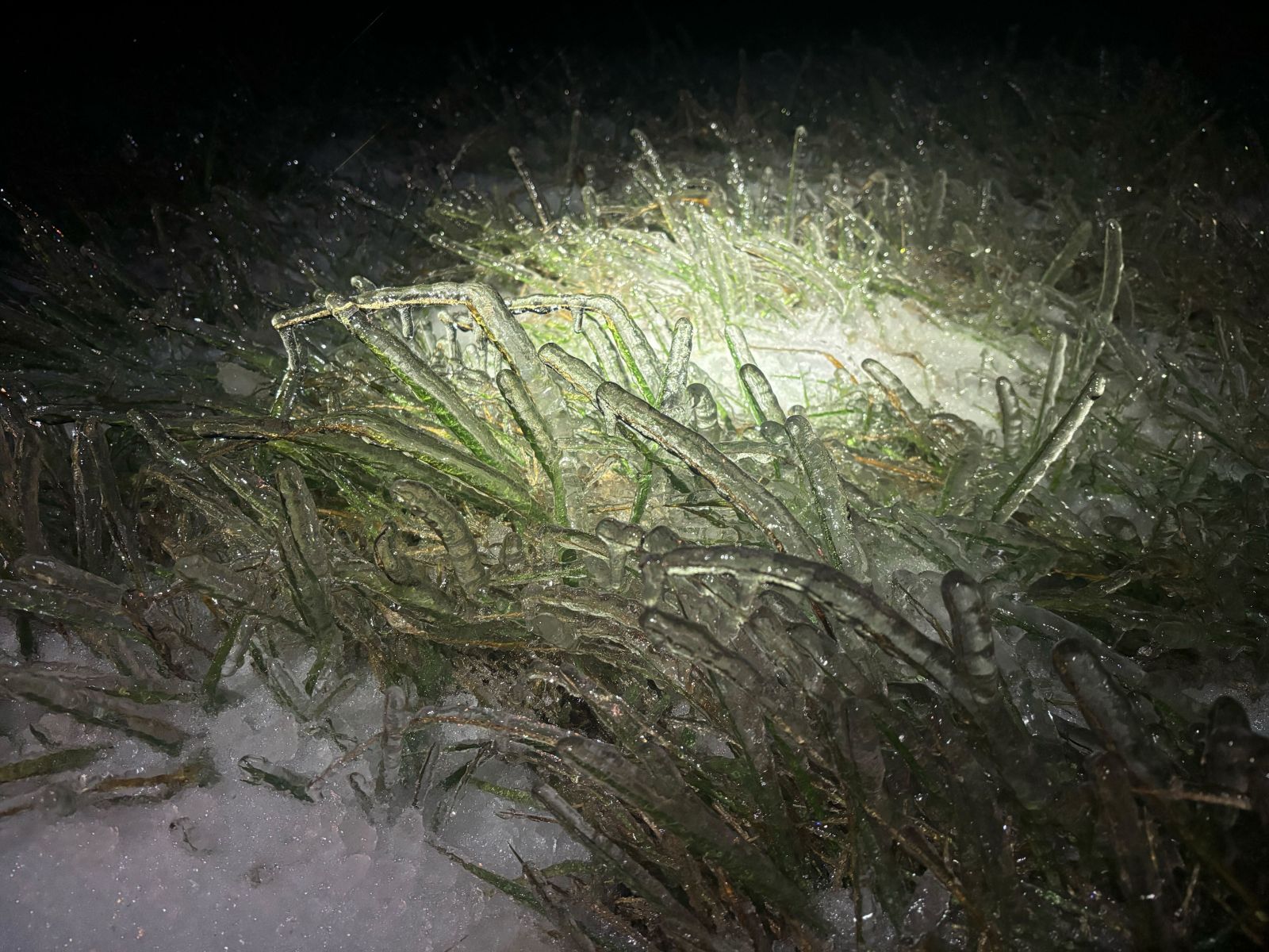
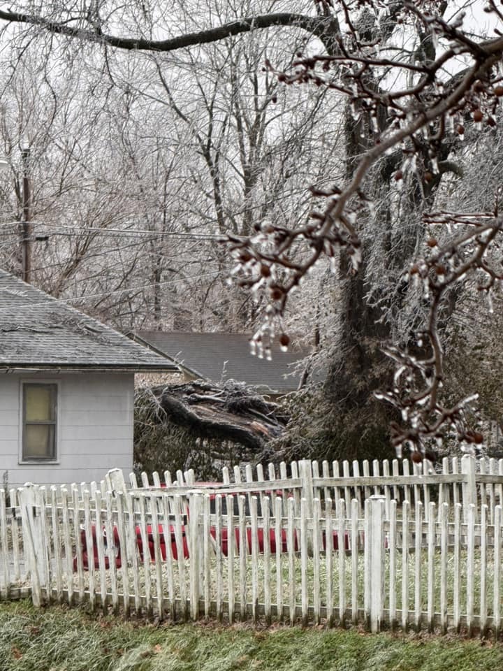
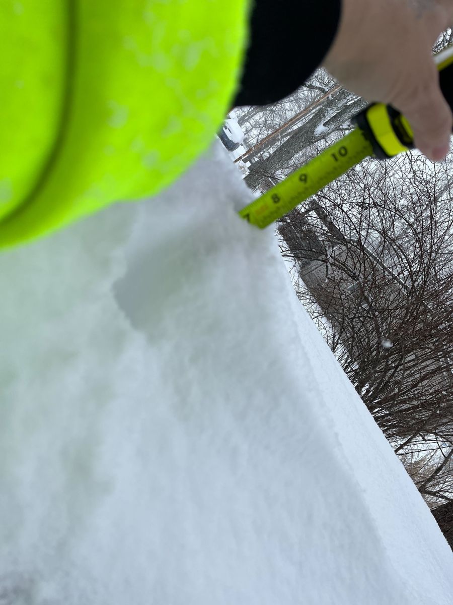
| Ice Damage to Trees and Power Lines in Cape Girardeau County, Missouri (Charlie Herbst) | Estimated Snow and Sleet Accumulations (Map Courtesy of Iowa State Mesonet) |
Estimated Freezing Rain Accumulation. |
Photos (Click to Enlarge)
 |
 |
 |
 |
| Tree damage from freezing rain in Carterville, IL. (Richard Piper) |
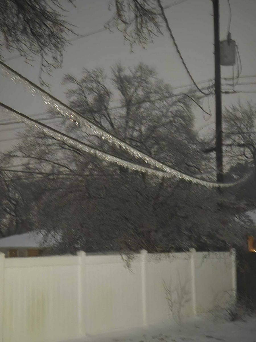
Ice on power lines in Evansville, IN. (Sharon Taylor) |
Ice in Hamilton County, IL (Ashton Middendorf/Hamilton County EMA) |
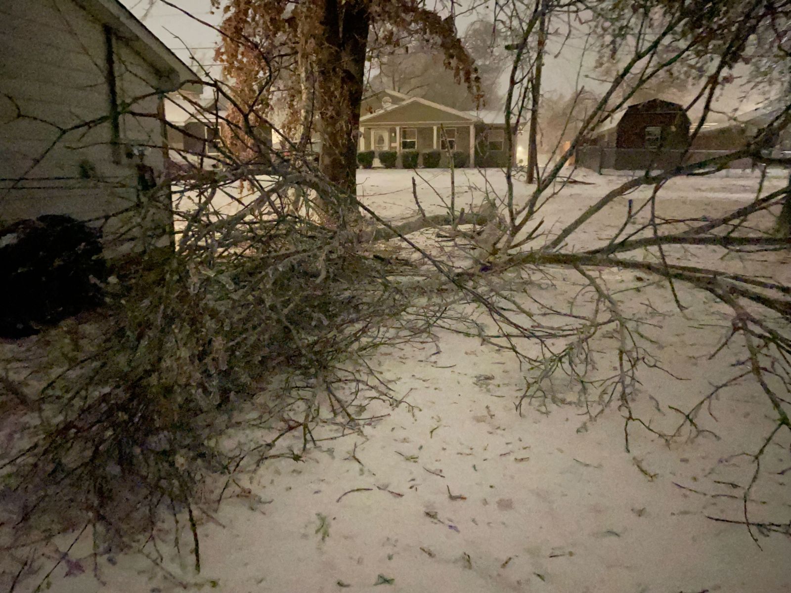
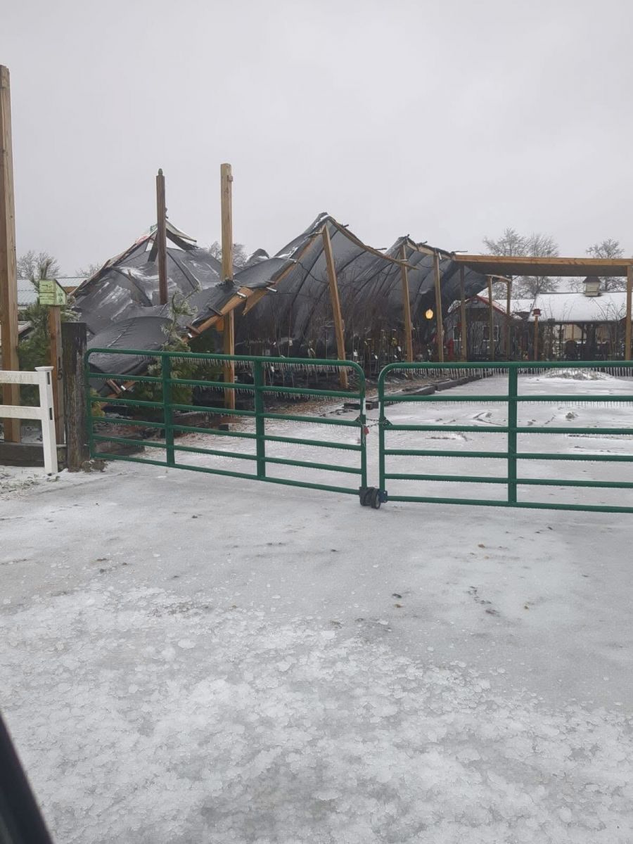
Collapsed plant canopy in Herrin, IL. (Nick Hausen) |
 |
 |
 |
 |
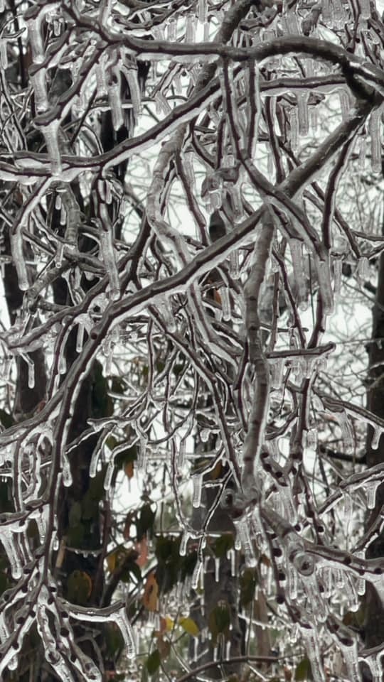
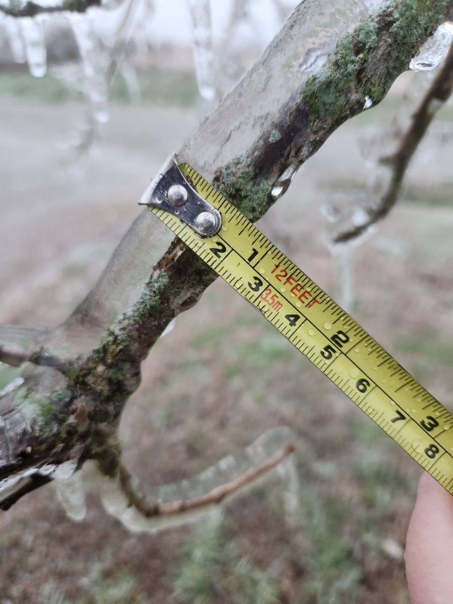
| Ice on tree limbs in Jackson, MO. (Beau Dodson) |
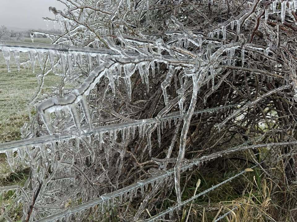
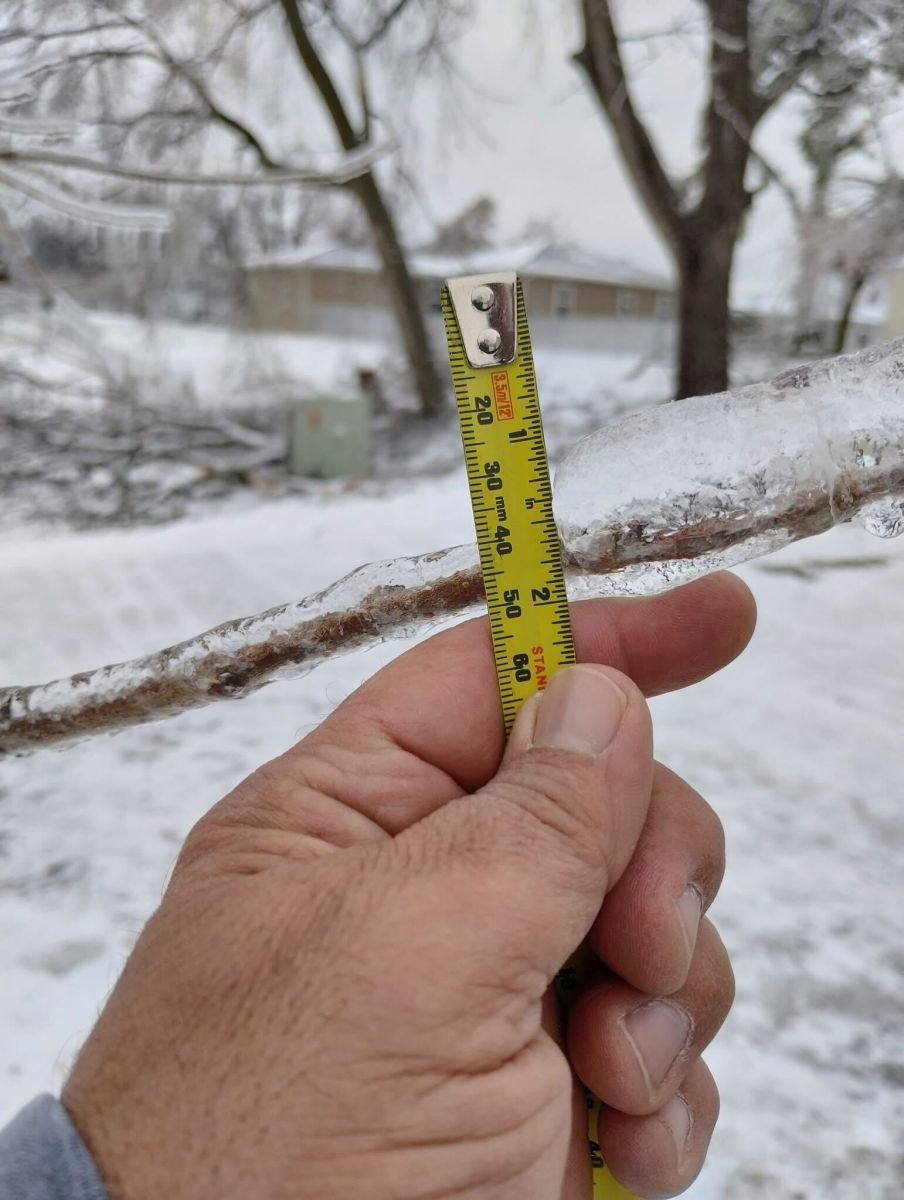
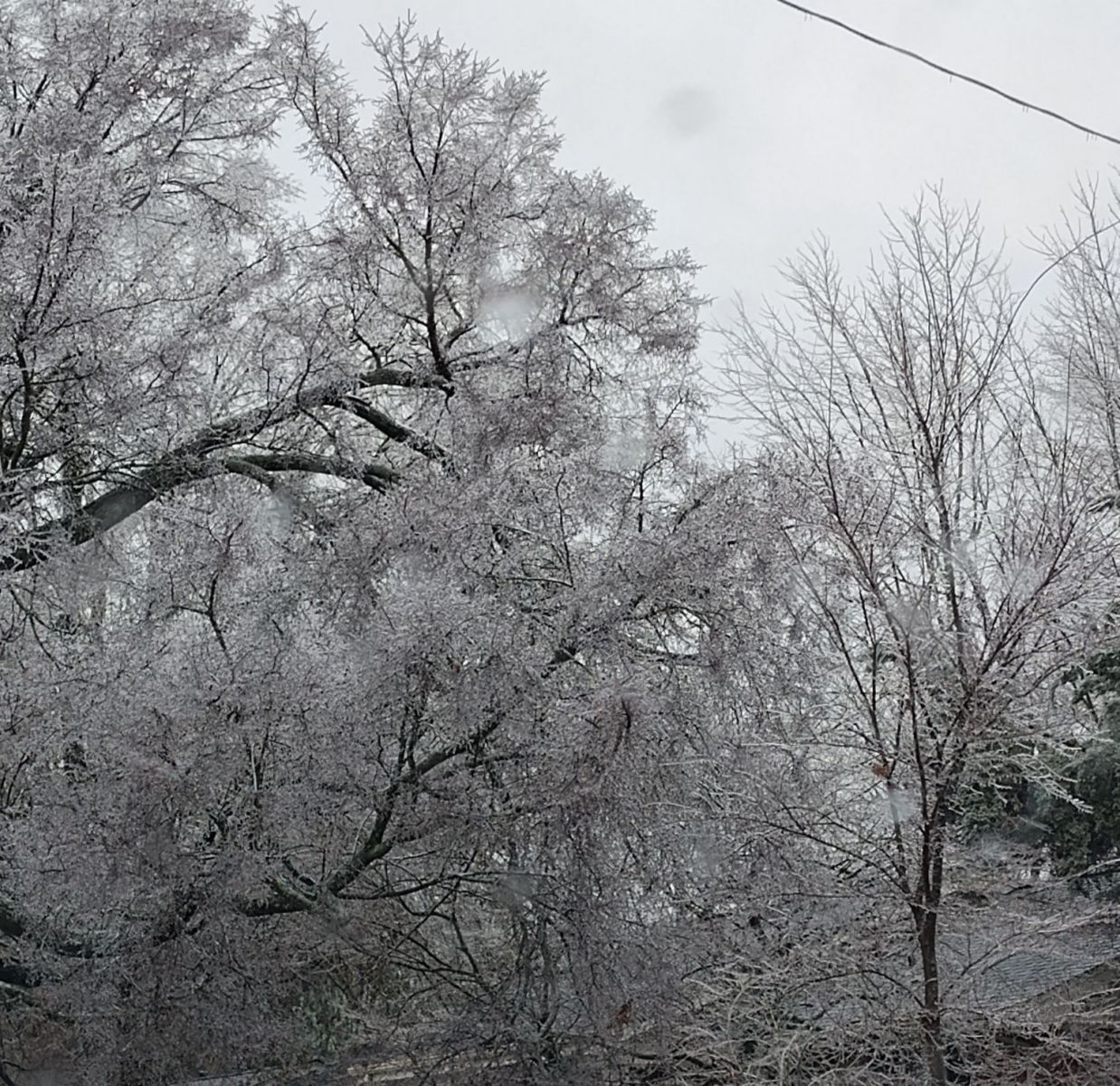
Ice on tree branches in Marble Hill, MO. (Caitlin Wright/Beau Dodson) |
Tree damage from freezing rain in Metropolis, IL. (Lukkas Allen/Beau Dodson) |
Ice on tree limbs near Dycusburg, KY. (Natalie Mc/Beau Dodson) |
 |
 |
 |
 |
| Ice in New Columbia, IL. (Beau Dodson) |
Ice in Paducah, KY. (Jennifer Rukavina) |
Ice on tree branch in Perry County, MO. (Jason Kelly/Perry County Sheriff's Office) |
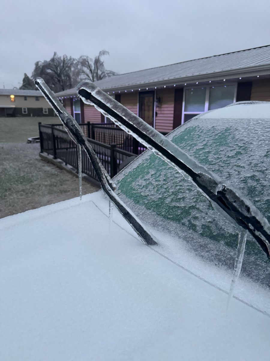
Ice on windshield wipers in Perryville, MO. (Jeremy Mantz/ Perryville Fire Department) |
 |
 |
 |
 |
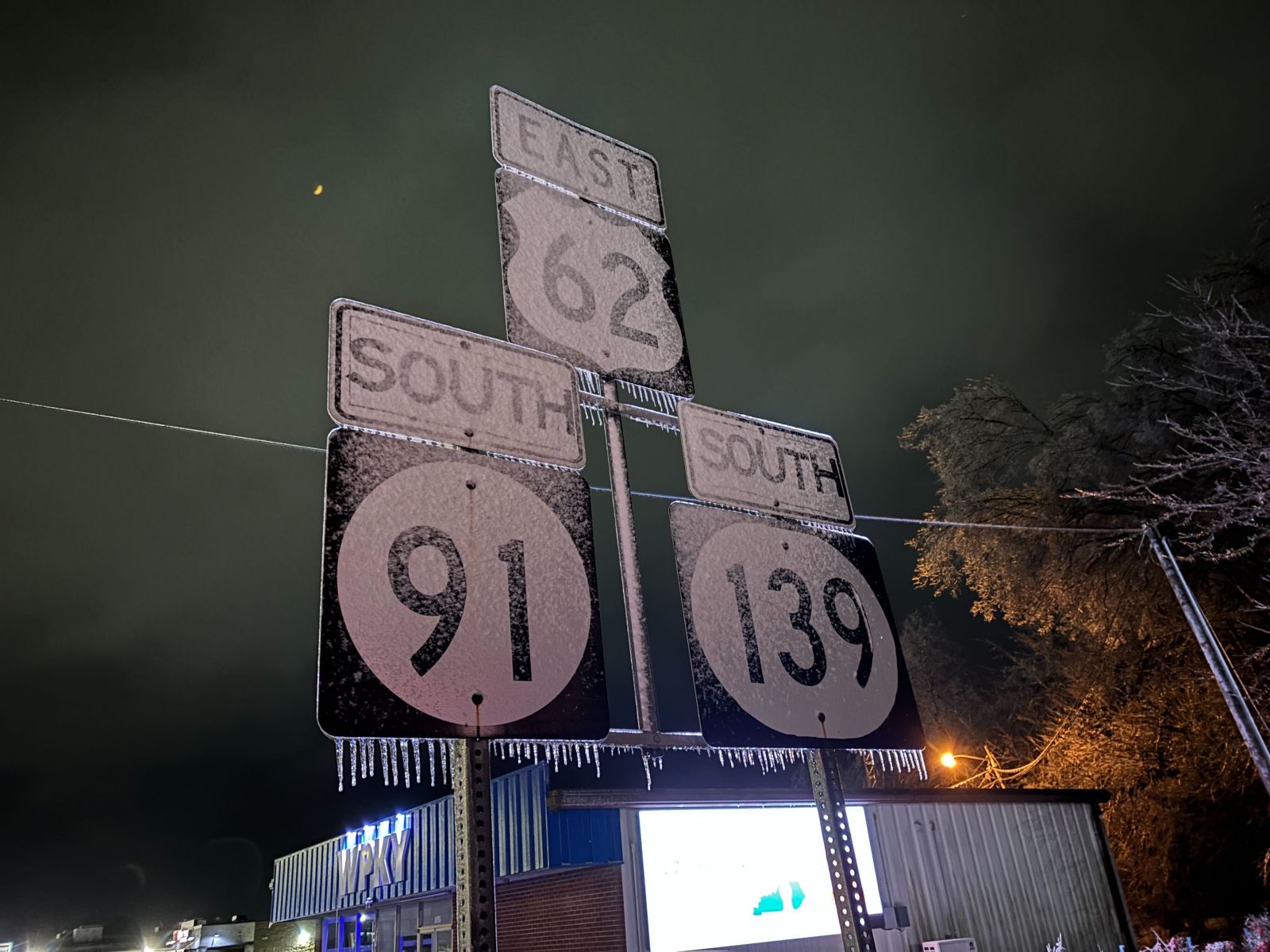
| Ice on road signs in Princeton, KY. (Joshua Claussen/WKDZ Radio) |
Ice on trees in Reidland, KY. (Jeannie Woodruff/Beau Dodson) |
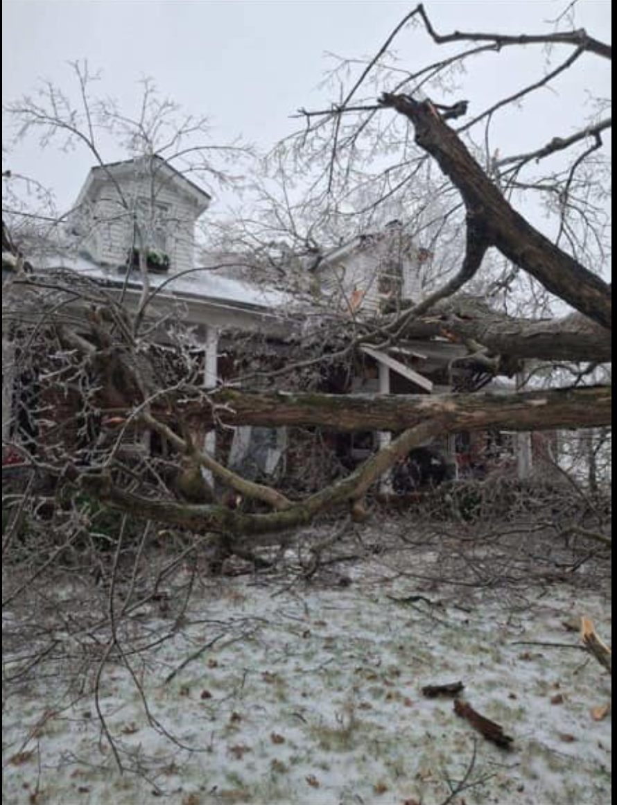
Tree fallen on a house due to ice accumulation in Morganfield, KY. (Will Hazel/Beau Dodson) |
Snow in Du Quoin, IL. (Raymond Clark/City of Du Quoin) |
 |
 |
 |
 |
| Snow in Melody Hill, IN. (David Skau) |
Snow in northeast Vanderburgh County, IN. (Walt Egenmaier) |
Snowy roads in Newburgh, IN. (Matthew Goebel/Warrick County EMA) |
Lots of snow in Princeton, IN. (Stephanie McKinney/ Gibson County EMA) |
Storm Reports
Preliminary Local Storm Report...Summary
National Weather Service Paducah KY
743 PM CST Mon Jan 6 2025
..TIME... ...EVENT... ...CITY LOCATION... ...LAT.LON...
..DATE... ....MAG.... ..COUNTY LOCATION..ST.. ...SOURCE....
..REMARKS..
0100 AM Freezing Rain Perryville 37.73N 89.87W
01/05/2025 M0.50 Inch Perry MO Public
Report received via social media with tape
measure and ice accretion.
0800 AM Freezing Rain 4 E Grahamville 37.09N 88.71W
01/05/2025 M0.20 Inch McCracken KY Public
Ice on grass, elevated surfaces, power
lines, and trees from surface to top. Roads
wet and/or icy. Report from retired NWS
employee.
0802 AM Snow 2 SE Evansville 37.96N 87.52W
01/05/2025 M1.8 Inch Vanderburgh IN Trained Spotter
1.8" snow on ground and currently snowing
heavily in Angel Mounds, IN.
0836 AM Snow 1 NW Evansville 38.00N 87.55W
01/05/2025 M3.4 Inch Vanderburgh IN Public
Heavy snow falling at time of report.
0851 AM Sleet Carbondale 37.72N 89.22W
01/05/2025 M1.0 Inch Jackson IL Trained Spotter
1 inch of sleet on the sidewalks and grounds
in and around Carbondale, reported by Elite
Spotter.
0858 AM Snow Princeton 38.36N 87.57W
01/05/2025 M3.0 Inch Gibson IN Emergency Mngr
3" measured snow on ground in Gibson County,
IN.
0915 AM Snow/Ice Dmg Princeton 37.11N 87.88W
01/05/2025 Caldwell KY Emergency Mngr
Power lines down, power outage northwest
side of town.
0930 AM Snow Petersburg 38.49N 87.28W
01/05/2025 M5.5 Inch Pike IN Public
Up to 1/2 inch of ice accumulated. Report
received via social media.
0943 AM Snow Evansville 37.98N 87.54W
01/05/2025 M2.8 Inch Vanderburgh IN Trained Spotter
2.8" snow measured north side of Evansville,
IN.
0948 AM Snow Boonville 38.05N 87.27W
01/05/2025 M3.5 Inch Warrick IN Trained Spotter
3.5" measured snow at Warrick County
Courthouse.
1003 AM Snow Du Quoin 38.00N 89.24W
01/05/2025 M1.8 Inch Perry IL Emergency Mngr
Emergency management reports 1.75" of
snow/sleet near downtown Du Quoin.
1012 AM Snow Fairfield 38.38N 88.36W
01/05/2025 M4.8 Inch Wayne IL Public
1021 AM Snow Newburgh 37.95N 87.40W
01/05/2025 M3.0 Inch Warrick IN Fire Dept/Rescue
3" of snow in Newburgh.
1029 AM Snow 6 W Petersburg 38.48N 87.39W
01/05/2025 M7.0 Inch Pike IN Emergency Mngr
Emergency Management reports 7 inches of
snow.
1030 AM Snow 4 W Duff 38.30N 87.13W
01/05/2025 M6.0 Inch Pike IN Public
Heavy snow at time of measurement.
1046 AM Snow Melody Hill 38.03N 87.51W
01/05/2025 E3.5 Inch Vanderburgh IN Emergency Mngr
3.5 inches of snow.
1106 AM Freezing Rain Cape Girardeau 37.31N 89.55W
01/05/2025 M0.25 Inch Cape Girardeau MO Broadcast Media
1119 AM Freezing Rain 2 N Murphysboro 37.80N 89.34W
01/05/2025 M0.30 Inch Jackson IL Emergency Mngr
0.3 inches of ice accumulation and sleet.
1134 AM Freezing Rain Carbondale 37.72N 89.22W
01/05/2025 M0.25 Inch Jackson IL Public
0.25 inches of freezing rain and 1 inch of
sleet.
1200 PM Snow Mount Carmel 38.42N 87.77W
01/05/2025 M6.3 Inch Wabash IL Public
Report received via social media.
1203 PM Freezing Rain 3 NE Earlington 37.30N 87.48W
01/05/2025 M0.25 Inch Hopkins KY Public
Ice measured on flat surface and tree limbs.
1205 PM Snow Fairfield 38.38N 88.37W
01/05/2025 M5.0 Inch Wayne IL Emergency Mngr
Corrects previous freezing rain report from
Fairfield. 5 inches of snow as of 11 am.
Snow has since switched over to sleet.
1240 PM Snow 2 SW Mackey 38.23N 87.41W
01/05/2025 M7.0 Inch Gibson IN Public
Report received via social media.
0100 PM Snow 4 NNW Robards 37.73N 87.57W
01/05/2025 M1.5 Inch Henderson KY Emergency Mngr
1.5 inches of snow/sleet on the ground.
Close to .10 inches of icing on trees.
0115 PM Snow/Ice Dmg Biehle 37.61N 89.84W
01/05/2025 Perry MO Public
Numerous trees down in Biehle area. Relayed
by KFVS 12.
0144 PM Snow/Ice Dmg Cape Girardeau 37.31N 89.55W
01/05/2025 Cape Girardeau MO Fire Dept/Rescue
Countless trees and branches down and power
outages across the county. Approx 2000
without power in Cape Girardeau city and
1000 without power in county.
0147 PM Freezing Rain Henderson 37.83N 87.58W
01/05/2025 E0.20 Inch Henderson KY Public
Overhead wires with a coating of ice and
freezing rain falling steadily at time of
observation.
0208 PM Snow/Ice Dmg 3 SSE Big Bay 37.28N 88.70W
01/05/2025 Massac IL Trained Spotter
Half of a tree fell and numerous limbs down
from freezing rain. Sporadic power outages.
0213 PM Snow/Ice Dmg Carbondale 37.73N 89.22W
01/05/2025 Jackson IL Emergency Mngr
Power outages increasing. Over 1000 outages
in Carbondale at 2 PM.
0215 PM Snow/Ice Dmg Herrin 37.80N 89.03W
01/05/2025 Williamson IL Fire Dept/Rescue
Trees and power lines down in the community
from freezing rain.
0216 PM Snow/Ice Dmg Cape Girardeau 37.30N 89.55W
01/05/2025 Cape Girardeau MO Fire Dept/Rescue
Large tree down and power lines down near
intersection of Perryville Rd and Sherwood
Ln in Cape Girardeau.
0227 PM Freezing Rain Melody Hill 38.02N 87.51W
01/05/2025 E0.25 Inch Vanderburgh IN Trained Spotter
About 1/4 inch of ice accretion in Melody
Hill area of Evansville.
0229 PM Flood 3 SE La Center 37.04N 88.93W
01/05/2025 Ballard KY Public
Ponding of water on some roadways in Ballard
County, including Hinkleville Rd.
0237 PM Snow/Ice Dmg Greenville 37.20N 87.18W
01/05/2025 Muhlenberg KY Emergency Mngr
Numerous reports of trees down with power
outages in Muhlenberg County.
0238 PM Freezing Rain Christopher 37.98N 89.05W
01/05/2025 M0.25 Inch Franklin IL Emergency Mngr
One quarter inch of ice from freezing rain
in Christopher. Small tree limbs starting to
break.
0254 PM Snow/Ice Dmg Murphysboro 37.77N 89.34W
01/05/2025 Jackson IL Emergency Mngr
Murphysboro Fire Dept responding to utility
lines down from freezing rain. Carbondale
Fire Dept also responding to power lines
down.
0319 PM Snow/Ice Dmg Marion 37.73N 88.94W
01/05/2025 Williamson IL Emergency Mngr
Multiple reports of trees and power lines
down across the county from freezing rain.
0330 PM Snow/Ice Dmg 1 WNW Metropolis 37.16N 88.73W
01/05/2025 Massac IL Public
Large section of a tree split by the weight
of ice. Time estimated.
0336 PM Snow/Ice Dmg Dexter 36.79N 89.96W
01/05/2025 Stoddard MO Emergency Mngr
Icing line runs from about 4 miles S of
Puxico to SE of Dexter. Everything north of
there is iced over on trees and power lines.
Little to no icing observed south of
Crowleys Ridge.
0343 PM Freezing Rain 2 WSW Evansville 37.97N 87.58W
01/05/2025 M0.25 Inch Vanderburgh IN Broadcast Media
One quarter inch of ice accretion in
Evansville. Reported by WEVV 44 News.
0343 PM Snow/Ice Dmg Evansville 37.99N 87.54W
01/05/2025 Vanderburgh IN Trained Spotter
Trees and power lines down in Evansville
from freezing rain.
0345 PM Snow 7 SE Winslow 38.32N 87.11W
01/05/2025 M7.0 Inch Pike IN Cocorahs
Snow accumulation between 7-8 inches earlier
this afternoon before changing over to
freezing rain.
0345 PM Snow/Ice Dmg 3 W Evansville 37.99N 87.59W
01/05/2025 Vanderburgh IN Broadcast Media
3 to 4 inch diameter tree limbs down from
freezing rain on west side of Evansville.
Reported by WFIE 14 News.
0349 PM Snow/Ice Dmg 3 W Bandana 37.15N 89.00W
01/05/2025 Ballard KY Trained Spotter
Numerous large tree limbs down from freezing
rain in Oscar KY area.
0350 PM Freezing Rain New Columbia 37.31N 88.78W
01/05/2025 M0.50 Inch Massac IL Trained Spotter
One half inch of ice from freezing rain
measured in New Columbia IL.
0413 PM Freezing Rain Marion 37.33N 88.08W
01/05/2025 E0.75 Inch Crittenden KY Public
Public report estimating ice accretion at
1/2 to 3/4 of an inch in Marion KY. Freezing
rain has caused multiple mangled trees and
power outages.
0418 PM Snow/Ice Dmg 1 NW Herrin 37.81N 89.05W
01/05/2025 Williamson IL Trained Spotter
Plant nursery in Herrin had canopies
collapse under weight of ice. Several
thousands of dollars of trees under canopies
likely damaged or lost. Reported by private
meteorologist.
0430 PM Snow/Ice Dmg 1 S Morganfield 37.67N 87.91W
01/05/2025 Union KY Public
Large tree fell on home from weight of ice.
0434 PM Snow/Ice Dmg 1 SW Lone Oak 37.02N 88.68W
01/05/2025 McCracken KY Public
Power lines down on trees from icing on
Clinton Road in Lone Oak KY.
0440 PM Snow/Ice Dmg 6 ESE Newburgh 37.92N 87.30W
01/05/2025 Warrick IN Fire Dept/Rescue
Tree fell on house from weight of ice in
Yankeetown IN area.
0501 PM Snow/Ice Dmg Marble Hill 37.30N 89.98W
01/05/2025 Bollinger MO Public
Public photo of ice accumulations on tree
branches. Amount unknown.
0503 PM Freezing Rain 2 S Christopher 37.94N 89.05W
01/05/2025 M0.27 Inch Franklin IL Fire Dept/Rescue
0.27 inches of ice measured.
0504 PM Freezing Rain 1 NE Marion 37.34N 88.07W
01/05/2025 M0.20 Inch Crittenden KY Public
0512 PM Snow/Ice Dmg Perryville 37.73N 89.87W
01/05/2025 Perry MO Trained Spotter
Electric crews contending with extensive
tree damage and managing thousands of meters
without electricity due to ice storm. Over
20 broken poles with broken crossarms and
insulators reported.
0513 PM Snow/Ice Dmg 4 SE Evansville 37.95N 87.49W
01/05/2025 Vanderburgh IN Amateur Radio
Report relayed of transformers blowing with
trees and wires down from freezing rain in
Evansville.
0514 PM Snow/Ice Dmg Carterville 37.76N 89.08W
01/05/2025 Williamson IL Public
Public reports large tree branches on homes
via photos.
0537 PM Freezing Rain Jackson 37.38N 89.65W
01/05/2025 M0.50 Inch Cape Girardeau MO Trained Spotter
Spotter report of 0.50" measured ice on
trees.
0541 PM Freezing Rain 2 S Du Quoin 37.98N 89.24W
01/05/2025 M0.38 Inch Perry IL Emergency Mngr
Emergency management reports of 0.38 inches
of ice. Also measured 3 inches of
accumulated snow and sleet.
0542 PM Freezing Rain Perryville 37.73N 89.87W
01/05/2025 M0.75 Inch Perry MO Public
0.75 inches of freezing rain measured.
Numerous tree limbs and trees down.
0613 PM Snow/Ice Dmg 2 S Evansville 37.95N 87.55W
01/05/2025 Vanderburgh IN Amateur Radio
Tree fell on neighbors house from weight of
ice.
0618 PM Snow/Ice Dmg Cambria 37.78N 89.12W
01/05/2025 Williamson IL Trained Spotter
Trees and amateur radio antenna toppled by
ice storm in Cambria. Tree blocking Cambria
Road.
0624 PM Snow/Ice Dmg Broughton 37.94N 88.46W
01/05/2025 Hamilton IL Emergency Mngr
Substantial icing in Hamilton County with
trees down in the south end of the county.
0745 PM Snow/Ice Dmg Herrin 37.81N 89.03W
01/05/2025 Williamson IL Fire Dept/Rescue
Herrin Fire Dept has received 35 calls for
trees and power lines down. Several areas of
town without power.
0800 PM Snow/Ice Dmg 1 S Stonefort 37.60N 88.71W
01/05/2025 Williamson IL Utility Company
Power Outages website indicates tens of
thousands without power in southern Illinois
as of 8 PM CST, including over 5000 in
Jackson County, over 11000 in Williamson
County, over 9000 in Saline County, over
1900 in Gallatin County, over 2600 in Pope
County, near 2000 in Hardin County.
0800 PM Snow/Ice Dmg 3 NNE Waverly 37.76N 87.79W
01/05/2025 Henderson KY Utility Company
Power Outages website indicates thousands
without power in northwest Kentucky as of 8
PM CST, including over 3600 in Union County
and over 7000 in Henderson County.
0800 PM Snow/Ice Dmg 3 SSW Dycusburg 37.12N 88.21W
01/05/2025 Livingston KY Utility Company
Power Outages website indicates thousands
without power in western Kentucky as of 8 PM
CST, including over 1700 in Livingston
County, and over 1900 in Lyon County.
0800 PM Snow/Ice Dmg 1 WSW Biehle 37.60N 89.86W
01/05/2025 Perry MO Utility Company
Power Outages website indicates thousands
without power in southeast Missouri as of 8
PM CST, including over 2500 in Bollinger
County, over 4000 in Cape Girardeau County,
over 5500 in Perry County.
0811 PM Freezing Rain Vergennes 37.90N 89.34W
01/05/2025 M0.50 Inch Jackson IL Public
0.5 inches of ice on trees, and 1.75 inches
of sleet total. Still freezing drizzle
falling at observation time.
0841 PM Snow 1 S Fort Branch 38.24N 87.58W
01/05/2025 M6.0 Inch Gibson IN Public
1000 PM Snow/Ice Dmg Herrin 37.80N 89.03W
01/05/2025 Williamson IL Fire Dept/Rescue
Major tree and power line damage with
numerous roads closed or blocked. Some
buildings damaged. Time estimated.
1030 PM Snow/Ice Dmg Evansville 37.98N 87.54W
01/05/2025 Vanderburgh IN Public
Several trees broken and damaged. Pictures
shared via social media. Ice total unknown.
0600 AM Freezing Rain 6 WSW Greenville 37.16N 87.27W
01/06/2025 M0.30 Inch Muhlenberg KY Cocorahs
0.3 inch of ice. 0.2 inch of snow.
0600 AM Freezing Rain Mount Vernon 37.94N 87.90W
01/06/2025 M0.50 Inch Posey IN CO-OP Observer
24 hour total.
0700 AM Snow 2 NNE Melody Hill 38.05N 87.50W
01/06/2025 M4.0 Inch Vanderburgh IN Cocorahs
Two day peak snowfall total, which ended up
being compressed due to transition to sleet
and freezing rain.
0700 AM Freezing Rain North City 37.99N 89.06W
01/06/2025 M0.20 Inch Franklin IL CO-OP Observer
0.2 inch of freezing rain, 0.8 inch of
snow/sleet.
0700 AM Freezing Rain De Soto 37.81N 89.22W
01/06/2025 M0.30 Inch Jackson IL Cocorahs
0.3 inch of freezing rain, 1.2 inch of sleet
solidified by the freezing rain, 1.5 inches
of snow (0.5 inch of snow as bottom layer, 1
inch on top).
0700 AM Snow 2 NNE Belle Rive 38.26N 88.73W
01/06/2025 M5.5 Inch Jefferson IL Cocorahs
5.5 inches of snow with 0.1 inch of ice.
0700 AM Snow 2 NNE Phillipstown 38.17N 88.01W
01/06/2025 M6.0 Inch White IL Cocorahs
6 inches of snow with a roughly 1 inch layer
of sleet and freezing rain mix in the
middle.
0700 AM Snow Francisco 38.33N 87.45W
01/06/2025 M5.0 Inch Gibson IN Cocorahs
5 inches of snow/sleet with a quarter inch
of freezing rain.
0700 AM Snow 3 SSE Poseyville 38.14N 87.75W
01/06/2025 M6.9 Inch Posey IN Cocorahs
6.9 inch snow/sleet total.
0700 AM Snow 3 SW Darmstadt 38.06N 87.62W
01/06/2025 M4.6 Inch Vanderburgh IN Cocorahs
Snow/sleet total with some mixing of
freezing rain.
0700 AM Snow Newburgh 37.94N 87.40W
01/06/2025 M5.0 Inch Warrick IN Cocorahs
5 inches of snow with some mixing of sleet
and freezing rain.
0700 AM Freezing Rain Crofton 37.05N 87.49W
01/06/2025 M0.25 Inch Christian KY Cocorahs
Quarter inch of ice. Mix of rain, freezing
rain, sleet, and snow flurries. Broken tree
limbs and scattered power outages.
0700 AM Freezing Rain 2 WSW Thompsonville 37.90N 88.79W
01/06/2025 M0.50 Inch Franklin IL Cocorahs
Half inch of ice and 1.5 inches of snow.
Numerous trees and branches downed with
power outages.
0715 AM Freezing Rain 1 NW Princeton 37.12N 87.90W
01/06/2025 E0.15 Inch Caldwell KY Broadcast Media
Layer of ice from freezing rain/drizzle on
various surfaces/objects around WPKY-FM
studio in Princeton with a lighter glaze on
roads.
0724 AM Freezing Rain Murphysboro 37.76N 89.33W
01/06/2025 M0.40 Inch Jackson IL Emergency Mngr
Storm total ice of 0.4 inch with 1 inch of
snow.
0730 AM Freezing Rain 6 S Marion 37.65N 88.95W
01/06/2025 M0.65 Inch Williamson IL Amateur Radio
Storm total ice of 0.65 inches and 1 inch of
snow. Many tree branches were downed in the
area.
0800 AM Freezing Rain Henderson 37.84N 87.58W
01/06/2025 M0.50 Inch Henderson KY Broadcast Media
Storm totals of a half inch of ice measured
on northeast side of Henderson, after 2.1
inches of snow.
0800 AM Freezing Rain Du Quoin 38.01N 89.24W
01/06/2025 M0.30 Inch Perry IL Emergency Mngr
Storm total of 0.3 inch freezing rain, 0.3
inch sleet, and 1.5 inches of snow.
0800 AM Snow Cape Girardeau 37.30N 89.55W
01/06/2025 M0.5 Inch Cape Girardeau MO Broadcast Media
Half inch of snow in Cape Girardeau.
0827 AM Rain 4 E Grahamville 37.09N 88.71W
01/06/2025 M2.00 Inch McCracken KY Public
0900 AM Snow 1 NNE Newburgh 37.96N 87.39W
01/06/2025 M5.1 Inch Warrick IN Cocorahs
5.1 inches of snow with 0.3 inches of an icy
mix of sleet and freezing rain.
1108 AM Freezing Rain 1 SW West Frankfort 37.89N 88.94W
01/06/2025 M0.30 Inch Franklin IL Public
Fallen tree branches in the area.
 |
Media use of NWS Web News Stories is encouraged! Please acknowledge the NWS as the source of any news information accessed from this site. |
|

