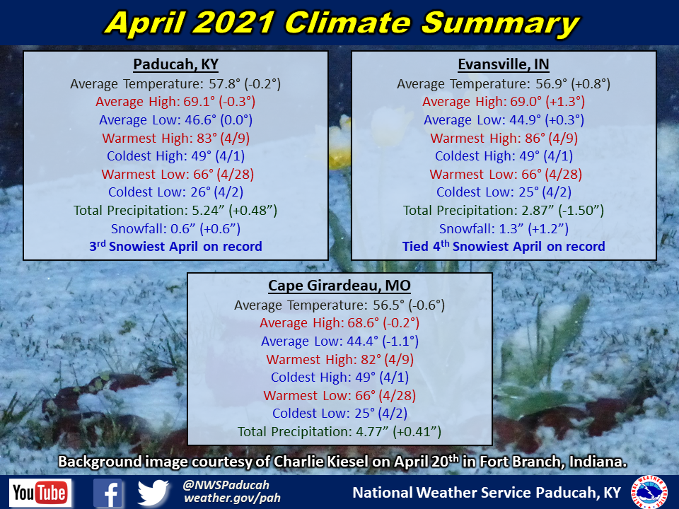
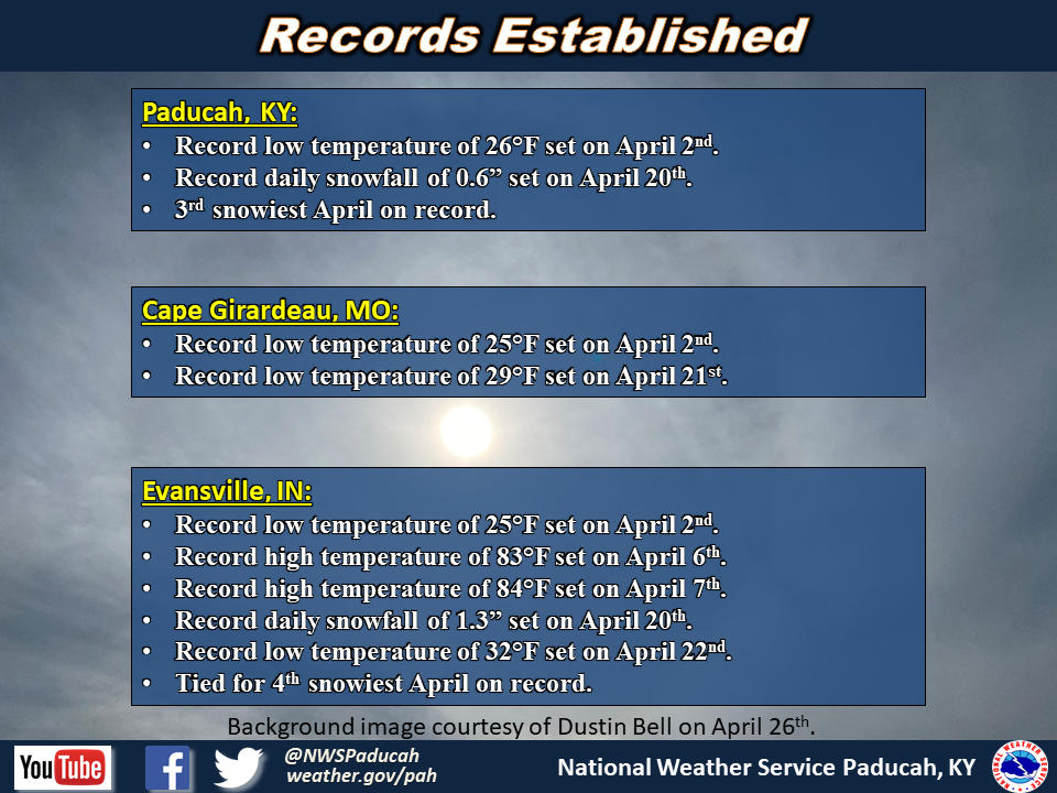
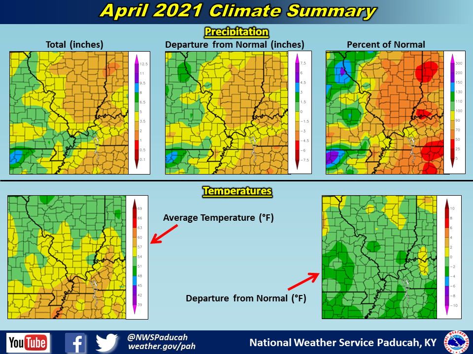
April 2021 Climate Review: Temperatures finished near to slightly below normal across much of the region. Evansville was one of the lone exceptions, finishing slightly above normal. As is common during the transition seasons, temperatures were up and down throughout the month. After a cold first couple of days to the month, above normal temperatures were commonplace from the 4th through the 13th. After this, a prolonged period of below normal temperatures was experienced from the 15th through the 25th. This included record lows in the upper 20s to mid 30s occurring April 20-22. These abnormally cold temperatures allowed a rare late season snow to fall on April 20th across the region. Evansville picked up 1.3” and Paducah received 0.6”, both of which became the latest measurable snow on record dating back to 1948 and 1937 respectively. We quickly warmed up again during the final week of the month, with temperatures back into the 70s and low 80s.
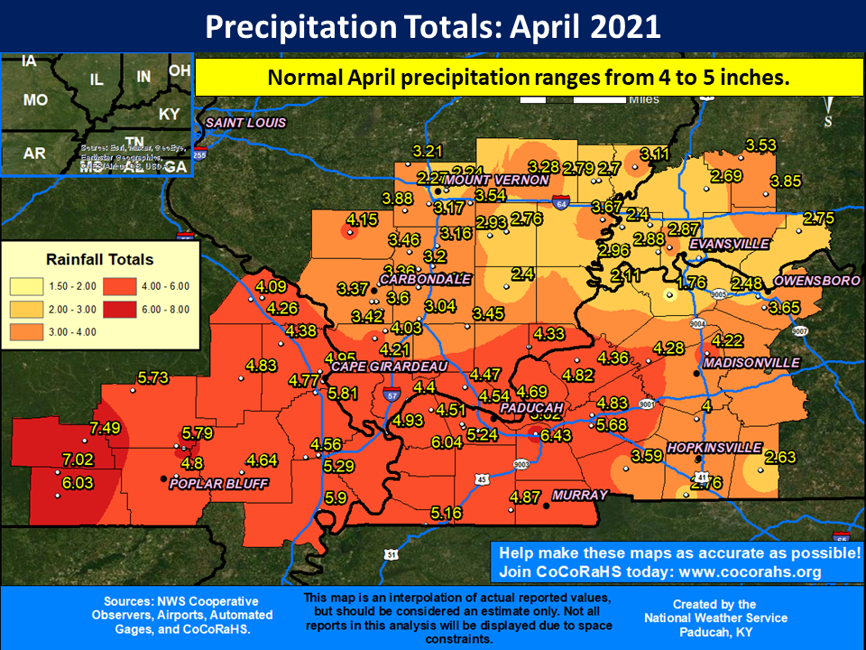
Precipitation varied across the region, essentially split in half between drier and wetter than normal. Most of southeast Missouri, far southern Illinois, and far western Kentucky finished wetter than normal. Meanwhile, a large chunk of southern Illinois into southwest Indiana and the Pennyrile region of west Kentucky ended drier the normal. Some locations from Shawneetown, IL east into the Henderson, Evansville and Santa Clause, IN areas received amounts ranging from 2 to 3 inches. The lowest observed report was 1.76” from the Henderson, KY COOP station. On the flip side, there were some locations in southeast Missouri and far west Kentucky that picked up over 6” of rain. The heaviest observed amount in our forecast area was 7.49” at the Ellsinore, MO 4.8 WNW CoCoRaHS station.
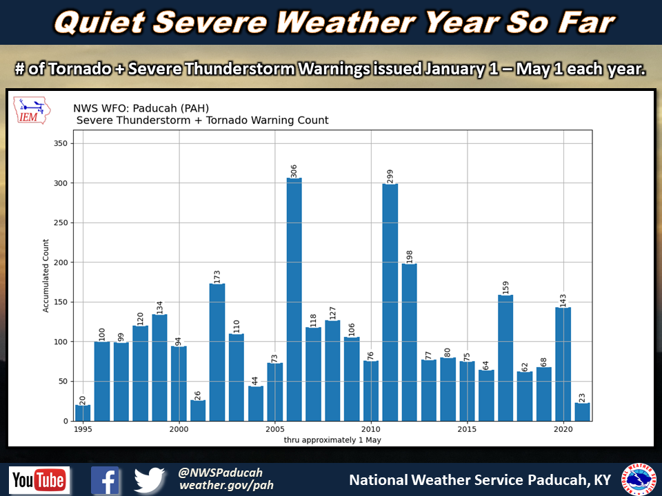
It was another quieter than normal month for severe thunderstorms in our area. There were 15 combined Severe Thunderstorm and Tornado Warnings issued. This is well below the average number for April of 58 warnings. This brings our total count of combined severe thunderstorm and tornado warnings to 23 since January 1. This is our lowest total of warnings issued in the first 4 months of the year since way back in 1995 (only 20 warnings issued January 1 – April 30 that year). For comparison, the average number of warnings (SVR+TOR) issued through May 1 is around 108. Each of the past 16 years dating back to 2005, NWS Paducah had issued at least 62 warnings up to this point.
The graphic below is an interpolated rainfall map using actual observations. Please note that there are likely discrepancies in between observations, since the values are estimated based on nearest reports.
| April 2021 Review: Precipitation and Temperature Maps (Click on image to enlarge) |
 |
| Climate Maps are from the Northeast Regional Climate Center |