Overview
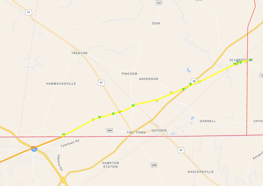
Clusters of thunderstorms developed by mid morning across northeast Arkansas and the Missouri Bootheel. They lifted northeast across west Kentucky and Tennessee during the late morning and into the afternoon. A few of these storms became severe across west Kentucky. The prominent storm moved from Clarksville, TN into southern Todd County around 2 PM before moving into Logan County. NWS Damage surveys confirmed that an EF-2 tornado touched down in Todd County. Damage was rated EF-3 just south of our border in the Clarksville, TN area. This tornado was on the ground for approximately 48 miles, 13 of which were in our forecast area.Tornado:
|
Tornado - Southern Todd County, KY
|
||||||||||||||||
The Enhanced Fujita (EF) Scale classifies tornadoes into the following categories:
| EF0 Weak 65-85 mph |
EF1 Moderate 86-110 mph |
EF2 Significant 111-135 mph |
EF3 Severe 136-165 mph |
EF4 Extreme 166-200 mph |
EF5 Catastrophic 200+ mph |
 |
|||||
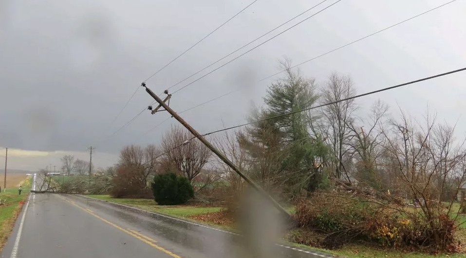
Photos
 |
 |
 |
 |
| Damage in southern Todd County courtesy of WEKT Radio | Damage in southern Todd County courtesy of WEKT Radio | Damage in southern Todd County courtesy of WEKT Radio | Damage in southern Todd County courtesy of NWS Storm Survey |
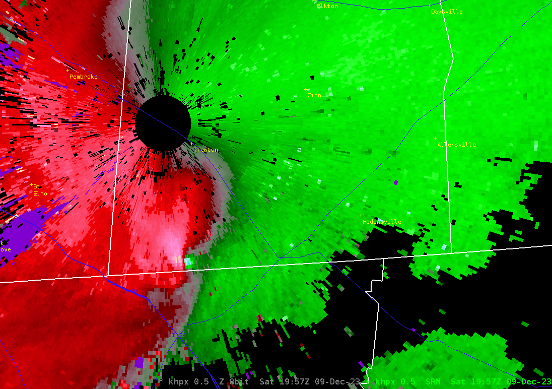
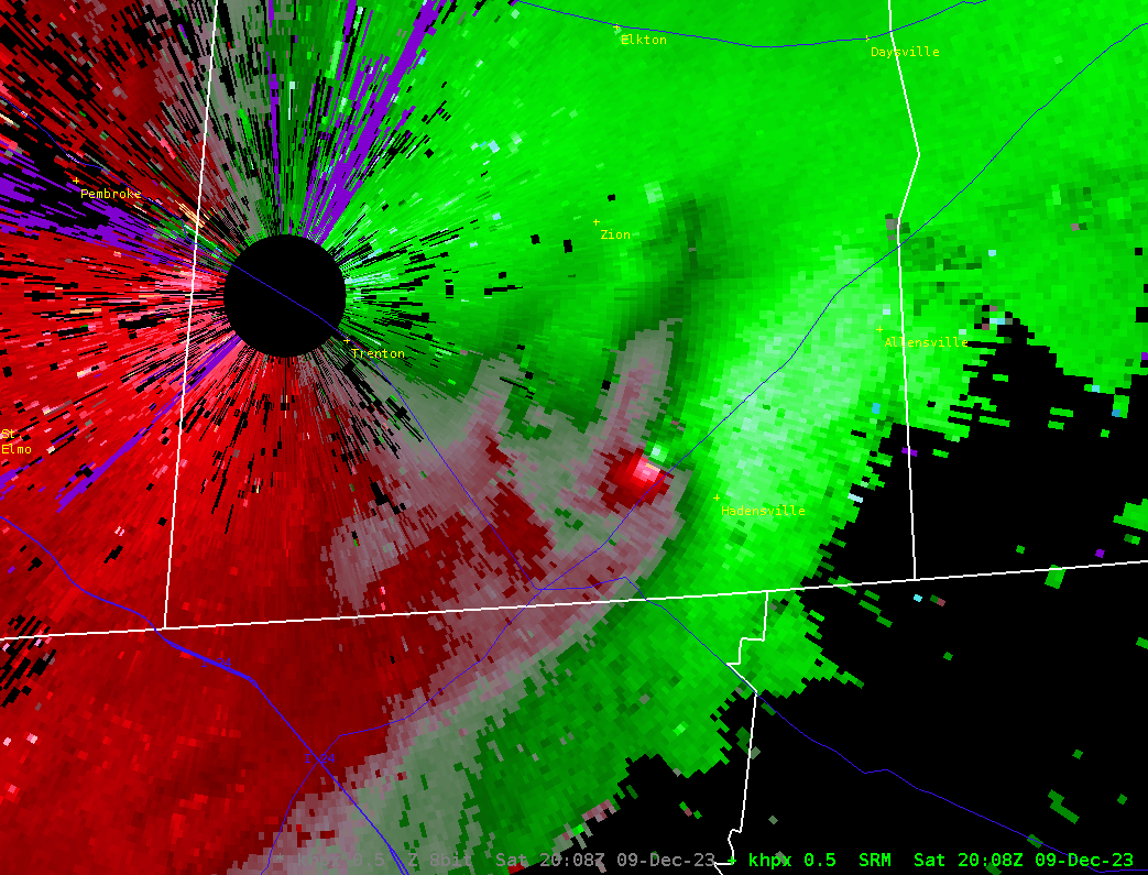
Radar
Here is a radar loop of this event.
 |
 |
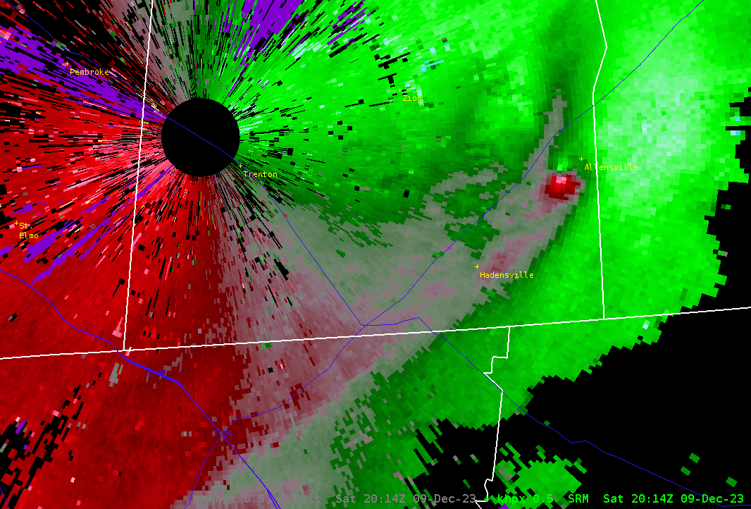 |
| Storm Relative Velocity at 1:57 PM CST | Storm Relative Velocity at 2:08 PM CST | Storm Relative Velocity at 2:14 PM CST |
Storm Reports
Preliminary Local Storm Report...Summary
National Weather Service Paducah KY
629 PM CST Sat Dec 9 2023

..TIME...   ...EVENT...      ...CITY LOCATION...     ...LAT.LON...
..DATE...   ....MAG....      ..COUNTY LOCATION..ST.. ...SOURCE....
            ..REMARKS..

0203 PM     Tornado          2 WNW Guthrie           36.66N 87.21W
12/09/2023                   Todd               KY   Broadcast Media

            Trees down along US 41 southeast of Trenton,
            KY. Relayed by WHOP radio. Time estimated
            from radar.

0211 PM     Tornado          4 NE Guthrie            36.69N 87.13W
12/09/2023                   Todd               KY   Trained Spotter

            Trained spotter reports many trees and
            powerlines down and barnes destroyed in
            addition to minor damage to houses along US
            79 southwest of Allensville. Time estimated
            from radar.

0214 PM     Tornado          Allensville             36.72N 87.07W
12/09/2023                   Todd               KY   Public

            Social media and public reports quite a bit
            of damage in and near Allensville.

1135 AM     Hail             3 NNW Lone Oak          37.07N 88.69W
12/09/2023  E0.70 inch       McCracken          KY   Public

            Reported at Kentucky Oaks Mall in Paducah.

0947 AM     Hail             Fulton                  36.51N 88.88W
12/09/2023  M0.70 inch       Fulton             KY   Trained Spotter
Environment
A cold front was moving eastward across western Kentucky around midday on December 9th. Aloft we had a strong mid and upper level jet streak across the Midwest with Kentucky and Tennessee in the favored right entrance region for thunderstorm development.
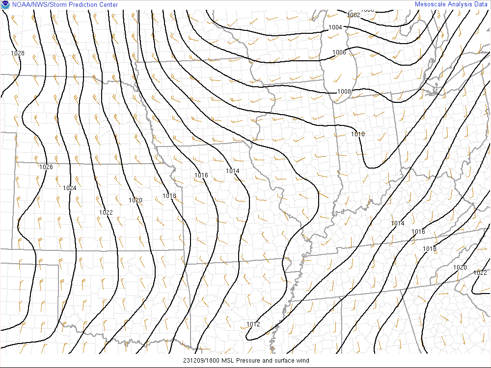 |
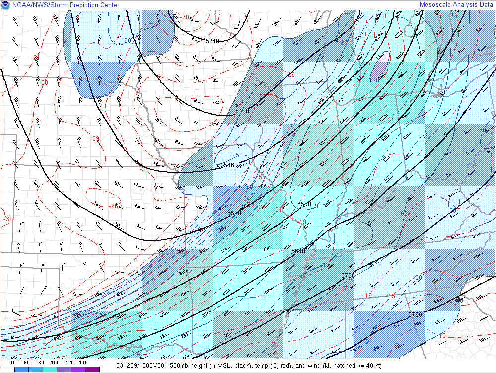 |
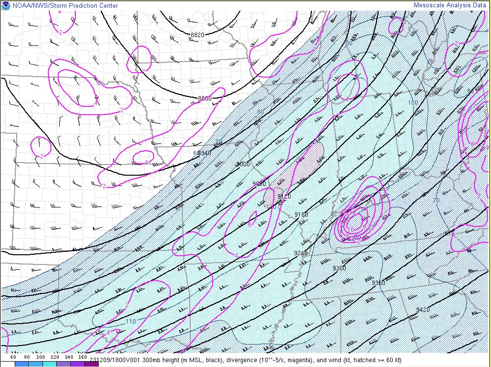 |
| Surface Chart (MSLP) at 12 PM CST Dec 9 | 500 mb chart at 12 PM CST Dec 9 | 300 mb chart at 12 PM CST Dec 9 |
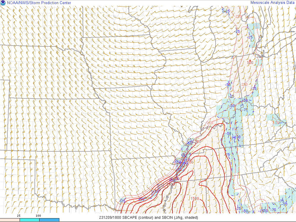
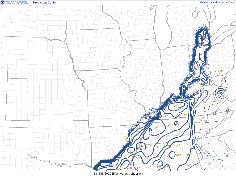
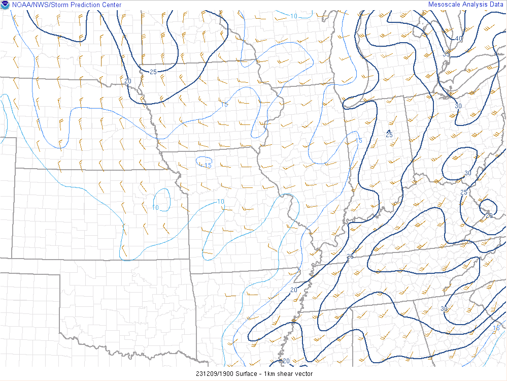
The airmass had become quite unstable by Noon across western Tennessee and into far southern portions of west Kentucky (SBCAPE in excess of 1000 j/kg). As is commonly the case during the cool season, we had plenty of wind shear present with both low level and deep layer values supportive for damaging winds and tornado threats with any thunderstorms.
 |
 |
 |
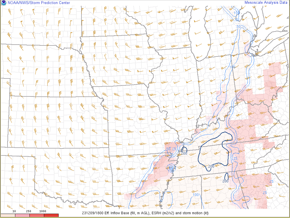 |
| Surface Based CAPE at 12 PM CST Dec 9 | Effective Bulk Shear at 2 PM CST Dec 9 | 0-1 km shear at 1 PM CST Dec 9 | Effective SRH at 12 PM CST Dec 9 |
 |
Media use of NWS Web News Stories is encouraged! Please acknowledge the NWS as the source of any news information accessed from this site. |
|