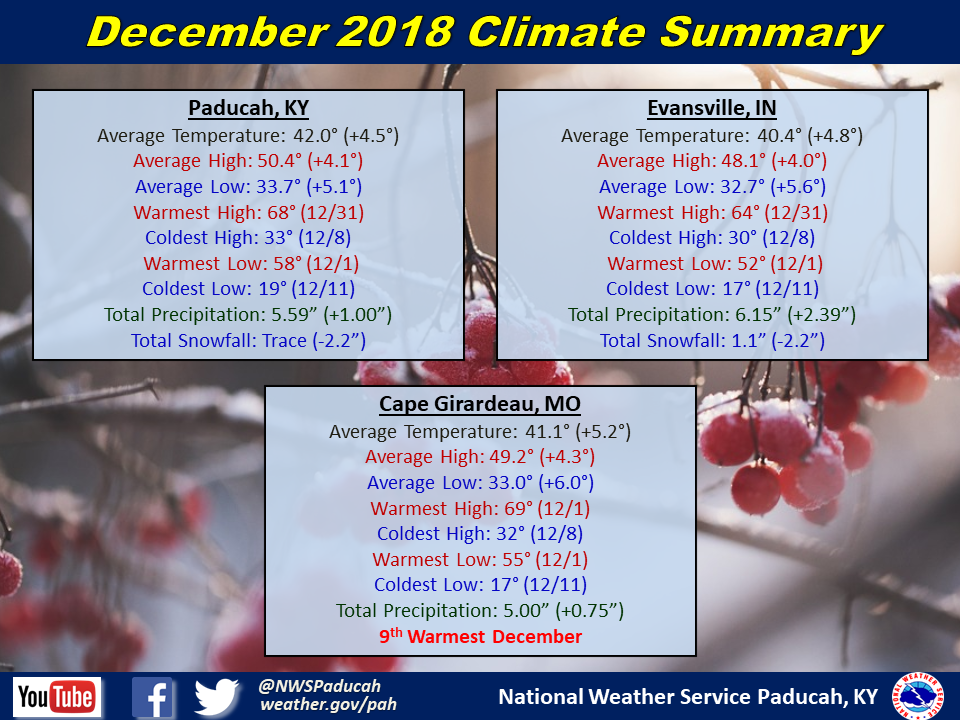
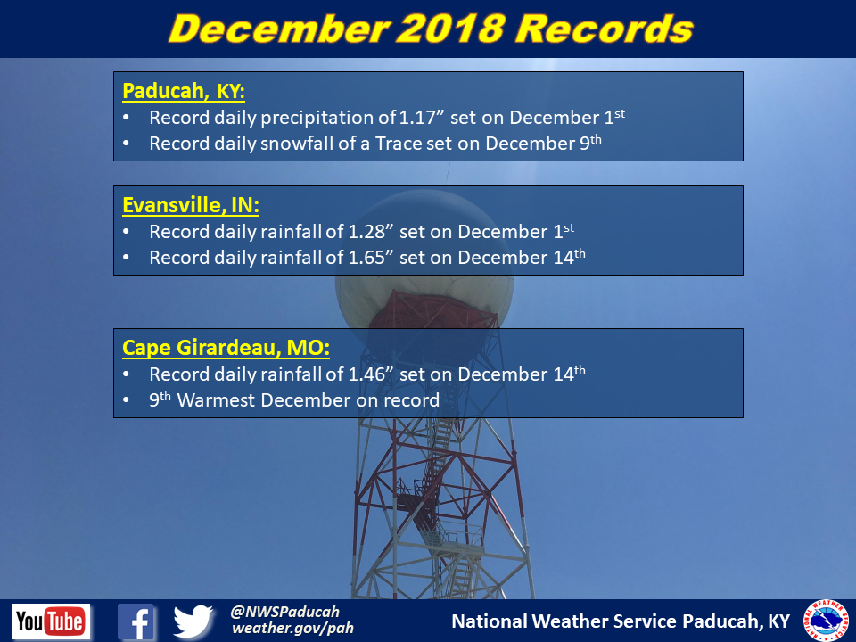
December 2018 Climate Review: Above normal temperatures were common throughout much of the month with temperatures finishing 4 to 5 degrees above normal. This was a nice change after the cold November. In fact, the average temperature for the month was actually the exact same in both November and December in Evansville, and nearly the same in Paducah. Typically, December temperatures average around 11 degrees colder than November.
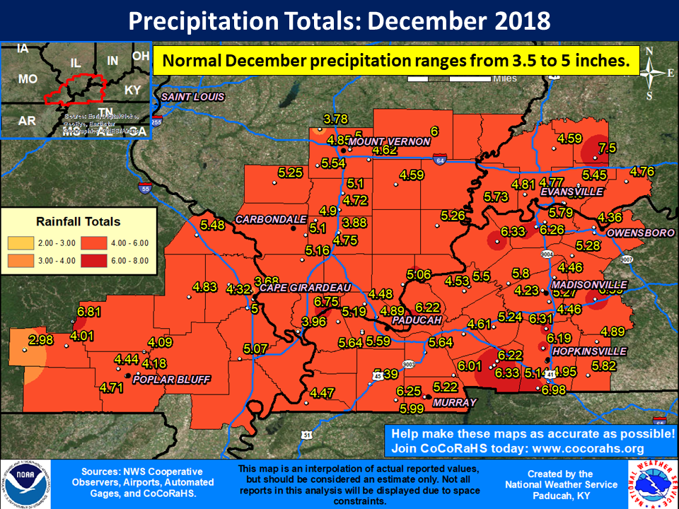
As for precipitation, the month finished wetter than normal across a large portion of the region, particularly across sections of southern Illinois, southwest Indiana, and the Pennyrile region of western Kentucky. Drier than normal conditions were observed across portions of southeast Missouri and the Jackson Purchase area of west Kentucky. With the lack of cold air much of the month, very little to no snow fell. This was the 4th consecutive December to finish with no measurable snow in Paducah. Evansville did pick up around 1 inch of snow on December 4th into the 5th. The year ended with a bang, with a line of thunderstorms producing damaging winds across the region during the late morning and early afternoon hours on New Year’s Eve Day.
The graphic below is an interpolated rainfall map using actual observations. Please note that there are likely discrepancies in between observations, since the values are estimated based on nearest reports.
| December 2018 Review: Precipitation and Temperature Maps (Click on image to enlarge) |
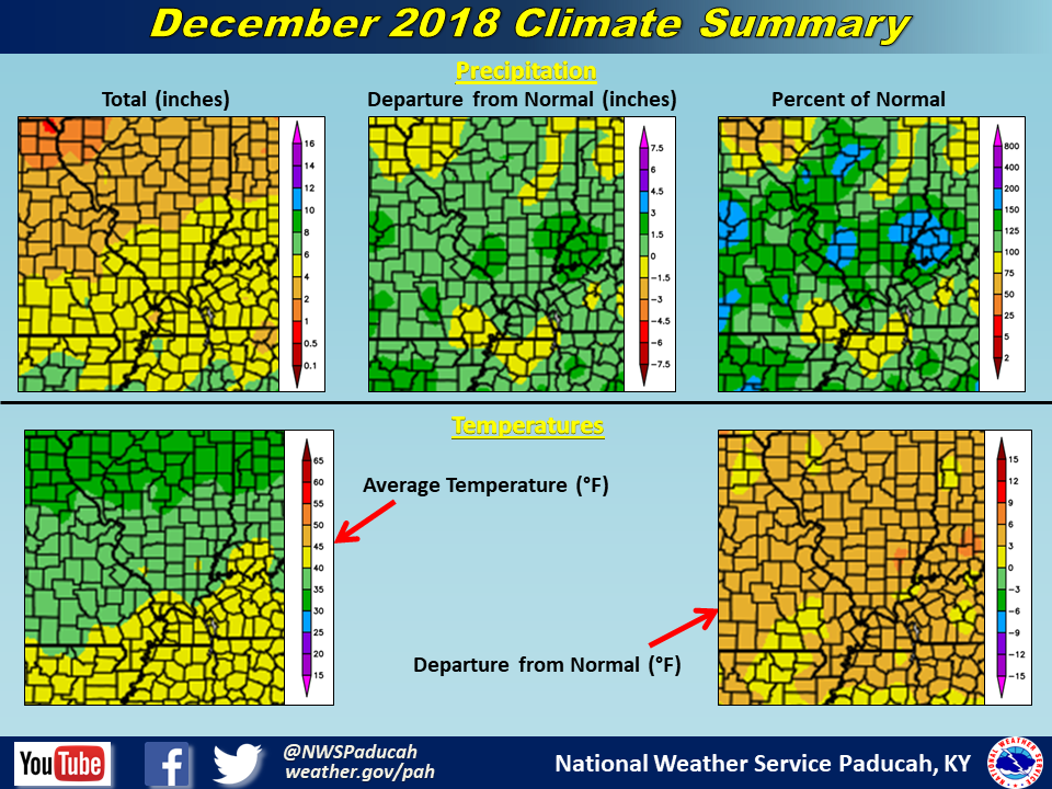 |
| Climate Maps are from the Northeast Regional Climate Center |