Paducah, KY
Weather Forecast Office
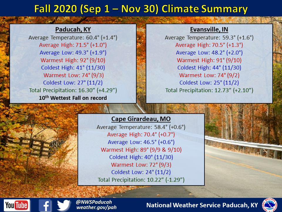
Fall 2020 Climate Summary: Temperatures averaged above normal by around 1 to 1.5 degrees. The warmest month compared to normal was November with temperatures 3.5 to 5 degrees above normal. October was the only month of the season to finish below normal.
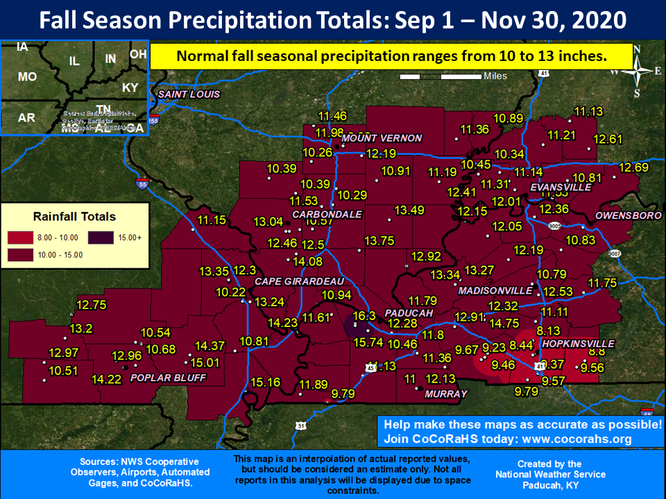
Precipitation was variable across the region with both Paducah and Evansville finishing wetter than normal. Paducah registered their 10th wettest Fall on record. Southern portions of west Kentucky were the driest relative to normal, although some other locations across the region were drier than normal as well. The highest observed amount for the season occurred in Paducah with the NWS Office picking up 16.86”, while the Airport received 16.30. Meanwhile portions of the southern Kentucky Pennyrile only received 8 to 9 inches.
 |
| Fall 2020 Review: Precipitation and Temperature Maps |
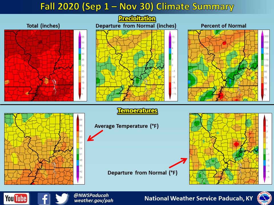 |
| Climate Maps are from the Northeast Regional Climate Center |
FORECASTS
Forecast Discussion
User Defined Area Forecast
Hourly Forecasts
Fire Weather
Activity Planner
LOCAL INFORMATION
Aviation Weather
Our Office
SKYWARN
Items of Interest
Hazardous Weather Support
Local Observations
Weather History
NWS Paducah KY Weekly Partner Briefing
US Dept of Commerce
National Oceanic and Atmospheric Administration
National Weather Service
Paducah, KY
8250 Kentucky Highway 3520
West Paducah, KY 42086-9762
270-744-6440
Comments? Questions? Please Contact Us.