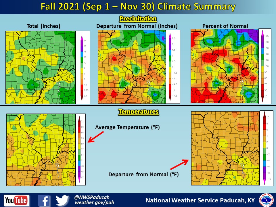
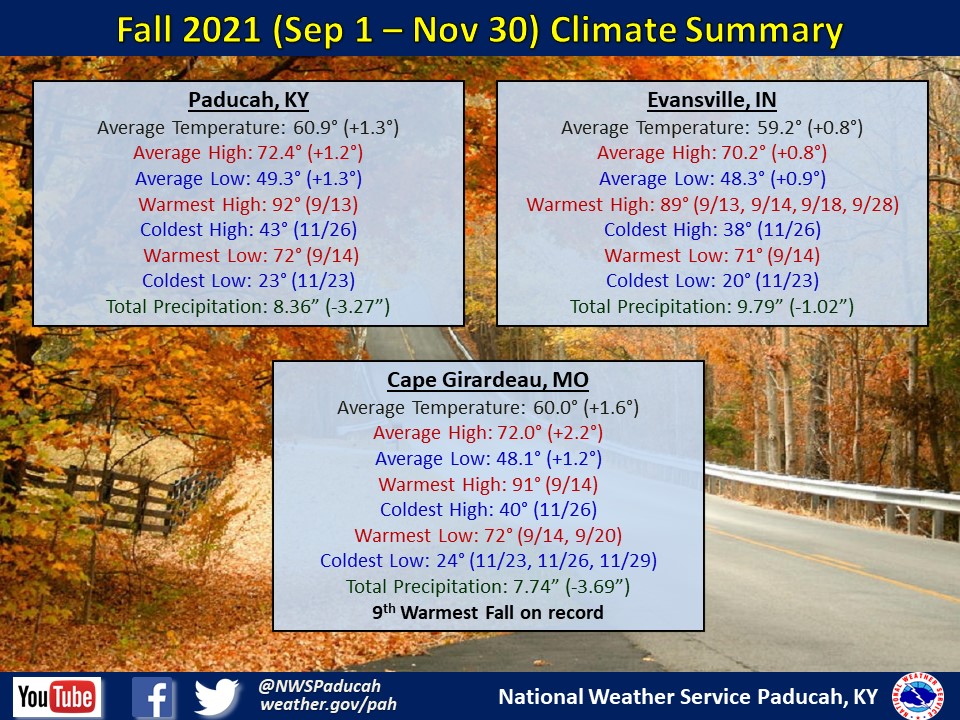
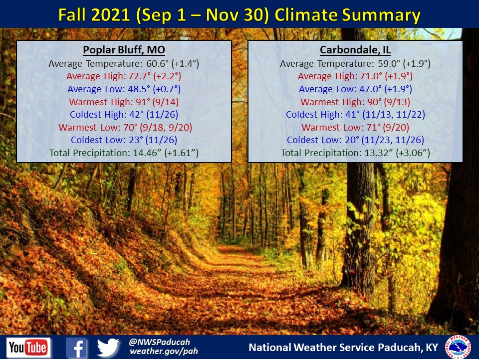
Fall 2021 Climate Summary: Temperatures averaged above normal by around 1 to 2 degrees. The warmest month compared to normal was October with temperatures 4 to 6 degrees above normal while the coldest compared to normal was November with temperatures 1.5 to 3.5 degrees below normal. It was the 9th warmest fall at Cape Girardeau.
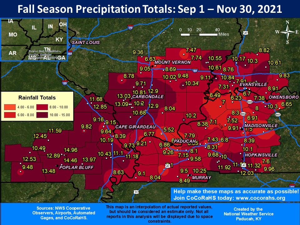
Precipitation was variable across the region with both Carbondale and Poplar Bluff finishing wetter than normal. Aside from counties that include or are near those two cities, precipitation was near or below average for the rest of the Quad State. Sites near Poplar Bluff received the most precipitation with almost 15’’ of rainfall, while the lowest totals were around 6-8 inches, primarily at sites near the Ohio River. November was drier than normal across the entire Quad State, while September and October had some above normal and some below normal areas.
The graphic below is an interpolated rainfall map using actual observations. Please note that there are likely discrepancies in between observations, since the values are estimated based on nearest reports.
| Summer 2021 Review: Precipitation and Temperature Maps (Click on image to enlarge) |
 |
| Climate Maps are from the Northeast Regional Climate Center |
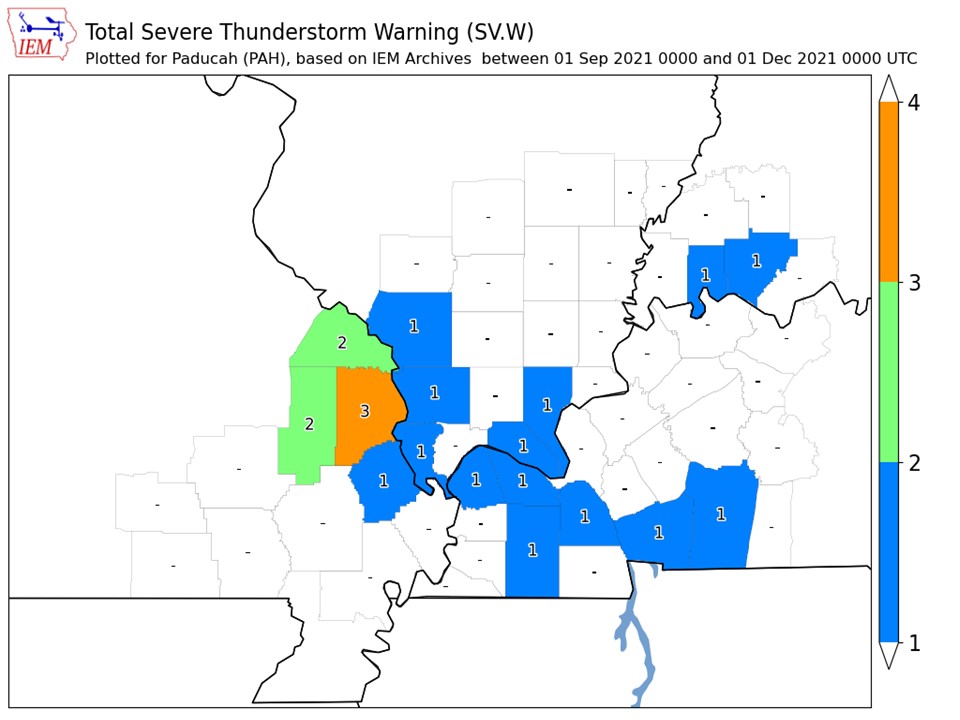
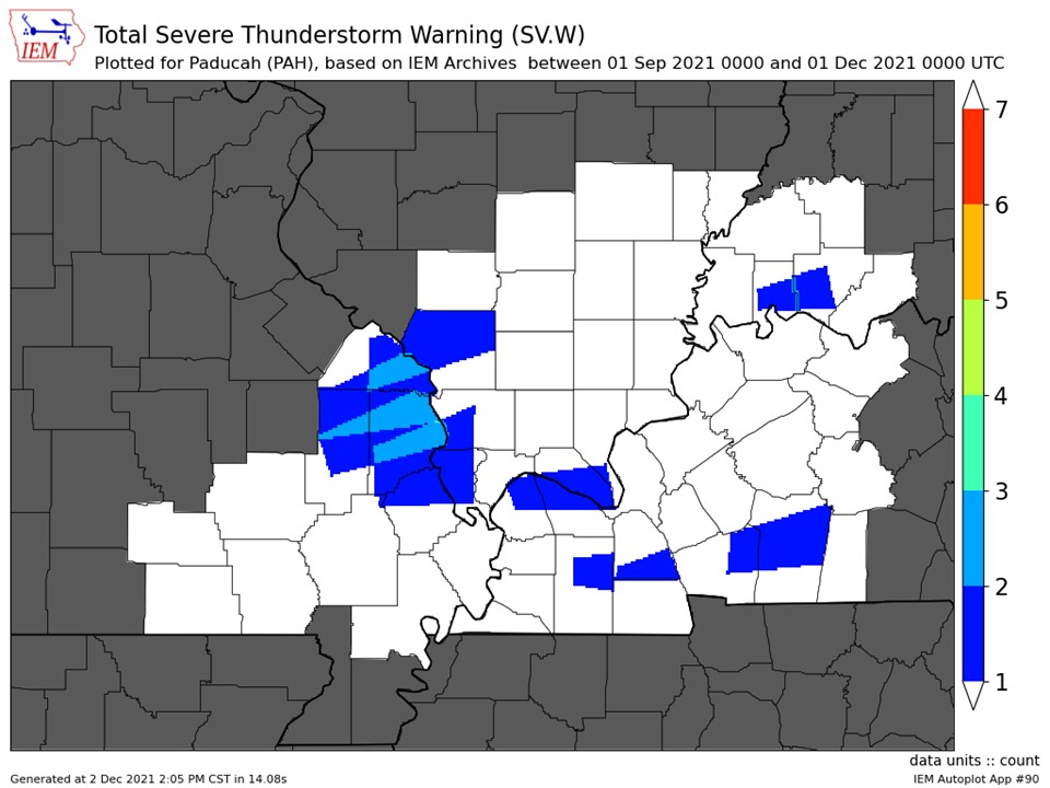
| Severe Thunderstorm Warnings - County Based | Severe Thunderstorm Warnings - Polygon Based |
 |
 |
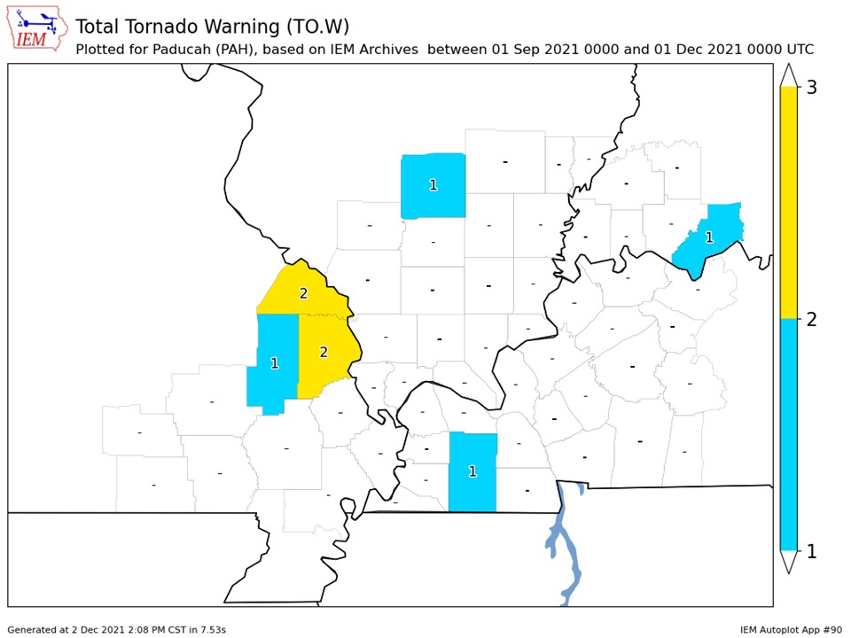
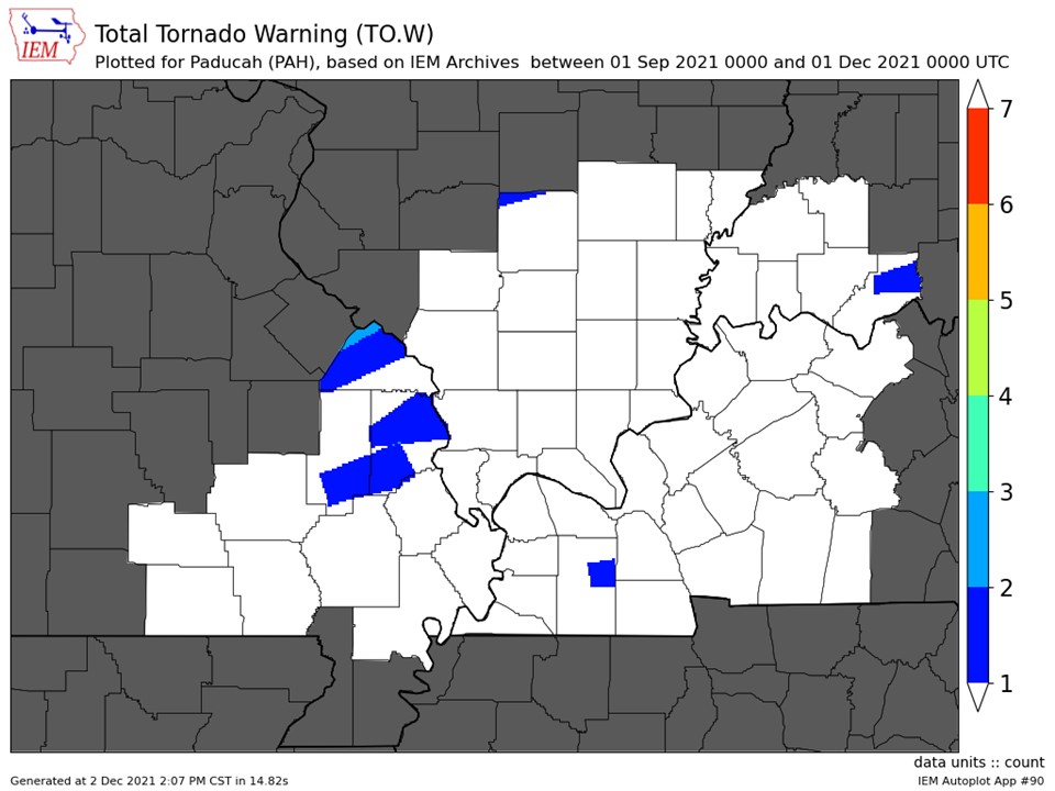
| Tornado Warnings - County Based | Tornado Warnings - Polygon Based |
 |
 |

