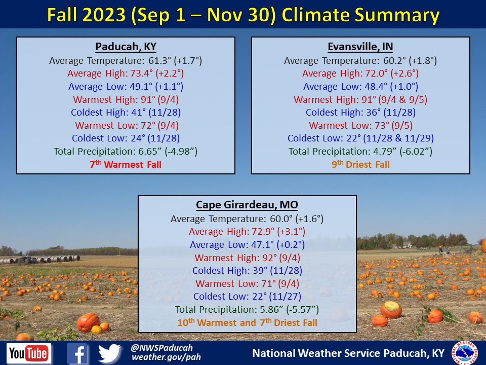
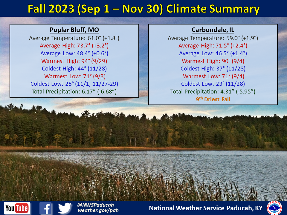
Fall 2023 Climate Summary:
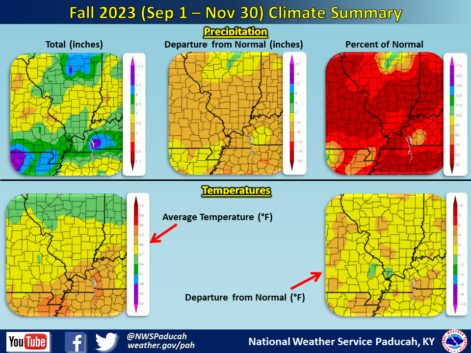
Temperatures averaged above normal by 1.5 to 2 degrees. All 3 months of the season were fairly similar regarding temperature departures with each one finishing 1.5 to 2 degrees above normal.
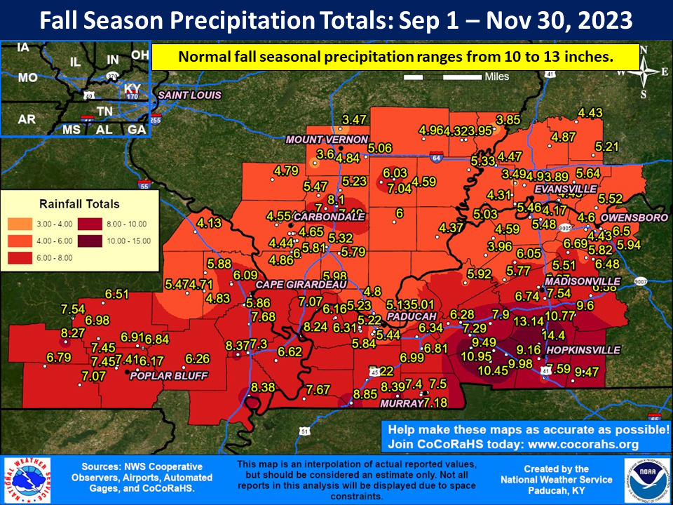
On the heels of a very wet summer, the faucet turned off during the fall season. 3 of our 5 climate sites registered a top 10 driest fall. Most locations only received amounts ranging from 4 to 8 inches. Deficits of 5 to 7 inches were commonplace, with many areas observing 50% or less of normal rainfall. Highest totals were focused across southern sections of western Kentucky, in particular areas of Trigg, Christian and Todd counties. Some of this area received amounts over 10”. The highest observed amount was 14.4 inches at the Christian County Kentucky Mesonet site (6 miles north of Hopkinsville). On the flip side, there were a few locations that didn’t even receive 4 inches in portions of southeast Illinois and southwest Indiana.
The graphic below is an interpolated rainfall map using actual observations. Please note that there are likely discrepancies in between observations, since the values are estimated based on nearest reports.
| Fall 2023 Review: Precipitation and Temperature Maps (Click on image to enlarge) |
 |
| Climate Maps are from the Northeast Regional Climate Center |
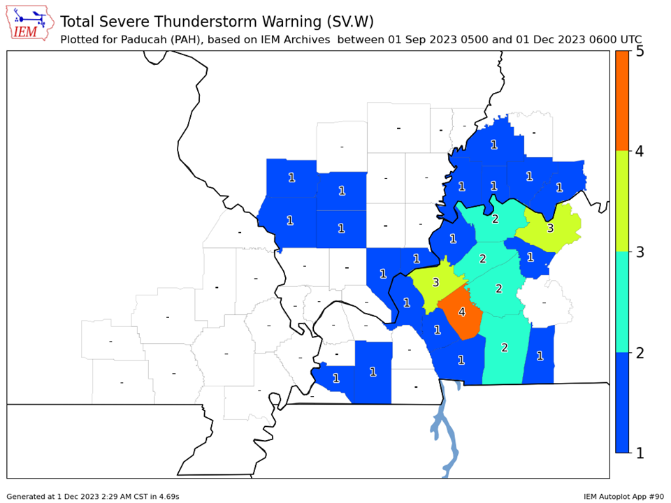
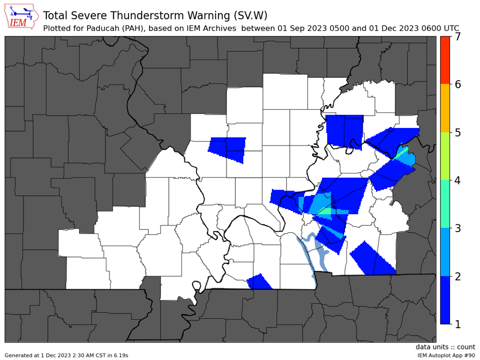
| Severe Thunderstorm Warnings - County Based | Severe Thunderstorm Warnings - Polygon Based |
 |
 |
| Tornado Warnings - County Based | Tornado Warnings - Polygon Based |
|
No tornado warnings were issued during the Fall season. |
|

