Overview
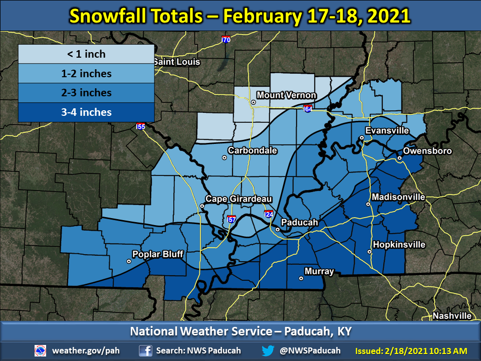
Initially, the snow impacted mainly southeast Missouri and adjacent areas of far west Kentucky and southwest Illinois during the overnight and early morning hours on the 17th. After a lull, snow spread northeastward from Tennessee and Arkansas during the late afternoon and early evening hours. The most concentrated area of snow occurred across western Kentucky, the Missouri Bootheel, extreme southeast Illinois, and southwest Indiana during the evening and overnight hours. The last snow band pivoted across the region during the morning of the 18th. Snowfall totals ranged from 1 to 4" across much of the region for this event. Highest totals were primarily focused across areas of west Kentucky closer to the Tennessee border. With temperatures well below freezing, snow quickly accumulated on roads and created treacherous travel conditions from the evening of the 17th through the morning of the 18th.Snow
Snowfall totals ranged from 1 to 4 inches across much of the region. Highest amounts were generally across western Kentucky, particularly closer to the Tennessee state border. The official snowfall total in Paducah, KY was 1.9" and in Evansville, IN it was 1.5". February 18th marked the 5th consecutive day with measurable snow (0.1" or greater) in Paducah, KY. This tied the record of 5 days set back on March 7-11, 1960. This was quite the feat after Paducah had gone 461 days without a 1" snowfall from November 12, 2019 to February 13, 2021.
 |
Photos
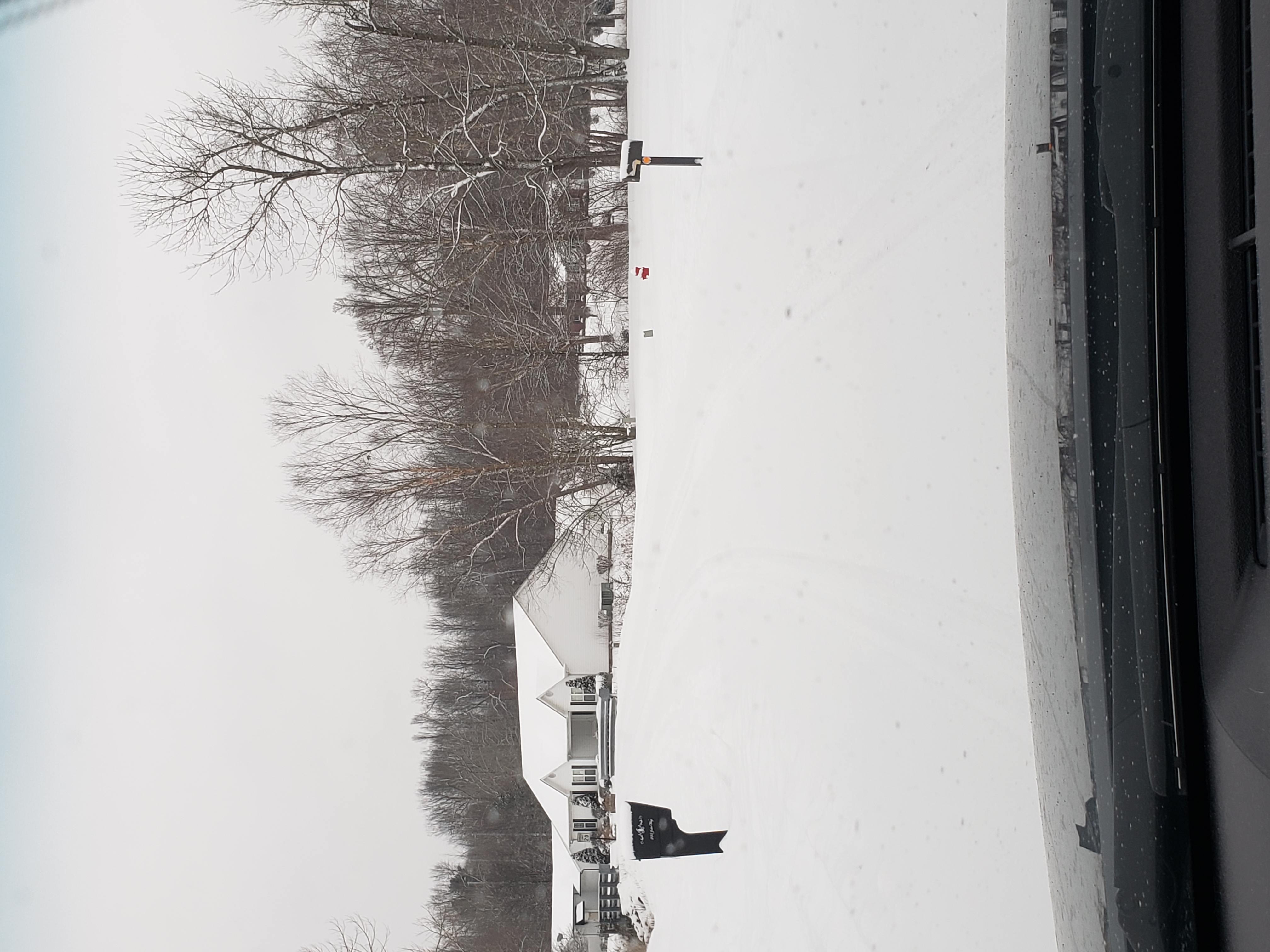
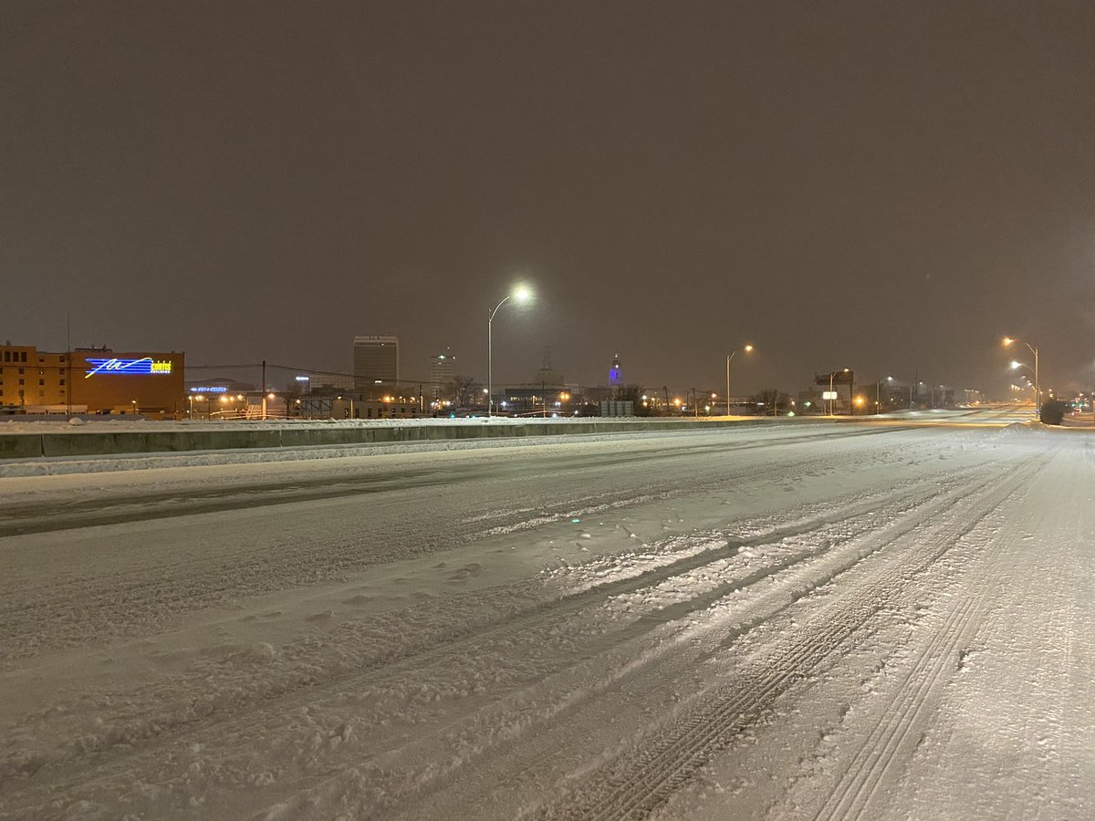
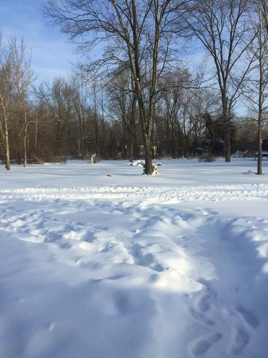
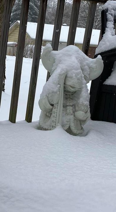
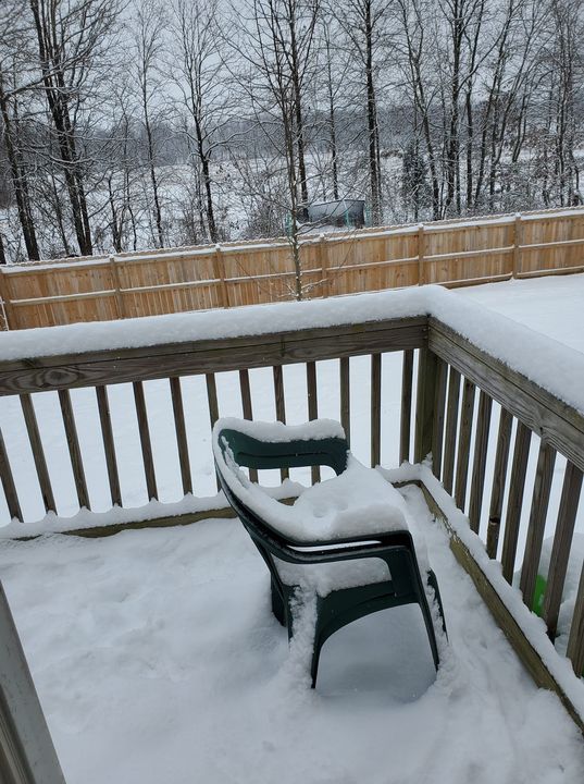
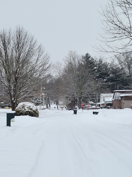
Here are some pictures from around the area during this snowstorm.
 |
 |
 |
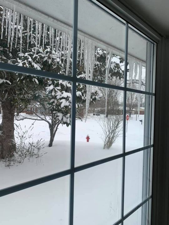 |
| Lone Oak, KY side roads via NWS Employee | Evansville, IN Lloyd Expressway via Griffin Glasscock | Carbondale, IL via Teresa Elsner | Paducah, KY via Angela Elder |
 |
 |
 |
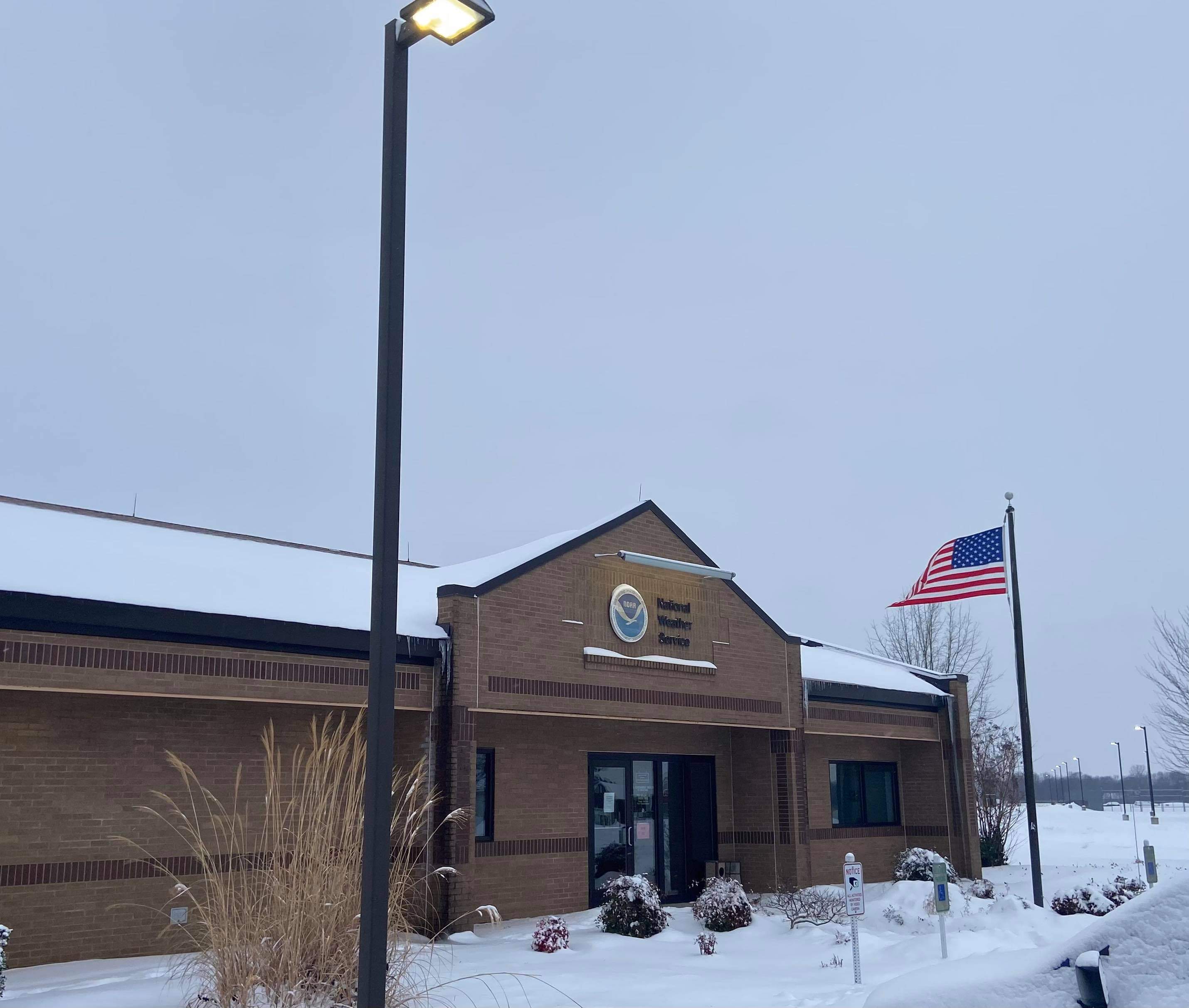 |
| Greenville, KY via Theresa Creager | Philpot, KY via Joshua Meier | Metropolis, IL via Dakota Stowers | NWS Paducah on the morning of February 18th |
Storm Reports
Click here for an interactive map of reports from the event
PUBLIC INFORMATION STATEMENT
NATIONAL WEATHER SERVICE PADUCAH KY
1242 PM CST THU FEB 18 2021

...STORM TOTAL SNOWFALL REPORTS ENDING AT 12 PM THURSDAY, FEBRUARY 18...

LOCATION                     AMOUNT    TIME/DATE       PROVIDER
HERNDON KY 4 SW              4.2 IN    0700 AM 02/18   COOP
5 ENE PHILPOT KY             4.0 IN    0837 AM 02/18   PUBLIC
GREENVILLE KY                4.0 IN    0806 AM 02/18   PUBLIC
EDDYVILLE KY                 3.5 IN    1022 AM 02/18   PUBLIC
OAK GROVE KY                 3.5 IN    0928 AM 02/18   PUBLIC
2 NNE BREWERS KY             3.5 IN    0715 AM 02/18   PUBLIC
BENTON KY                    3.5 IN    0714 AM 02/18   PUBLIC
FANCY FARM KY                3.5 IN    0642 AM 02/18   PUBLIC
PRINCETON KY                 3.5 IN    0619 AM 02/18   PUBLIC
ROBARDS KY                   3.0 IN    1009 AM 02/18   PUBLIC
PUXICO KY                    3.0 IN    1001 AM 02/18   PUBLIC
3 ENE HOPKINSVILLE KY        3.0 IN    0941 AM 02/18   TRAINED SPOTTER
1 N MADISONVILLE KY          3.0 IN    0836 AM 02/18   PUBLIC
OWENSBORO KY                 3.0 IN    0835 AM 02/18   PUBLIC
3 NNW ELKTON KY              3.0 IN    0800 AM 02/18   TRAINED SPOTTER
OAKLAND CITY IN              3.0 IN    0749 AM 02/18   PUBLIC
5 SE CAYCE KY                3.0 IN    0745 AM 02/18   TRAINED SPOTTER
OAK GROVE KY 4.6 NW          3.0 IN    0700 AM 02/18   COCORAHS
7 SE DEXTER MO               3.0 IN    0600 AM 02/18   TRAINED SPOTTER
MURRAY KY                    3.0 IN    0542 AM 02/18   CO-OP OBSERVER
AURORA KY                    3.0 IN    1129 PM 02/17   BROADCAST MEDIA
1 WNW CENTRAL CITY KY        2.8 IN    0957 AM 02/18   TRAINED SPOTTER
REIDLAND KY                  2.8 IN    0905 AM 02/18   NWS EMPLOYEE
MURRAY KY 1 WSW              2.7 IN    0700 AM 02/18   COCORAHS
MORGANFIELD KY               2.5 IN    0836 AM 02/18   PUBLIC
HICKMAN KY                   2.5 IN    0801 AM 02/18   PUBLIC
1 N CADIZ KY                 2.5 IN    0759 AM 02/18   PUBLIC
HENDERSON KY 0.4 SSW         2.5 IN    0700 AM 02/18   COCORAHS
EVANSVILLE IN 5.9 WNW        2.5 IN    0700 AM 02/18   COCORAHS
HENDERSON KY                 2.5 IN    0617 AM 02/18   PUBLIC
CADIZ KY 2 NNW               2.5 IN    0600 AM 02/18   COOP
4 NW NEWBURGH IN             2.5 IN    0430 AM 02/18   AMATEUR RADIO
POPLAR BLUFF MO              2.4 IN    0700 AM 02/18   COOP
EDDYVILLE KY 2 NNE           2.3 IN    0800 AM 02/18   COCORAHS
CUNNINGHAM KY                2.3 IN    0721 AM 02/18   PUBLIC
CARMI IL                     2.2 IN    1032 AM 02/18   TRAINED SPOTTER
BOONVILLE IN                 2.2 IN    1021 AM 02/18   TRAINED SPOTTER
3 N NEWBURGH                 2.2 IN    1000 AM 02/18   TRAINED SPOTTER
JACKSON MO 1 SW              2.2 IN    0700 AM 02/18   COCORAHS
MOUNT VERNON IN              2.2 IN    0600 AM 02/18   COOP
DUDLEY MO                    2.0 IN    0900 AM 02/18   TRAINED SPOTTER
3 W NEWBURGH IN              2.0 IN    0749 AM 02/18   TRAINED SPOTTER
7 SE DEXTER MO               2.0 IN    0722 AM 02/18   PUBLIC
CAVE-IN-ROCK IL              2.0 IN    0713 AM 02/18   PUBLIC
PERRYVILLE MO 1 NE           2.0 IN    0700 AM 02/18   COCORAHS
1 W PADUCAH KY               2.0 IN    0700 AM 02/18   TRAINED SPOTTER
ROCKPORT IN 4.0 WNW          2.0 IN    0700 AM 02/18   COCORAHS
1 NNE MAYFIELD KY            2.0 IN    0644 AM 02/18   PUBLIC
MAYFIELD KY                  2.0 IN    0633 AM 02/18   BROADCAST MEDIA
LONE OAK KY                  2.0 IN    0617 AM 02/18   PUBLIC
SMITHLAND LOCK AND DAM KY    2.0 IN    0600 AM 02/18   COOP
PADUCAH KY                   1.9 IN    1000 AM 02/18   OFFICIAL NWS OBSERVATION
BARLOW KY                    1.9 IN    0815 AM 02/18   PUBLIC
CROFTON KY 3 N               1.9 IN    0700 AM 02/18   COOP
BROOKPORT IL 7 ENE           1.9 IN    0700 AM 02/18   COCORAHS
MARION KY 6.3 NW             1.8 IN    0930 AM 02/18   COCORAHS
KEVIL KY 4.6 NW              1.8 IN    0700 AM 02/18   COCORAHS
EVANSVILLE IN 10 NW          1.8 IN    0700 AM 02/18   COCORAHS
NEWBURGH 0.3 SE              1.8 IN    0700 AM 02/18   COCORAHS
FAIRDEALING MO 6 W           1.8 IN    0500 AM 02/18   COCORAHS
1 WSW CAPE GIRARDEAU MO      1.8 IN    0818 AM 02/18   BROADCAST MEDIA
TRENTON KY                   1.8 IN    0700 AM 02/18   TRAINED SPOTTER
EVANSVILLE IN 8.8 WSW        1.7 IN    0804 AM 02/18   COCORAHS
ROUND KNOB IL 1 WNW          1.7 IN    0700 AM 02/18   COCORAHS
EVANSVILLE IN 6.7 NW         1.6 IN    0700 AM 02/18   COCORAHS
EVANSVILLE IN                1.5 IN    1200 PM 02/18   OFFICIAL NWS OBSERVATION
CARRIER MILLS IL             1.5 IN    1153 AM 02/18   LAW ENFORCEMENT
WEST PADUCAH KY 3.1 SSW      1.5 IN    0900 AM 02/18   COCORAHS
MARION IL                    1.5 IN    0755 AM 02/18   TRAINED SPOTTER
GRAYVILLE IL                 1.5 IN    0741 AM 02/18   PUBLIC
CAIRO IL                     1.5 IN    0700 AM 02/18   COCORAHS
MOUNT VERNON IN 10.6 ENE     1.5 IN    0700 AM 02/18   COCORAHS
ROSICLARE IL 5 NW            1.5 IN    0700 AM 02/18   COOP
EVANSVILLE IN 5.4 NNE        1.5 IN    0700 AM 02/18   COCORAHS
POSEYVILLE IN 2.8 NW         1.5 IN    0700 AM 02/18   COCORAHS
CROSSVILLE IL 3.0 E          1.5 IN    0700 AM 02/18   COCORAHS
DEXTER 0.6 WNW               1.5 IN    0630 AM 02/18   COCORAHS
HOLLAND IN 6.3 NW            1.4 IN    0600 AM 02/18   COCORAHS
SANTA CLAUS IN 1 WSW         1.1 IN    0700 AM 02/18   COCORAHS
MURPHYSBORO                  1.0 IN    1219 PM 02/18   PUBLIC
CAPE GIRARDEAU MO 2 N        1.0 IN    0949 AM 02/18   COCORAHS
MURPHYSBORO                  1.0 IN    0803 AM 02/18   EMERGENCY MNGR
MOUNT VERNON 5.2 SSW         1.0 IN    0800 AM 02/18   COCORAHS
CRAINEVILLE IL               1.0 IN    0800 AM 02/18   COCORAHS
CARTERVILLE IL               1.0 IN    0733 AM 02/18   BROADCAST MEDIA
COBDEN IL 0.8 SSE            1.0 IN    0700 AM 02/18   COCORAHS
CARBONDALE IL 1.2 W          1.0 IN    0700 AM 02/18   COCORAHS
FORT BRANCH IN               1.0 IN    0630 AM 02/18   TRAINED SPOTTER
PETERSBURG IN 1 ENE          1.0 IN    0600 AM 02/18   COCORAHS
ELLSINORE MO 4.8 WNW         0.7 IN    0700 AM 02/18   COCORAHS
DONIPHAN MO 14.5 NW          0.7 IN    0700 AM 02/18   COCORAHS
DE SOTO IL 0.3 ESE           0.7 IN    0700 AM 02/18   COCORAHS
PATTERSON MO 2.0 SE          0.5 IN    0708 AM 02/18   COCORAHS
CHRISTOPHER 1.1 NNW          0.5 IN    0700 AM 02/18   COCORAHS
BENTON IL 1 NE               0.5 IN    0700 AM 02/18   COCORAHS
PERRYVILLE MO WATER PLANT    0.5 IN    0700 AM 02/18   COOP
WALNUT HILL IL 1 WSW         0.5 IN    0700 AM 02/18   COCORAHS
LAMBERT MO 0.8 ESE           0.3 IN    0700 AM 02/18   COCORAHS
 |
Media use of NWS Web News Stories is encouraged! Please acknowledge the NWS as the source of any news information accessed from this site. |
|

