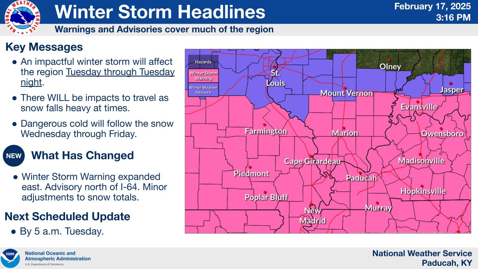
Overview
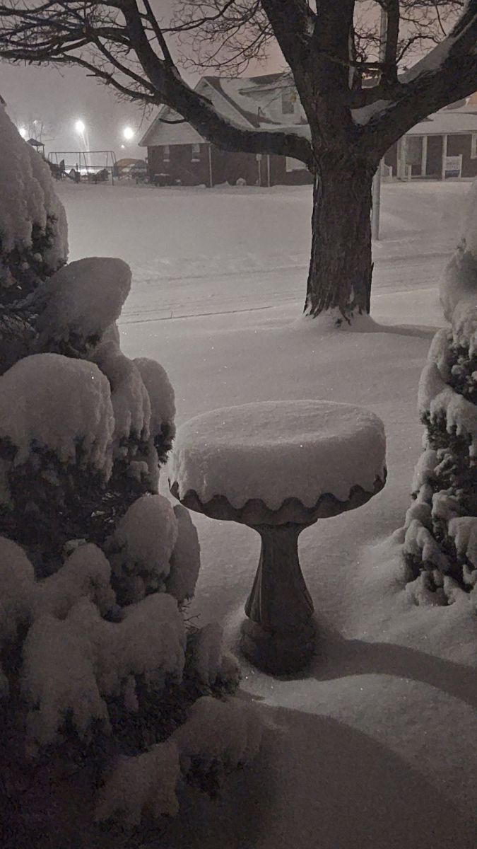
Right on the heels of a major flooding event, which produced rainfall amounts of 2 to 7 inches on February 15th, the area was transformed into a winter wonderland as snow quickly spread across the area on the afternoon and evening of February 18th. Roads quickly became snow covered due to temperatures only in the teens to low 20s. Parts of I-57 and I-24 were briefly closed overnight due to poor road conditions and accidents. By the morning of the 19th, most of our region had received anywhere from 3 to 8 inches of snow, and localized higher amounts up to 11 inches were observed in southeast Missouri. Wind gusts around 25 mph also accompanied the event, leading to some blowing and drifting of the snow which made measuring it a bit of a challenge.Snow
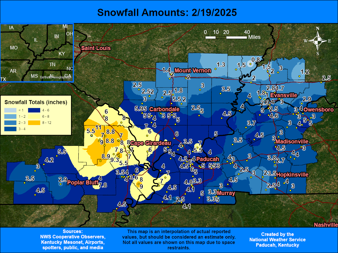
The map below is an interpolated graphic using local storm reports. Amounts of 3 to 8 inches occurred across much of the region except along and north of I-64 where only 1 to 2 inches were observed. The highest amounts were focused across southeast Missouri into far southern Illinois where localized higher totals up to 11 inches were reported. Cape Girardeau was among the hardest hit areas with 6 to 8 inches in and around the city. The official snowfall total in Paducah was 4.3" and Evansville was 2.3".
 |
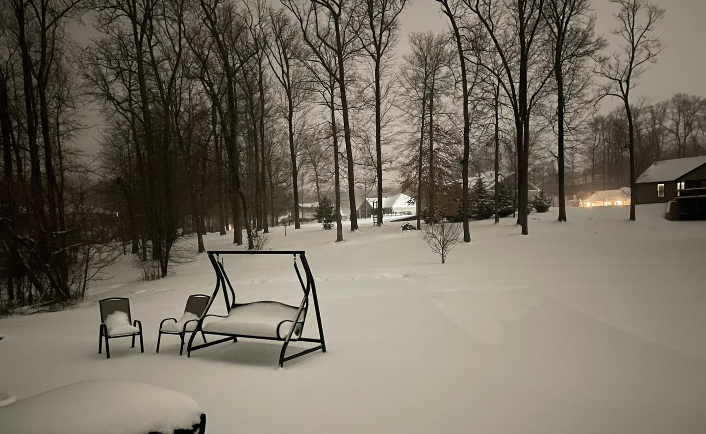
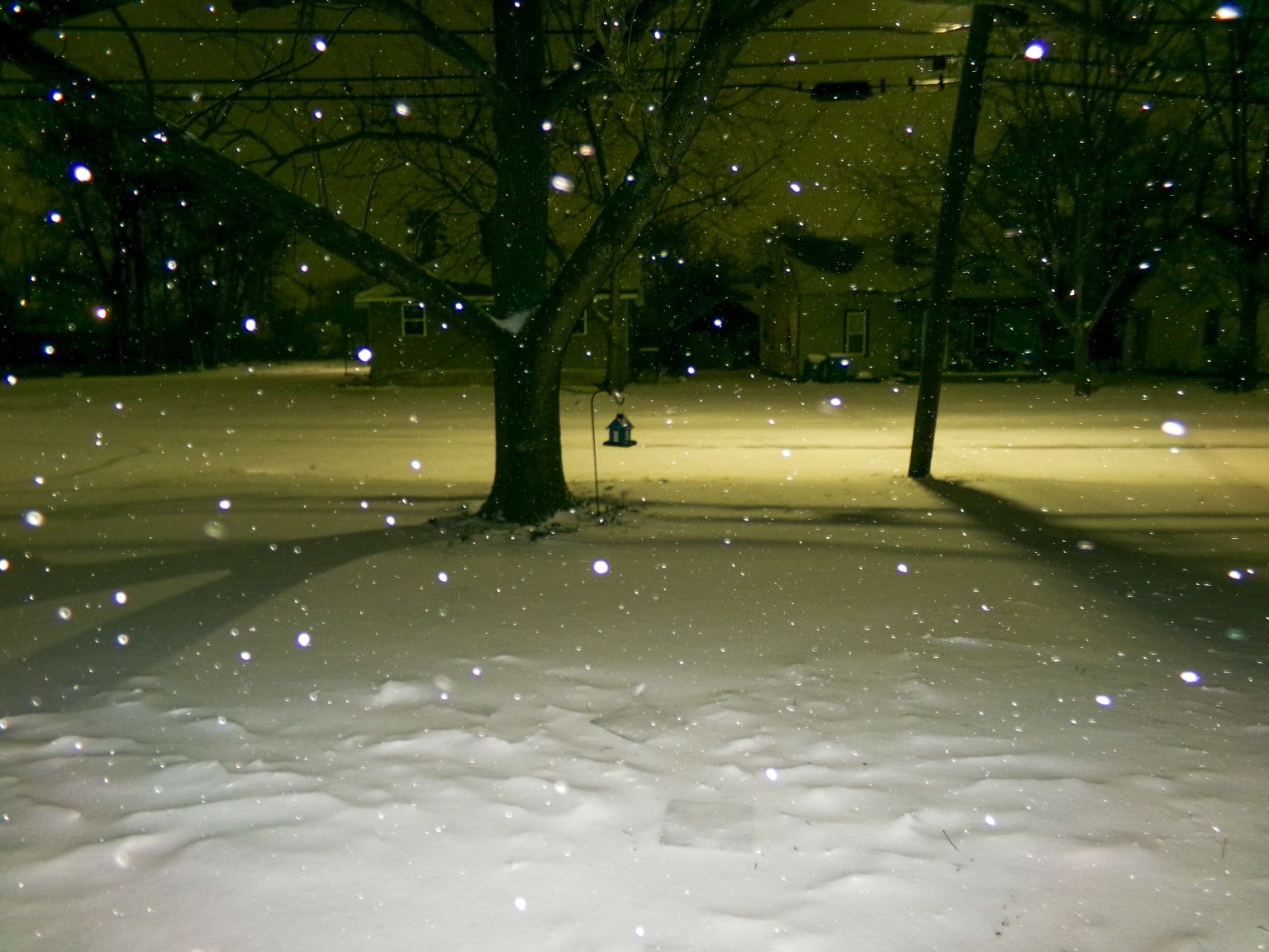
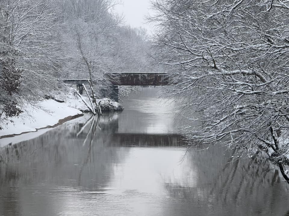
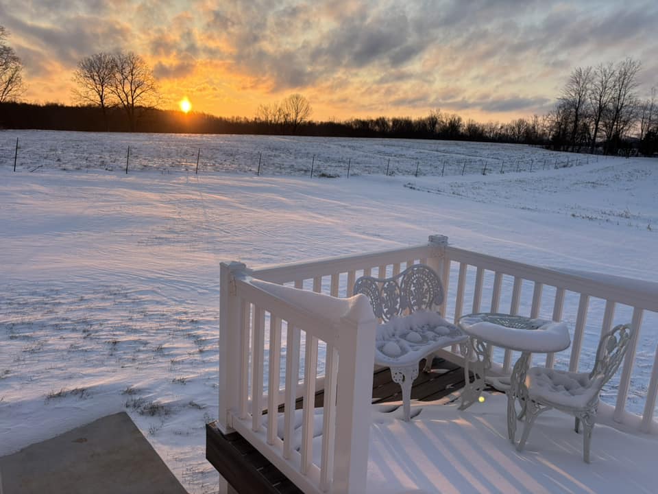
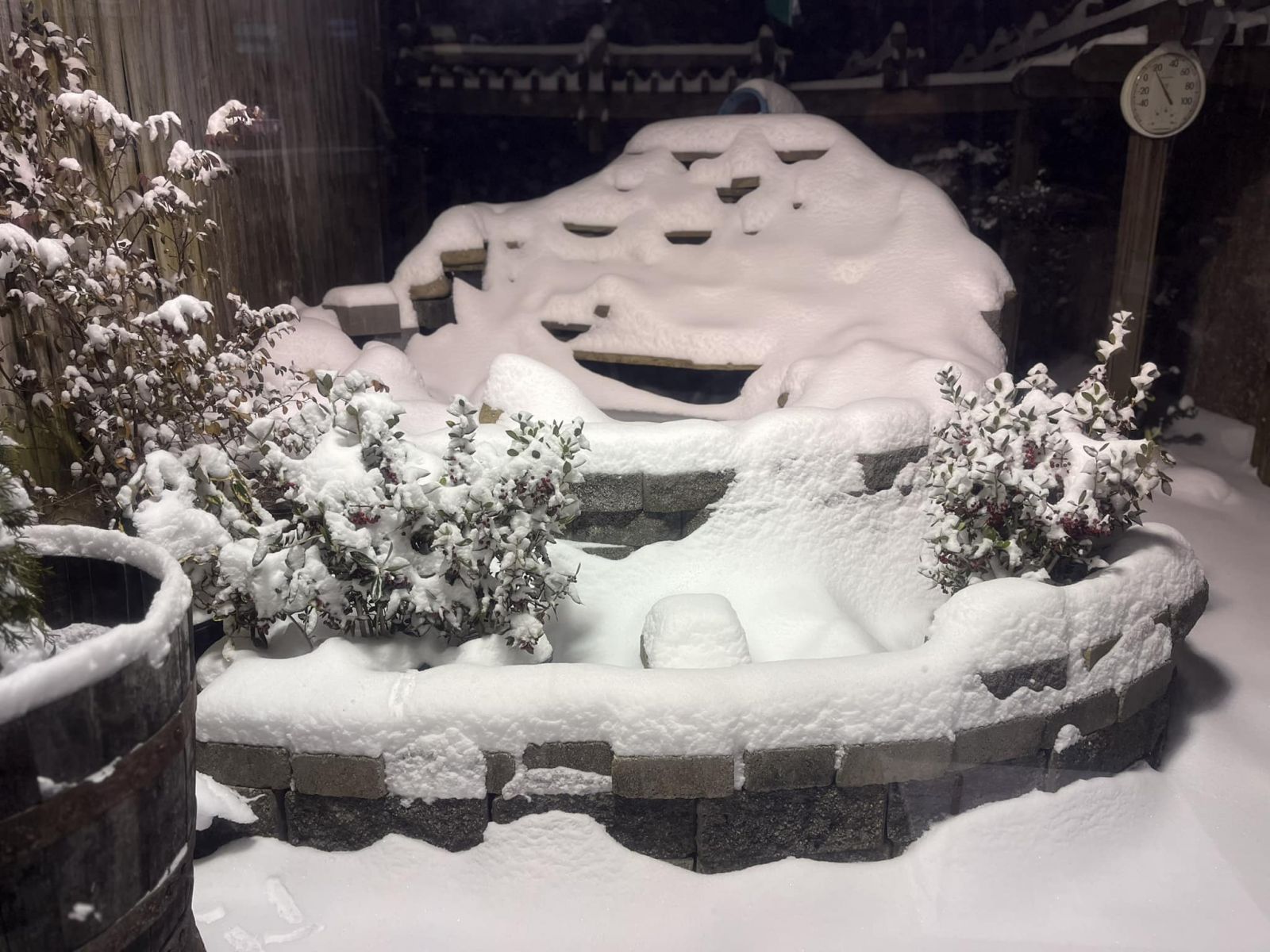
Photos
 |
 |
 |
 |
| Cape Girardeau, MO courtesy of Grant Dade | Mayfield, KY courtesy of Kota McKinney | Milo in Eddyville, KY courtesy of Brianne Jackson Schuchardt | Near Fulton, KY courtesy of Tracie Pitt Bing |
 |
 |
 |
 |
| Perryville, MO courtesy of Brittney Stueve | Reidland, KY courtesy of Jim Holloway | Salem, KY courtesy of Karen Hunt Slayden | WPSD Station Paducah, KY courtesy of Trent Okerson |
Radar
Here is a radar loop of the entire event from 12 PM February 18th through 5 AM February 19th. Snow quickly spread east across the region through the afternoon into the early evening. It then exited during the overnight hours, with only very light snow lingering past 5 AM.
Storm Reports
Preliminary Local Storm Report...Summary National Weather Service Paducah KY 452 PM CST Wed Feb 19 2025 ..TIME... ...EVENT... ...CITY LOCATION... ...LAT.LON... ..DATE... ....MAG.... ..COUNTY LOCATION..ST.. ...SOURCE.... ..REMARKS.. 0415 PM Snow Cape Girardeau 37.30N 89.54W 02/18/2025 E0.5 Inch Cape Girardeau MO Fire Dept/Rescue Minor snow accumulation has caused very slick roads and numerous motor vehicle accidents across Cape Girardeau County. 0504 PM Snow 1 W Jackson 37.38N 89.67W 02/18/2025 E1.0 Inch Cape Girardeau MO Public 0522 PM Snow Chaffee 37.18N 89.66W 02/18/2025 E1.3 Inch Scott MO Public 0524 PM Snow 1 N Doniphan 36.64N 90.82W 02/18/2025 E1.0 Inch Ripley MO Trained Spotter 0612 PM Snow 1 N Murphysboro 37.78N 89.34W 02/18/2025 E2.0 Inch Jackson IL Emergency Mngr 0612 PM Snow 2 SE Heath 37.07N 88.77W 02/18/2025 M1.0 Inch McCracken KY Official NWS Obs 0617 PM Snow 2 N Cape Girardeau 37.34N 89.55W 02/18/2025 M2.5 Inch Cape Girardeau MO Trained Spotter 0625 PM Snow Cape Girardeau 37.31N 89.55W 02/18/2025 E2.0 Inch Cape Girardeau MO Fire Dept/Rescue 0650 PM Snow Clinton 36.67N 88.99W 02/18/2025 E1.0 Inch Hickman KY Emergency Mngr 0653 PM Snow 1 S Cape Girardeau 37.30N 89.55W 02/18/2025 M3.0 Inch Cape Girardeau MO Public 0707 PM Snow Jackson 37.38N 89.65W 02/18/2025 M2.8 Inch Cape Girardeau MO Emergency Mngr 0709 PM Snow 2 N Pembroke 36.80N 87.35W 02/18/2025 M0.5 Inch Christian KY Trained Spotter 0710 PM Snow 1 SE Paducah 37.06N 88.62W 02/18/2025 M1.3 Inch McCracken KY Public 0713 PM Snow Murray 36.61N 88.32W 02/18/2025 M1.8 Inch Calloway KY Trained Spotter 0720 PM Snow 2 N Jackson 37.41N 89.65W 02/18/2025 M4.0 Inch Cape Girardeau MO Trained Spotter Trained spotter report of 4 inches at time of report. 0739 PM Snow Marion 37.73N 88.94W 02/18/2025 M1.5 Inch Williamson IL Broadcast Media 0741 PM Snow 3 N Cape Girardeau 37.35N 89.56W 02/18/2025 M5.0 Inch Cape Girardeau MO Trained Spotter 0753 PM Snow 3 NE Earlington 37.30N 87.48W 02/18/2025 M1.0 Inch Hopkins KY Public 0754 PM Snow 1 N Doniphan 36.64N 90.82W 02/18/2025 M2.5 Inch Ripley MO Trained Spotter 0802 PM Snow 1 W Paducah 37.07N 88.65W 02/18/2025 M2.0 Inch McCracken KY Trained Spotter 0810 PM Snow Oak Ridge 37.50N 89.73W 02/18/2025 M6.0 Inch Cape Girardeau MO Trained Spotter 0813 PM Snow Jackson 37.38N 89.65W 02/18/2025 M3.5 Inch Cape Girardeau MO Emergency Mngr 0825 PM Snow 1 ESE Crainville 37.75N 89.05W 02/18/2025 E2.5 Inch Williamson IL Broadcast Media Reported by WSIL TV. 0830 PM Snow 2 NE Robards 37.69N 87.51W 02/18/2025 M1.5 Inch Henderson KY Trained Spotter 0833 PM Snow 3 NE Earlington 37.30N 87.48W 02/18/2025 M2.0 Inch Hopkins KY Public 0837 PM Snow Lone Oak 37.04N 88.67W 02/18/2025 M2.8 Inch McCracken KY Broadcast Media 0837 PM Snow Cape Girardeau 37.31N 89.55W 02/18/2025 M3.0 Inch Cape Girardeau MO Fire Dept/Rescue Corrects previous snow report from Cape Girardeau. 0838 PM Snow Fruitland 37.45N 89.64W 02/18/2025 M7.0 Inch Cape Girardeau MO Broadcast Media Drifts up to 2 feet. Relayed by KFVS TV. 0848 PM Snow Jackson 37.38N 89.66W 02/18/2025 M5.0 Inch Cape Girardeau MO Public Relayed by KFVS TV. 0849 PM Snow Murray 36.61N 88.32W 02/18/2025 M2.0 Inch Calloway KY Trained Spotter 0852 PM Snow Sedgewickville 37.52N 89.91W 02/18/2025 M6.0 Inch Bollinger MO Public Relayed by KFVS TV. 0852 PM Snow Patton 37.51N 90.01W 02/18/2025 M5.0 Inch Bollinger MO Public Relayed by KFVS TV. 0852 PM Snow Gordonville 37.31N 89.67W 02/18/2025 M6.0 Inch Cape Girardeau MO Public Relayed by KFVS TV. 0854 PM Snow 1 SE Paducah 37.06N 88.62W 02/18/2025 M2.1 Inch McCracken KY Public 0855 PM Snow 2 NE Lone Oak 37.05N 88.64W 02/18/2025 M3.3 Inch McCracken KY Broadcast Media Reported by WPSD TV. 0857 PM Snow 2 NNE Henderson 37.87N 87.57W 02/18/2025 M1.0 Inch Henderson KY Broadcast Media Reported by WEHT TV. 0857 PM Snow 1 S Cape Girardeau 37.30N 89.55W 02/18/2025 M4.2 Inch Cape Girardeau MO Public 0902 PM Snow Cayce 36.56N 89.04W 02/18/2025 E3.0 Inch Fulton KY Amateur Radio 0903 PM Snow 1 N Murphysboro 37.78N 89.34W 02/18/2025 M4.0 Inch Jackson IL Emergency Mngr 0930 PM Snow Du Quoin 38.01N 89.24W 02/18/2025 M1.0 Inch Perry IL Emergency Mngr 0936 PM Snow 2 S Evansville 37.95N 87.55W 02/18/2025 M0.8 Inch Vanderburgh IN Trained Spotter 0937 PM Snow 3 W Evansville 37.99N 87.59W 02/18/2025 M0.5 Inch Vanderburgh IN Broadcast Media Reported by WFIE TV. 0940 PM Snow Hopkinsville 36.86N 87.49W 02/18/2025 M2.0 Inch Christian KY Public Media relayed viewer report. 0940 PM Snow 1 WNW Owensboro 37.77N 87.14W 02/18/2025 M1.5 Inch Daviess KY Public West end of Owensboro. 0940 PM Snow 1 NNE Henderson 37.86N 87.58W 02/18/2025 M1.8 Inch Henderson KY Trained Spotter Off Hwy 60 east side of Henderson. 0941 PM Snow 2 E Owensboro 37.75N 87.08W 02/18/2025 M1.5 Inch Daviess KY Amateur Radio 0945 PM Snow Perryville 37.73N 89.87W 02/18/2025 M6.0 Inch Perry MO Local Official 0948 PM Snow 1 S Melody Hill 38.01N 87.51W 02/18/2025 M1.0 Inch Vanderburgh IN Trained Spotter By Lynch Rd and Oak Hill Rd. 1004 PM Snow Delta 37.20N 89.74W 02/18/2025 M7.0 Inch Cape Girardeau MO Public Media relayed report. 1006 PM Snow 1 NW Owensboro 37.77N 87.13W 02/18/2025 M2.0 Inch Daviess KY Amateur Radio 1008 PM Snow 7 WNW Burfordville 37.40N 89.92W 02/18/2025 M7.0 Inch Bollinger MO Public Media relayed report from Scopus. 1025 PM Snow Chaffee 37.18N 89.66W 02/18/2025 M8.0 Inch Scott MO Public Relayed by KFVS TV. 1025 PM Snow Jackson 37.38N 89.65W 02/18/2025 M8.0 Inch Cape Girardeau MO Public Relayed by KFVS TV. 1050 PM Snow Herrin 37.80N 89.03W 02/18/2025 M2.6 Inch Williamson IL Public 1056 PM Snow 1 S Melody Hill 38.01N 87.51W 02/18/2025 M1.5 Inch Vanderburgh IN Trained Spotter 1105 PM Snow 2 NNE Henderson 37.87N 87.57W 02/18/2025 M1.9 Inch Henderson KY Broadcast Media Reported by WEHT TV. 1121 PM Snow 2 NE Cape Girardeau 37.33N 89.52W 02/18/2025 M3.5 Inch Cape Girardeau MO Fire Dept/Rescue 1156 PM Snow Carterville 37.76N 89.08W 02/18/2025 M4.5 Inch Williamson IL Broadcast Media Measured 4 to 5 inches of snow. Reported by WSIL TV. 1200 AM Snow 2 SE Heath 37.07N 88.77W 02/19/2025 M3.0 Inch McCracken KY Official NWS Obs 3.0 inches of snow measured at NWS Paducah. With the gusty wind, individual measurements ranged from nearly bare ground up to 12 inches in one drift. 1203 AM Snow 2 NNE Henderson 37.87N 87.57W 02/19/2025 M2.3 Inch Henderson KY Broadcast Media Reported by WEHT TV. 1204 AM Snow Du Quoin 38.01N 89.24W 02/19/2025 M2.0 Inch Perry IL Emergency Mngr 1245 AM Snow East Prairie 36.78N 89.39W 02/19/2025 M8.0 Inch Mississippi MO Trained Spotter 0409 AM Snow 1 ENE Owensboro 37.76N 87.10W 02/19/2025 M3.5 Inch Daviess KY Broadcast Media Uncertainty due to drifting. 0429 AM Snow 3 NE Earlington 37.30N 87.48W 02/19/2025 M4.5 Inch Hopkins KY Public 0436 AM Snow 6 NNE Marble Hill 37.38N 89.94W 02/19/2025 E9.0 Inch Bollinger MO Broadcast Media Average of viewer reports around Bollinger and into northern Cape Girardeau Counties. 0446 AM Snow 2 SE Heath 37.07N 88.77W 02/19/2025 M4.0 Inch McCracken KY Official NWS Obs The snow drifts were even evident on the snowboard. 3 inches on one side 5.5 inches on the other. Flat surface average around the building averages to 4.0 storm total.There are several 10-12 inch drifts in the lawn and surrounding the building. 0526 AM Snow 2 NNW Reidland 37.03N 88.54W 02/19/2025 M6.5 Inch McCracken KY Public Difficult to measure with the blowing/drifting. 0526 AM Snow New Columbia 37.31N 88.78W 02/19/2025 M3.5 Inch Massac IL Trained Spotter 0537 AM Snow Fruitland 37.45N 89.63W 02/19/2025 M9.0 Inch Cape Girardeau MO Public 0538 AM Snow 5 NNE Calvert City 37.09N 88.32W 02/19/2025 M3.0 Inch Livingston KY Public 0538 AM Snow Boaz 36.89N 88.63W 02/19/2025 M5.0 Inch Graves KY Public 0538 AM Snow 1 SSE Mermet 37.26N 88.84W 02/19/2025 M4.0 Inch Massac IL Public 0544 AM Snow 2 S Chaffee 37.15N 89.66W 02/19/2025 M9.3 Inch Scott MO Public 0544 AM Snow Newburgh 37.95N 87.41W 02/19/2025 M4.0 Inch Warrick IN Trained Spotter 0545 AM Snow 1 WSW Sikeston 36.88N 89.59W 02/19/2025 M4.0 Inch Scott MO Public 0545 AM Snow Perryville 37.72N 89.87W 02/19/2025 M8.0 Inch Perry MO Public 0545 AM Snow 1 N Dongola 37.37N 89.16W 02/19/2025 M8.3 Inch Union IL Public 0548 AM Snow 1 NNE Lone Oak 37.05N 88.66W 02/19/2025 M6.0 Inch McCracken KY Trained Spotter 0600 AM Snow 8 W Evansville 37.98N 87.69W 02/19/2025 M2.9 Inch Vanderburgh IN Trained Spotter 0600 AM Snow Crofton 37.05N 87.49W 02/19/2025 M2.7 Inch Christian KY Cocorahs Cocorahs station KY-CH-12 Crofton 0.3 W. 0600 AM Snow 7 NE Santa Claus 38.20N 86.85W 02/19/2025 M2.5 Inch Spencer IN Cocorahs Cocorahs station IN-SP-7 Ferdinand 2.3 SSE. 0600 AM Snow 10 SSW Mount Vernon 37.80N 87.98W 02/19/2025 M4.0 Inch Posey IN CO-OP Observer CO-OP Observer station ULDI3 3.3 NW Uniontown. 0600 AM Snow 1 NE Mount Vernon 37.95N 87.88W 02/19/2025 M4.0 Inch Posey IN CO-OP Observer CO-OP Observer station MTVI3 Mount Vernon IN. 0600 AM Snow 6 ENE Spurgeon 38.28N 87.15W 02/19/2025 M1.2 Inch Pike IN CO-OP Observer CO-OP Observer station STDI3 Stendal IN. 0602 AM Snow Corydon 37.75N 87.70W 02/19/2025 M5.0 Inch Henderson KY Public 0602 AM Snow Mount Vernon 38.32N 88.91W 02/19/2025 M3.0 Inch Jefferson IL Public 0607 AM Snow 2 ESE Heath 37.07N 88.76W 02/19/2025 M4.3 Inch McCracken KY Official NWS Obs 0.31 liquid water for 13.7 SWE ratio. 0612 AM Snow 2 NW Newburgh 37.97N 87.43W 02/19/2025 M3.0 Inch Warrick IN Public 0625 AM Snow 1 ESE Murray 36.61N 88.30W 02/19/2025 M3.3 Inch Calloway KY CO-OP Observer 0625 AM Snow 1 NW Metropolis 37.16N 88.72W 02/19/2025 M4.0 Inch Massac IL Public 0629 AM Snow 2 NE Lynnville 36.59N 88.54W 02/19/2025 M5.0 Inch Graves KY Cocorahs Cocorahs station KY-GV-7 Sedalia 5.0 SE. 0630 AM Snow 1 N Murphysboro 37.78N 89.34W 02/19/2025 M5.0 Inch Jackson IL Emergency Mngr 0630 AM Snow 2 WSW Thompsonville 37.90N 88.79W 02/19/2025 M2.0 Inch Franklin IL Cocorahs Cocorahs station IL-FK-15 West Frankfort 7.5 E. 0644 AM Snow Karnak 37.29N 88.97W 02/19/2025 E5.0 Inch Pulaski IL Public 0654 AM Snow 3 SSE Dexter 36.70N 88.28W 02/19/2025 E3.0 Inch Calloway KY Public 0654 AM Snow Vienna 37.42N 88.89W 02/19/2025 M6.0 Inch Johnson IL Public 0655 AM Snow 1 NE Mayfield 36.75N 88.64W 02/19/2025 M4.8 Inch Graves KY Public 0655 AM Snow Bardwell 36.87N 89.01W 02/19/2025 E7.0 Inch Carlisle KY Public 0655 AM Snow West Frankfort 37.90N 88.93W 02/19/2025 M5.5 Inch Franklin IL Public 0656 AM Snow 1 NNE Dexter 36.80N 89.96W 02/19/2025 M4.0 Inch Stoddard MO Public 0656 AM Snow 1 ENE Patton 37.51N 90.00W 02/19/2025 M11.0 Inch Bollinger MO Public 0656 AM Snow 1 N Hopkinsville 36.87N 87.49W 02/19/2025 M3.5 Inch Christian KY Public 0657 AM Snow 3 WNW Owensboro 37.78N 87.17W 02/19/2025 M4.0 Inch Daviess KY Public Several obs of 3 to 3.5 and 4.0 inches in Owensboro. 0657 AM Snow Carterville 37.76N 89.08W 02/19/2025 E3.0 Inch Williamson IL Public 0657 AM Snow Jonesboro 37.45N 89.27W 02/19/2025 E6.0 Inch Union IL Public 0658 AM Snow Calvert City 37.04N 88.35W 02/19/2025 M5.0 Inch Marshall KY Public 0658 AM Snow Gracey 36.88N 87.66W 02/19/2025 M2.0 Inch Christian KY Public 0659 AM Snow Henderson 37.84N 87.59W 02/19/2025 M3.5 Inch Henderson KY Public 0659 AM Snow Karnak 37.29N 88.98W 02/19/2025 M5.0 Inch Pulaski IL Public 0659 AM Snow 5 NE Midway 37.29N 88.57W 02/19/2025 E7.0 Inch Pope IL Public 0700 AM Snow De Soto 37.81N 89.22W 02/19/2025 M3.5 Inch Jackson IL Public 0700 AM Snow 2 NNW Rockcastle 36.92N 87.99W 02/19/2025 M2.5 Inch Lyon KY Cocorahs Cocorahs station KY-LY-6 1 NNW Rockcastle. 0700 AM Snow 3 NW Kuttawa 37.09N 88.16W 02/19/2025 M4.0 Inch Lyon KY Cocorahs Cocorahs station KY-LY-3 Kuttawa 3.4 NW. 0700 AM Snow 2 NE Hanson 37.44N 87.44W 02/19/2025 M3.0 Inch Hopkins KY Cocorahs Cocorahs station KY-HP-1 Hanson KY 2.2 NE. 0700 AM Snow Henderson 37.83N 87.58W 02/19/2025 M2.5 Inch Henderson KY Cocorahs Cocorahs station KY-HS-1 Henderson KY 0.4 SSW. 0700 AM Snow 4 W Owensboro 37.75N 87.19W 02/19/2025 M3.0 Inch Daviess KY Cocorahs Cocorahs station KY-DV-32 Owensboro 4.1 W. 0700 AM Snow 2 S Philpot 37.70N 86.99W 02/19/2025 M3.0 Inch Daviess KY Cocorahs Cocorahs station KY-DV-19 Philpot 2.0 S. 0700 AM Snow 3 NNW Crofton 37.09N 87.50W 02/19/2025 M3.8 Inch Christian KY CO-OP Observer CO-OP Observer station CRFK2 Crofton 3 N. 0700 AM Snow 5 NNW Fort Campbell Nor 36.72N 87.48W 02/19/2025 M4.0 Inch Christian KY Cocorahs Cocorahs station KY-CH-9 Oak Grove KY 4.6 NW. 0700 AM Snow Murray 36.61N 88.31W 02/19/2025 M3.3 Inch Calloway KY CO-OP Observer CO-OP Observer station MRYK2 Murray KY. 0700 AM Snow 2 WSW Murray 36.60N 88.34W 02/19/2025 M3.5 Inch Calloway KY Cocorahs Cocorahs station KY-CW-3 Murray KY 1 WSW. 0700 AM Snow 1 SSE Bandana 37.13N 88.94W 02/19/2025 M4.0 Inch Ballard KY Cocorahs Cocorahs station KY-BA-3 Kevil KY 4.6 NW. 0700 AM Snow Newburgh 37.94N 87.40W 02/19/2025 M2.2 Inch Warrick IN Cocorahs Cocorahs station IN-WK-25 Newburgh 0.3 SE. 0700 AM Snow 2 SE Chandler 38.02N 87.35W 02/19/2025 M3.0 Inch Warrick IN Cocorahs Cocorahs station IN-WK-22 Boonville IN 4.5 WSW. 0700 AM Snow 2 NNE Melody Hill 38.05N 87.50W 02/19/2025 M1.7 Inch Vanderburgh IN Cocorahs Cocorahs station IN-VN-41 Evansville 5.4 NNE. 0700 AM Snow 3 SW Darmstadt 38.06N 87.62W 02/19/2025 M2.8 Inch Vanderburgh IN Cocorahs Cocorahs station IN-VN-40 Evansville 6.7 NW. 0700 AM Snow 4 WNW Rockport 37.90N 87.12W 02/19/2025 M2.9 Inch Spencer IN Cocorahs Cocorahs station IN-SP-4 Rockport 4.0 WNW. 0700 AM Snow 9 W Evansville 37.99N 87.71W 02/19/2025 M1.8 Inch Posey IN Cocorahs Cocorahs station IN-PS-7 Mount Vernon 11.0 ENE. 0700 AM Snow 3 NW Poseyville 38.20N 87.82W 02/19/2025 M2.0 Inch Posey IN Cocorahs Cocorahs station IN-PS-1 Poseyville IN 2.8 NW. 0700 AM Snow 1 WSW Princeton 38.35N 87.59W 02/19/2025 M1.5 Inch Gibson IN Cocorahs Cocorahs station IN-GB-21 Princeton 1.3 WSW. 0700 AM Snow Francisco 38.33N 87.45W 02/19/2025 M3.0 Inch Gibson IN Cocorahs Cocorahs station IN-GB-9 Francisco IN 0.1 SE. 0700 AM Snow 2 W Creal Springs 37.61N 88.88W 02/19/2025 M5.0 Inch Williamson IL Cocorahs Cocorahs station IL-WM-18 Creal Springs 2.2 W. 0700 AM Snow Whiteash 37.78N 88.93W 02/19/2025 M5.0 Inch Williamson IL Cocorahs Cocorahs station IL-WM-17 Marion 3.3 NNE. 0700 AM Snow 3 E Fairfield 38.38N 88.32W 02/19/2025 M1.3 Inch Wayne IL CO-OP Observer CO-OP Observer station FFDI2 Fairfield IL. 0700 AM Snow 4 SW Burfordville 37.32N 89.86W 02/19/2025 M8.8 Inch Cape Girardeau MO Cocorahs Cocorahs station MO-CG-21 Marble Hill 6.8 E. 0700 AM Snow 3 WNW Millersville 37.45N 89.85W 02/19/2025 M8.8 Inch Cape Girardeau MO Cocorahs Cocorahs station MO-CG-18 Millersville 3.2 WNW. 0700 AM Snow 6 WSW Greenville 37.16N 87.27W 02/19/2025 M4.0 Inch Muhlenberg KY Cocorahs Cocorahs station KY-MU-1 Greenville 6.2 WSW. 0700 AM Snow 1 W Paducah 37.07N 88.66W 02/19/2025 M4.0 Inch McCracken KY Cocorahs Cocorahs station KY-MK-12 Paducah 1.3 W. 0700 AM Snow 1 ESE Cape Girardeau 37.30N 89.53W 02/19/2025 M8.0 Inch Cape Girardeau MO Cocorahs 24 hour snowfall total. 0700 AM Snow 2.5 SSW Calvert City 37.00N 88.37W 02/19/2025 M5.0 Inch Marshall KY Cocorahs 24 hour snowfall total. 0700 AM Snow 2 NW Smithland 37.16N 88.43W 02/19/2025 M4.0 Inch Livingston KY CO-OP Observer 24 hour snowfall total at Smithland Dam COOP. 0700 AM Snow 2 N Mayfield 36.77N 88.65W 02/19/2025 M3.3 Inch Graves KY CO-OP Observer 24 hour snowfall total. 0700 AM Snow 4 ENE Calhoun 37.56N 87.19W 02/19/2025 M4.0 Inch McLean KY CO-OP Observer 24 hour snowfall total. 0700 AM Snow Marion 37.33N 88.08W 02/19/2025 M3.5 Inch Crittenden KY Emergency Mngr Average of 3 to 3.5 inches of snow throughout the county. 0700 AM Snow Mcleansboro 38.09N 88.53W 02/19/2025 M3.0 Inch Hamilton IL Emergency Mngr Average of 2.5 to 3 inches across Hamilton County. 0700 AM Snow 1 NE Portageville 36.44N 89.69W 02/19/2025 E4.5 Inch New Madrid MO Emergency Mngr Average of 4 to 5 inches across the south part of New Madrid County. 0700 AM Snow 2.3 SSW Trenton 36.69N 87.28W 02/19/2025 M3.0 Inch Todd KY Cocorahs 24 hour snowfall total. 0700 AM Snow 1 SSE Cobden 37.52N 89.25W 02/19/2025 M7.0 Inch Union IL Cocorahs Cocorahs station IL-UN-6 Cobden IL 0.8 SSE. 0700 AM Snow 2 N Pinckneyville 38.10N 89.38W 02/19/2025 M2.5 Inch Perry IL CO-OP Observer CO-OP Observer station PNKI2 Pinckneyville IL 2 N. 0700 AM Snow 1 WSW Cypress 37.36N 89.04W 02/19/2025 M4.0 Inch Johnson IL Cocorahs Cocorahs station IL-JH-3 1 WSW Cypress. 0700 AM Snow 1 WSW Mount Vernon 38.31N 88.93W 02/19/2025 M1.4 Inch Jefferson IL Cocorahs Cocorahs station IL-JF-14 Mount Vernon 1.3 WSW. 0700 AM Snow 2 NNE Belle Rive 38.26N 88.73W 02/19/2025 M2.0 Inch Jefferson IL Cocorahs Cocorahs station IL-JF-9 Belle Rive IL 1 NNE. 0700 AM Snow 1 ENE Carbondale 37.73N 89.20W 02/19/2025 M5.0 Inch Jackson IL CO-OP Observer CO-OP Observer station MDHI2 Carbondale IL Sewage Plant. 0700 AM Snow Murphysboro 37.77N 89.33W 02/19/2025 M5.9 Inch Jackson IL Cocorahs Cocorahs station IL-JK-35 Murphysboro 0.2 NE. 0700 AM Snow 1 NNE Benton 38.02N 88.91W 02/19/2025 M1.8 Inch Franklin IL Cocorahs Cocorahs station IL-FK-6 Benton IL 1 NE. 0700 AM Snow North City 37.99N 89.06W 02/19/2025 M2.5 Inch Franklin IL Cocorahs Cocorahs station IL-FK-7 Christopher 1.1 NNW. 0700 AM Snow 1 E Albion 38.38N 88.03W 02/19/2025 M1.5 Inch Edwards IL Cocorahs Cocorahs station IL-EW-4 Albion IL 1.4 E. 0700 AM Snow 2 SE Patterson 37.17N 90.52W 02/19/2025 M5.5 Inch Wayne MO Cocorahs Cocorahs station MO-WY-1 Patterson MO 2.0 SE. 0700 AM Snow 2 W Sikeston 36.88N 89.62W 02/19/2025 M3.5 Inch Scott MO CO-OP Observer CO-OP Observer station SKSM7 Sikeston MO Power Station. 0700 AM Snow 1 SSE Miner 36.88N 89.53W 02/19/2025 M3.6 Inch Scott MO Cocorahs Cocorahs station MO-SC-10 Miner 0.7 SSE. 0700 AM Snow 1 E Scott City 37.22N 89.52W 02/19/2025 M7.0 Inch Scott MO Cocorahs Cocorahs station MO-SC-5 Scott City MO 0.9 E. 0700 AM Snow Kelso 37.19N 89.55W 02/19/2025 M7.0 Inch Scott MO Cocorahs Cocorahs station MO-SC-11 Kelso 0.2 SSE. 0700 AM Snow 8 WSW Grandin 36.80N 90.97W 02/19/2025 M3.5 Inch Ripley MO Cocorahs Cocorahs station MO-RP-7 Doniphan MO 14.5 NW. 0700 AM Snow 5 WNW Ellsinore 36.97N 90.82W 02/19/2025 M3.0 Inch Carter MO Cocorahs Cocorahs station MO-CT-1 Ellsinore MO 4.8 WNW. 0708 AM Snow Murphysboro 37.77N 89.33W 02/19/2025 E5.0 Inch Jackson IL Emergency Mngr 0.41 liquid water equiv. 12.1 SWE radio. 0709 AM Snow Central City 37.30N 87.13W 02/19/2025 M3.0 Inch Muhlenberg KY Public 0712 AM Snow 2 NNE Eddyville 37.10N 88.07W 02/19/2025 M4.0 Inch Lyon KY Cocorahs Cocorahs station KY-LY-2 Eddyville KY 2 NNE. 0715 AM Snow 2 NE Makanda 37.64N 89.20W 02/19/2025 M4.0 Inch Jackson IL Public 0715 AM Snow 2 ENE Makanda 37.64N 89.20W 02/19/2025 M4.0 Inch Jackson IL Cocorahs Cocorahs station IL-JK-38 Carbondale 6.2 S. 0723 AM Snow 3 SW Patton 37.46N 90.04W 02/19/2025 M5.5 Inch Bollinger MO Public 0730 AM Snow 3 SE Water Valley 36.52N 88.79W 02/19/2025 M4.1 Inch Graves KY Public 0755 AM Snow Vergennes 37.90N 89.34W 02/19/2025 E3.0 Inch Jackson IL Public 0800 AM Snow Du Quoin 38.01N 89.23W 02/19/2025 M2.5 Inch Perry IL Emergency Mngr 0800 AM Snow 1 WSW Mill Spring 37.05N 90.70W 02/19/2025 M4.2 Inch Wayne MO Cocorahs Cocorahs station MO-WY-3 Mill Spring 1.3 WSW. 0800 AM Snow 3 S Chaffee 37.14N 89.67W 02/19/2025 M5.5 Inch Scott MO Cocorahs Cocorahs station MO-SC-12 3 S Chaffee. 0800 AM Snow 2 NE Madisonville 37.36N 87.49W 02/19/2025 M3.0 Inch Hopkins KY Cocorahs Cocorahs station KY-HP-15 Madisonville 1.6 NE. 0800 AM Snow 5 NNW Robards 37.74N 87.58W 02/19/2025 M4.6 Inch Henderson KY Cocorahs Cocorahs station KY-HS-11 Robards 4.9 NNW. 0800 AM Snow 1 NNE Newburgh 37.96N 87.39W 02/19/2025 M2.1 Inch Warrick IN Cocorahs Cocorahs station IN-WK-27 1 NNE Newburgh. 0800 AM Snow 4 NW Mount Carmel 38.45N 87.83W 02/19/2025 M0.8 Inch Wabash IL Cocorahs Cocorahs station IL-WB-3 Mount Carmel 4.2 NW. 0800 AM Snow Cobden 37.53N 89.25W 02/19/2025 M7.7 Inch Union IL Cocorahs Cocorahs station IL-UN-13. 0800 AM Snow 2 SSE Junction 37.70N 88.23W 02/19/2025 M4.5 Inch Gallatin IL Cocorahs Cocorahs station IL-GL-4 Junction 1.7 SSE. 0826 AM Snow Jackson 37.38N 89.67W 02/19/2025 M9.3 Inch Cape Girardeau MO Public 0828 AM Snow 1 N Pembroke 36.79N 87.36W 02/19/2025 M4.0 Inch Christian KY Public 0830 AM Snow Frohna 37.64N 89.63W 02/19/2025 E8.0 Inch Perry MO Emergency Mngr 0830 AM Snow 4 E Grahamville 37.09N 88.71W 02/19/2025 M4.5 Inch McCracken KY Public There were also drifts 6 to 8 inches in spots. Water equivalent was 0.32 inches. 0830 AM Snow 5 ENE Sturgis 37.57N 87.89W 02/19/2025 M3.7 Inch Union KY Cocorahs Cocorahs station KY-UN-1 Sturgis 5.4 ENE. 0830 AM Snow 1 SW Herndon 36.70N 87.62W 02/19/2025 M2.5 Inch Christian KY CO-OP Observer CO-OP Observer station HRNK2 Herndon KY 4 SW. 0832 AM Snow 4 WNW Calhoun 37.57N 87.32W 02/19/2025 M3.0 Inch McLean KY Emergency Mngr 0833 AM Snow Henderson 37.84N 87.58W 02/19/2025 E3.5 Inch Henderson KY Broadcast Media 0834 AM Snow 1 NE Marion 37.74N 88.93W 02/19/2025 M5.0 Inch Williamson IL Public 0835 AM Snow Clinton 36.67N 88.99W 02/19/2025 E4.5 Inch Hickman KY Emergency Mngr Blowing snow made it difficult to measure. Estimated between 4 and 5 inches. Primary roads being cleared but are patchy and slick. Secondary roads are snow covered. 0839 AM Snow Fulton 36.51N 88.88W 02/19/2025 E2.5 Inch Fulton KY Public 0839 AM Snow 3 N Fort Branch 38.29N 87.57W 02/19/2025 E2.0 Inch Gibson IN Public 0840 AM Snow Murray 36.61N 88.31W 02/19/2025 M3.3 Inch Calloway KY Trained Spotter Water equivalent was 0.19. 0842 AM Snow 4 NW Bonnie 38.25N 88.95W 02/19/2025 M2.0 Inch Jefferson IL Cocorahs Cocorahs station IL-JF-10 Mount Vernon 5.2 SSW. 0843 AM Snow 1 W Carbondale 37.72N 89.23W 02/19/2025 M4.2 Inch Jackson IL Cocorahs Cocorahs station IL-JK-31 Carbondale 0.7 W. 0845 AM Snow 4 WNW Poplar Bluff 36.78N 90.47W 02/19/2025 M2.9 Inch Butler MO Cocorahs Cocorahs station MO-BU-3 Poplar Bluff 3.7 WNW. 0851 AM Snow 1 N Doniphan 36.63N 90.82W 02/19/2025 M4.5 Inch Ripley MO Trained Spotter 0851 AM Snow 3 W Greenville 37.22N 87.24W 02/19/2025 M3.3 Inch Muhlenberg KY Public 0852 AM Snow Tamms 37.24N 89.26W 02/19/2025 E6.0 Inch Alexander IL Public 0854 AM Snow 1 W Brookport 37.13N 88.64W 02/19/2025 E6.0 Inch Massac IL Public 0855 AM Snow Advance 37.11N 89.91W 02/19/2025 E8.9 Inch Stoddard MO Public 0901 AM Snow Sikeston 36.88N 89.59W 02/19/2025 M4.0 Inch Scott MO Trained Spotter 0917 AM Snow Bertrand 36.91N 89.45W 02/19/2025 E6.0 Inch Mississippi MO Public 0918 AM Snow 1 S Lone Oak 37.03N 88.67W 02/19/2025 E6.0 Inch McCracken KY Public 0919 AM Snow Delta 37.20N 89.73W 02/19/2025 E7.0 Inch Cape Girardeau MO Public 0919 AM Snow Princeton 37.11N 87.88W 02/19/2025 E3.0 Inch Caldwell KY Public 0922 AM Snow 5 WSW Evansville 37.96N 87.64W 02/19/2025 E1.0 Inch Vanderburgh IN Trained Spotter 0927 AM Snow 2 SW Cape Girardeau 37.29N 89.58W 02/19/2025 M6.8 Inch Cape Girardeau MO Broadcast Media 0930 AM Snow Reidland 37.01N 88.53W 02/19/2025 E5.0 Inch McCracken KY Public 0930 AM Snow Midway 37.23N 88.64W 02/19/2025 E5.5 Inch Massac IL Public 0931 AM Snow 5 SW Carmi 38.04N 88.25W 02/19/2025 E3.5 Inch White IL Public 0932 AM Snow Ledbetter 37.05N 88.49W 02/19/2025 E4.8 Inch Livingston KY Public 0932 AM Snow Hazel 36.51N 88.33W 02/19/2025 E5.0 Inch Calloway KY Public 0937 AM Snow 1 N Cambria 37.80N 89.12W 02/19/2025 M4.0 Inch Williamson IL Trained Spotter 0948 AM Snow 6 SSW Greenville 37.13N 87.22W 02/19/2025 E4.0 Inch Muhlenberg KY Amateur Radio 0.39 liquid equivalent. 0951 AM Snow Harrisburg 37.73N 88.54W 02/19/2025 E5.0 Inch Saline IL Trained Spotter 1000 AM Snow 1 NNW Jackson 37.39N 89.67W 02/19/2025 E7.0 Inch Cape Girardeau MO Trained Spotter 1000 AM Snow 1 NNW Muddy 37.78N 88.52W 02/19/2025 M2.5 Inch Saline IL Cocorahs Cocorahs station IL-SL-7 Harrisburg 3.5 NNE. 1008 AM Snow 3 NNE Henderson 37.88N 87.56W 02/19/2025 M4.0 Inch Henderson KY Trained Spotter 1009 AM Snow Chaffee 37.18N 89.66W 02/19/2025 E9.3 Inch Scott MO Public Drifts measured over 3 feet. 1011 AM Snow Herrin 37.80N 89.03W 02/19/2025 E3.5 Inch Williamson IL Public 1014 AM Snow Dexter 36.79N 89.96W 02/19/2025 E7.8 Inch Stoddard MO Public 1024 AM Snow 2 W Providence 37.40N 87.78W 02/19/2025 M4.5 Inch Webster KY Public 1025 AM Snow Utica 37.61N 87.11W 02/19/2025 E5.0 Inch Daviess KY Public 1026 AM Snow Wickliffe 36.97N 89.08W 02/19/2025 E4.0 Inch Ballard KY Public 1027 AM Snow Cadiz 36.87N 87.82W 02/19/2025 E3.0 Inch Trigg KY Public 1027 AM Snow Kuttawa 37.07N 88.11W 02/19/2025 E3.0 Inch Lyon KY Public 1029 AM Snow East Prairie 36.78N 89.38W 02/19/2025 E9.0 Inch Mississippi MO Public 1029 AM Snow Aurora 36.78N 88.14W 02/19/2025 E4.5 Inch Marshall KY Public 1030 AM Snow Masonville 37.68N 87.04W 02/19/2025 E5.0 Inch Daviess KY Public 1032 AM Snow Columbus 36.76N 89.10W 02/19/2025 M7.0 Inch Hickman KY Public 1033 AM Snow 1 S Paducah 37.06N 88.64W 02/19/2025 E5.8 Inch McCracken KY Broadcast Media 1037 AM Snow 4 N Newburgh 38.00N 87.41W 02/19/2025 M3.0 Inch Warrick IN Public 1042 AM Snow 5 S Stanley 37.76N 87.24W 02/19/2025 E3.0 Inch Daviess KY Public 1221 PM Snow Cypress 37.37N 89.02W 02/19/2025 E7.0 Inch Johnson IL Public 1222 PM Snow 2 SSW Cayce 36.53N 89.06W 02/19/2025 M4.1 Inch Fulton KY Public 1223 PM Snow Eddyville 37.08N 88.08W 02/19/2025 E4.0 Inch Lyon KY Public 1223 PM Snow Wingo 36.64N 88.74W 02/19/2025 E4.1 Inch Graves KY Public 0100 PM Snow Rosiclare 37.42N 88.35W 02/19/2025 M5.0 Inch Hardin IL CO-OP Observer CO-OP Observer station ROSI2 Rosiclare IL 5 NW. 0109 PM Snow Fruitland 37.45N 89.63W 02/19/2025 M8.0 Inch Cape Girardeau MO Park/Forest Srvc Report from DNR - MO Dept of Conservation.
Environment
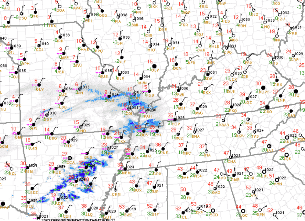
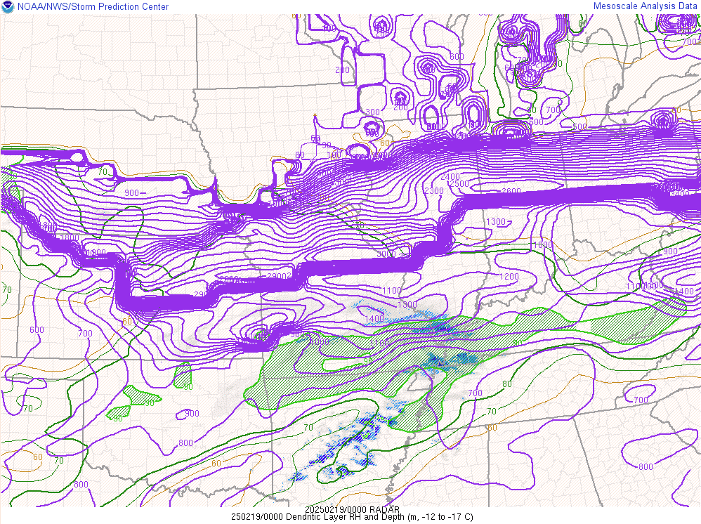
A shortwave moved east across the Missouri/Arkansas border into the Ohio Valley on February 18th into the morning of the 19th. At the surface, temperatures were very cold as arctic air had already become established across the region behind a cold frontal passage on the 16th. Lift quickly increase ahead of the 700mb wave during the afternoon on the 18th with moderate to heavy snow developing across southeast Missouri and spreading east across the rest of the area through the evening. Snowfall rates up to 1" per hour were realized in some of the bands that set up across the Quad State. Roads quickly became snow covered within an hour of the snow starting due to temperatures in the teens to low 20s. The dendritic growth zone was quite deep, especially across the north half of southeast Missouri into southwest Illinois. Snow ratios were highest in these locations which combined with the lift and moisture being maximized allowed for the narrow swath of heaviest amounts to set up from Bollinger and Cape Girardeau County Missouri into Union County Illinois. The best lift quickly faded by late evening into the overnight, which lead to rates decreasing. Also, a dry slot developed across the southern portions of southeast Missouri into west Kentucky which ended up cutting down on totals from Poplar Bluff to New Madrid, Missouri and Fulton, Kentucky.
 |
 |
 |
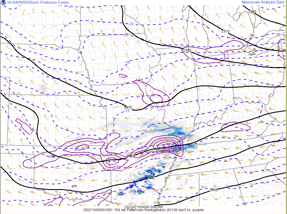 |
| Surface Observations at 6 PM February 18 | Dendritic Growth Layer Depth and RH at 6 PM Feb 18 | 700mb Analysis at 6 PM Feb 18 | 700mb Frontogenesis at 6 PM Feb 18 |
Additional Information
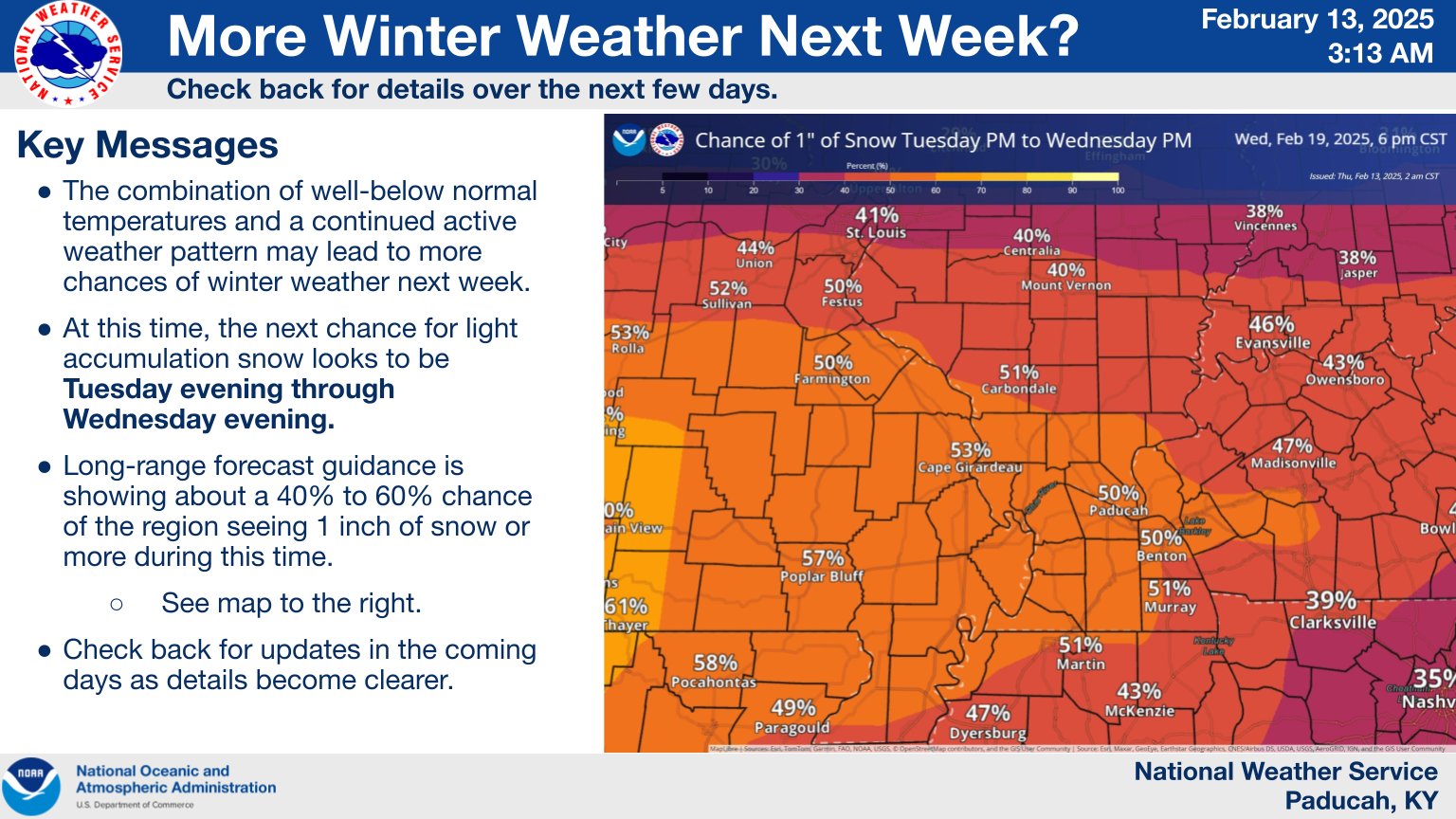
We started messaging the potential for accumulating snow on the morning of February 13th, 5 to 6 days ahead of the storm. Our main focus at that time was a significant heavy rain and flash flooding event forecast to impact the region on February 15th with 3 to 6 inches of rain. After the major flooding event exited the region, we had a quick 1 to 3 inch snow event on the morning of February 16th. During this time we messaged fairly high probabilities of receiving at least 6 inches of snow for a good chunk of our region. Winter Storm Warnings were posted in southeast Missouri on the morning of February 17th, roughly 36 hours before the snow began. Most of the rest of the region was put under a Winter Storm Warning on the afternoon of the 17th, 24 to 30 hours before snow began. Our forecast issued right at the start of the event was for most areas to receive between 3 and 7 inches, but locally higher across southeast Missouri and slightly less near the I-64 corridor.
 |
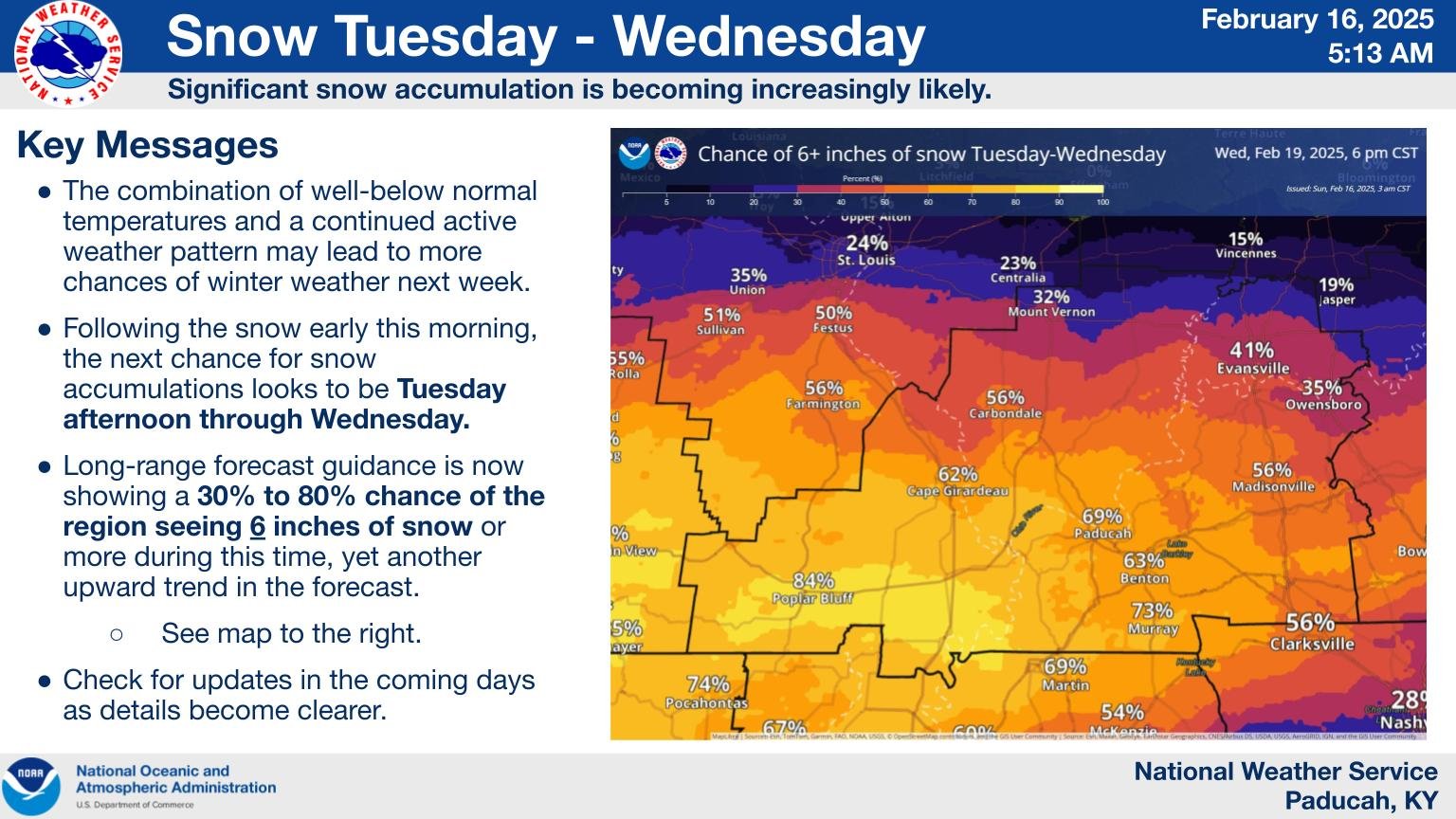 |
| NWS Paducah Weather Story 3 AM Feb 13 | NWS Paducah Weather Story 5 AM Feb 16 |
 |
 |
| NWS Paducah Weather Story 3 PM Feb 17 | NWS Paducah Weather Story 3 PM Feb 18 |
Summaries from other NWS Offices
 |
Media use of NWS Web News Stories is encouraged! Please acknowledge the NWS as the source of any news information accessed from this site. |
|

