Overview
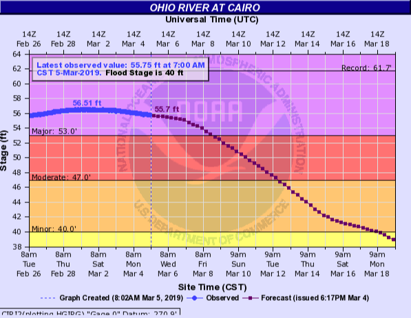
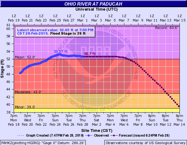
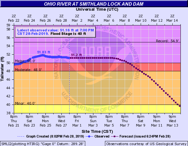
The weather pattern set up in a favorable pattern for repeated rounds of heavy rainfall across the lower Ohio Valley and Tennessee Valley from February 6th through 23rd. This resulted in major flooding developing along the Ohio River at Smithland, Paducah, and Cairo. Numerous points along area rivers crested in moderate flood stage during the month. Several locations experienced their highest crest since the historic flooding in 2011.Flooding
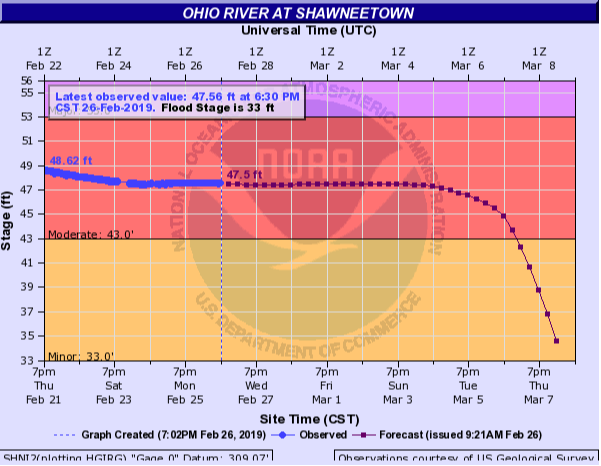
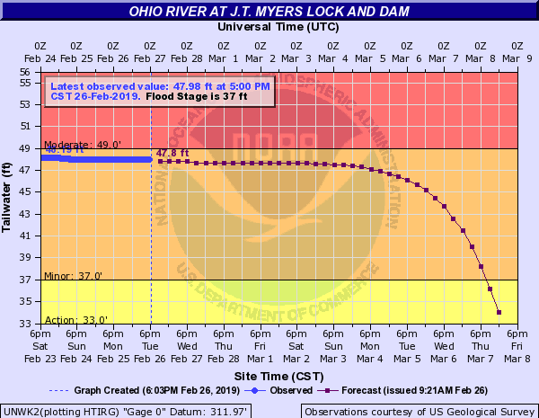
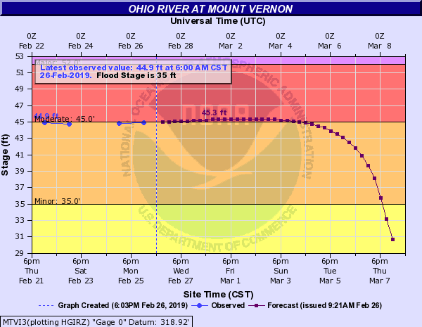
Major flooding occurred along the Ohio River at Smithland, Paducah, and Cairo. Moderate flooding occurred along other points on the Ohio River, as well as portions of the Mississippi and Green Rivers.
 |
 |
 |
 |
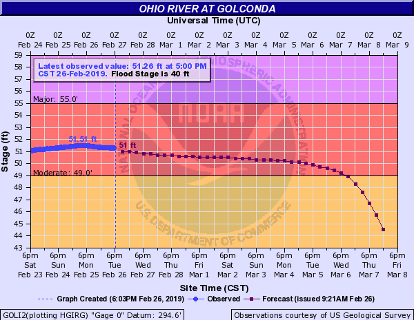 |
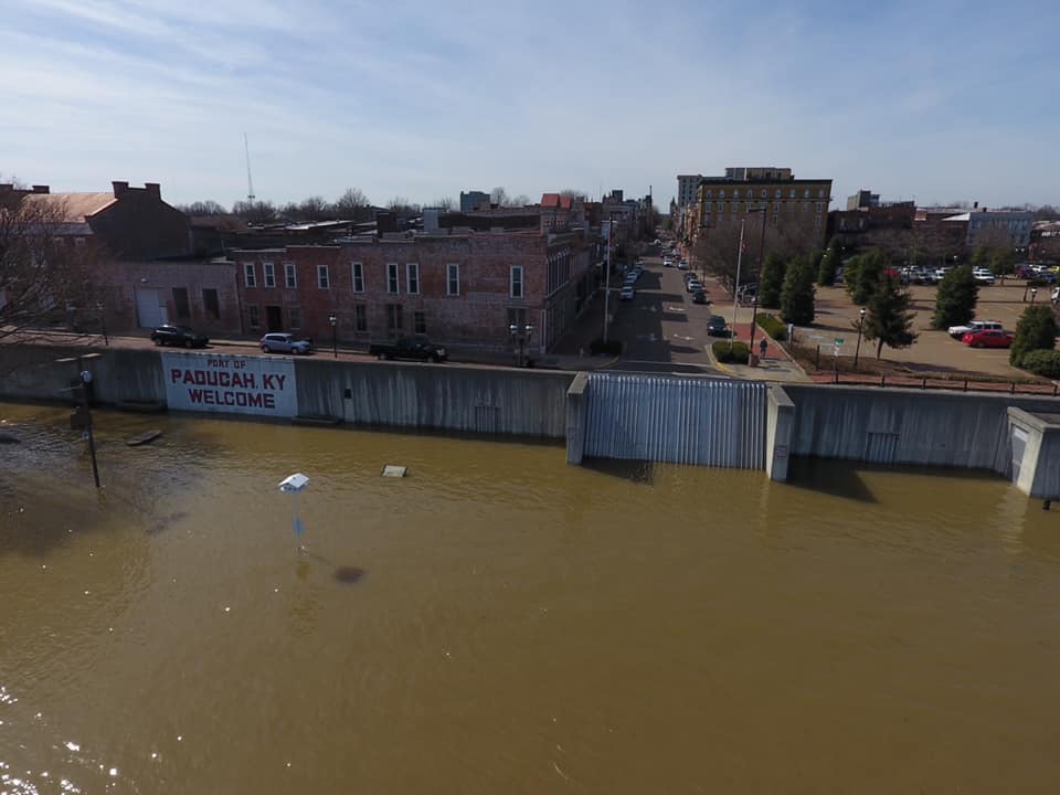
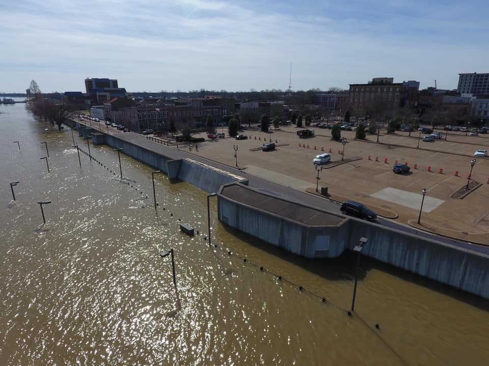
| Major flooding on Ohio River at Cairo, IL | Major flooding on Ohio River at Paducah, KY | Major flooding on Ohio River at Smithland, KY | Moderate flooding on Ohio River at Golconda, IL |
 |
 |
 |
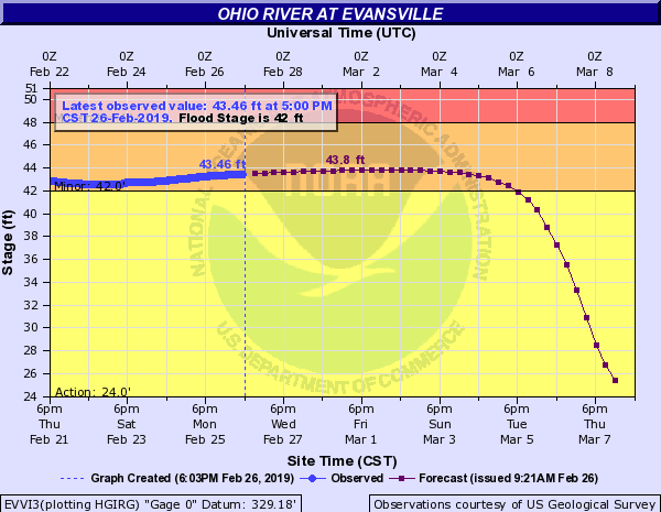 |
| Moderate flooding on Ohio River at Shawneetown, IL | Minor flooding on Ohio River at J.T. Myers, KY | Moderate flooding on Ohio River at Mount Vernon, IN | Minor flooding on Ohio River at Evansville, IN |
 |
 |
 |
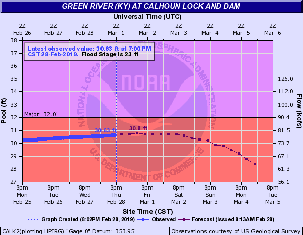 |
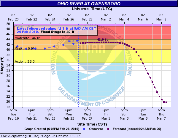
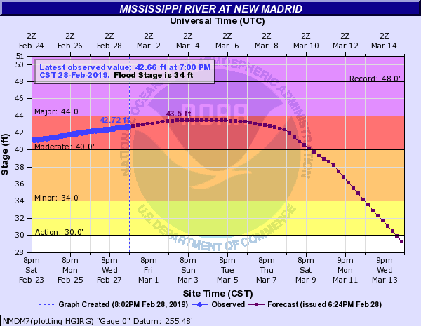
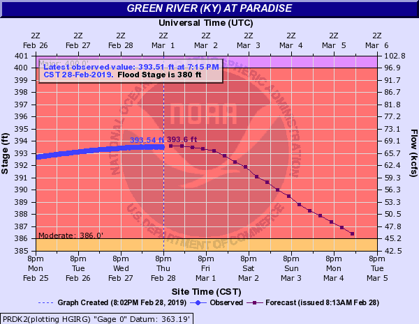
| Minor flooding on Ohio River at Owensboro, KY | Moderate flooding on Mississippi River at New Madrid, MO | Moderate flooding on Green River at Paradise, KY | Moderate flooding on Green River at Calhoun, KY |
Photos
 |
 |
 |
 |
| Paducah, KY Riverfront February 25 courtesy of Jennifer Rukavina (53.2 feet) | Paducah, KY Riverfront February 25 courtesy of Jennifer Rukavina (53.2 feet) | Paducah, KY Riverfront February 21 courtesy of Vikas Patel (50.6 feet) | Paducah, KY Riverfront February 21 courtesy of Vikas Patel (50.6 feet) |
 |
 |
 |
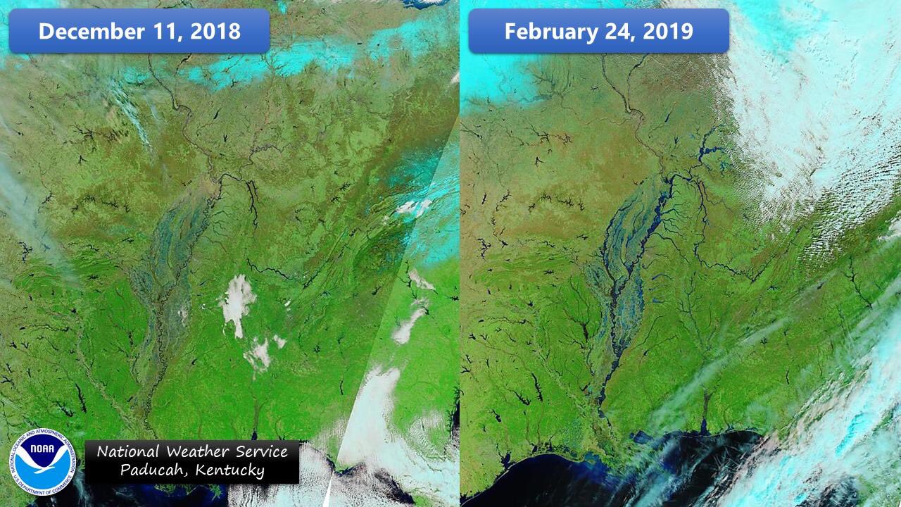 |
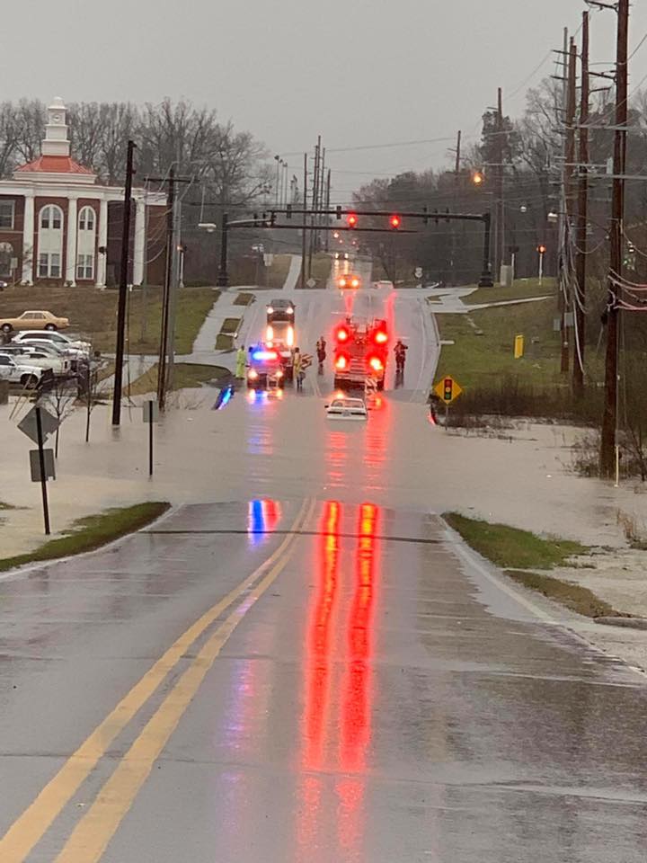
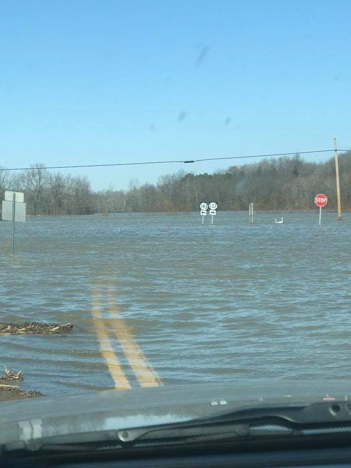
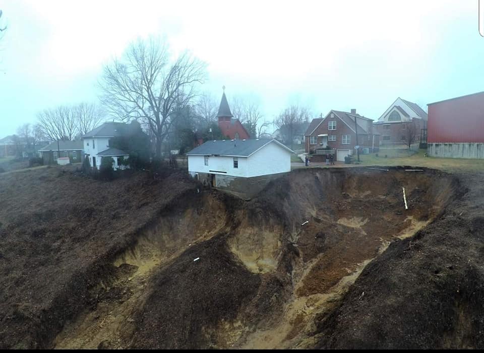
| Flooding Murray, KY on Feb 23 courtesy of Jennifer Rukavina | Flooding in Webster County KY on Feb 24 courtesy of Johnny Ray Feltner | Mudslide in Hickman, KY on Feb 20 courtesy of Dave Thomas | Satellite Imagery showing river flooding on Feb 24 courtesy of MODIS |
Rain Reports
A swath of 10 to 15 inches occurred across western Kentucky, generally along and south of a Paducah to Madisonville line, from February 1st through 23rd. Most areas across the region picked up at least 6 inches of rain. To put this in perspective, normal February precipitation ranges from 3 to 4.5 inches. So most locations observed anywhere from 150% to 350% of their normal rainfall during this 3 week period.
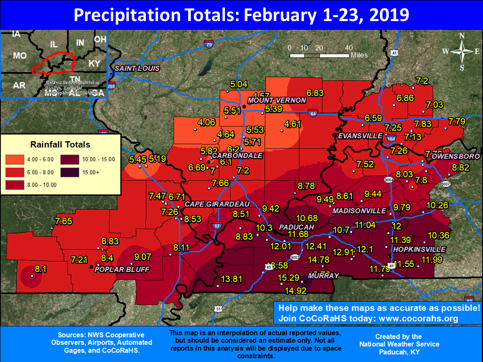 |
| Rainfall Totals February 1-23, 2019 |
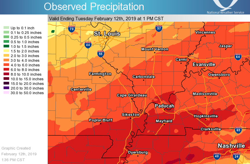
Breaking it down further, there were 4 separate heavy rainfall events during February that resulted in rainfall amounts of 2-3+ inches somewhere across the area.
 |
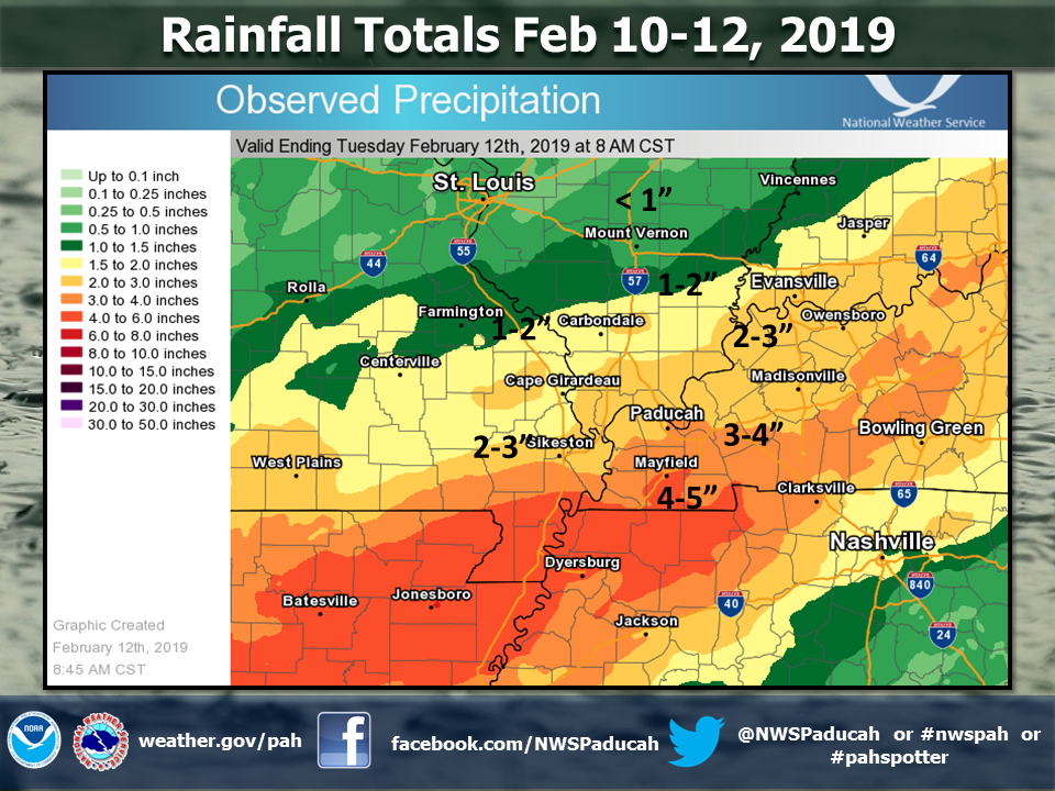 |
| Rainfall Totals February 6-7 | Rainfall Totals February 10-12 |
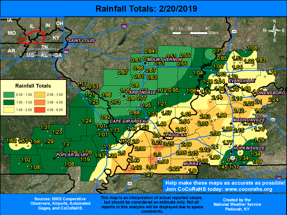 |
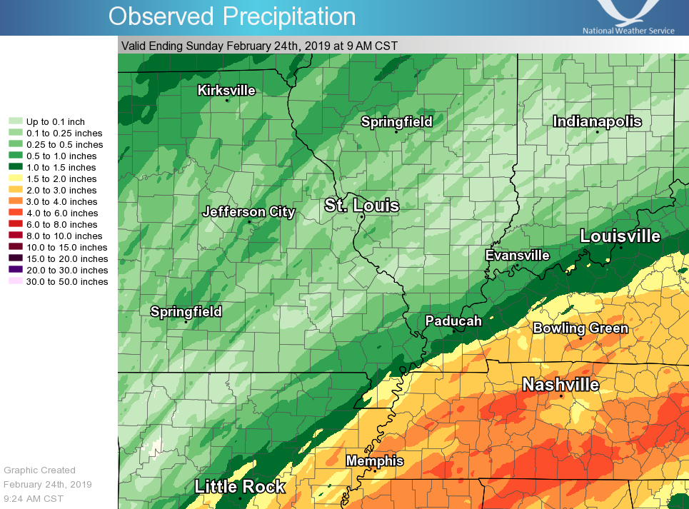 |
| Rainfall Totals February 19-20 | Rainfall Totals February 22-23 |
.
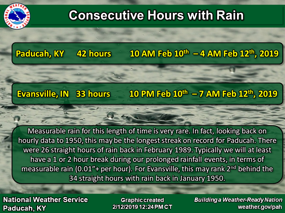
| Paducah, KY observed 42 consecutive hours of measurable rainfall February 10-12, 2019. Looking back on hourly data to 1950 from the Midwest Regional Climate Center, this shatters the previous longest streak of hours with rainfall set back in February 1989 of 26 hours. Evansville, IN observed 33 consecutive hours with measurable rainfall, which appears to have placed 2nd on record behind a 34 hour stretch in January 1950. |
 |
 |
Media use of NWS Web News Stories is encouraged! Please acknowledge the NWS as the source of any news information accessed from this site. |
|

