Paducah, KY
Weather Forecast Office
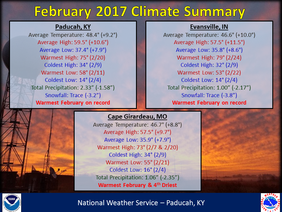
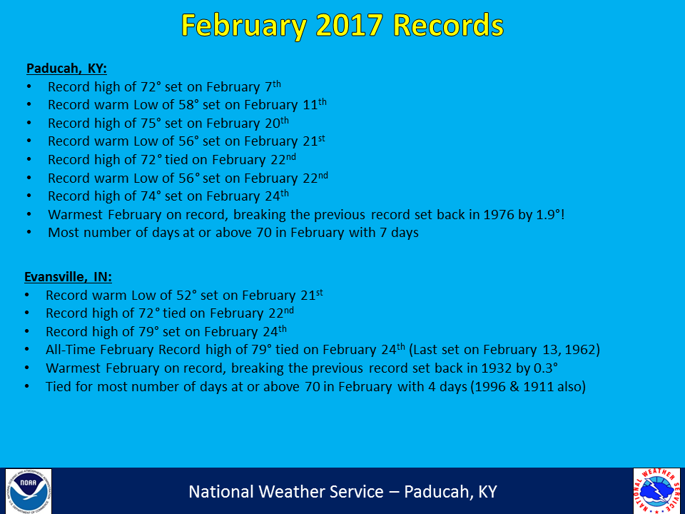
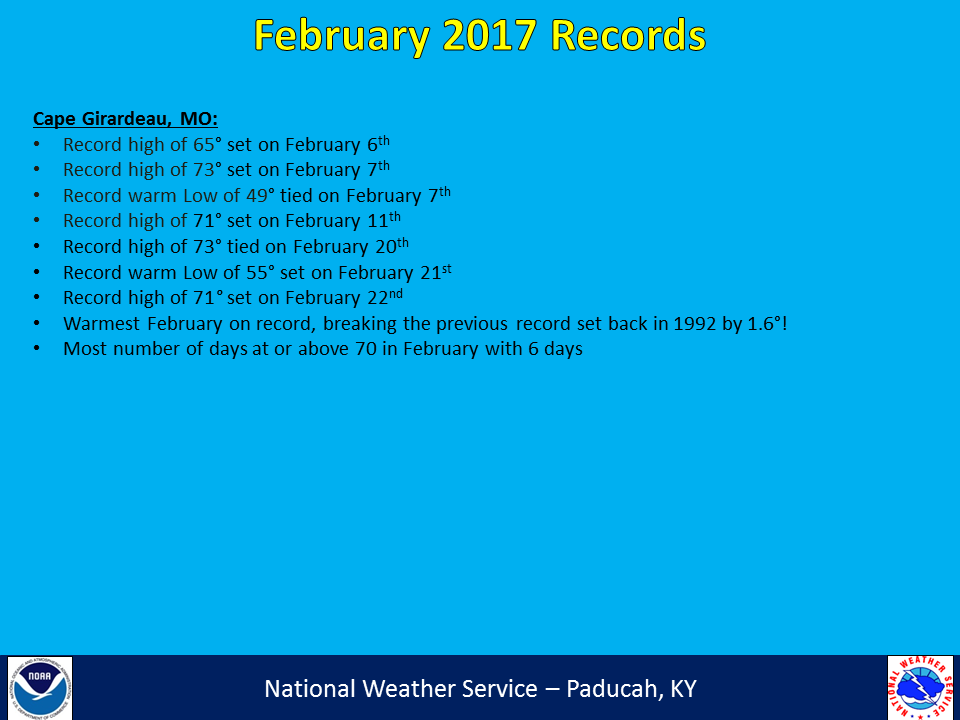
February 2017 was a very warm month across our region, with temperatures running 8 to 10 degrees above normal. In fact, Paducah, Evansville, and Cape Girardeau all established their warmest February on record. Daytime highs in the 60s and 70s were fairly common. Average temperatures for the month finished right near what you would expect in a typical March. Evansville tied their all-time record high for the month of February, reaching 79 degrees on the 24th. The region was also drier than normal, with the most notable area being mainly north of the Ohio River across southern Illinois and southwest Indiana and also over into portions of southeast MO. Snow was basically nonexistent with no measurable snow falling for the whole month for most communities including Paducah and Evansville. The month ended with a bang, as a significant severe weather event unfolded on the evening of the 28th. Damaging winds, hail, and numerous tornadoes were reported with this event.
| February 2017 Review: Precipitation and Temperature Maps |
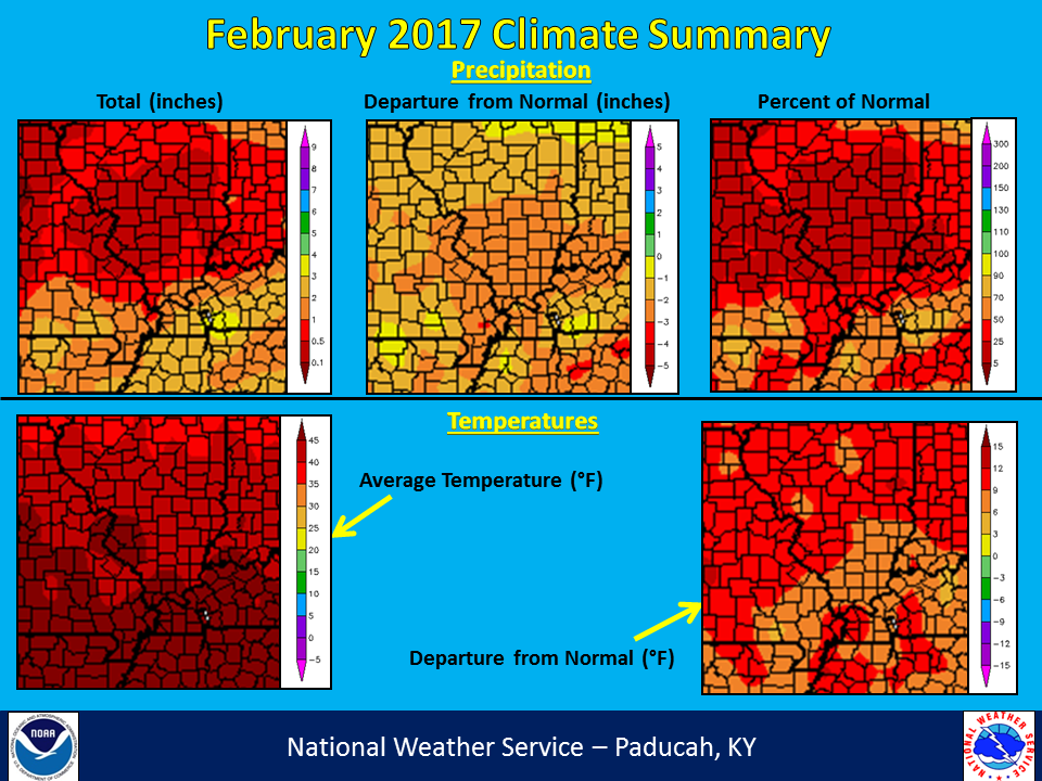 |
| Climate Maps are from the Northeast Regional Climate Center |
FORECASTS
Forecast Discussion
User Defined Area Forecast
Hourly Forecasts
Fire Weather
Activity Planner
LOCAL INFORMATION
Aviation Weather
Our Office
SKYWARN
Items of Interest
Hazardous Weather Support
Local Observations
Weather History
NWS Paducah KY Weekly Partner Briefing
US Dept of Commerce
National Oceanic and Atmospheric Administration
National Weather Service
Paducah, KY
8250 Kentucky Highway 3520
West Paducah, KY 42086-9762
270-744-6440
Comments? Questions? Please Contact Us.