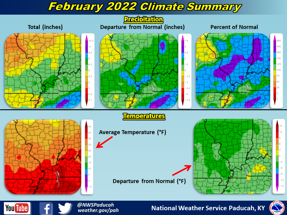
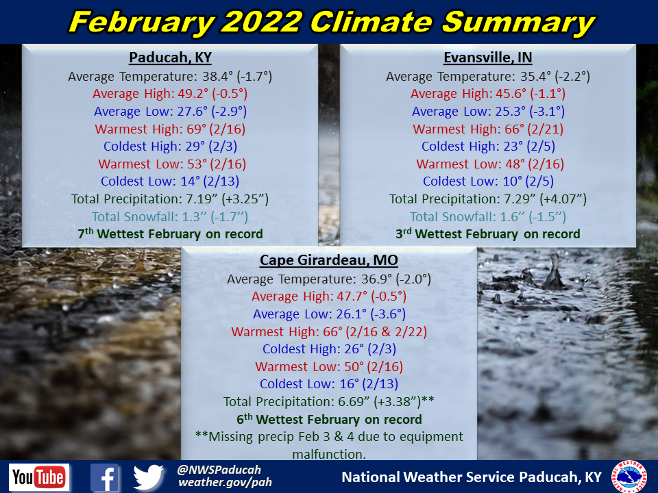
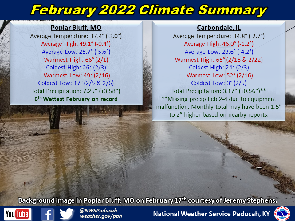
Temperatures: Monthly average temperatures ranged from 1.5 to 3 degrees below normal. The most pronounced colder periods were February 3-5 and 23-25 when high temperatures were routinely in the 20s and 30s. The warmest stretch of the month occurred from February 15-22, when most areas reached into the 60s for highs on 6 of the 8 days.
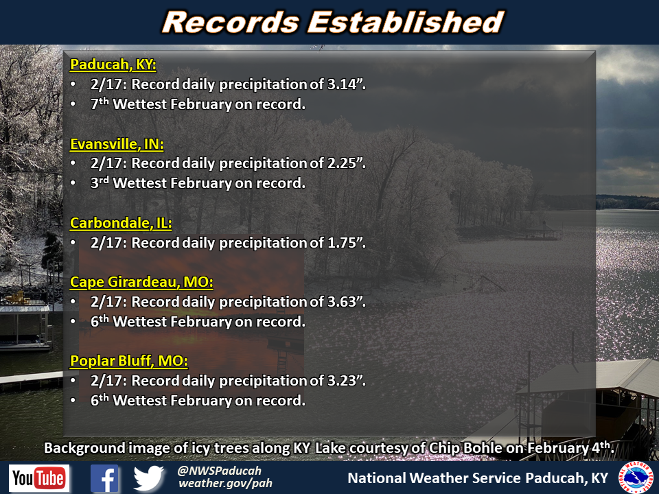
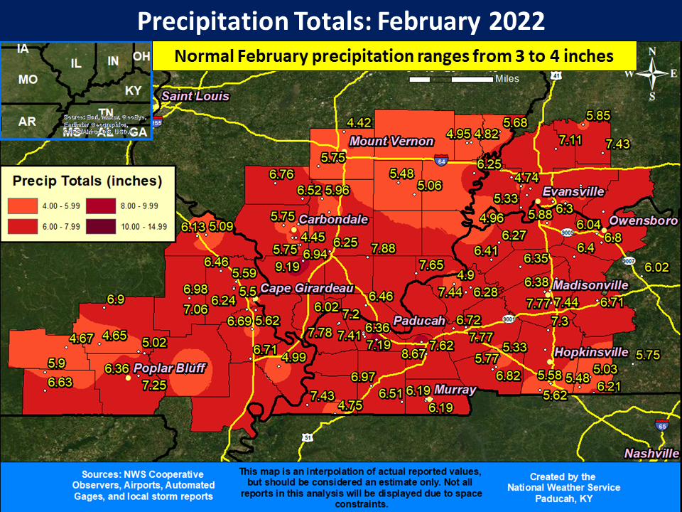
Precipitation: February finished much wetter than normal across the entire region. Amounts of 5 to 8” were observed, with some locally higher amounts of 9 to 10”. This was 2 to 6” above normal for February. Paducah, Evansville, Cape Girardeau, and Poplar Bluff all observed one of their top 10 wettest February’s on record. Carbondale most likely would have too, if not for an equipment malfunction that resulted in no precipitation measured from February 2-4. Surrounding reports observed anywhere from 1.5” to 2” of precipitation during that 3 day period. The highest observed amount was a CoCoRaHS station in 4.5 miles SW of Paducah, KY that received 10.03” for the month. In Paducah, 4 of the 10 wettest February's on record have now occurred in the past 5 years.
The month was jammed packed with impactful events. Two events produced significant sleet and ice accumulations on Feb 3-4 and 23-24. Widespread heavy rain produced flash flooding on February 17 and severe thunderstorms produced damage on February 22.
| February 2022 Review: Precipitation and Temperature Maps (Click on image to enlarge) |
 |
| Climate Maps are from the Northeast Regional Climate Center |
Monthly Climate Report: Paducah | Evansville | Cape Girardeau | Poplar Bluff | Carbondale