Overview
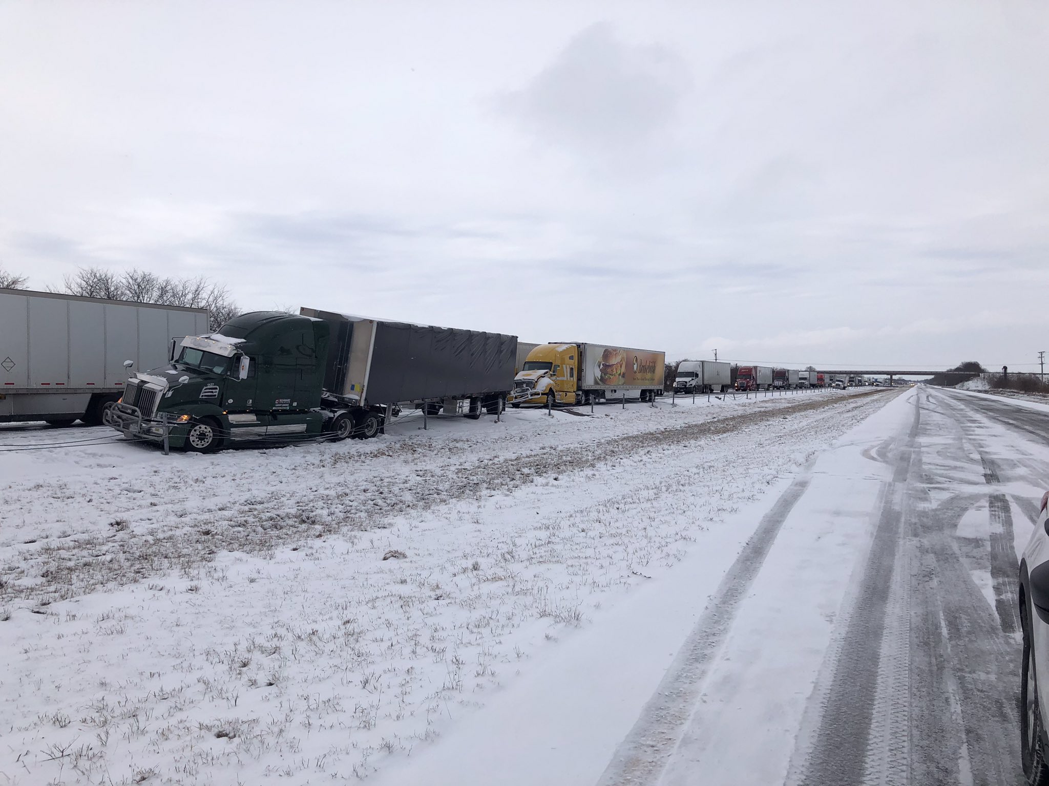
An upper level wave intensified as it moved into the the Ohio Valley region. Temperatures had already fallen well below freezing ahead of it, due to a cold front sweeping through the region the day before. Dry air in the low levels quickly saturated and snow rapidly developed during the early to mid morning on January 6th. Temperatures in the upper teens to lower 20s allowed snow ratios to be higher than normal, resulting in a dry fluffy snow. These cold temperatures also allowed snow to quickly accumulate on all surfaces including area roads. Shortly after 8 AM, nearly 25 semi trailers were reported off the road along I-55 in New Madrid County, Missouri. Snowfall rates of 1 inch per hour occurred across western Kentucky during the morning and early afternoon. The snow ended from west to east through the afternoon, exiting our far eastern counties by 5 PM.Snow
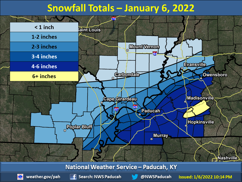
Snowfall totals were highest across western Kentucky, where amounts ranged from 3 to 6 inches. Amounts tapered off farther north and west, with 1 to 2 inches common in southeast Missouri, southwest Indiana, and along and south of Route 13 in southern Illinois. The official snowfall total in Paducah was 3.6", while Evansville received 1.7". The highest amount in our forecast area was 6.5" near Central City, KY (Muhlenberg County).
 |
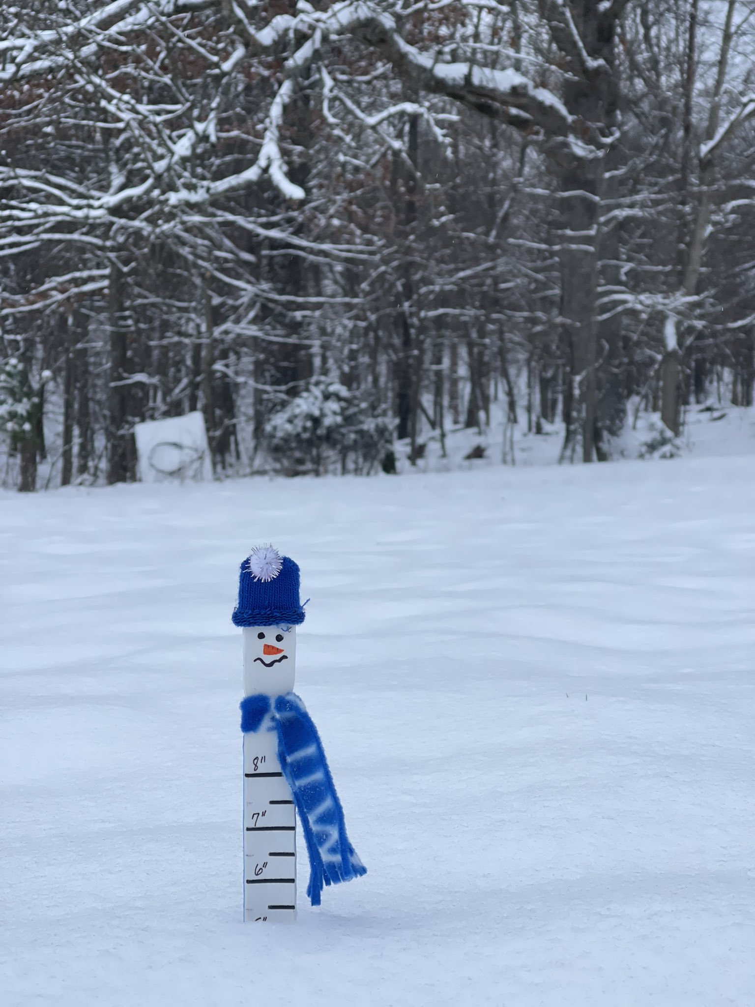
Photos
 |
 |
 |
 |
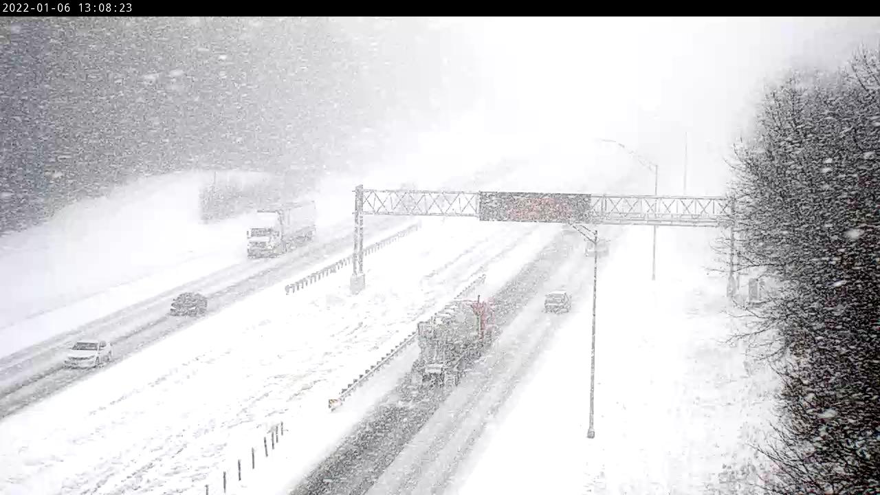
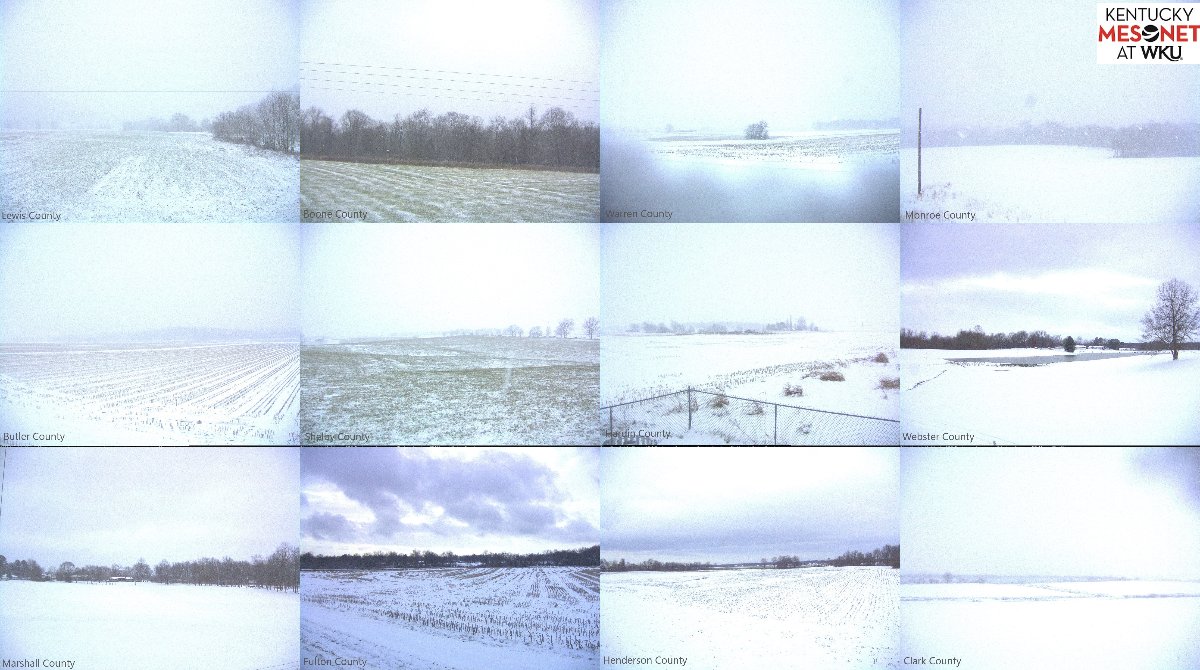
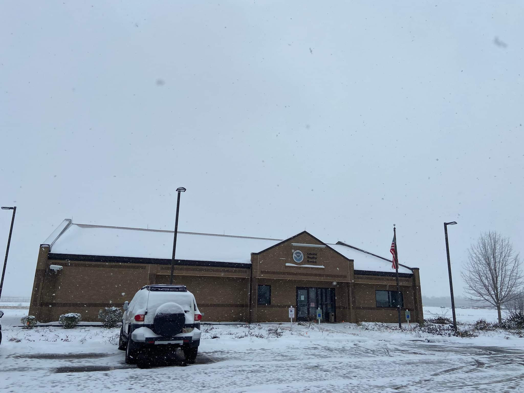
| KYTC Traffic Cam on I-24 near Hopkinsville, KY around 1 PM | KY Mesonet webcams | NWS Paducah office around 12 PM | Graves County, KY near sunset via Jacob Woods |
 |
 |
 |
 |
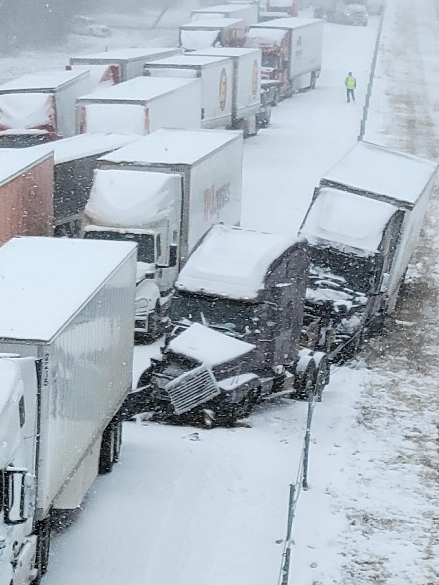
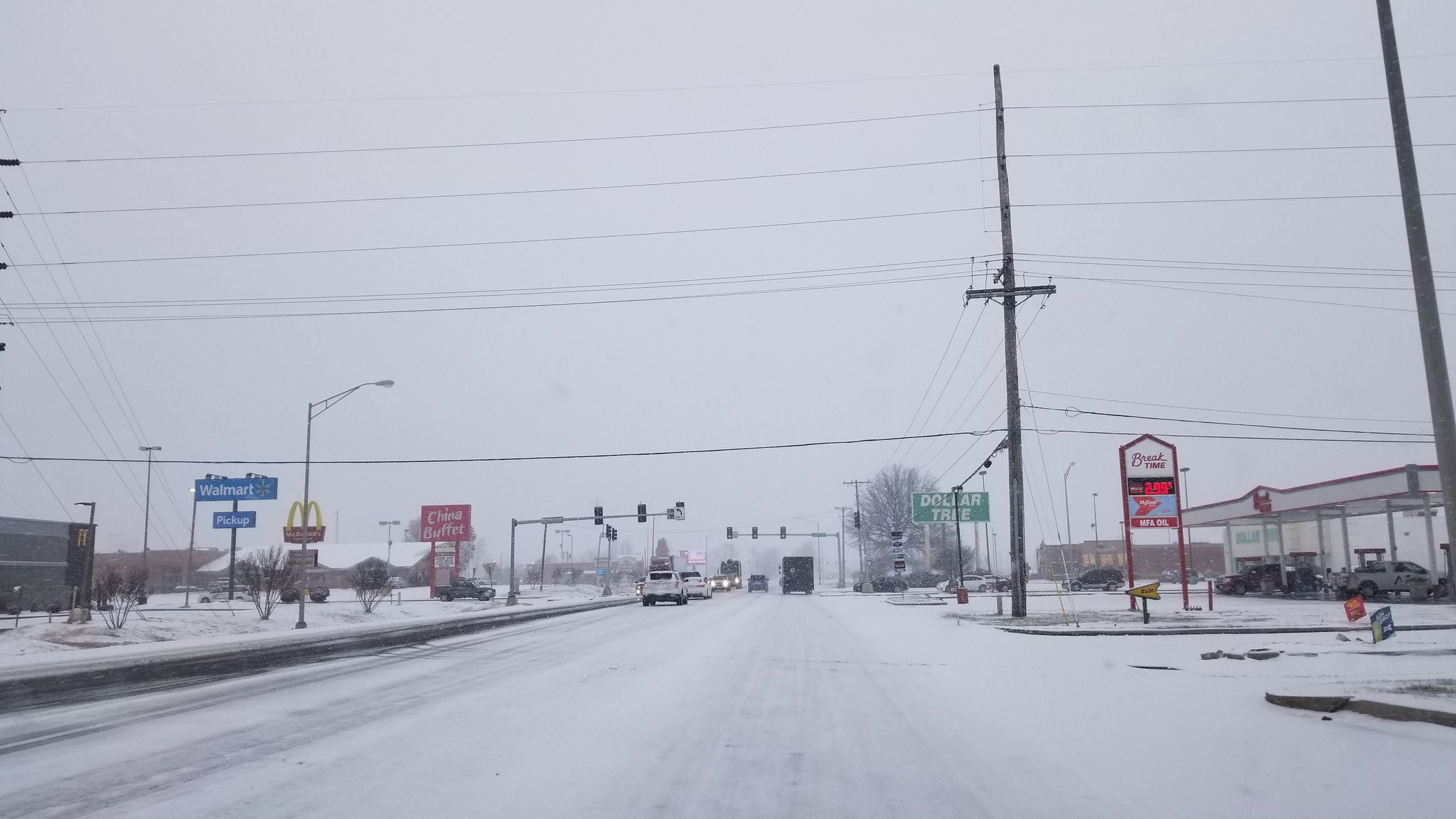
| Nearly 2 dozen semis off the road along I-55 in New Madrid County via Andy Wilkerson | I-55 in New Madrid County, MO via MSHP Troop E | Snow covered roads in Sikeston, MO via Jeremy Stephens | Graves County, KY via Jacob Woods |
Storm Reports
Click here for an interactive map of storm reports.
PUBLIC INFORMATION STATEMENT...CORRECTED
NATIONAL WEATHER SERVICE PADUCAH KY
759 PM CST THU JAN 6 2022

...UPDATED SNOWFALL REPORTS AS OF 8 PM THURSDAY, JANUARY 6TH...

LOCATION                     AMOUNT    TIME/DATE       PROVIDER
3 NE CENTRAL CITY            6.5 IN    0144 PM 01/06   PUBLIC
NEW CONCORD                  6.0 IN    0320 PM 01/06   PUBLIC
GREENVILLE                   6.0 IN    0500 PM 01/06   PUBLIC
BREMEN                       6.0 IN    0505 PM 01/06   PUBLIC
POWDERLY                     6.0 IN    0630 PM 01/06   PUBLIC
CROFTON                      6.0 IN    0630 PM 01/06   PUBLIC
PEMBROKE                     5.5 IN    0415 PM 01/06   PUBLIC
6 NNE PEMBROKE               5.5 IN    0430 PM 01/06   TRAINED SPOTTER
DAWSON SPRINGS               5.5 IN    0630 PM 01/06   PUBLIC
2 WSW SYMSONIA               5.3 IN    0354 PM 01/06   TRAINED SPOTTER
FARIDEALING                  5.0 IN    0100 PM 01/06   PUBLIC
4 W LYNNVILLE                5.0 IN    0208 PM 01/06   PUBLIC
FORT CAMPBELL NORTH          5.0 IN    0245 PM 01/06   PUBLIC
OAK GROVE                    5.0 IN    0345 PM 01/06   PUBLIC
2 WNW FARIDEALING            5.0 IN    0352 PM 01/06   PUBLIC
4 SW CADIZ                   5.0 IN    0400 PM 01/06   CO-OP OBSERVER
2 N HOPKINSVILLE             5.0 IN    0415 PM 01/06   EMERGENCY MNGR
BREMEN                       5.0 IN    0500 PM 01/06   PUBLIC
CLINTON                      5.0 IN    0630 PM 01/06   PUBLIC
2 S MADISONVILLE             5.0 IN    0630 PM 01/06   PUBLIC
3 N ELKTON                   5.0 IN    0630 PM 01/06   PUBLIC
5 SSW CALVERT CITY           5.0 IN    0630 PM 01/06   PUBLIC
WATER VALLEY                 5.0 IN    0630 PM 01/06   PUBLIC
2 E HOPKINSVILLE             4.9 IN    0250 PM 01/06   PUBLIC
1 WNW CENTRAL CITY           4.8 IN    0208 PM 01/06   TRAINED SPOTTER
3 S AURORA                   4.8 IN    0410 PM 01/06   TRAINED SPOTTER
1 WNW CENTRAL CITY           4.8 IN    0448 PM 01/06   TRAINED SPOTTER
WINGO                        4.5 IN    0150 PM 01/06   PUBLIC
3 WNW OWENSBORO              4.5 IN    0230 PM 01/06   PUBLIC
SHADY GROVE                  4.5 IN    0630 PM 01/06   PUBLIC
BENTON                       4.5 IN    0337 PM 01/06   PUBLIC
1 ENE LIVERMORE              4.5 IN    0418 PM 01/06   PUBLIC
SACRAMENTO                   4.5 IN    0423 PM 01/06   TRAINED SPOTTER
SHADY GROVE                  4.5 IN    0630 PM 01/06   PUBLIC
3 SSW HICKORY                4.4 IN    0434 PM 01/06   NWS EMPLOYEE
EDDYVILLE                    4.3 IN    0630 PM 01/06   PUBLIC
6 SSE MASONVILLE             4.3 IN    0630 PM 01/06   PUBLIC
CENTRAL CITY                 4.0 IN    1254 PM 01/06   PUBLIC
3 NE SYMSONIA                4.0 IN    0100 PM 01/06   PUBLIC
NEW MADRID                   4.0 IN    0125 PM 01/06   EMERGENCY MNGR
DIXON                        4.0 IN    0200 PM 01/06   PUBLIC
LOWES                        4.0 IN    0207 PM 01/06   PUBLIC
MAYFIELD                     4.0 IN    0207 PM 01/06   PUBLIC
CADIZ                        4.0 IN    0235 PM 01/06   BROADCAST MEDIA
1 ESE OWENSBORO              4.0 IN    0308 PM 01/06   PUBLIC
7 NNW CALHOUN                4.0 IN    0355 PM 01/06   PUBLIC
3 ENE MURRAY                 4.0 IN    0406 PM 01/06   PUBLIC
MURRAY                       4.0 IN    0415 PM 01/06   CO-OP OBSERVER
MORTONS GAP                  4.0 IN    0600 PM 01/06   TRAINED SPOTTER
3 E PADUCAH                  4.0 IN    0748 PM 01/06   PUBLIC
6 SSW CALVERT CITY           3.9 IN    0200 PM 01/06   NWS EMPLOYEE
LONE OAK                     3.8 IN    0300 PM 01/06   TRAINED SPOTTER
3 ENE MELBER                 3.7 IN    0230 PM 01/06   PUBLIC
2 SSE DAWSON SPRINGS         3.7 IN    0525 PM 01/06   BROADCAST MEDIA
2 SE HEATH                   3.6 IN    0337 PM 01/06   OFFICIAL NWS OBS
PRINCETON                    3.6 IN    0630 PM 01/06   PUBLIC
2 SSE DAWSON SPRINGS         3.5 IN    0140 PM 01/06   BROADCAST MEDIA
EAST PRAIRIE                 3.5 IN    0215 PM 01/06   TRAINED SPOTTER
OWENSBORO                    3.5 IN    0245 PM 01/06   PUBLIC
4 ESE GRAHAMVILLE            3.5 IN    0419 PM 01/06   NWS EMPLOYEE
KEVIL                        3.5 IN    0630 PM 01/06   TRAINED SPOTTER
ROBARDS                      3.5 IN    0630 PM 01/06   PUBLIC
STURGIS 5.4 ENE              3.4 IN    1000 AM 01/06   COCORAHS
3 SSW HICKORY                3.3 IN    1217 PM 01/06   TRAINED SPOTTER
3 ENE MELBER                 3.3 IN    0115 PM 01/06   PUBLIC
4 NNW MURRAY                 3.3 IN    0432 PM 01/06   EMERGENCY MNGR
4 ESE GRAHAMVILLE            3.2 IN    0100 PM 01/06   NWS EMPLOYEE
4 NNW MURRAY                 3.2 IN    0318 PM 01/06   EMERGENCY MNGR
4 W OWENSBORO                3.1 IN    0321 PM 01/06   TRAINED SPOTTER
1 SE HEATH                   3.0 IN    1203 PM 01/06   OFFICIAL NWS OBS
3 SE REIDLAND                3.0 IN    1230 PM 01/06   BROADCAST MEDIA
LONE OAK                     3.0 IN    1245 PM 01/06   BROADCAST MEDIA
MURRAY                       3.0 IN    1255 PM 01/06   OFFICIAL NWS OBS
4 NNW MURRAY                 3.0 IN    0100 PM 01/06   EMERGENCY MNGR
5 NNE BIG BAY                3.0 IN    0112 PM 01/06   BROADCAST MEDIA
3 NW REIDLAND                3.0 IN    0131 PM 01/06   PUBLIC
1 W PADUCAH                  3.0 IN    0145 PM 01/06   TRAINED SPOTTER
1 ESE PADUCAH                3.0 IN    0300 PM 01/06   PUBLIC
KEWANEE                      3.0 IN    0330 PM 01/06   BROADCAST MEDIA
WICKLIFFE                    3.0 IN    0330 PM 01/06   BROADCAST MEDIA
1 W PADUCAH                  2.8 IN    1157 AM 01/06   TRAINED SPOTTER
SPOTTSVILLE                  2.8 IN    0245 PM 01/06   PUBLIC
NEW COLUMBIA                 2.8 IN    0305 PM 01/06   TRAINED SPOTTER
FULTON KY 5.0 W              2.8 IN    0328 PM 01/06   COCORAHS
3 SSE LONE OAK               2.6 IN    1156 AM 01/06   NWS EMPLOYEE
SHAWNEETOWN                  2.5 IN    0330 PM 01/06   BROADCAST MEDIA
SIKESTON                     2.5 IN    0330 PM 01/06   BROADCAST MEDIA
PORTAGEVILLE                 2.5 IN    0330 PM 01/06   BROADCAST MEDIA
1 SSE HEATH                  2.3 IN    1042 AM 01/06   OFFICIAL NWS OBS
1 NNE HENDERSON              2.2 IN    0321 PM 01/06   BROADCAST MEDIA
1 NNE OWENSBORO              2.1 IN    1045 AM 01/06   EMERGENCY MNGR
CREAL SPRINGS                2.0 IN    0117 PM 01/06   BROADCAST MEDIA
OWENSVILLE                   2.0 IN    0200 PM 01/06   PUBLIC
THEBES                       2.0 IN    0329 PM 01/06   BROADCAST MEDIA
5 WSW EVANSVILLE             2.0 IN    0445 PM 01/06   PUBLIC
4 WNW NEWBURGH               2.0 IN    0446 PM 01/06   PUBLIC
1 NW EVANSVILLE              2.0 IN    0455 PM 01/06   PUBLIC
3 W NEWBURGH                 1.8 IN    0322 PM 01/06   TRAINED SPOTTER
CREAL SPRINGS                1.8 IN    0419 PM 01/06   EMERGENCY MNGR
2 NW MELODY HILL             1.7 IN    0637 PM 01/06   OFFICIAL NWS OBS
2 SE HEATH                   1.6 IN    0955 AM 01/06   OFFICIAL NWS OBS
3 W NEWBURGH                 1.6 IN    1233 PM 01/06   TRAINED SPOTTER
SIKESTON                     1.5 IN    1001 AM 01/06   PUBLIC
MURRAY                       1.5 IN    1054 AM 01/06   TRAINED SPOTTER
4 NNW MURRAY                 1.5 IN    1111 AM 01/06
5 WSW EVANSVILLE             1.5 IN    1130 AM 01/06   PUBLIC
ELDORADO                     1.5 IN    0200 PM 01/06   PUBLIC
QULIN                        1.5 IN    0330 PM 01/06   BROADCAST MEDIA
CUTLER                       1.5 IN    0334 PM 01/06   PUBLIC
CARBONDALE                   1.3 IN    1237 PM 01/06   TRAINED SPOTTER
NEWBURGH                     1.3 IN    0355 PM 01/06   BROADCAST MEDIA
EVANSVILLE                   1.2 IN    1230 PM 01/06   BROADCAST MEDIA
5 NNW OXLY                   1.1 IN    1219 PM 01/06   TRAINED SPOTTER
BOONVILLE                    1.1 IN    0530 PM 01/06   TRAINED SPOTTER
5 NNW OXLY                   1.0 IN    1007 AM 01/06
MURRAY                       1.0 IN    1015 AM 01/06   PUBLIC
2 NE DARMSTADT               1.0 IN    1020 AM 01/06
DEXTER                       1.0 IN    0100 PM 01/06   EMERGENCY MNGR
CAPE GIRARDEAU               1.0 IN    0114 PM 01/06   BROADCAST MEDIA
3 W EVANSVILLE               1.0 IN    0140 PM 01/06   BROADCAST MEDIA
TAMAROA                      1.0 IN    0330 PM 01/06   BROADCAST MEDIA
VAN BUREN                    1.0 IN    0330 PM 01/06   BROADCAST MEDIA
PERRYVILLE                   1.0 IN    0630 PM 01/06   PUBLIC
1 NNW EVANSVILLE             0.9 IN    1110 AM 01/06   BROADCAST MEDIA
AVA                          0.8 IN    0115 PM 01/06   PUBLIC
MURPHYSBORO                  0.8 IN    0200 PM 01/06   EMERGENCY MNGR
CARTERVILLE                  0.8 IN    0215 PM 01/06   BROADCAST MEDIA
1 N DEXTER                   0.6 IN    1048 AM 01/06   EMERGENCY MNGR
5 NNW OXLY                   0.5 IN    0854 AM 01/06
1 NNW CAPE GIRARDEAU         0.5 IN    0956 AM 01/06   BROADCAST MEDIA
3 E WARE                     0.5 IN    1032 AM 01/06   TRAINED SPOTTER
1 SW MOUNT VERNON            0.5 IN    1245 PM 01/06   TRAINED SPOTTER
1 NW JACKSON                 0.3 IN    1148 AM 01/06   PUBLIC

OBSERVATIONS ARE COLLECTED FROM A VARIETY OF SOURCES WITH VARYING
EQUIPMENT AND EXPOSURES. WE THANK ALL VOLUNTEER WEATHER OBSERVERS
FOR THEIR DEDICATION. NOT ALL DATA LISTED ARE CONSIDERED OFFICIAL.
 |
Media use of NWS Web News Stories is encouraged! Please acknowledge the NWS as the source of any news information accessed from this site. |
|

