Overview
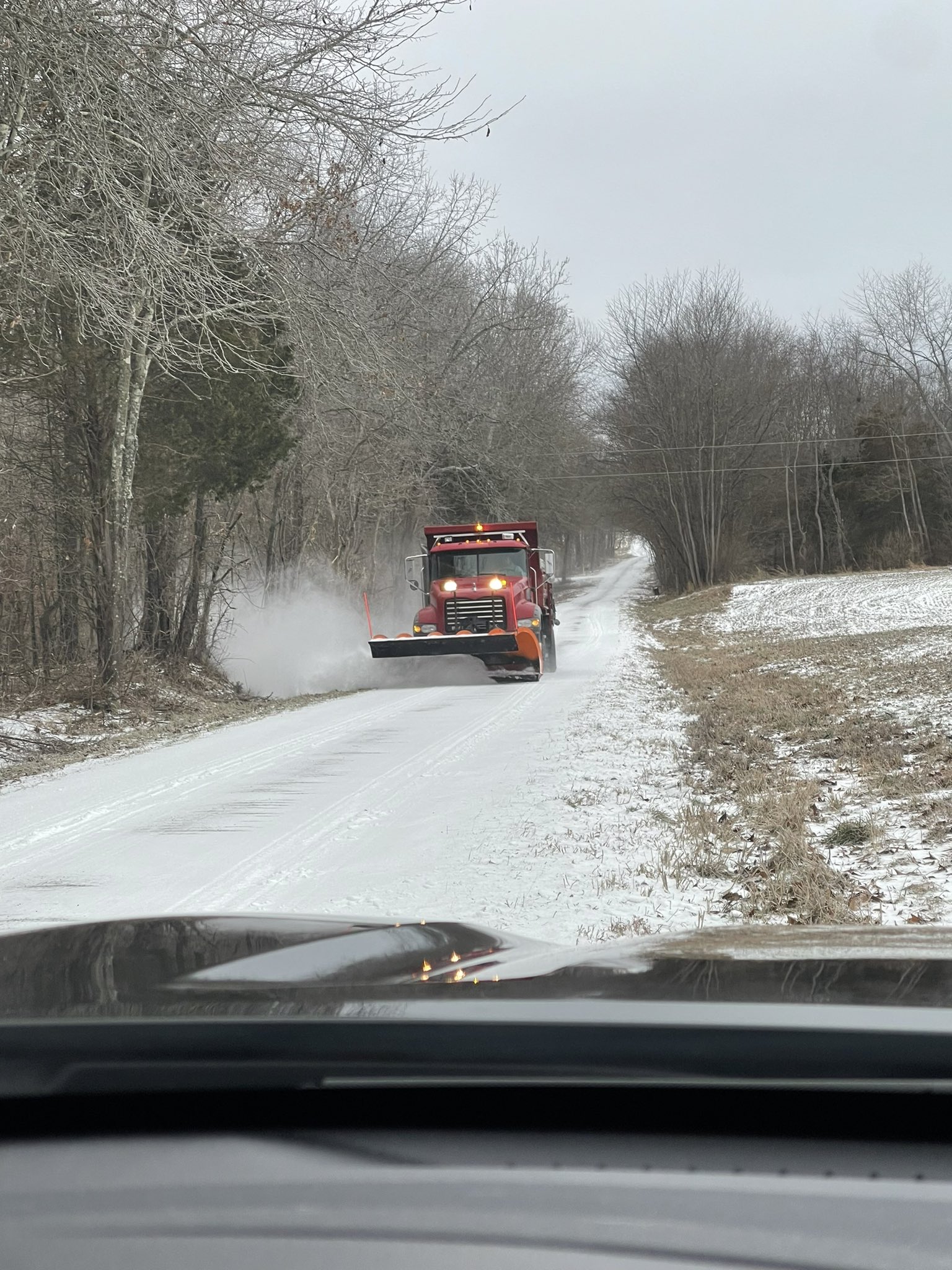
A mixture of sleet and freezing rain impacted the region during the late afternoon and evening on January 30th. The initial round moved out overnight, and then a secondary wave moved in during the afternoon and evening on January 31st. Temperatures were well below freezing so roads quickly became covered with sleet, which compacted down to an icy coating. Even in the days that followed, many secondary roads were ice-covered as temperatures remained below freezing through the morning of February 2nd. There were numerous slide-offs and some accidents. Schools were cancelled in most counties from January 30th through February 2nd. A multi-vehicle pileup on Interstate 24 over the Cumberland River closed the eastbound lanes in parts of Lyon and Livingston Counties on the morning of February 1.Sleet/Ice
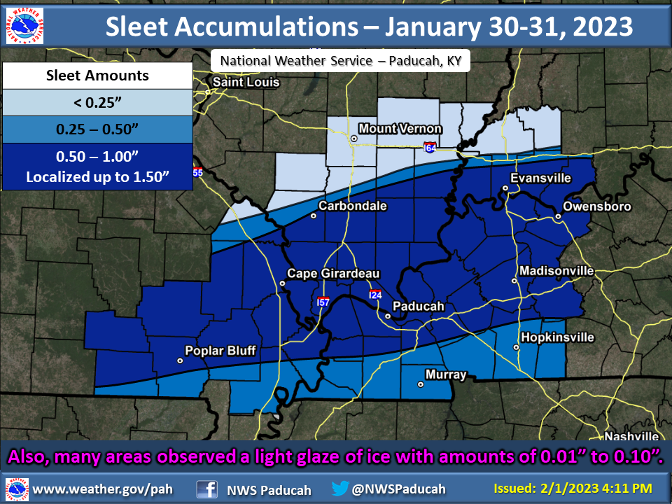
Here is a look at observed sleet accumulations from this event based on reports we received. A wide swath of 1/2 to 1 inch of sleet occurred across southeast Missouri, far southern Illinois, western Kentucky, and areas near the Ohio River in southwest Indiana. Some localized amounts of up to 1.5" were observed as well. Many areas also received a light glaze of ice due to freezing rain.
 |
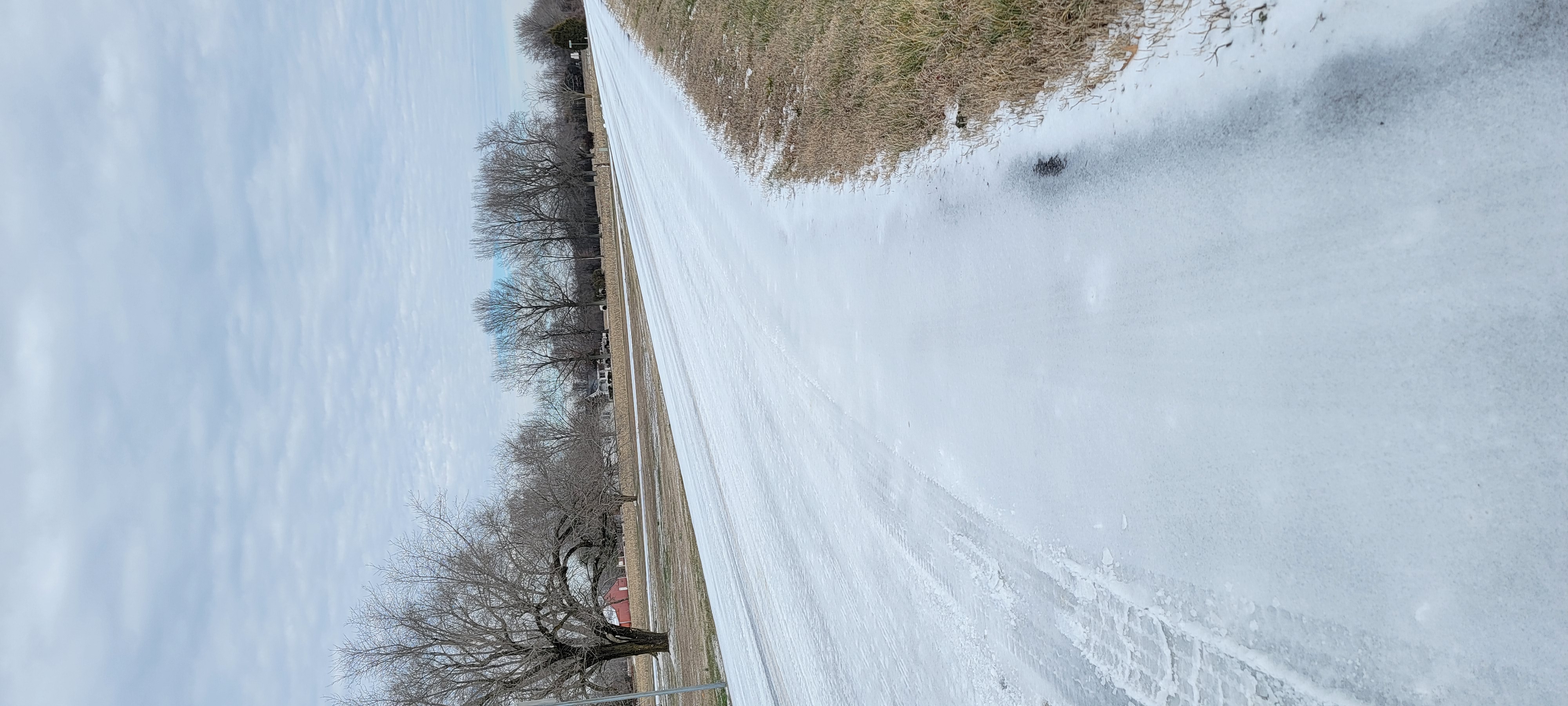
Photos
 |
 |
 |
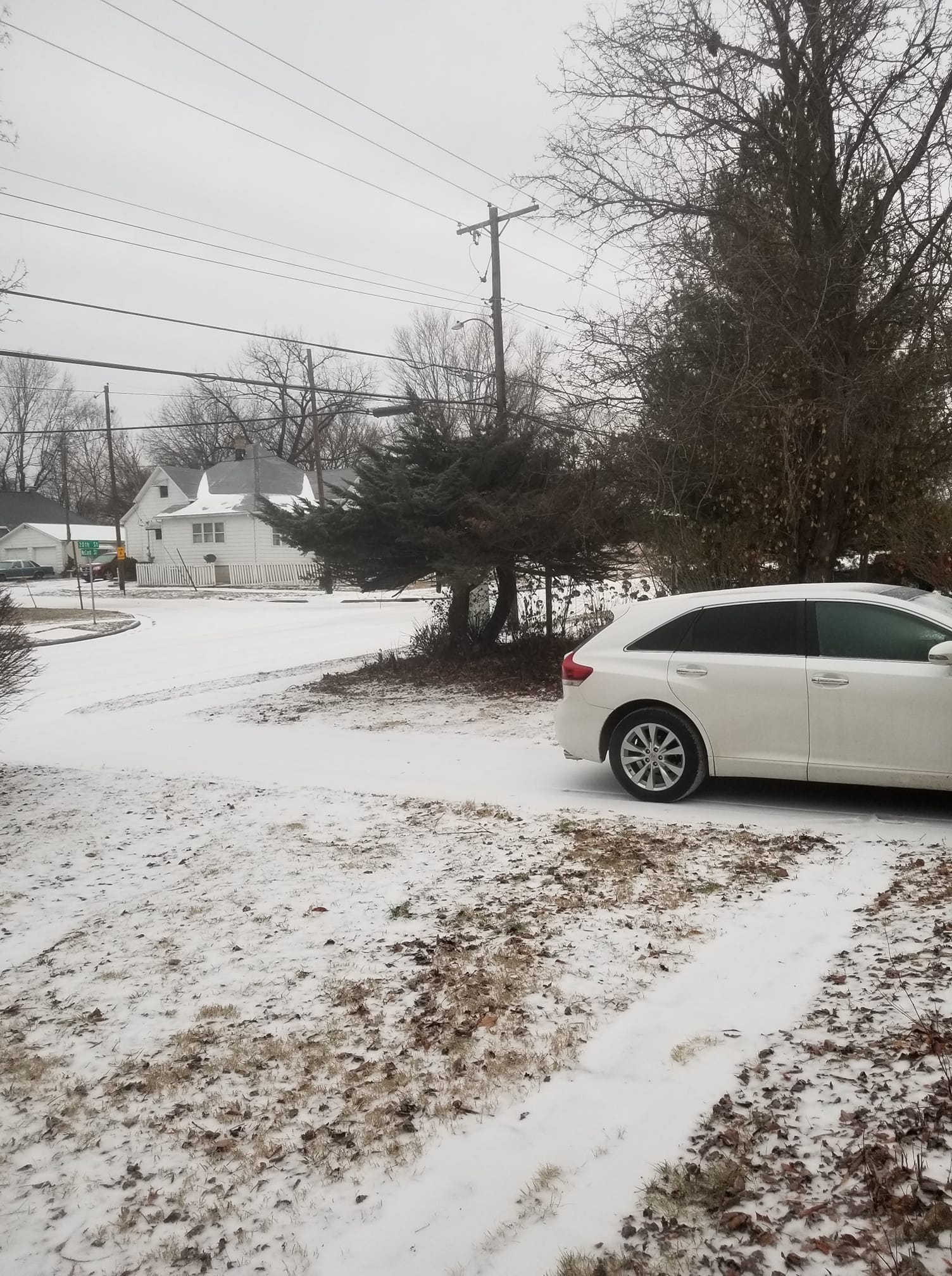 |
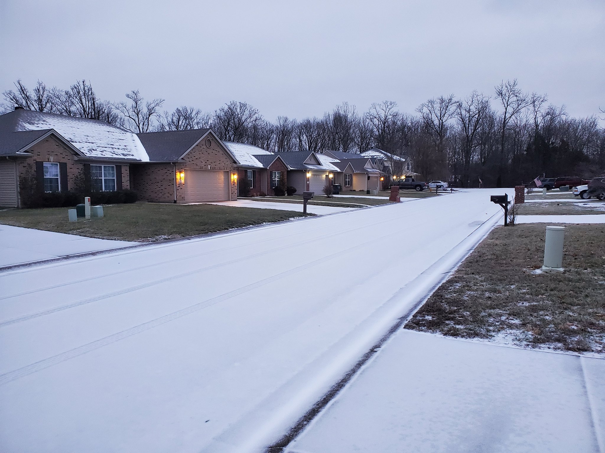
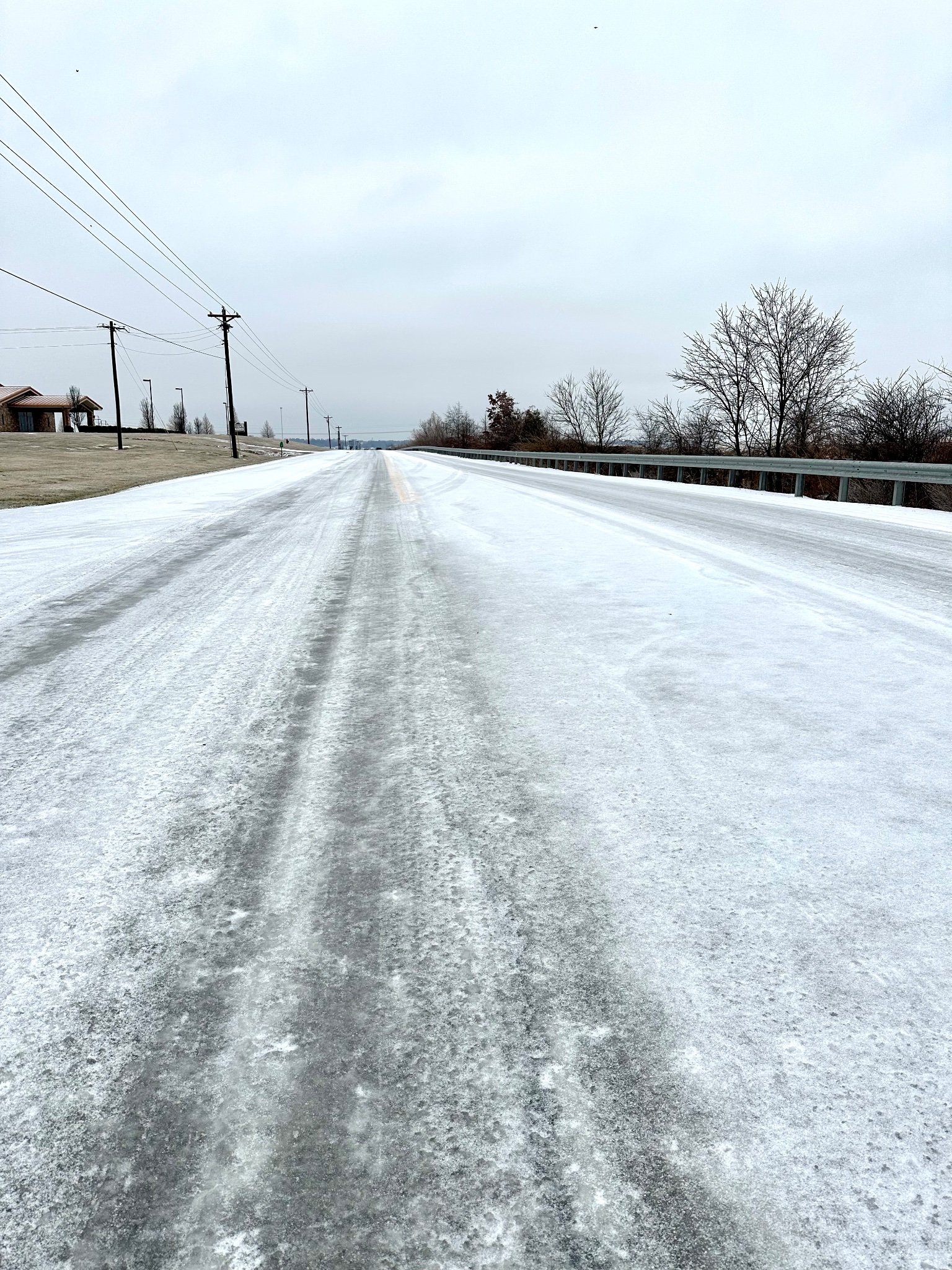
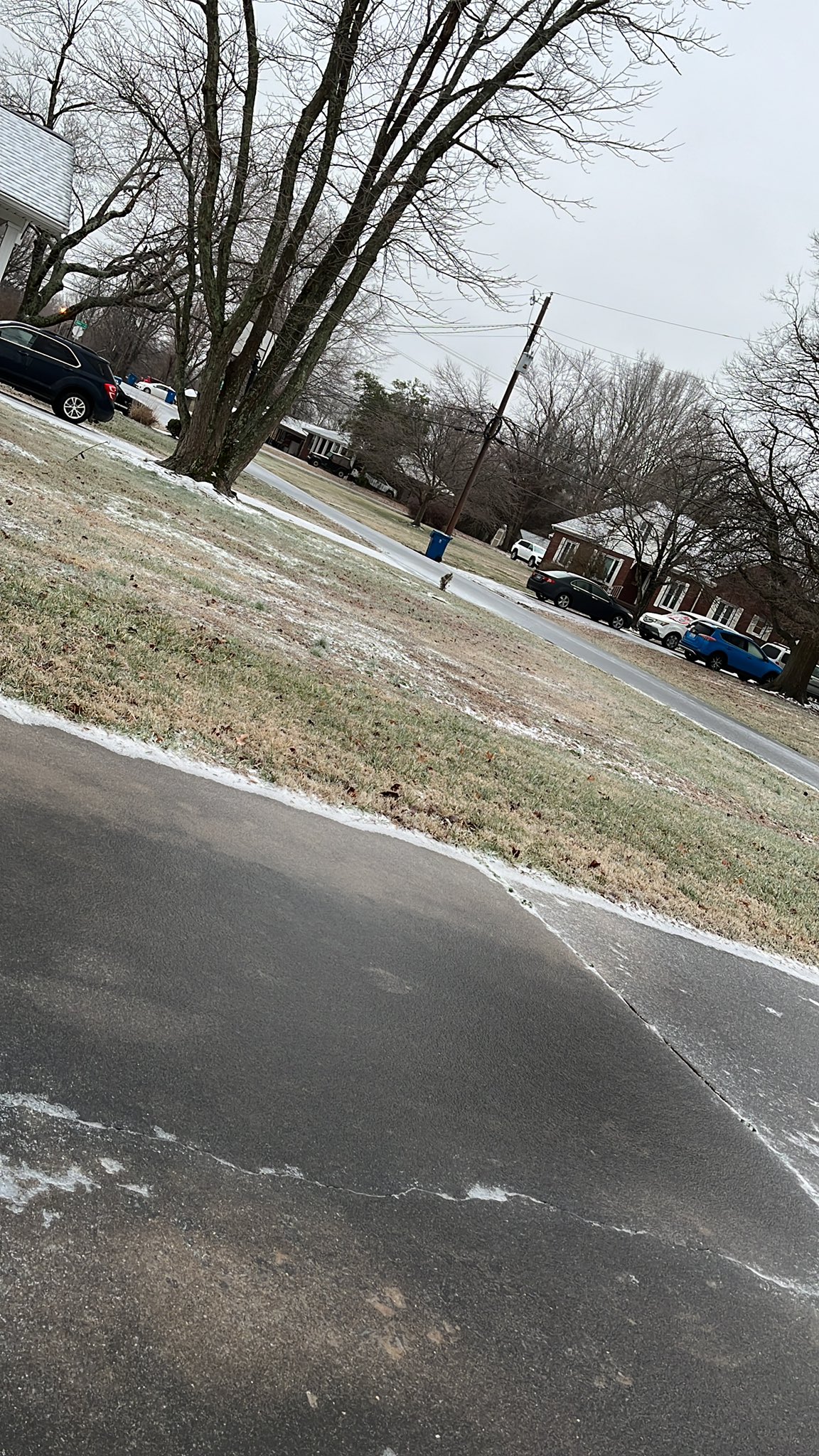
| Evansville, IN courtesy of David Skau | Galatia Road in Saline County IL courtesy of Mike Cummins | Marion, IL courtesy of Cody Simmerman | Murphysboro, IL courtesy of Kimberly Jane Glasser |
 |
 |
 |
 |
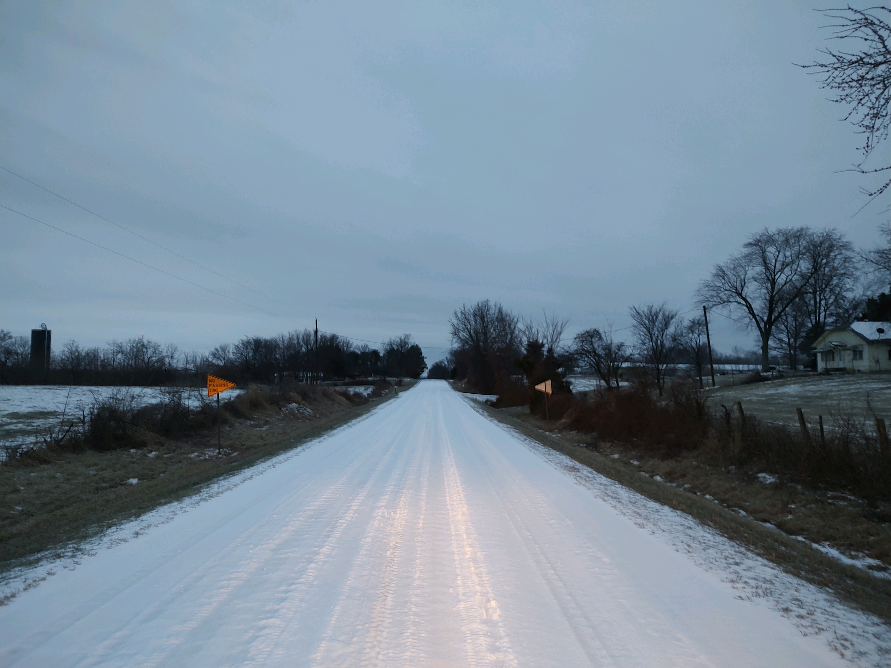
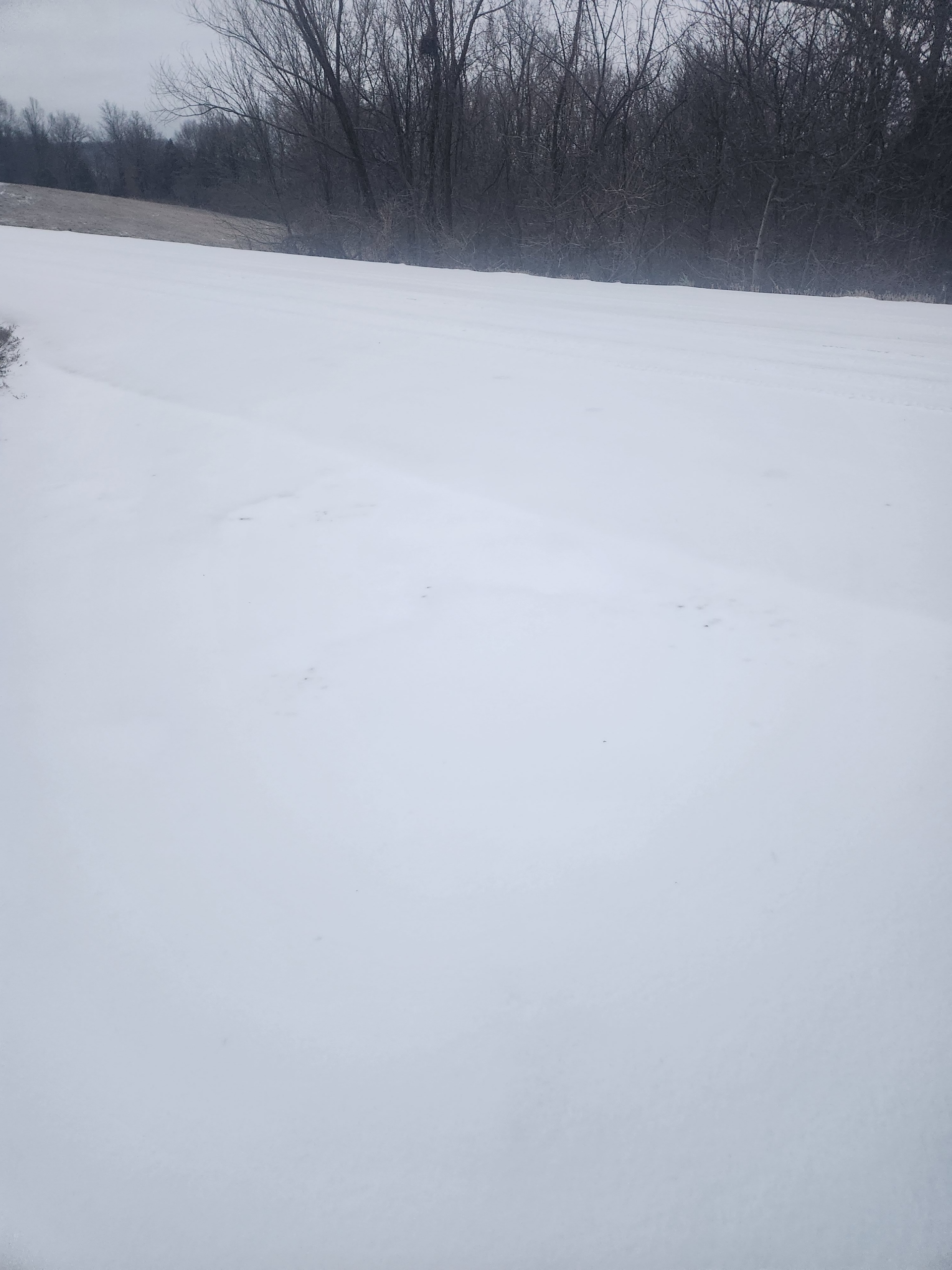
| Crittenden County KY courtesy of Buddy Chandler | Owensboro, KY courtesy of Daviess County Fiscal Court | Murray, KY courtesy of RacerBlueGold on Twitter | Road in front of NWS Paducah on afternoon of February 1st |
Radar
Here is a radar loop showing the first wave of precipitation moving in from southeast Missouri during the mid afternoon and over spreading the area through the evening on January 30th. It moved out of most of western Kentucky by 4 AM on January 31st.
The second wave impacted the region on the afternoon and evening of January 31st. It lingered near the TN/KY border into the early morning hours on February 1st.
Storm Reports
PRELIMINARY LOCAL STORM REPORT...SUMMARY
NATIONAL WEATHER SERVICE PADUCAH KY
1111 AM CST TUE JAN 31 2023

..TIME...   ...EVENT...      ...CITY LOCATION...     ...LAT.LON...
..DATE...   ....MAG....      ..COUNTY LOCATION..ST.. ...SOURCE....
            ..REMARKS..

0840 PM     SLEET            2 SE EVANSVILLE         37.96N 87.51W
01/30/2023  M0.5 INCH        VANDERBURGH        IN   TRAINED SPOTTER


0917 PM     SLEET            DUDLEY                  36.79N 90.09W
01/30/2023  M0.3 INCH        STODDARD           MO   PUBLIC


0938 PM     SLEET            1 NE NEWBURGH           37.95N 87.40W
01/30/2023  M0.4 INCH        WARRICK            IN   TRAINED SPOTTER


1102 PM     SLEET            CAPE GIRARDEAU          37.31N 89.55W
01/30/2023  M1.3 INCH        CAPE GIRARDEAU     MO   BROADCAST MEDIA

            TOTAL EVENT SLEET ACCUMULATION REPORTED BY
            KFVS 12 METEOROLOGIST.

1200 AM     SLEET            2 SE HEATH              37.07N 88.77W
01/31/2023  E0.7 INCH        MCCRACKEN          KY   OFFICIAL NWS OBS

            TOTAL SLEET ACCUMULATION AT THE NWS PADUCAH
            OFFICE BETWEEN 6 PM AND MIDNIGHT.

0431 AM     SLEET            4 W HARVIELL            36.66N 90.54W
01/31/2023  M0.5 INCH        BUTLER             MO   PUBLIC


0600 AM     SLEET            PADUCAH                 37.07N 88.64W
01/31/2023  M0.8 INCH        MCCRACKEN          KY   OFFICIAL NWS OBS

            STORM TOTAL SLEET AT THE NWS PADUCAH OFFICE.

0600 AM     SLEET            EVANSVILLE              37.98N 87.54W
01/31/2023  M0.6 INCH        VANDERBURGH        IN   OFFICIAL NWS OBS

            STORM TOTAL SLEET AT THE EVANSVILLE ASOS.

0600 AM     SLEET            MOUNT VERNON            37.94N 87.90W
01/31/2023  M0.5 INCH        POSEY              IN   TRAINED SPOTTER


0600 AM     SLEET            CROFTON                 37.05N 87.49W
01/31/2023  M0.4 INCH        CHRISTIAN          KY   COCORAHS

            COCORAHS STATION KY-CH-12 CROFTON 0.3 W.

0600 AM     SLEET            3 NW SMITHLAND          37.17N 88.43W
01/31/2023  M0.2 INCH        LIVINGSTON         KY   CO-OP OBSERVER

            CO-OP OBSERVER STATION SMLI2 SMITHLAND LOCK
            AND DAM.

0641 AM     SLEET            5 WSW ROCKPORT          37.86N 87.13W
01/31/2023  M0.6 INCH        SPENCER            IN   TRAINED SPOTTER

            SLEET AND ICE ACCUMULATION.

0654 AM     SLEET            7 SSW STURGIS           37.45N 88.02W
01/31/2023  M1.0 INCH        CRITTENDEN         KY   TRAINED SPOTTER

            MOSTLY SLEET MIXED WITH A LITTLE FREEZING
            RAIN.

0700 AM     SLEET            5 WNW ELLSINORE         36.97N 90.82W
01/31/2023  M1.0 INCH        CARTER             MO   COCORAHS

            COCORAHS STATION MO-CT-1 ELLSINORE MO 4.8
            WNW.

0700 AM     SLEET            1 SSW PADUCAH           37.06N 88.65W
01/31/2023  M1.0 INCH        MCCRACKEN          KY   COCORAHS

            COCORAHS STATION KY-MK-14 PADUCAH 1.3 SSW.

0700 AM     SLEET            2 W CREAL SPRINGS       37.61N 88.88W
01/31/2023  M0.8 INCH        WILLIAMSON         IL   COCORAHS

            COCORAHS STATION IL-WM-18 CREAL SPRINGS 2.2
            W.

0700 AM     SLEET            8 WSW GRANDIN           36.80N 90.97W
01/31/2023  M0.7 INCH        RIPLEY             MO   COCORAHS

            COCORAHS STATION MO-RP-7 DONIPHAN MO 14.5
            NW.

0700 AM     SLEET            3 WNW HAMLETSBURG       37.16N 88.50W
01/31/2023  M0.7 INCH        MASSAC             IL   COCORAHS

            COCORAHS STATION IL-MC-3 BROOKPORT IL 7 ENE.

0700 AM     SLEET            3 NW KUTTAWA            37.09N 88.16W
01/31/2023  M0.6 INCH        LYON               KY   COCORAHS

            COCORAHS STATION KY-LY-3 KUTTAWA 3.4 NW.

0700 AM     SLEET            1 SSE BANDANA           37.13N 88.94W
01/31/2023  M0.6 INCH        BALLARD            KY   COCORAHS

            COCORAHS STATION KY-BA-3 KEVIL KY 4.6 NW.

0700 AM     SLEET            1 SW JACKSON            37.37N 89.67W
01/31/2023  M0.6 INCH        CAPE GIRARDEAU     MO   CO-OP OBSERVER

            CO-OP OBSERVER STATION JACM7 JACKSON MO.

0700 AM     SLEET            2 NNW ROCKCASTLE        36.92N 87.99W
01/31/2023  M0.4 INCH        LYON               KY   COCORAHS

            COCORAHS STATION KY-LY-6 1 NNW ROCKCASTLE.

0700 AM     SLEET            2 NNW ROCKCASTLE        36.92N 88.00W
01/31/2023  M0.3 INCH        LYON               KY   COCORAHS

            COCORAHS STATION KY-LY-4 EDDYVILLE 11.5 SSE.

0700 AM     SLEET            2 WNW PERRYVILLE        37.73N 89.92W
01/31/2023  M0.2 INCH        PERRY              MO   CO-OP OBSERVER

            CO-OP OBSERVER STATION PRRM7 PERRYVILLE MO
            WATER PLANT.

0700 AM     SLEET            2 SE CHANDLER           38.02N 87.35W
01/31/2023  M0.2 INCH        WARRICK            IN   COCORAHS

            COCORAHS STATION IN-WK-22 BOONVILLE IN 4.5
            WSW.

0700 AM     SLEET            NEWBURGH                37.94N 87.40W
01/31/2023  M0.1 INCH        WARRICK            IN   COCORAHS

            COCORAHS STATION IN-WK-25 NEWBURGH 0.3 SE.

0700 AM     SLEET            3 SW DARMSTADT          38.06N 87.62W
01/31/2023  M0.0 INCH        VANDERBURGH        IN   COCORAHS

            COCORAHS STATION IN-VN-40 EVANSVILLE 6.7 NW.

0703 AM     SLEET            HENDERSON               37.84N 87.58W
01/31/2023  M0.7 INCH        HENDERSON          KY   BROADCAST MEDIA


0724 AM     SLEET            5 S MARBLE HILL         37.23N 89.98W
01/31/2023  M0.6 INCH        BOLLINGER          MO   TRAINED SPOTTER

            BETWEEN 1/2 AND 5/8 OF AN INCH OF SLEET
            ACCUMULATION SOUTH OF MARBLE HILL.

0730 AM     SLEET            BIEHLE                  37.61N 89.84W
01/31/2023  M1.5 INCH        PERRY              MO   TRAINED SPOTTER


0735 AM     SLEET            ROUND KNOB              37.25N 88.74W
01/31/2023  M0.4 INCH        MASSAC             IL   TRAINED SPOTTER

            ALSO 0.01 INCH OF FREEZING RAIN.

0752 AM     SLEET            ALTENBURG               37.63N 89.58W
01/31/2023  M1.0 INCH        PERRY              MO   TRAINED SPOTTER


0753 AM     SLEET            MURRAY                  36.61N 88.32W
01/31/2023  M0.3 INCH        CALLOWAY           KY   TRAINED SPOTTER

            LIGHT GLAZE OF ICE ON TOP OF THE SLEET AS
            WELL.

0800 AM     SLEET            MARION                  37.73N 88.94W
01/31/2023  M1.5 INCH        WILLIAMSON         IL   TRAINED SPOTTER


0800 AM     SLEET            2 SW LONE OAK           37.02N 88.68W
01/31/2023  M0.8 INCH        MCCRACKEN          KY   COCORAHS

            COCORAHS STATION KY-MK-6 PADUCAH KY 4.5 SW.

0800 AM     SLEET            EDDYVILLE               37.08N 88.08W
01/31/2023  M0.8 INCH        LYON               KY   PUBLIC


0800 AM     SLEET            1 NNE NEWBURGH          37.96N 87.39W
01/31/2023  M0.6 INCH        WARRICK            IN   COCORAHS

            COCORAHS STATION IN-WK-27 1 NNE NEWBURGH.

0800 AM     SLEET            LYNNVILLE               38.20N 87.32W
01/31/2023  M0.5 INCH        WARRICK            IN   TRAINED SPOTTER


0811 AM     SLEET            SHAWNEETOWN             37.71N 88.17W
01/31/2023  M1.0 INCH        GALLATIN           IL   TRAINED SPOTTER


0815 AM     SLEET            CAMBRIDGE SHORES        36.96N 88.29W
01/31/2023  M0.5 INCH        MARSHALL           KY   PUBLIC


0820 AM     SLEET            2 S CARBONDALE          37.70N 89.22W
01/31/2023  M0.9 INCH        JACKSON            IL   PUBLIC


0853 AM     SLEET            2.2 W CREAL SPRINGS     37.62N 88.88W
01/31/2023  M0.8 INCH        WILLIAMSON         IL   EMERGENCY MNGR

            MELTED TO 0.29 OF LIQUID. ALSO ABOUT 1 MM OF
            LIGHT ICING. SIDEWALKS VERY SLICK.

1000 AM     SLEET            4 WNW POPLAR BLUFF      36.78N 90.47W
01/31/2023  M0.5 INCH        BUTLER             MO   COCORAHS

            COCORAHS STATION MO-BU-3 POPLAR BLUFF 3.7
            WNW.
 |
Media use of NWS Web News Stories is encouraged! Please acknowledge the NWS as the source of any news information accessed from this site. |
|

