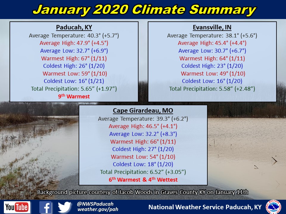
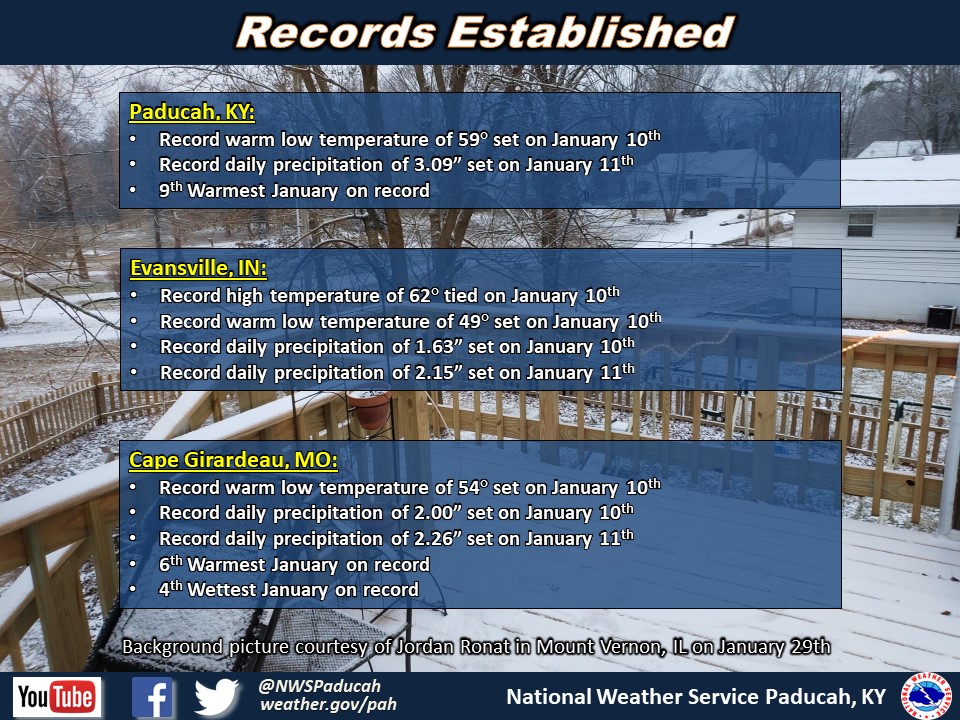
January 2020 Climate Review: Temperatures averaged around 5 to 6 degrees above normal. It was the warmest start to January on record through the 18th at Paducah and Cape Girardeau, and it was the 6th warmest start in Evansville. However, the final 2 weeks of the month were cooler, helping to bring down the average temperature. We officially finished as the 6th warmest January in Cape Girardeau and 9th warmest in Paducah.
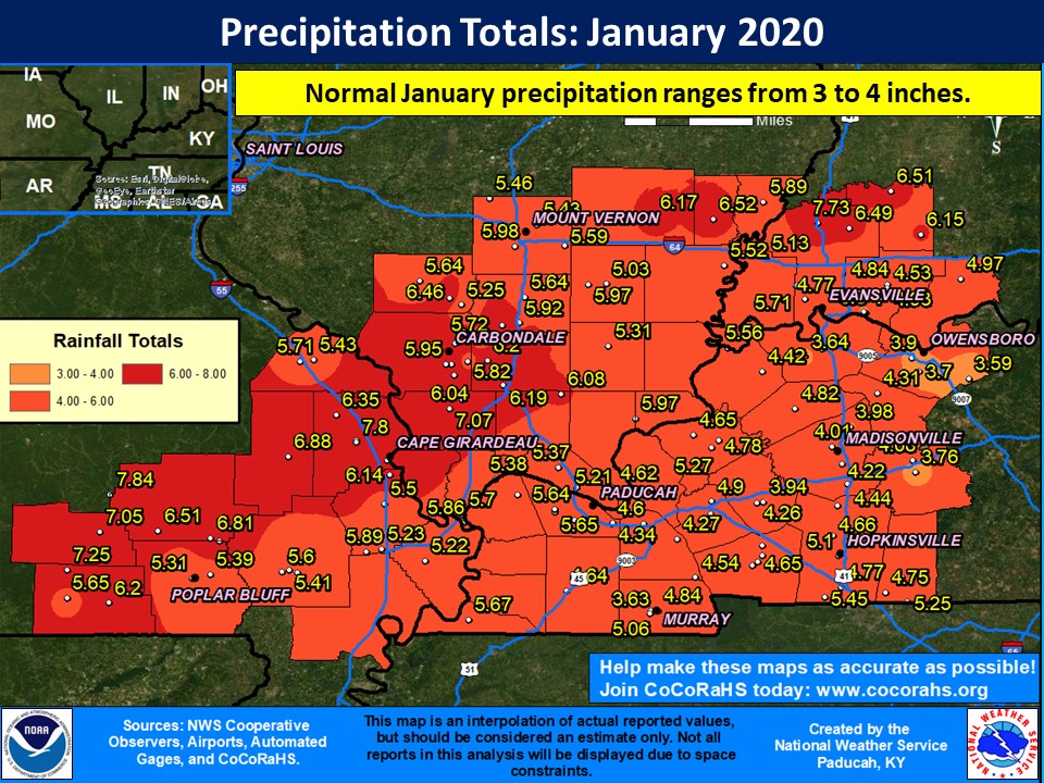
January was a wet month across the region with above normal precipitation nearly everywhere. The corridor that observed the most precipitation was across northern portions of southeast Missouri extending into portions of southern Illinois from the Carbondale area northeastward to the I-64 corridor and then into southwest Indiana. Some areas picked up 3 to 4+ inches above normal January precipitation amounts. Monthly totals ranged from around 4 to 5 inches in western Kentucky to 6+ inches in northern and western portions of our forecast area.
Although it was a wet month, precipitation was mostly all in the liquid form. Snowfall was well below normal for the month, with no measurable snow occurring in Paducah or Evansville. This was the first January with no measurable snow in either city since 2007.
The graphic below is an interpolated rainfall map using actual observations. Please note that there are likely discrepancies in between observations, since the values are estimated based on nearest reports.
| January 2020 Review: Precipitation and Temperature Maps (Click on image to enlarge) |
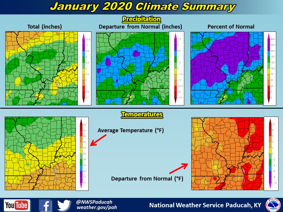 |
| Climate Maps are from the Northeast Regional Climate Center |