January 2023 Climate Review:
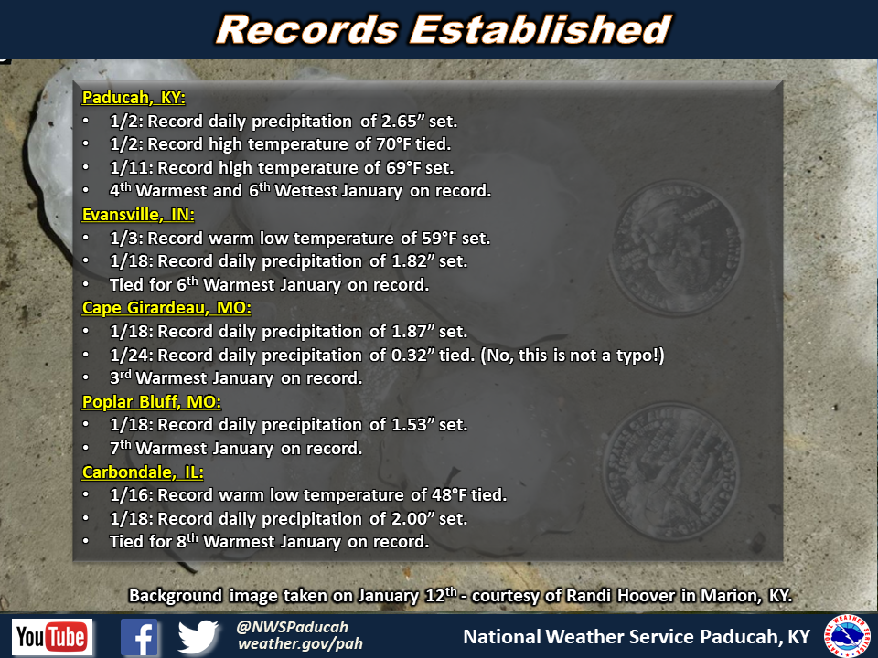
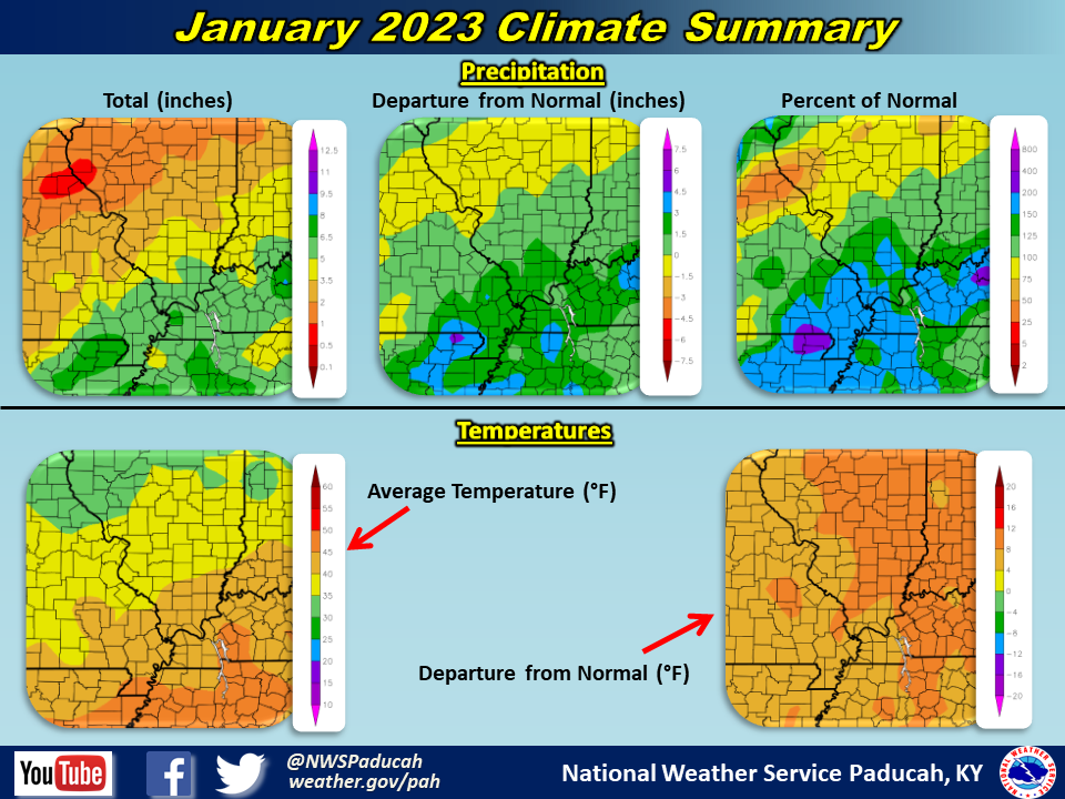
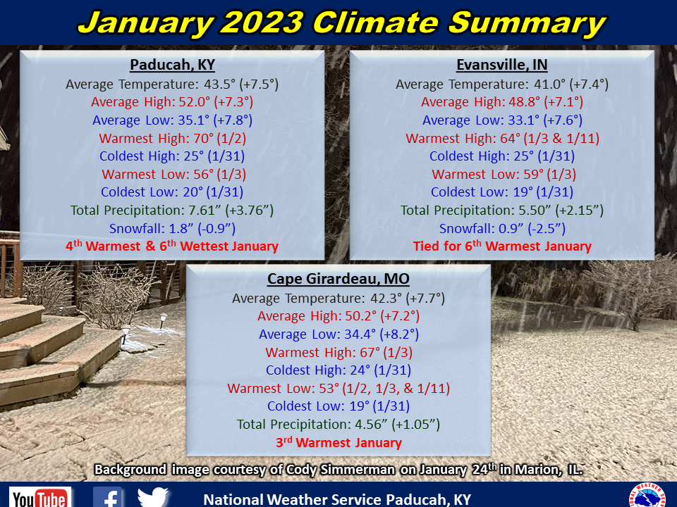
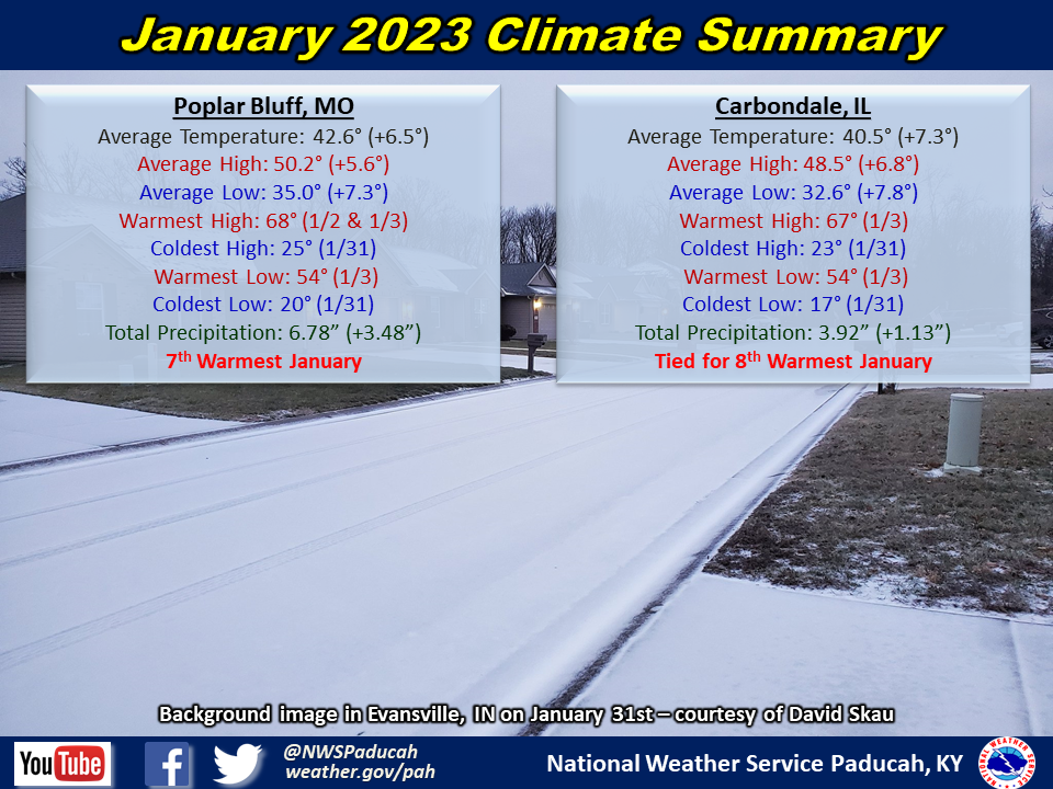
Temperatures averaged well above normal by 7 to 8 degrees. All 5 of our official climate stations finished as one of their top 8 warmest January’s on record and the warmest since 2006. Paducah was on pace to finish as their warmest January on record through January 30th, but we ended the month with a blast of arctic air with highs only in the 20s on the 31st that bumped us down to 4th warmest. Many days were in the 60s across the area, with Paducah observing 9 such days (average for January is 4 and only 6 other years observed more). We even managed to reach a rare 70 on January 2nd! The most exceptional warmth was focused from January 1 through 19. After that, temperatures trended somewhat closer to normal, particularly from the 20th through 27th. The only real cold snap of the month occurred right at the end when an arctic airmass invaded the region.
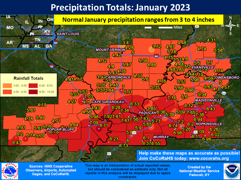
Precipitation averaged wetter than normal across the entire area with amounts of 4 to 8 inches. This was generally 2 to 3 inches above normal in many locations. The highest observed amount was 8.71” at a CoCoRaHS station in Mississippi County Missouri (Anniston 1.9 WNW). Swaths of heavier precipitation were focused from the Missouri Bootheel into far west Kentucky and also across the Pennyrile region of west Kentucky, where 6 to 8 inches were more common. There were 4 separate events during the month that produced widespread amounts over 1 inch, with the heaviest occurring on January 2-3. Several daily precipitation records were established throughout the month.
Snowfall averaged below normal for most of west Kentucky and southwest Indiana. Meanwhile, portions of southeast Missouri and southern Illinois received 4 to 8 inches of heavy wet snow on January 24-25, leading to an above average month. This event also caused significant power outages that lasted for days in the Ozark Foothills of Missouri. The month ended with an icy mixture of sleet and freezing rain that lead to widespread travel impacts January 30-31. The icy road conditions lingered for several days due to subfreezing temperatures leading to treacherous travel on secondary untreated roads. Sleet amounts of 0.5” to 1.5” occurred in many areas along with a glaze of ice.
There were two severe thunderstorm events that impacted the region during the month, the first on January 2-3 and the second early in the morning on January 12. The former produced an EF-0 tornado in the Hopkinsville area, while the latter produced large amounts of hail and in some cases hail of golf ball to hen egg sized!
| January 2023 Review: Precipitation and Temperature Maps (Click on image to enlarge) |
 |
| Climate Maps are from the Northeast Regional Climate Center |
Monthly Climate Report: Paducah | Evansville | Cape Girardeau | Poplar Bluff | Carbondale