Overview
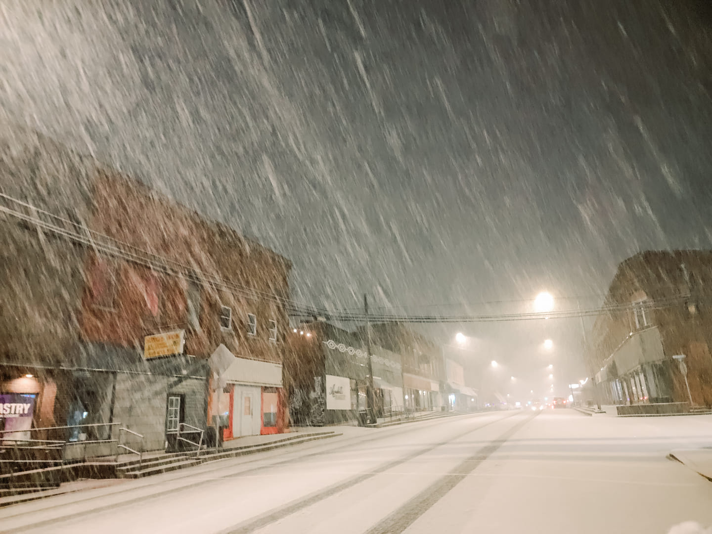
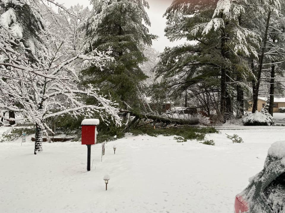
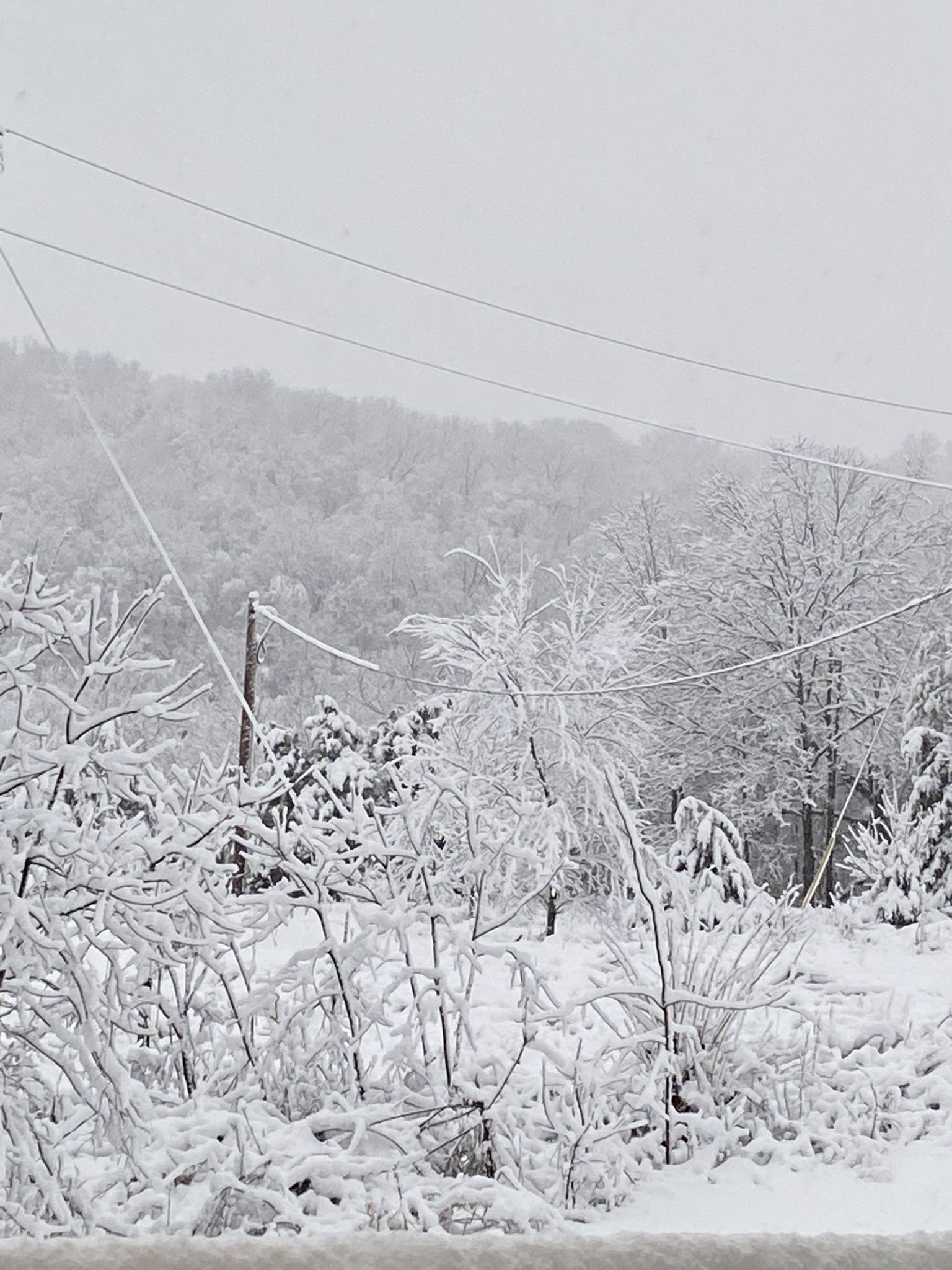
A winter storm impacted the region from the evening of January 24th into the morning on January 25th. The bulk of the snow accumulations occurred across southeast Missouri and southern Illinois. These areas remained far enough northwest of a surface low that moved from Memphis, TN to Murray and Owensboro, KY that cold air remained in place once temperatures cooled during the evening of the 24th. Amounts in excess of 3 to 4 inches occurred along and northwest of a line from Poplar Bluff and Cape Girardeau, MO to Marion and Mt Vernon, IL line. Due to the heavy wet nature of the snow combining with wind gusts of 15 to 20 mph, significant power outages occurred across the Ozark Foothills of Southeast Missouri. There were over 75,000 customers without power across south central and southeast Missouri at it's peak on the morning of January 25th. Numerous downed trees also occurred in these areas. The morning commute was impacted by snow covered roads, especially in areas that received in excess of 2 inches.Snow
Highest snowfall amounts from this system were across the Ozark Foothills of Missouri into extreme southwest Illinois. Amounts of 5 to 8 inches occurred from Van Buren to Marble Hill and Perryville, MO into the Murphysboro and Carbondale, IL areas. There was a sharp southeast cutoff to where no snow accumulated from New Madrid, MO to Paducah and Henderson, KY. The official snowfall measurement for Paducah was 1" at our office in West Paducah, while most of the city proper observed no measurable snow. Here is a listing of some of the amounts along with a map of the entire area:
| Ellsinore, MO | 9.4" |
| Marble Hill, MO | 7.5" |
| Perryville, MO | 6.0" |
| Cape Girardeau, MO | 4.8" |
| Carbondale, IL | 4.8" |
| Poplar Bluff, MO | 4.5" |
| Marion, IL | 4.0" |
| Mt Vernon, IL | 3.6" |
| Paducah, KY | 1.0" |
.png) |
| Observed snowfall totals for this event |
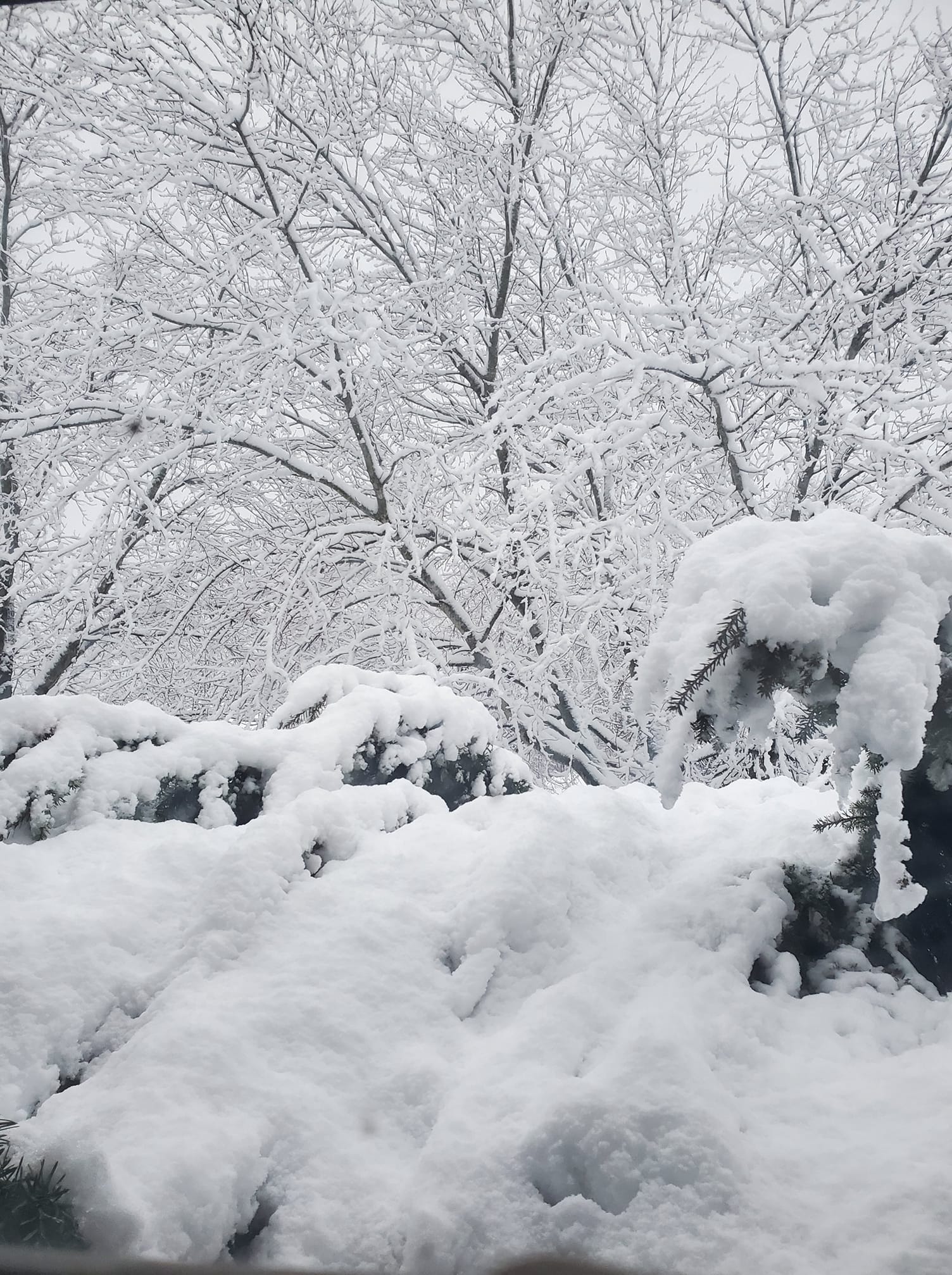
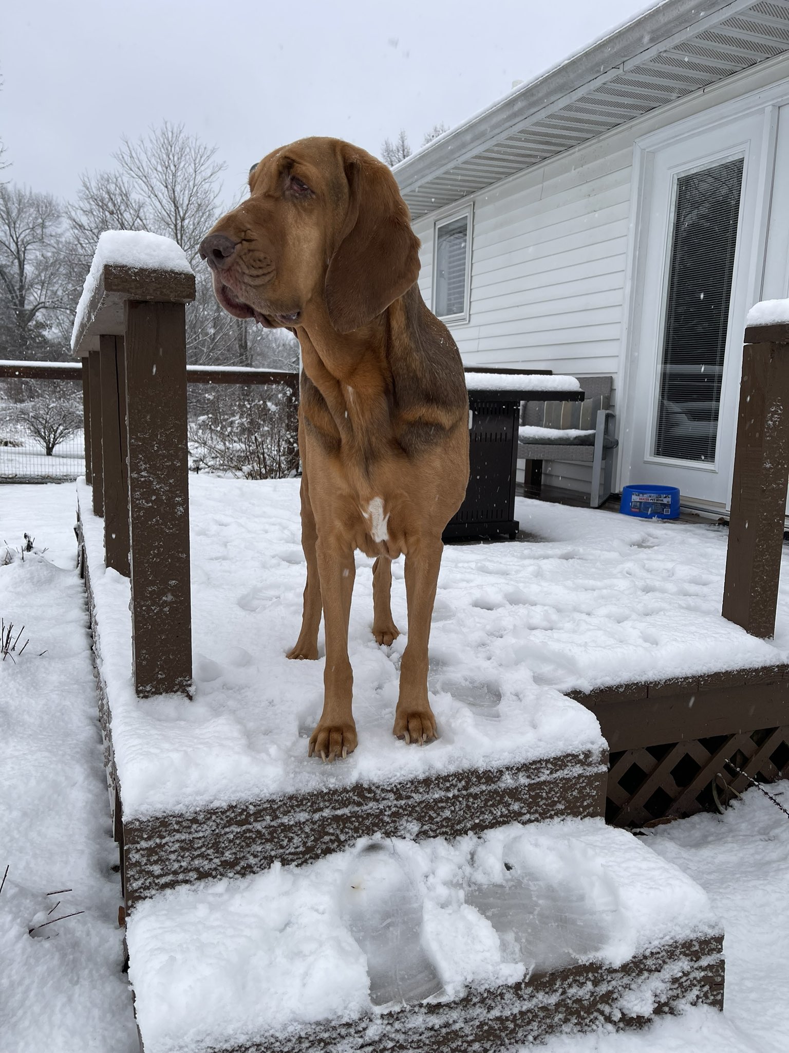
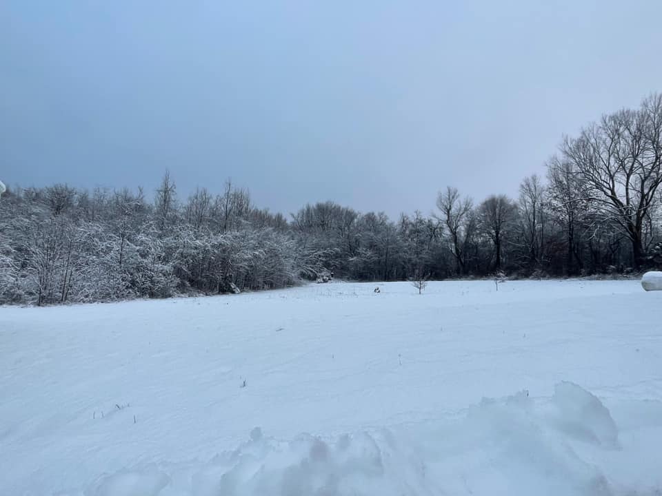
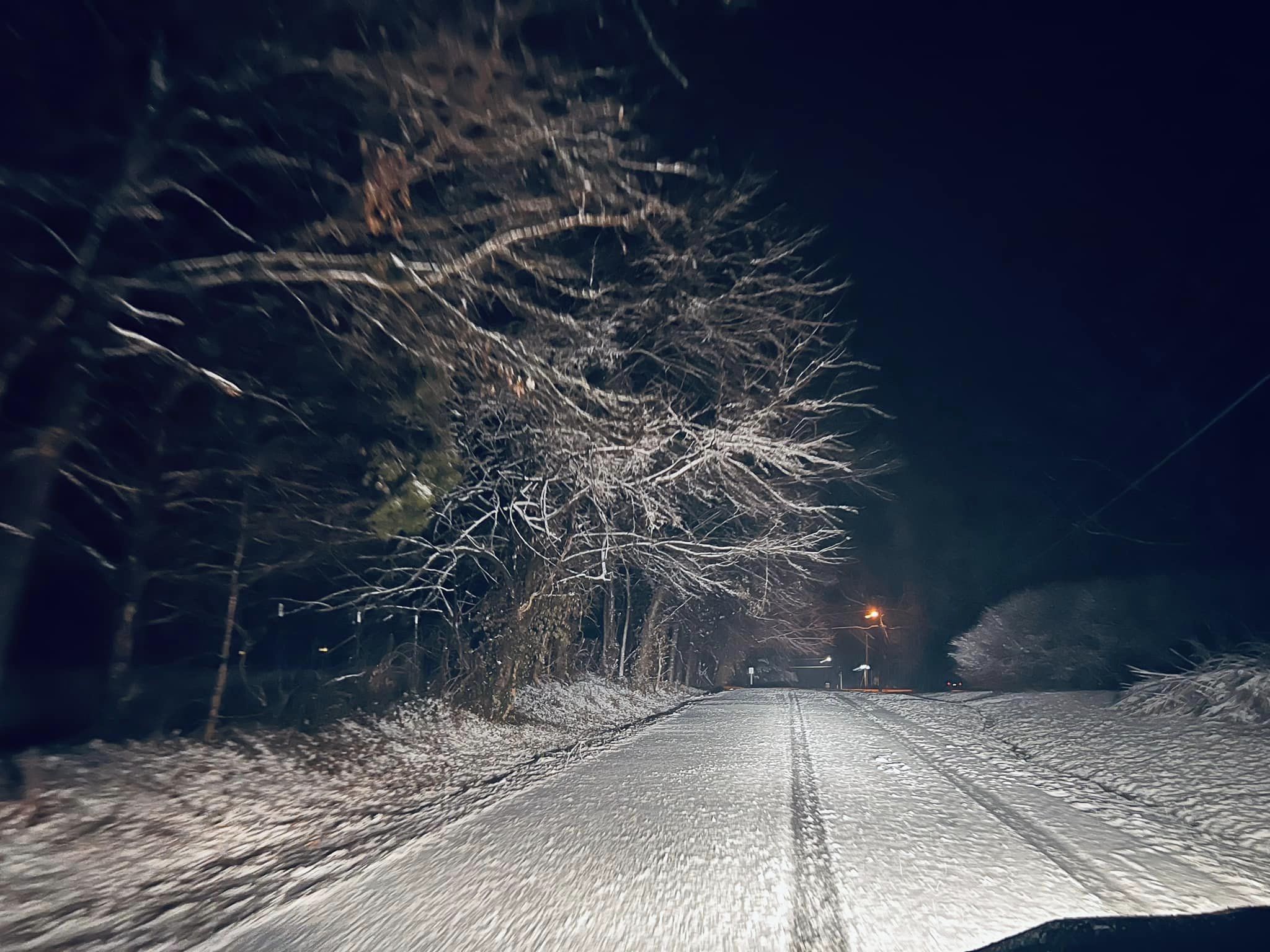
Photos
 |
 |
 |
 |
| Anna, IL courtesy of Amber Hubbs | Jackson County IL northwest of Carbondale courtesy of Linda Buhman | Murphysboro, IL courtesy of Cheryl Anderson | Marion, IL courtesy of Cody Simmerman |
 |
 |
 |
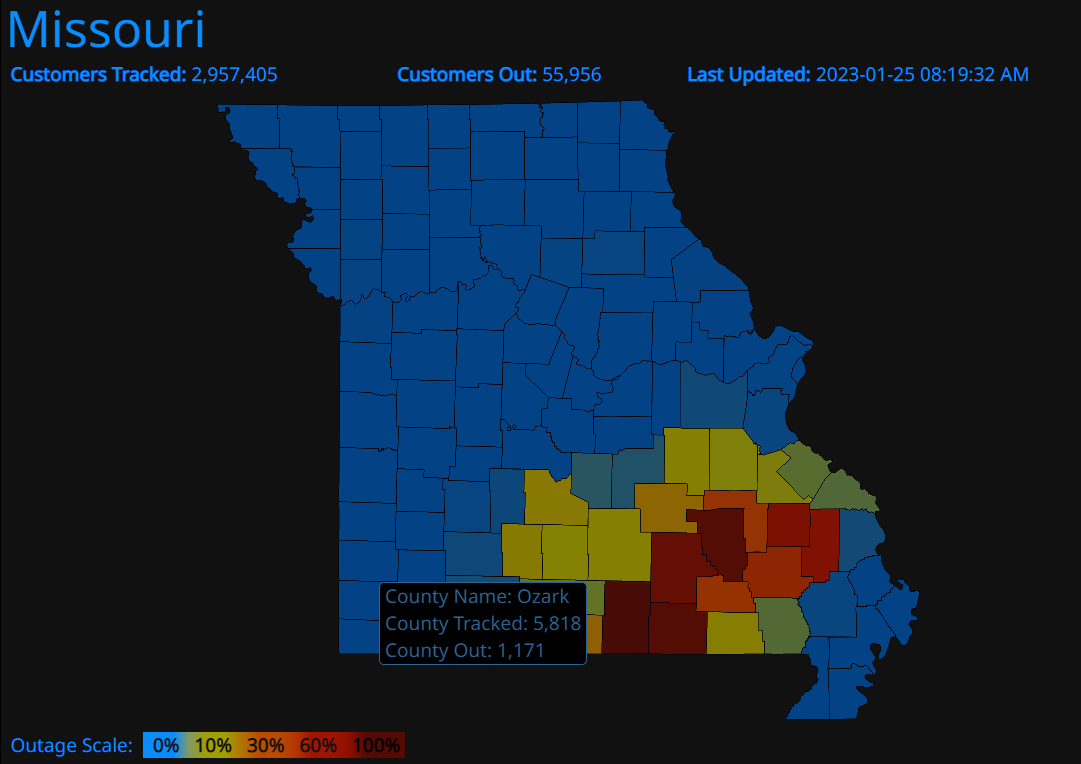 |
| Perry County, MO courtesy of Darin Deckerd | Puxico, MO courtesy of Jerod D Swallos | West Paducah, KY courtesy of Noah Bergren | Power outages in Missouri at 8:30 AM January 25 |
Radar
Click here for a radar loop of the event.
Rain began around sunset on January 25th near the MO/AR border and spread northeastward through the evening. It quickly changed to a heavy wet snow within a couple hours of starting across much of southeast Missouri, southern Illinois, southwest Indiana, and along the Ohio River in western Kentucky. The precipitation intensity let up between 1 and 3 AM on January 26th, as the initial wave moved northeast of the area. The wrap around deformation band moved into the Ozark Foothills of Missouri between 3 and 4 AM. It then pivoted northeast into southern Illinois through sunrise. The bulk of any accumulating snow exited southeast Missouri by 7 AM and ended around the Wabash River Valley around 10 AM on the 26th. Meanwhile, mainly rain was observed across western Kentucky except for an initial burst of heavy snow along the Ohio River counties between 9 PM and midnight.
Storm Reports
Click here for an interactive map of snowfall reports
PRELIMINARY LOCAL STORM REPORT...SUMMARY NATIONAL WEATHER SERVICE PADUCAH KY 1159 AM CST WED JAN 25 2023 ..TIME... ...EVENT... ...CITY LOCATION... ...LAT.LON... ..DATE... ....MAG.... ..COUNTY LOCATION..ST.. ...SOURCE.... ..REMARKS.. 0730 PM SNOW ELLSINORE 36.93N 90.75W 01/24/2023 E1.0 INCH CARTER MO BROADCAST MEDIA ROADS BECOMING SNOW-COVERED AND SLIPPERY. RELAYED BY KFVS. 0804 PM SNOW 5 NNW OXLY 36.66N 90.72W 01/24/2023 M2.1 INCH RIPLEY MO PUBLIC HEAVY WET SNOW CURRENTLY FALLING. 0900 PM SNOW DEXTER 36.79N 89.96W 01/24/2023 E1.0 INCH STODDARD MO PUBLIC HEAVY SNOW CURRENTLY FALLING. 0910 PM SNOW VIENNA 37.42N 88.90W 01/24/2023 M1.0 INCH JOHNSON IL PUBLIC FELL IN ABOUT 40 MINUTES. 0923 PM HEAVY SNOW OXLY 36.59N 90.69W 01/24/2023 E4.0 INCH RIPLEY MO PUBLIC RELAYED VIA TWITTER. 0924 PM HEAVY SNOW 4 SE ELLSINORE 36.90N 90.70W 01/24/2023 E4.0 INCH CARTER MO BROADCAST MEDIA REPORTED ALONG US 60 BETWEEN ELLSINORE AND POPLAR BLUFF IN EASTERN CARTER COUNTY. RELAYED BY KFVS. 0924 PM SNOW 4 SW HENDRICKSON 36.85N 90.52W 01/24/2023 E3.0 INCH BUTLER MO PUBLIC RELAYED VIA FACEBOOK. 0925 PM SNOW POPLAR BLUFF 36.76N 90.41W 01/24/2023 E3.0 INCH BUTLER MO BROADCAST MEDIA RELAYED BY KFVS. 0934 PM SNOW PIEDMONT 37.15N 90.70W 01/24/2023 E2.0 INCH WAYNE MO BROADCAST MEDIA RELAYED BY KFVS. 0945 PM SNOW NAYLOR 36.57N 90.61W 01/24/2023 E3.0 INCH RIPLEY MO PUBLIC 0945 PM HEAVY SNOW ELLSINORE 36.93N 90.75W 01/24/2023 E4.0 INCH CARTER MO BROADCAST MEDIA RELAYVED BY KFVS. 0948 PM SNOW DUDLEY 36.79N 90.09W 01/24/2023 E1.5 INCH STODDARD MO TRAINED SPOTTER 1000 PM HEAVY SNOW GRANDIN 36.83N 90.82W 01/24/2023 E4.5 INCH CARTER MO PUBLIC 1005 PM SNOW MAKANDA 37.62N 89.24W 01/24/2023 M1.5 INCH JACKSON IL TRAINED SPOTTER US 51 AND OLD 51 ARE SNOW-COVERED. 1016 PM SNOW 3 N SILVER LAKE 37.73N 90.00W 01/24/2023 M1.0 INCH PERRY MO TRAINED SPOTTER HEAVY SNOW CURRENTLY FALLING. RELAYED VIA TWITTER. 1023 PM SNOW BERNIE 36.67N 89.97W 01/24/2023 E3.0 INCH STODDARD MO PUBLIC RELAYED VIA FACEBOOK. 1024 PM SNOW SHAWNEETOWN 37.71N 88.17W 01/24/2023 E0.8 INCH GALLATIN IL PUBLIC RELAYED VIA FACEBOOK. 1024 PM SNOW 4 ESE GRAHAMVILLE 37.09N 88.71W 01/24/2023 M0.5 INCH MCCRACKEN KY NWS EMPLOYEE REPORT FROM RETIRED NWS EMPLOYEE. 1033 PM SNOW 5 E ANNA 37.46N 89.15W 01/24/2023 E2.0 INCH UNION IL PUBLIC SLIDE OFFS REPORTS ALONG HIGHWAY 146 EAST OF ANNA. 1037 PM SNOW 2 W CREAL SPRINGS 37.62N 88.88W 01/24/2023 M1.3 INCH WILLIAMSON IL EMERGENCY MNGR 1048 PM HEAVY SNOW 1 WSW HENDRICKSON 36.90N 90.49W 01/24/2023 E4.5 INCH BUTLER MO PUBLIC 1052 PM SNOW 2 SE HEATH 37.07N 88.77W 01/24/2023 M1.0 INCH MCCRACKEN KY OFFICIAL NWS OBS MEASURED AT THE NWS OFFICE IN WEST PADUCAH. 1056 PM SNOW MARION 37.73N 88.94W 01/24/2023 M1.5 INCH WILLIAMSON IL TRAINED SPOTTER RELAYED VIA TWITTER. 1056 PM SNOW 3 N SILVER LAKE 37.73N 90.00W 01/24/2023 M2.0 INCH PERRY MO TRAINED SPOTTER RELAYED VIA TWITTER. 1109 PM SNOW DONGOLA 37.36N 89.16W 01/24/2023 E3.0 INCH UNION IL PUBLIC RELAYED VIA FACEBOOK. 1128 PM SNOW CARRIER MILLS 37.69N 88.63W 01/24/2023 M1.5 INCH SALINE IL LAW ENFORCEMENT SNOW IS SLUSHY AND MELTING. 1128 PM SNOW CAPE GIRARDEAU 37.31N 89.55W 01/24/2023 M3.0 INCH CAPE GIRARDEAU MO BROADCAST MEDIA RELAYED BY KFVS. 1143 PM SNOW MARION 37.73N 88.94W 01/24/2023 M2.5 INCH WILLIAMSON IL TRAINED SPOTTER SNOWFALL TOTAL SINCE 10 PM. 1143 PM SNOW 2.2 W CREAL SPRINGS 37.62N 88.88W 01/24/2023 M2.5 INCH WILLIAMSON IL EMERGENCY MNGR 1151 PM HEAVY SNOW DUDLEY 36.79N 90.09W 01/24/2023 M4.0 INCH STODDARD MO TRAINED SPOTTER ROADS ARE SNOW-COVERED AND SLIPPERY. 1155 PM SNOW JACKSON 37.38N 89.65W 01/24/2023 M3.0 INCH CAPE GIRARDEAU MO TRAINED SPOTTER 1234 AM SNOW CAPE GIRARDEAU 37.31N 89.54W 01/25/2023 M3.5 INCH CAPE GIRARDEAU MO BROADCAST MEDIA PRECIP HAS SHIFTED TO DRIZZLE. 1235 AM SNOW 4 W CREAL SPRINGS 37.62N 88.92W 01/25/2023 M3.0 INCH WILLIAMSON IL EMERGENCY MNGR SNOW STARTED AT 9:27 PM. 1255 AM SNOW 2 WSW EVANSVILLE 37.97N 87.57W 01/25/2023 M1.2 INCH VANDERBURGH IN BROADCAST MEDIA 1.2 INCHES OF SNOW NEAR DOWNTOWN EVANSVILLE. 0100 AM SNOW 2 NNE VERGENNES 37.92N 89.33W 01/25/2023 M1.0 INCH JACKSON IL PUBLIC 0300 AM HEAVY SNOW CHRISTOPHER 37.98N 89.05W 01/25/2023 M2.0 INCH FRANKLIN IL PUBLIC 0318 AM HEAVY SNOW 1 SSE VAN BUREN 37.00N 91.01W 01/25/2023 M4.5 INCH CARTER MO PUBLIC HEAVY SNOW FALLING. ROADS HAVE BECOME SNOW COVERED AND SLICK AGAIN. 0450 AM HEAVY SNOW 5 NNW OXLY 36.66N 90.71W 01/25/2023 E5.8 INCH RIPLEY MO PUBLIC 0457 AM HEAVY SNOW 1 SSE VAN BUREN 37.00N 91.01W 01/25/2023 M5.5 INCH CARTER MO EMERGENCY MNGR EM REPORTS HALF THE COUNTY IS WITHOUT POWER. 0529 AM HEAVY SNOW 4 SSW BREWER 37.73N 89.94W 01/25/2023 E4.0 INCH PERRY MO PUBLIC HEAVY SNOW FALLING. 0556 AM HEAVY SNOW 4 SW HUNTER 36.84N 90.90W 01/25/2023 M7.5 INCH CARTER MO PUBLIC HEAVY WET SNOW, DAMAGING PINE TREES. 0600 AM SNOW 5 W MCLEANSBORO 38.09N 88.62W 01/25/2023 M1.9 INCH HAMILTON IL COCORAHS COCORAHS OBSERVER IL-HM-3: MCLEANSBORO 4.9 W. 0600 AM SNOW 10 SSW MOUNT VERNON 37.80N 87.98W 01/25/2023 M1.0 INCH POSEY IN CO-OP OBSERVER CO-OP OBSERVER STATION ULDI3 3.3 NW UNIONTOWN. 0615 AM SNOW POPLAR BLUFF 36.76N 90.41W 01/25/2023 M4.5 INCH BUTLER MO TRAINED SPOTTER 0630 AM SNOW 1 WSW CAPE GIRARDEAU 37.30N 89.57W 01/25/2023 M4.8 INCH CAPE GIRARDEAU MO BROADCAST MEDIA STORM TOTAL. 0641 AM HEAVY SNOW 2 SSW CARBONDALE 37.69N 89.23W 01/25/2023 M4.0 INCH JACKSON IL PUBLIC 0651 AM HEAVY SNOW 1 E PERRYVILLE 37.73N 89.86W 01/25/2023 M6.0 INCH PERRY MO UTILITY COMPANY 0652 AM SNOW 1 ESE CAPE GIRARDEAU 37.31N 89.53W 01/25/2023 M3.0 INCH CAPE GIRARDEAU MO COCORAHS COCORAHS STATION MO-CG-17 CAPE GIRARDEAU 1.0 ESE. 0700 AM SNOW 3 NW POSEYVILLE 38.20N 87.82W 01/25/2023 M1.3 INCH POSEY IN COCORAHS COCORAHS STATION IN-PS-1 POSEYVILLE IN 2.8 NW. 0700 AM SNOW 14.5 NW DONIPHAN 36.77N 91.01W 01/25/2023 M4.6 INCH RIPLEY MO COCORAHS NUMEROUS CEDAR/PINE TREES DOWN. 0700 AM SNOW 4.8 WNW ELLSINORE 36.96N 90.83W 01/25/2023 M9.4 INCH CARTER MO COCORAHS HEAVY WET SNOW. 0700 AM SNOW 6 W DARMSTADT 38.07N 87.69W 01/25/2023 M0.6 INCH VANDERBURGH IN COCORAHS COCORAHS STATION IN-VN-31 EVANSVILLE IN 10 NW. 0700 AM SNOW 1 SSE BANDANA 37.13N 88.94W 01/25/2023 M0.7 INCH BALLARD KY COCORAHS COCORAHS STATION KY-BA-3 KEVIL KY 4.6 NW. 0700 AM SNOW FRANCISCO 38.33N 87.45W 01/25/2023 M1.0 INCH GIBSON IN COCORAHS COCORAHS STATION IN-GB-9 FRANCISCO IN 0.1 SE. 0700 AM SNOW 1 N BOONVILLE 38.06N 87.27W 01/25/2023 M1.0 INCH WARRICK IN COCORAHS COCORAHS STATION IN-WK-12 BOONVILLE IN 1.4 N. 0700 AM SNOW 2 N BOONVILLE 38.08N 87.28W 01/25/2023 M1.0 INCH WARRICK IN COCORAHS COCORAHS STATION IN-WK-5 BOONVILLE IN 2.4 N. 0700 AM SNOW 1 E SCOTT CITY 37.22N 89.52W 01/25/2023 M3.0 INCH SCOTT MO COCORAHS COCORAHS STATION MO-SC-5 SCOTT CITY MO 0.9 E. 0700 AM SNOW AVA 37.89N 89.50W 01/25/2023 M5.0 INCH JACKSON IL PUBLIC 0700 AM SNOW 7 WSW SALEM 37.25N 88.36W 01/25/2023 E1.0 INCH LIVINGSTON KY PUBLIC RELAYED VIA FACEBOOK IN THE TOWN OF BURNA. 0700 AM SNOW JACKSON 37.38N 89.65W 01/25/2023 M3.0 INCH CAPE GIRARDEAU MO TRAINED SPOTTER 0700 AM SNOW WAPPAPELLO 36.94N 90.27W 01/25/2023 M4.0 INCH WAYNE MO PUBLIC 0700 AM SNOW LA CENTER 37.07N 88.97W 01/25/2023 M2.0 INCH BALLARD KY PUBLIC 0700 AM SNOW 9 W EVANSVILLE 37.99N 87.71W 01/25/2023 M1.5 INCH POSEY IN COCORAHS COCORAHS STATION IN-PS-8 8 W EVANSVILLE. 0700 AM SNOW 2 W SIKESTON 36.88N 89.62W 01/25/2023 M1.3 INCH SCOTT MO CO-OP OBSERVER CO-OP OBSERVER STATION SKSM7 SIKESTON MO POWER STATION. 0700 AM SNOW 2 N PINCKNEYVILLE 38.10N 89.38W 01/25/2023 M2.5 INCH PERRY IL CO-OP OBSERVER CO-OP OBSERVER STATION PNKI2 PINCKNEYVILLE IL 2 N. 0700 AM SNOW 2 W CREAL SPRINGS 37.61N 88.88W 01/25/2023 M3.0 INCH WILLIAMSON IL COCORAHS COCORAHS STATION IL-WM-18 CREAL SPRINGS 2.2 W. 0700 AM SNOW NORTH CITY 37.99N 89.06W 01/25/2023 M3.4 INCH FRANKLIN IL COCORAHS COCORAHS STATION IL-FK-7 CHRISTOPHER 1.1 NNW. 0700 AM SNOW 5 NW SALEM 37.32N 88.31W 01/25/2023 E1.5 INCH LIVINGSTON KY PUBLIC SNOWFALL TOTAL IN LOLA, KY. 0700 AM SNOW FRUITLAND 37.45N 89.64W 01/25/2023 M4.0 INCH CAPE GIRARDEAU MO TRAINED SPOTTER 0700 AM SNOW SESSER 38.09N 89.05W 01/25/2023 M4.0 INCH FRANKLIN IL TRAINED SPOTTER 0700 AM SNOW HARRISBURG 37.74N 88.55W 01/25/2023 M2.5 INCH SALINE IL TRAINED SPOTTER 0700 AM SNOW CUTLER 38.03N 89.57W 01/25/2023 M3.0 INCH PERRY IL BROADCAST MEDIA 0724 AM HEAVY SNOW PATTON 37.51N 90.01W 01/25/2023 E7.0 INCH BOLLINGER MO TRAINED SPOTTER 0724 AM SNOW 3 W NORTH CITY 37.97N 89.11W 01/25/2023 M3.0 INCH FRANKLIN IL PUBLIC 0725 AM SNOW FISK 36.78N 90.21W 01/25/2023 M3.5 INCH BUTLER MO TRAINED SPOTTER 0726 AM SNOW GORHAM 37.72N 89.49W 01/25/2023 E3.0 INCH JACKSON IL TRAINED SPOTTER 0727 AM SNOW 1 N DU QUOIN 38.01N 89.24W 01/25/2023 M3.0 INCH PERRY IL TRAINED SPOTTER 0728 AM HEAVY SNOW CARBONDALE 37.73N 89.22W 01/25/2023 M4.8 INCH JACKSON IL TRAINED SPOTTER 0729 AM HEAVY SNOW 3 S MARBLE HILL 37.26N 89.99W 01/25/2023 E7.5 INCH BOLLINGER MO TRAINED SPOTTER 0729 AM HEAVY SNOW 1 N OAK RIDGE 37.51N 89.73W 01/25/2023 E4.8 INCH CAPE GIRARDEAU MO TRAINED SPOTTER 0730 AM SNOW MURPHYSBORO 37.77N 89.34W 01/25/2023 M6.0 INCH JACKSON IL EMERGENCY MNGR 0730 AM SNOW COBDEN 37.53N 89.25W 01/25/2023 M5.0 INCH UNION IL CO-OP OBSERVER 0730 AM SNOW CHAFFEE 37.18N 89.66W 01/25/2023 M4.0 INCH SCOTT MO TRAINED SPOTTER SNOWFALL TOTAL. 0730 AM SNOW 3 SSE NEW BURNSIDE 37.54N 88.76W 01/25/2023 M4.2 INCH JOHNSON IL TRAINED SPOTTER SNOWFALL IN OZARK, IL. 0730 AM SNOW 5 S MURPHYSBORO 37.70N 89.34W 01/25/2023 M5.0 INCH JACKSON IL TRAINED SPOTTER SOME TREE LIMBS BREAKING. 0730 AM SNOW 3 NNE MAKANDA 37.65N 89.22W 01/25/2023 M3.5 INCH JACKSON IL TRAINED SPOTTER SNOWFALL 5 MILES SOUTH OF CARBONDALE. 0733 AM SNOW 2 SE PATTERSON 37.17N 90.52W 01/25/2023 M4.0 INCH WAYNE MO COCORAHS COCORAHS STATION MO-WY-1 PATTERSON MO 2.0 SE. 0740 AM SNOW 2 NNE VERGENNES 37.92N 89.33W 01/25/2023 M3.0 INCH JACKSON IL PUBLIC 0747 AM SNOW 1 WSW MILL SPRING 37.05N 90.70W 01/25/2023 M4.0 INCH WAYNE MO COCORAHS COCORAHS STATION MO-WY-3 MILL SPRING 1.3 WSW. 0800 AM SNOW ELLSINORE 36.93N 90.75W 01/25/2023 E8.0 INCH CARTER MO PUBLIC RELAYED VIA FACEBOOK. 0800 AM SNOW 1.3 SW MOUNT VERNON 38.30N 88.93W 01/25/2023 M3.6 INCH JEFFERSON IL TRAINED SPOTTER STILL SNOWING AT TIME OF REPORT. 0800 AM SNOW 4 WNW MOUNT CARMEL 38.44N 87.84W 01/25/2023 M1.2 INCH WABASH IL TRAINED SPOTTER SNOWING AT TIME OF REPORT. 0800 AM SNOW LYNNVILLE 38.18N 87.32W 01/25/2023 M1.5 INCH WARRICK IN TRAINED SPOTTER 0800 AM SNOW 4 NW BONNIE 38.25N 88.95W 01/25/2023 M3.0 INCH JEFFERSON IL COCORAHS COCORAHS STATION IL-JF-10 MOUNT VERNON 5.2 SSW. 0800 AM SNOW 7 SE WINSLOW 38.31N 87.12W 01/25/2023 M1.3 INCH PIKE IN CO-OP OBSERVER COOP OBSERVER 6.3 MILES NW OF HOLLAND. 0800 AM SNOW 2 SSE JUNCTION 37.70N 88.23W 01/25/2023 M3.1 INCH GALLATIN IL COCORAHS COCORAHS STATION IL-GL-4 JUNCTION 1.7 SSE. 0800 AM SNOW MARION 37.73N 88.94W 01/25/2023 M4.0 INCH WILLIAMSON IL BROADCAST MEDIA 0825 AM SNOW HERRIN 37.80N 89.03W 01/25/2023 E3.0 INCH WILLIAMSON IL PUBLIC 0825 AM SNOW ELDORADO 37.81N 88.44W 01/25/2023 E2.0 INCH SALINE IL PUBLIC 0830 AM SNOW 1 NNW GRANDIN 36.85N 90.83W 01/25/2023 M8.0 INCH CARTER MO PUBLIC RELAYED VIA FACEBOOK. BETWEEN GRANDIN AND HUNTER. CURRENTLY NO POWER IN THE CURRENT RIVER HILLS AREA. 0830 AM SNOW 1 WSW CYPRESS 37.36N 89.04W 01/25/2023 M2.0 INCH JOHNSON IL PUBLIC SNOWFALL TOTAL. 0830 AM SNOW 3 SW CAMBRIA 37.74N 89.15W 01/25/2023 E4.5 INCH WILLIAMSON IL PUBLIC ALONG JACKSON AND WILLIAMSON COUNTY LINE. RELAYED VIA FACEBOOK. STILL SNOWING AT TIME OF REPORT. 0929 AM SNOW CAMBRIA 37.78N 89.11W 01/25/2023 M3.5 INCH WILLIAMSON IL TRAINED SPOTTER 1 MILE NORTH OF CAMBRIA. 0930 AM SNOW FAIRFIELD 38.38N 88.37W 01/25/2023 M1.0 INCH WAYNE IL PUBLIC JUST OVER 1 INCH NEAR FAIRFIELD IL. FINE SNOW STILL FALLING. ROADS ARE SLUSHY.
 |
Media use of NWS Web News Stories is encouraged! Please acknowledge the NWS as the source of any news information accessed from this site. |
|

