Overview
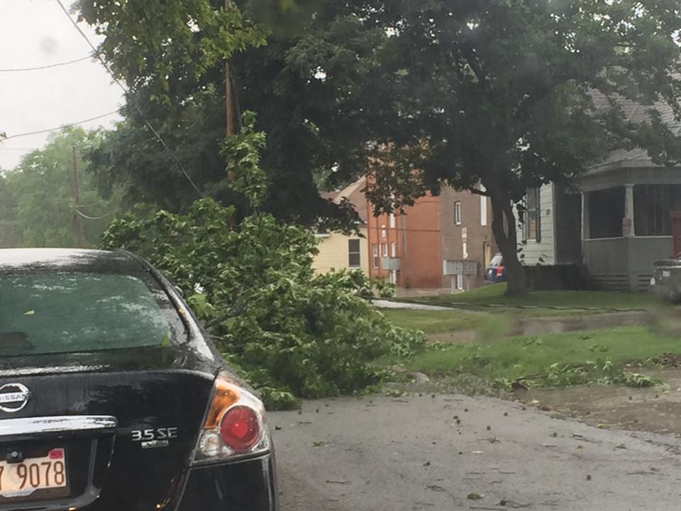
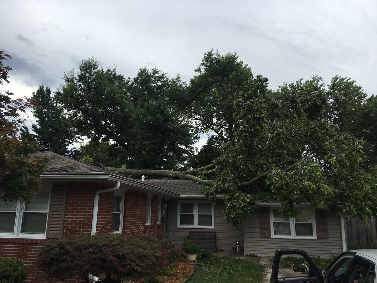
A line of strong to severe thunderstorms moved across a small portion of southeast MO, most of southern IL and into southwest IN and adjacent counties in western KY starting around 4pm. The northern end of the line packed a punch when it came to winds and many locations saw wind gusts 60-70 mph. This produced numerous reports of trees down, tree limbs down, power lines down and some minor structural damage (i.e shingles off roofs etc). Even further south, there were many reports of winds 40-50 mph. There were several thousand of folks without power after the storms rolled through.Wind & Hail:
Two microbursts in southern Illinois were surveyed by a damage assessment team from the National Weather Service. The first microburst occurred in Franklin County, and the second was near Mcleansboro in Hamilton County. The preliminary damage survey reports are listed below:
Wind
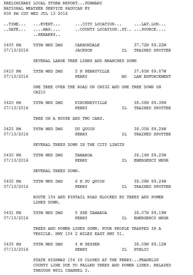
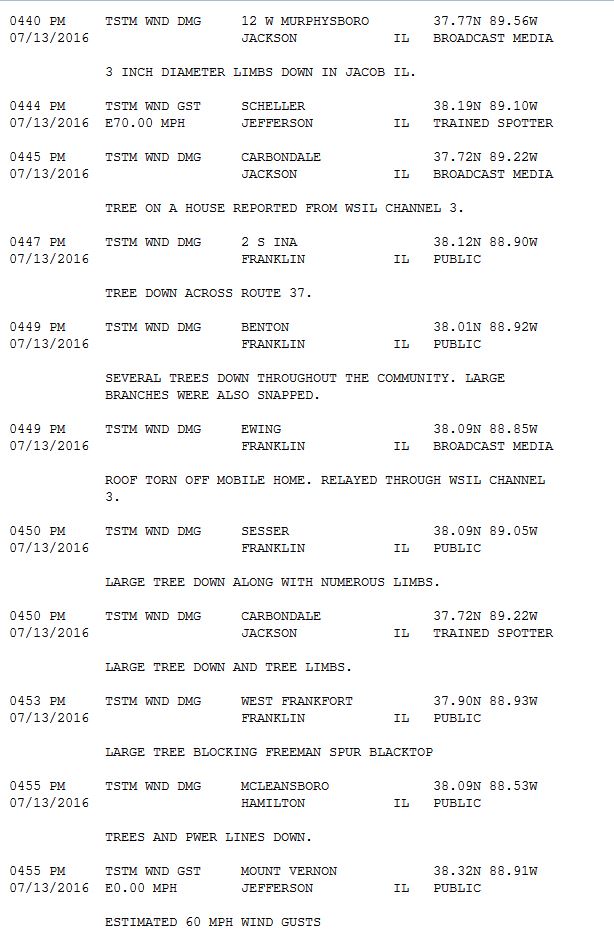
...NWS DAMAGE SURVEY FOR Sesser and Mcleansboro Illinois Microbursts...

.Sesser Microburst...

Estimate Peak wind :    85 mph
Path length /Statute/:  12 miles
Path width /Maximum/:   1.5 miles
Fatalities:             0
Injuries:               0

Start date:             Jul 13 2016
Start time:             348 PM CDT
Start location:         1.5 miles west of Sesser Illinois

End date:               July 13 2016
End time:               359 PM CDT
End location:           Ewing Illinois

SURVEY_SUMMARY:

The Microburst caused extensive Wind damage across mainly the
northern parts of Sesser.  Many dozens of trees and tree limbs
were blown down causing roof damage to a least a couple of houses.
Power outages occurred as power transformers were blown.

.Mcleansboro Microburst...

estimated Peak Wind:    75 mph
Path length /Statute/:  4 miles
Path width /Maximum/:   1.25 miles
Fatalities:             0
Injuries:               0

Start date:             Jul 13 2016
Start time:             407 PM CDT
Start location:         1 mile west of Mcleansboro Illinois

End date:               Jul 13 2016
End time:               412 PM CDT
End location:           3 miles east of Mcleansboro Illinois


SURVEY_SUMMARY:

The Microburst caused wind damage across the northern
parts of Mcleansboro, mainly along and north of Highway 14.
A few trees and dozens of limbs were blown down along with a
few power lines.

NOTE:

In addition to the Microburst areas listed above, scattered
straight line wind damage occurred across Perry County Illinois,
especially around Tamaroa, and areas east and northeast of
Du Quoin Illinois, along Highway 154.  Scattered wind damage also
occurred across parts of Franklin and Hamilton County in Illinois.

The information in this statement is PRELIMINARY and subject to
change pending final review of the events and publication in
NWS Storm Data.
Photos:
Here are some photos from around the area via social media feeds. Click for larger view.
|
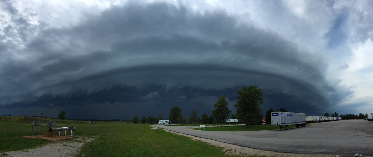
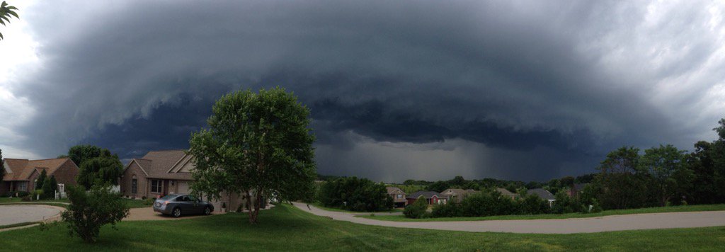
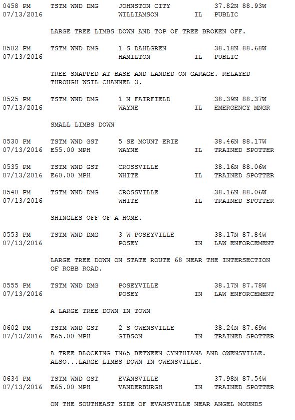
Chris Conley - Daviess County, KY |
|
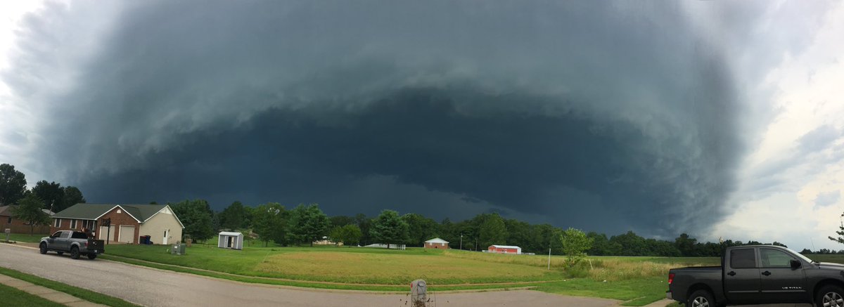
Elberfeld, IN: Jason Isaacs |
|
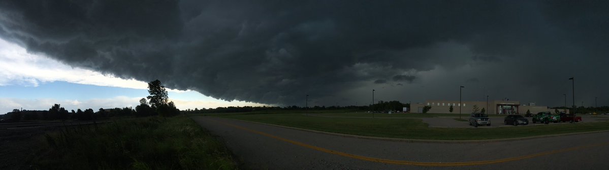
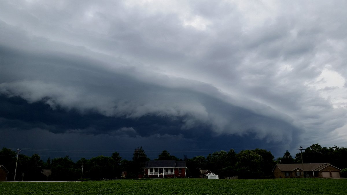
Evansville, IN: Evansville EMA |
|
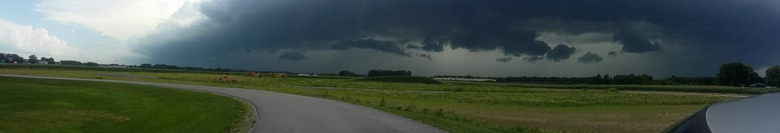
Benton Municipal Airport, IL: Bruce Hammons |
|
|
|
|
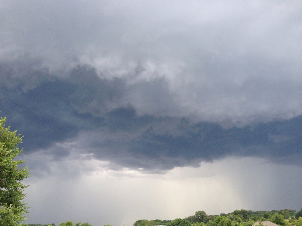
 Near Sorgho, KY Near Sorgho, KYTim Crabtree |
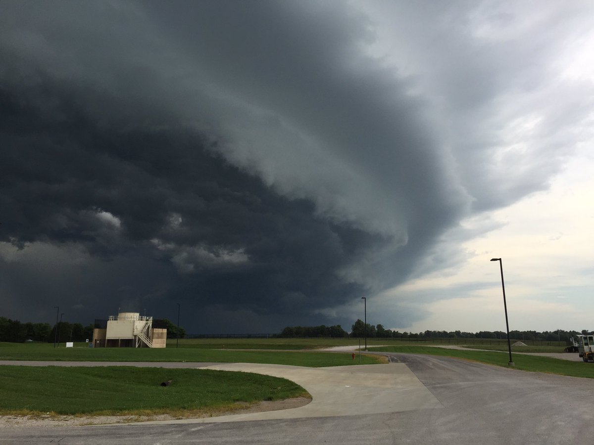 West end of Daviess Cty, KY West end of Daviess Cty, KYChris Conley |
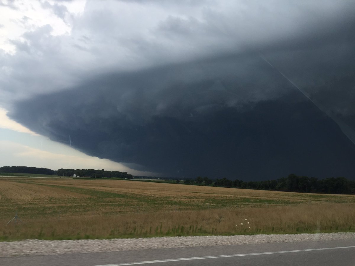 Near Mackey, IN Near Mackey, INCharlie Kiesel |
|
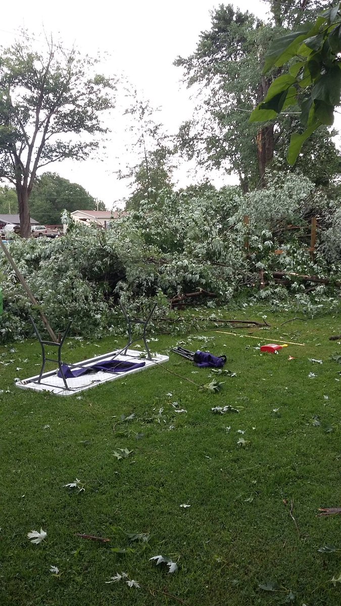
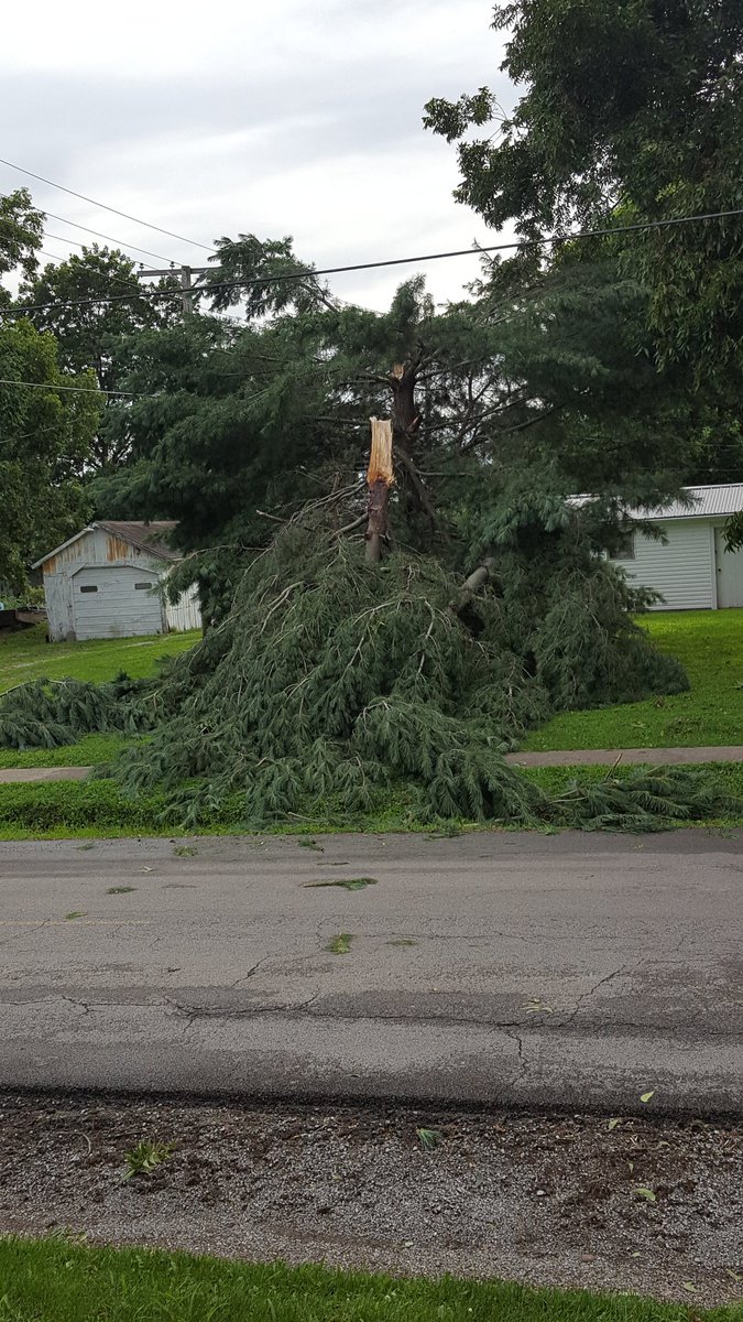
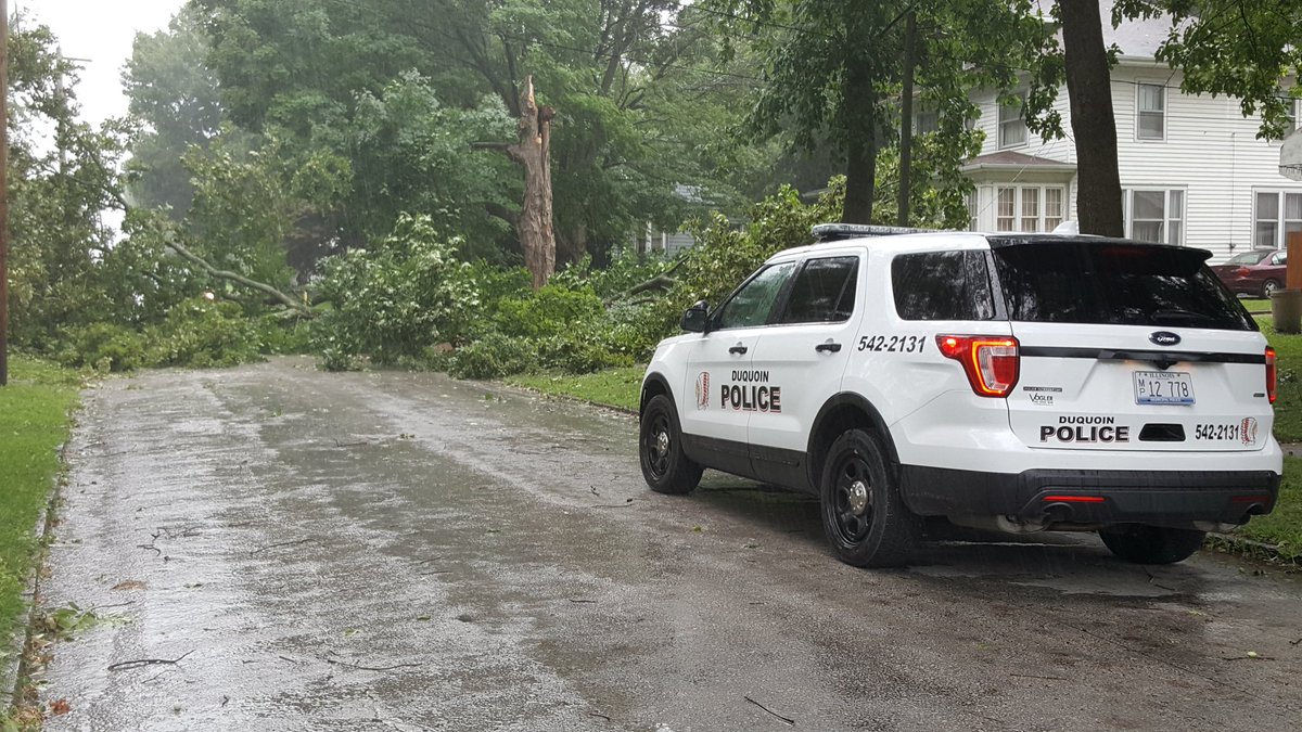
Sesser, IL |
Mcleansboro, IL |
Mount Vernon, IL |
Near Ina, IL |
 |
 |
 |
|
| Sesser, IL Chris Kuhner |
Carbondale, IL Ryan Pitt |
Carbondale, IL Brandon Merano |
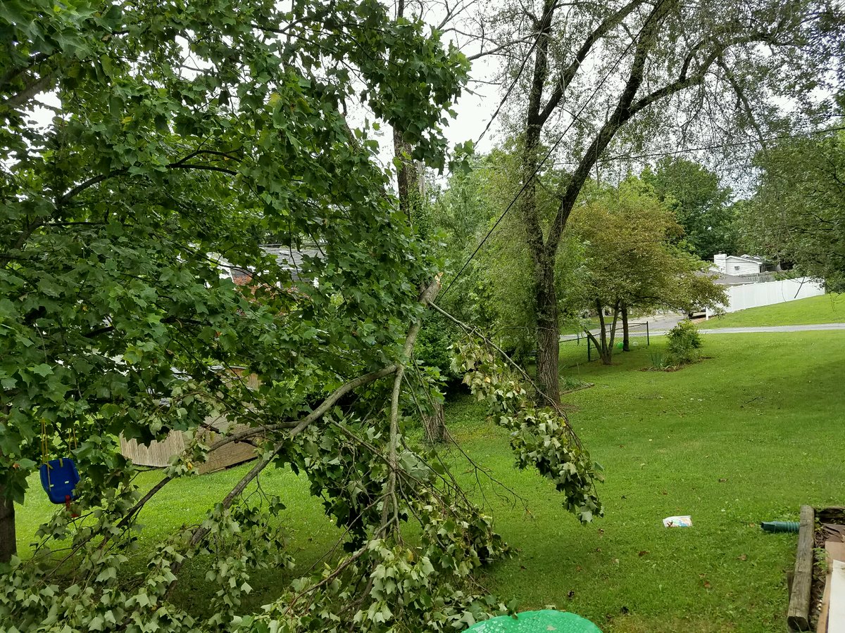
Du Quoin, IL Tony Laubach |
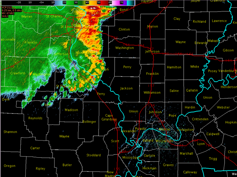
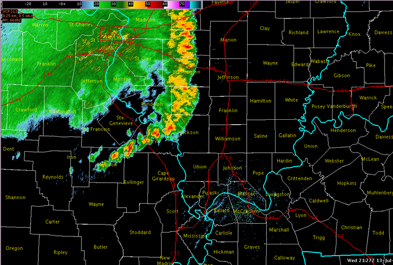
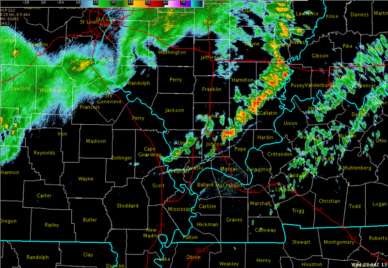
Radar:
Click here for a radar loop of this event
Click images for larger view:
 |
 |
 |
 |
| 4pm (Just about when the storms entered our area) | 430pm (The main bowing segment was impacting portions of Perry County IL) | 545pm (Storms about to enter southwest IN) | 645pm (Strongest storms over the southwest IN area and down into the adjacent KY counties) |
 |
Media use of NWS Web News Stories is encouraged! Please acknowledge the NWS as the source of any news information accessed from this site. |
|