A couple of frontal boundaries will move east and south from the Plains to the Gulf and Atlantic coastlines. These boundaries will focus showers and thunderstorms through the weekend, with scattered severe thunderstorms from the Southern Plains and across the Gulf Coast states. Locally heavy rainfall may also occur, which may be welcome news across drought areas. Meanwhile, heat spreads westward. Read More >
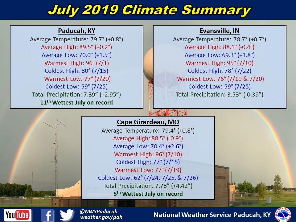
July 2019 Climate Review: Temperatures finished slightly above normal by around 1 degree. The most uncomfortable stretch of heat and high humidity was observed from July 18th through 21st when heat index readings topped 100 degrees daily. A few locations in southeast Missouri even topped 110 degrees on the 18th. A nice cool down followed for the week after, with low temperatures dipping into the 50s in many locations on July 25th.
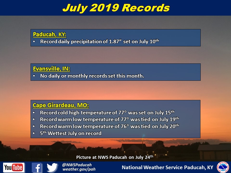
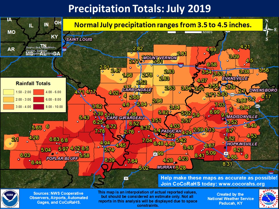
Precipitation varied across the region. It was wetter than normal across much of southeast Missouri into western Kentucky and far southern Illinois. The majority of southern Illinois along and north of Route 13 into portions of southwest Indiana observed drier than normal rainfall. As is common during the summer, precipitation varied quite a bit across some counties. This marked the 11th consecutive month with wetter than normal precipitation in Paducah, KY. Cape Girardeau picked up just under 8 inches of precipitation, making it the 5th wettest July on record there.
The graphic below is an interpolated rainfall map using actual observations. Please note that there are likely discrepancies in between observations, since the values are estimated based on nearest reports.
| July 2019 Review: Precipitation and Temperature Maps (Click on image to enlarge) |
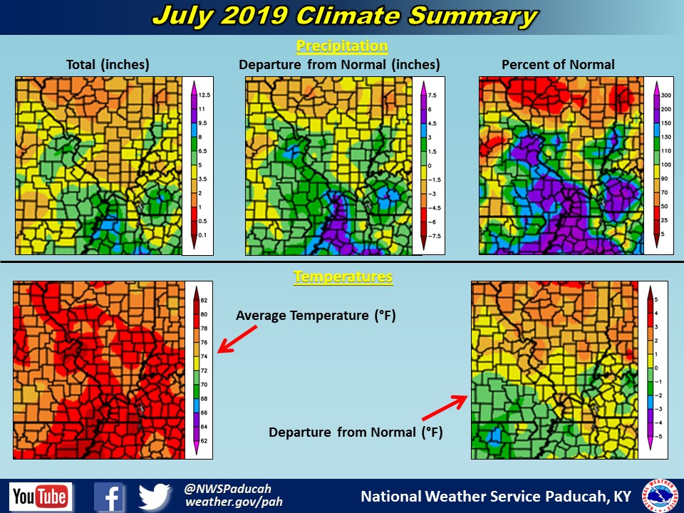 |
| Climate Maps are from the Northeast Regional Climate Center |