Overview
Scattered thunderstorms produced a few brief tornadoes across southwest Indiana on June 8, 2021.
Tornadoes:
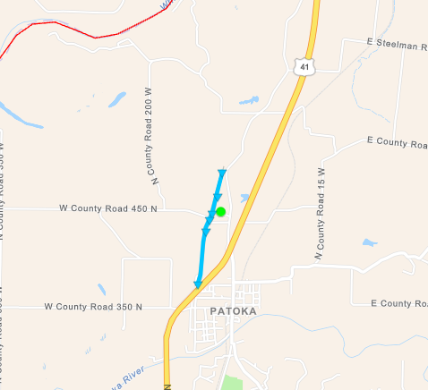
Tornado #1 - Patoka, Indiana
Gibson County
| Date |
June 8, 2021 |
| Time (CDT) |
5:25 - 5:35 PM |
| EF Rating |
EF-0 |
| Est. Peak Winds |
85 mph |
| Path Length |
1.3 miles |
| Max Width |
60 yards |
| Injuries/Deaths |
1/0 |
|
Summary: Barn roof and side walls torn off and part of a residence damaged. One male was injured by debris lofted while in a building. Several trees damaged along path with crop damage to bean field.
|
Track Map
|
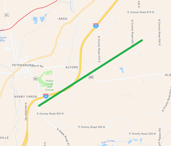
Tornado #2- Alford, Indiana
Pike County
| Date |
June 8, 2021 |
| Time (CDT) |
6:12 - 6:18 PM |
| EF Rating |
EF-1 |
| Est. Peak Winds |
90 mph |
| Path Length |
2.5 miles |
| Max Width |
90 yards |
| Injuries/Deaths |
0/0 |
|
Summary: Damage to carport in Alford. Metal debris on roadway noted near intersection of Highway 356 and Interstate 69 and near mile marker 50 on Interstate 69. Power lines down near Highway 356 and County Road 475 North.
|
Track Map
|
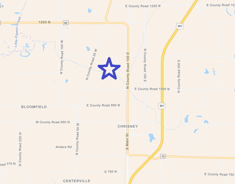
Tornado #3 - Chrisney, Indiana
Spencer County
| Date |
June 8, 2021 |
| Time (CDT) |
1:42 - 1:43 PM |
| EF Rating |
EF-0 |
| Est. Peak Winds |
65 mph |
| Path Length |
0.1 miles |
| Max Width |
15 yards |
| Injuries/Deaths |
0/0 |
|
Summary: A member of the public observed rope-like tornado develop twice in open farmland north-northwest of Chrisney near the intersection of County Road 1000 North and old Highway 231. A brief touchdown occurred, but no damage was reported.
|
Track Map
|
The Enhanced Fujita (EF) Scale classifies tornadoes into the following categories:
EF0
Weak
65-85 mph |
EF1
Moderate
86-110 mph |
EF2
Significant
111-135 mph |
EF3
Severe
136-165 mph |
EF4
Extreme
166-200 mph |
EF5
Catastrophic
200+ mph |
 |


