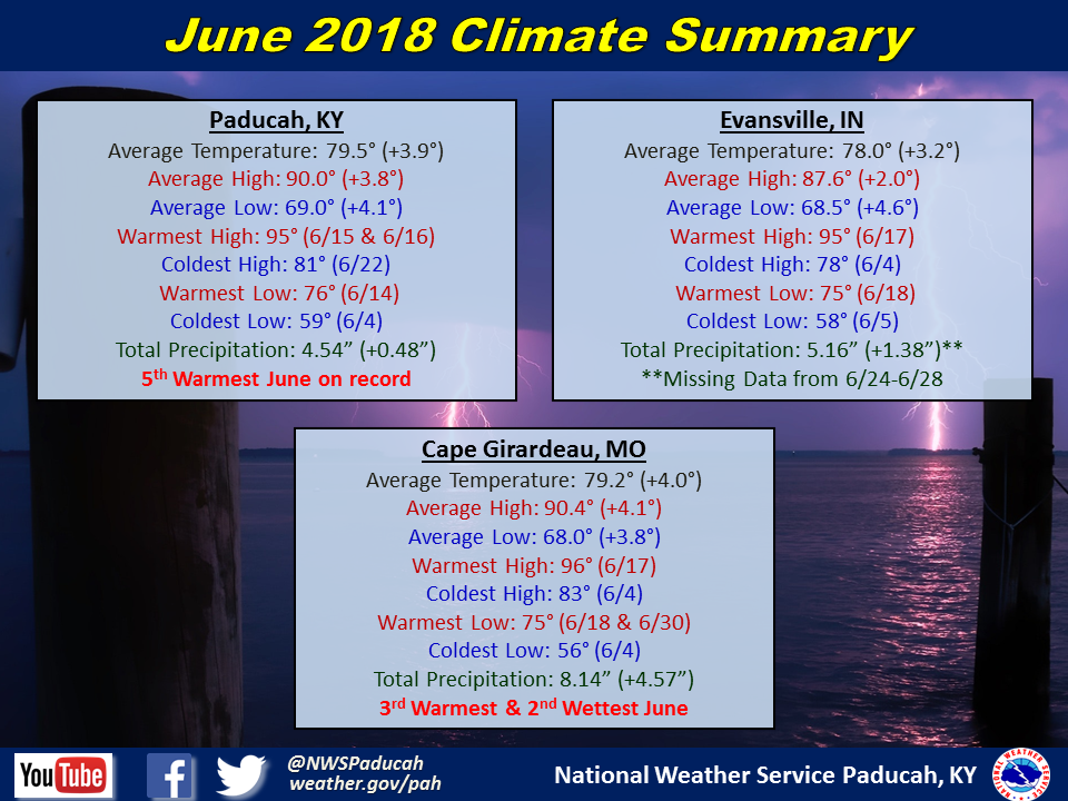
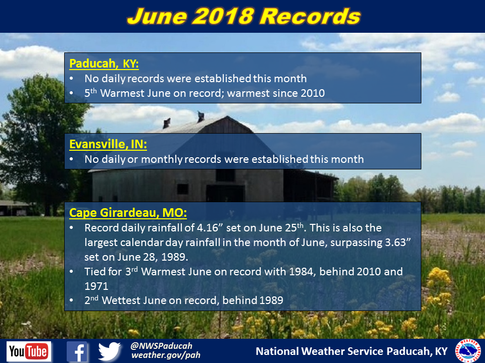
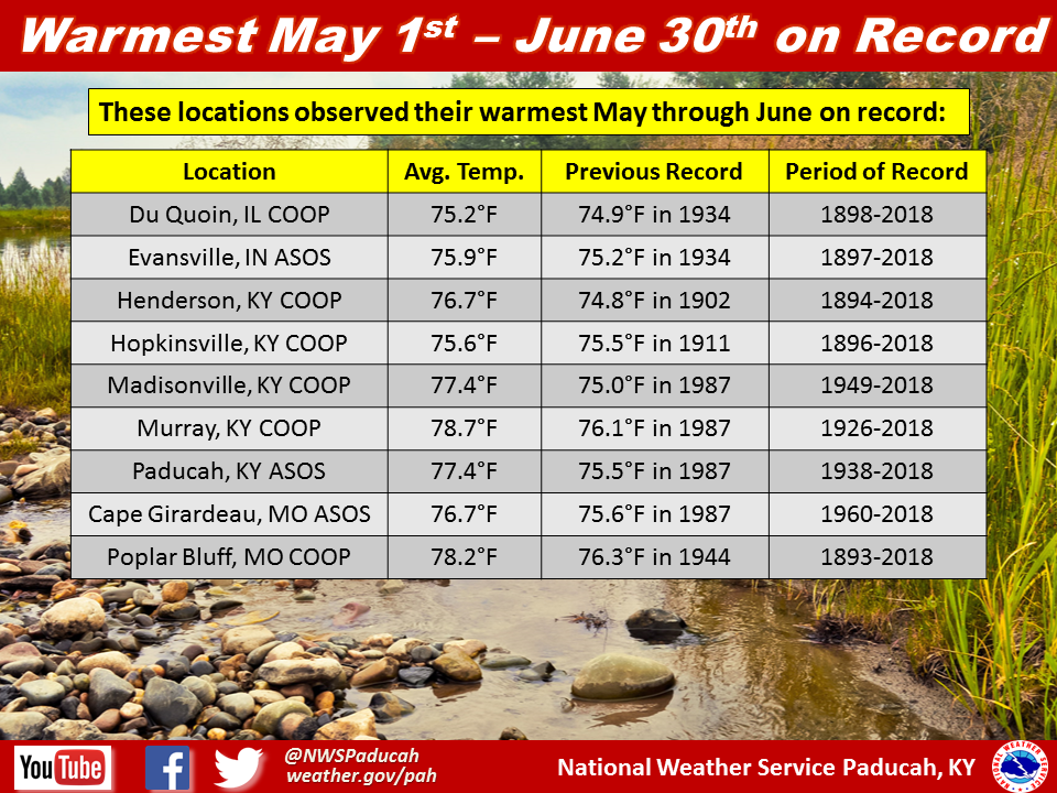
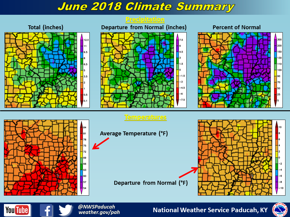
June 2018 Climate Review: It was a continuation of the warm May, with above normal temperatures dominating most of the month. Many locations were around 3 to 4 degrees above normal. There were only 5 days with daily temperatures below normal in Paducah, KY and Cape Girardeau, MO, with June finishing as the 5th and 3rd warmest on record respectively. High temperatures reached the 90s for 14 straight days between June 6th and 19th in Paducah and for 15 straight days in Cape Girardeau. While above normal temperatures were common, no record highs or warm lows were established. The humidity was also oppressive for long stretches of time, with dewpoints constantly up into the mid to upper 70s. In Paducah, there were 15 days in which the dewpoint reached at least 75 degrees. The dewpoint is basically a measure of how humid the air feels, and anything over 70 is quite uncomfortable to most people. Heat index values were topping 100 degrees on many days throughout the month.
As for rainfall, much of the region registered a wetter than normal June to some degree. The wettest areas were typically across much of southwest Indiana into a good portion of southeast Illinois and portions of far southern Illinois. Smaller portions of western Kentucky and southeast Missouri experienced wetter conditions as well, including Cape Girardeau which registered their 2nd wettest June on record. Drier than normal conditions were present across much of the Ozark Foothills in southeast Missouri and nudging into portions of the Jackson Purchase area of western Kentucky. Rainfall amounts ranged from 7 to 10+ inches in southwest Indiana to less than 2 inches in some areas of Carter and Ripley Counties in southeast Missouri.
June was an active month in regards to thunderstorms across the area. Severe thunderstorms occurred on several days throughout the month, with the two most widespread events occurring on June 26th and 28th. Damaging winds were the biggest impact from these events. The 28th event was classified as a derecho event as widespread wind damage was observed across southern Illinois into western Kentucky.
The graphic below is an interpolated rainfall map using actual observations. Please note that there are likely discrepancies in between observations, since the values are estimated based on nearest reports.
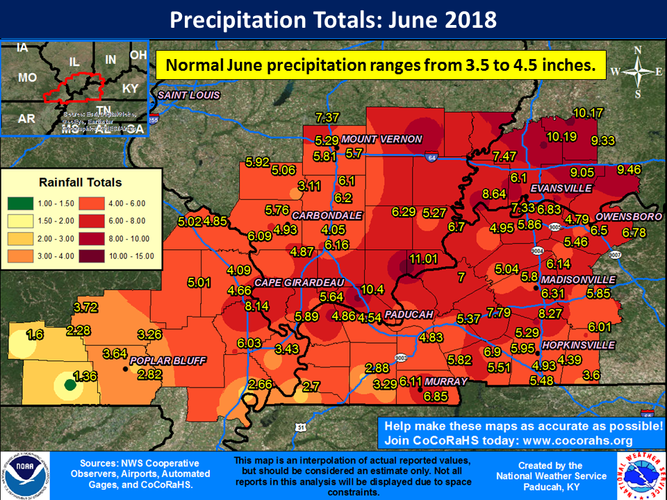
| June 2018 Review: Precipitation and Temperature Maps (Click on image to enlarge) |
 |
| Climate Maps are from the Northeast Regional Climate Center |