Overview
|
Driven by months of drought and periods of extreme heat during the summer and fall months in 2022, very low to record low river stages developed along the Lower Ohio and Mississippi Rivers in our area. In October 2022, river stages on the Mississippi River from the Ohio-Mississippi River confluence at Cairo, IL, to Baton Rouge, LA, were so low that commercial activities such as barge traffic and riverboats were experiencing difficulty navigating portions of the river. |
 True color satellite imagery showing the change between July 14 and October 17, 2022, of the Lower Ohio and Mississippi Rivers from their confluence at Cairo, Ill., to the Kentucky Bend of the Mississippi River at New Madrid, Mo. Source: Copernicus Sentinel 2. |
Satellite Imagery
These true color satellite images from Copernicus Sentinel 2 show the difference in river levels along the Lower Ohio and Mississippi Rivers between July 14 and October 17, 2022. Click each image to enlarge.
 |
 |
 |
 |
| Ohio River at Mound City Landing in Illinois and Kentucky. |
Confluence of the Ohio and Mississippi Rivers at Cairo, Ill. | Mississippi River at Cape Girardeau, Mo. |
Mississippi River at the Kentucky Bend and New Madrid, Mo. |
Photos
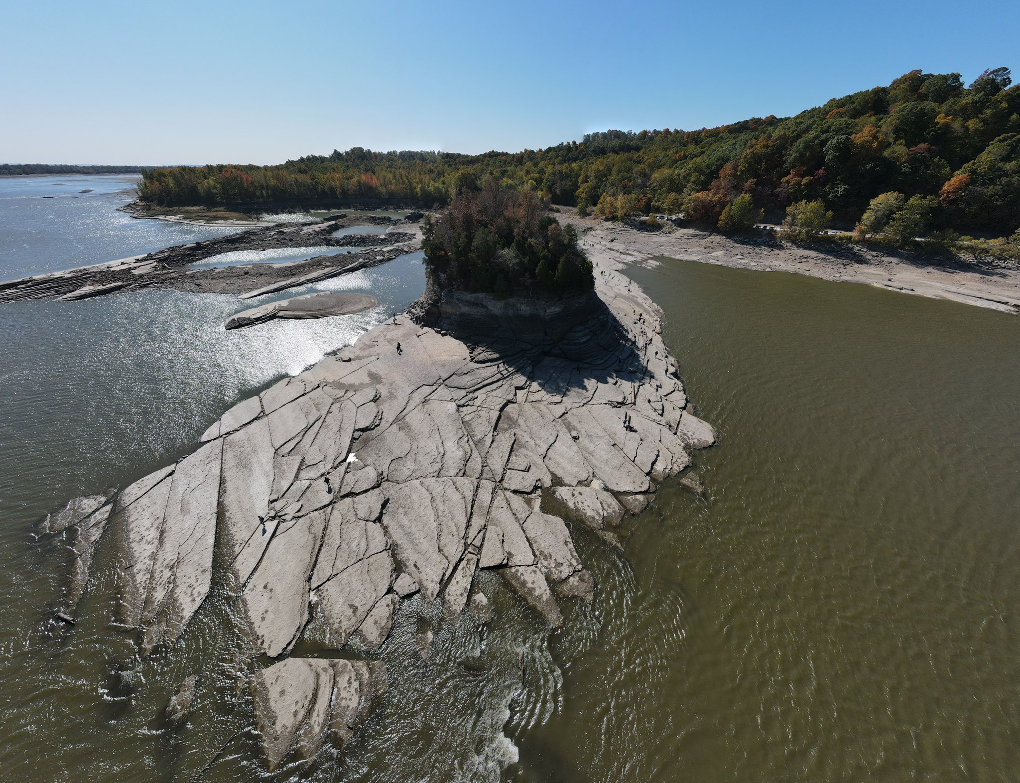
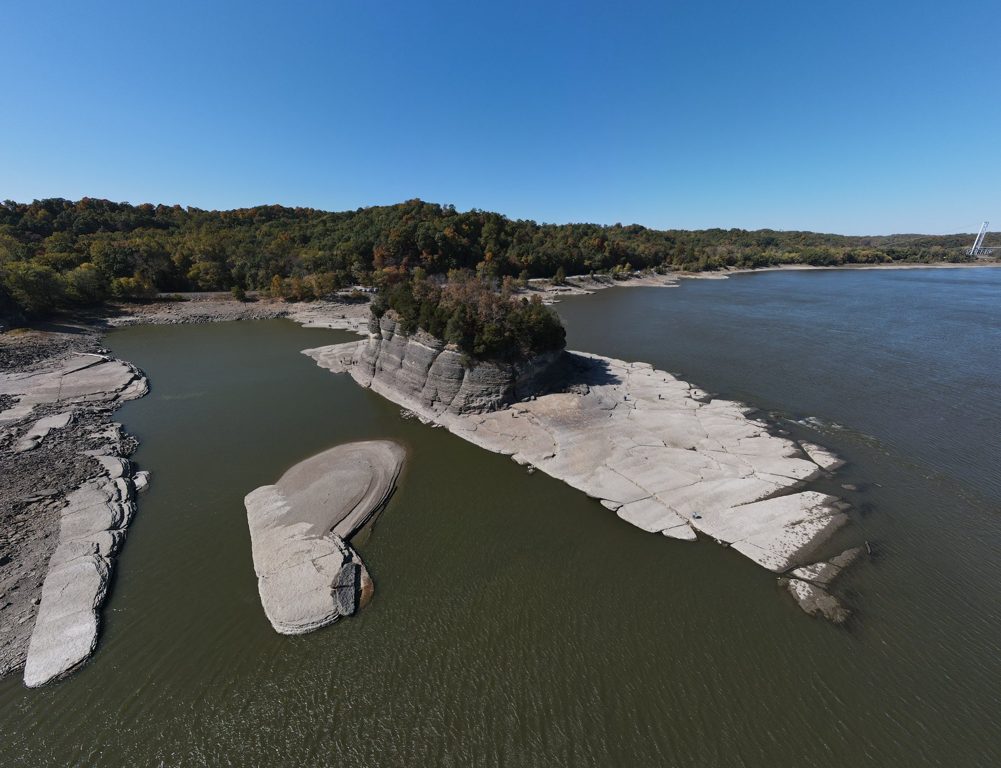
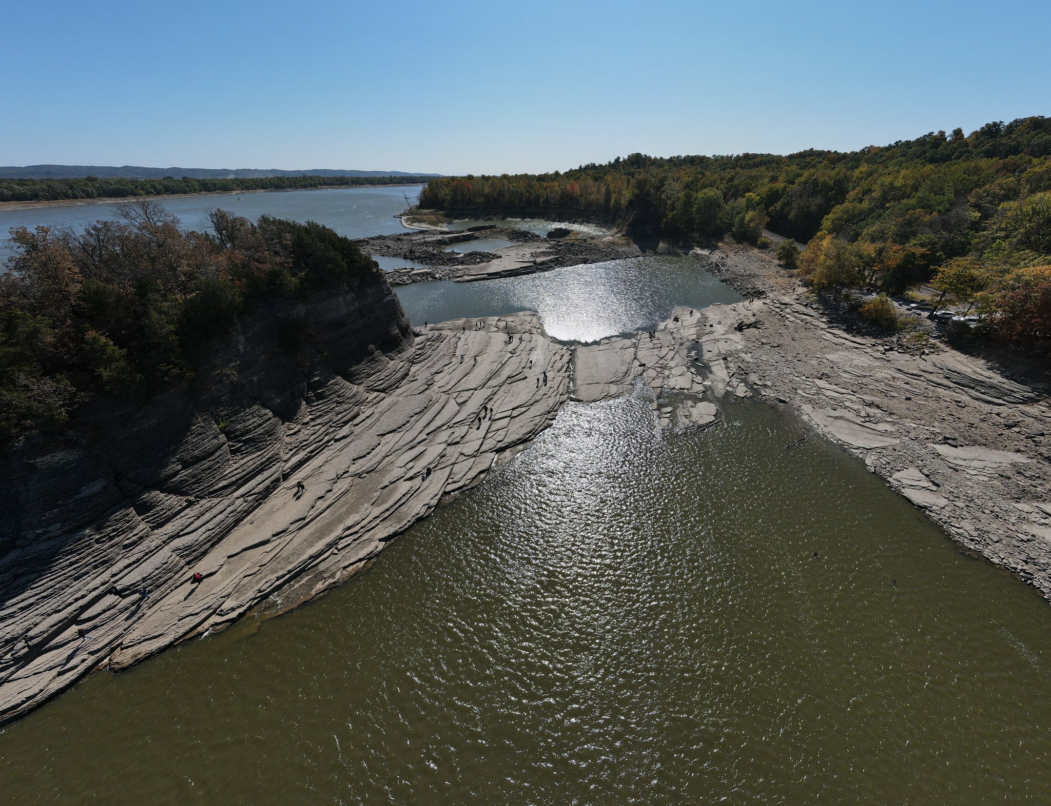
Aerial and ground level photos of low river levels in the region.
 |
 |
 |
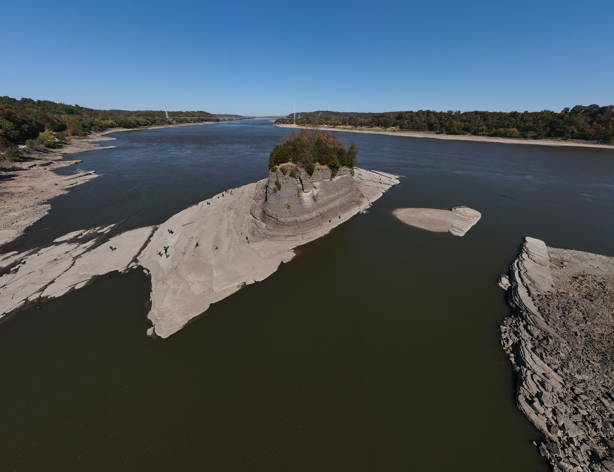 |
| Tower Rock on the Mississippi River at Grand Tower, Ill. (Reece Streufert) |
Tower Rock on the Mississippi River at Grand Tower, Ill. (Reece Streufert) |
Tower Rock on the Mississippi River at Grand Tower, Ill. (Reece Streufert) |
Tower Rock on the Mississippi River at Grand Tower, Ill. (Reece Streufert) |
 |
| Tower Rock on the Mississippi River at Grand Tower, Ill. (Leo Driscoll) |
Aerial photo of the record low Mississippi River just south of Cairo, IL #ilwx #kywx #mowx #tnwx #arwx #mswx #lawx #mississippiriver #aerial #cairoil #sandbar #drought #barge #commerce pic.twitter.com/vlxWykDJ1X
— Ohio Valley Aerial (@stmchsr01) October 15, 2022
Aerial photos of the record low Mississippi River just south of Cairo, IL #ilwx #kywx #mowx #tnwx #arwx #mswx #lawx #mississippiriver #aerial #cairoil #sandbar #drought #barge #commerce pic.twitter.com/fvt9PiAro2
— Ohio Valley Aerial (@stmchsr01) October 15, 2022
Drought
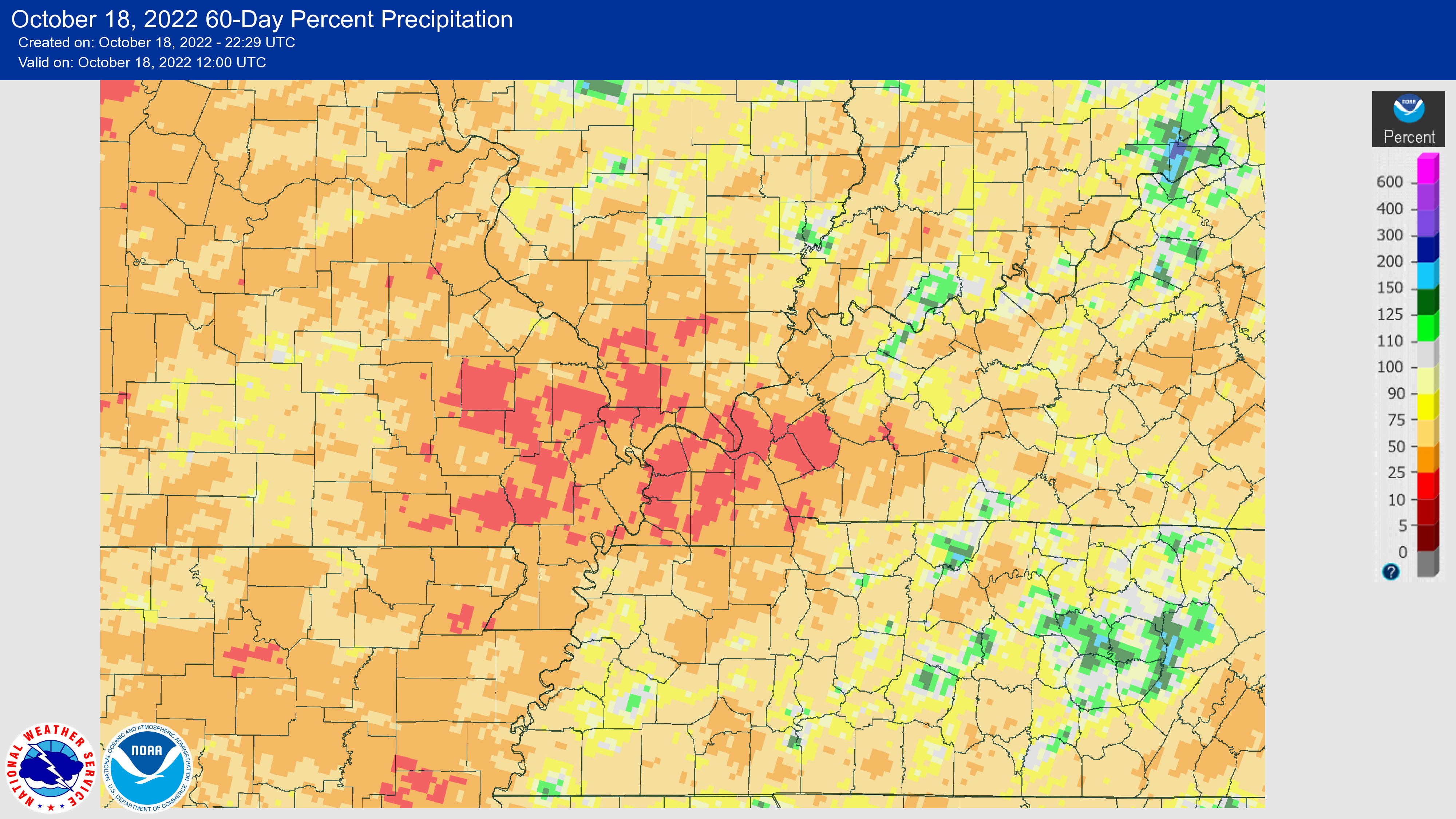
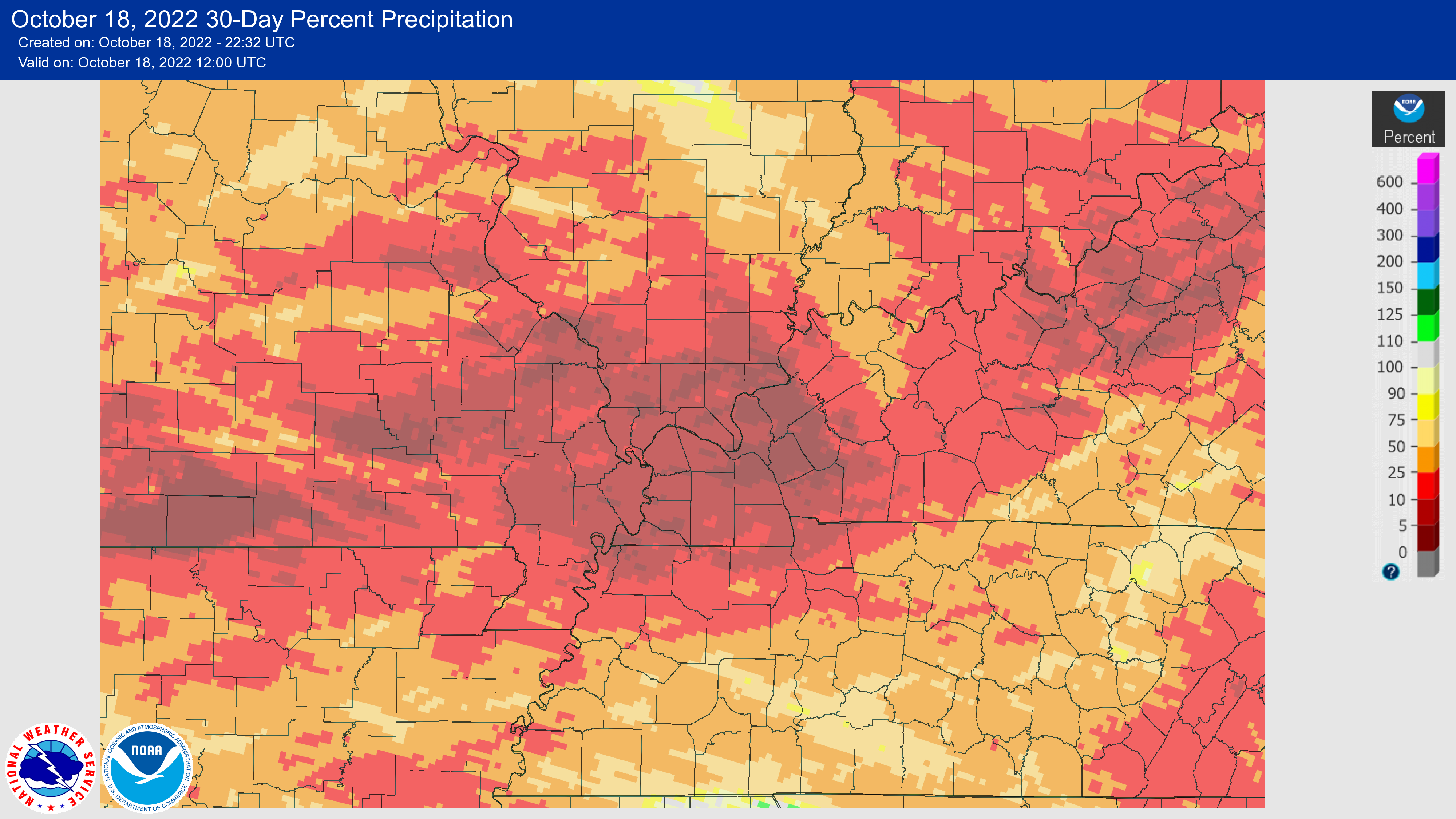
These images show the percentage of normal rainfall that has fallen over the region for the last 90, 60, and 30 days. The image on the right shows the drought categories across the NWS Paducah forecast area from Spring to Fall 2022.
 |
 |
 |
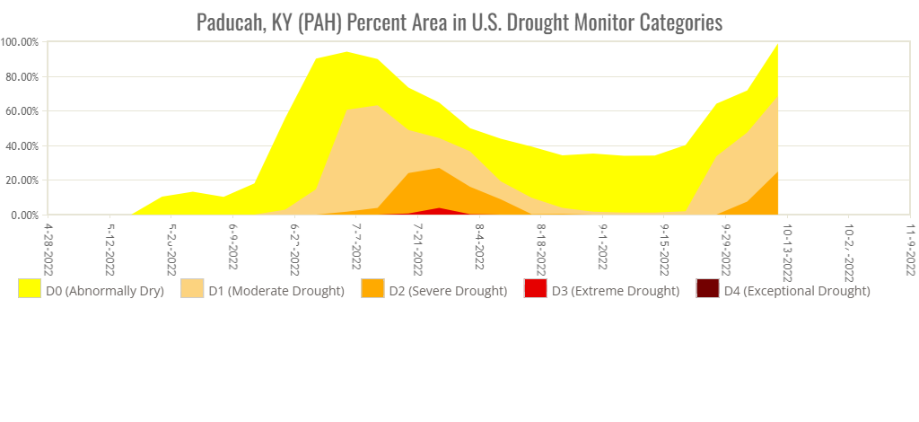 |
| Percentage of normal precipitation from July 17 to October 17, 2022. | Percentage of normal precipitation from August 17 to October 17, 2022. | Percentage of normal precipitation from September 17 to October 17, 2022. | Time series of drought categories across the NWS Paducah forecast area from Spring to Fall 2022. |
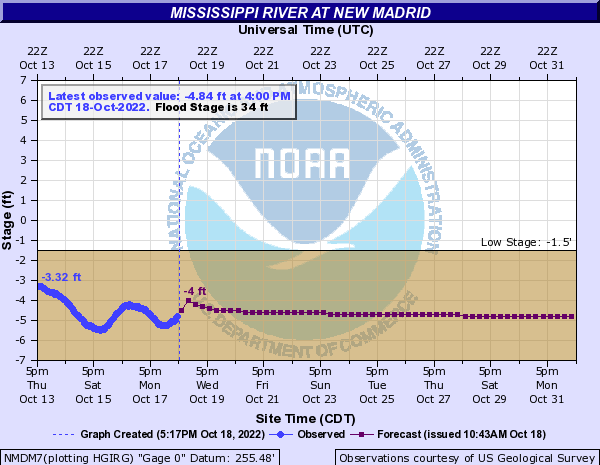
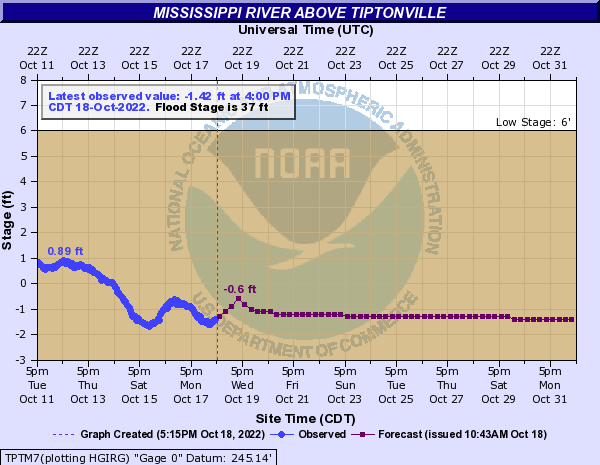
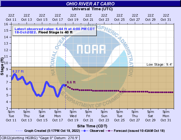
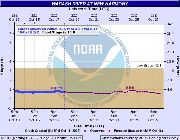
Historically Low River Stages
These images show the observed river stages at selected river gages in the area. On Saturday, October 15, 2022, the Mississippi River at New Madrid, Mo., fell to -5.45 feet. This was the lowest observed river stage on record at New Madrid, where observations began in 1879.
 |
 |
 |
 |
| Mississippi River at New Madrid, Mo. | Mississippi River above Tiptonville, Tenn. |
Ohio River at Cairo, Ill. |
Wabash River at New Harmony, Ind. |
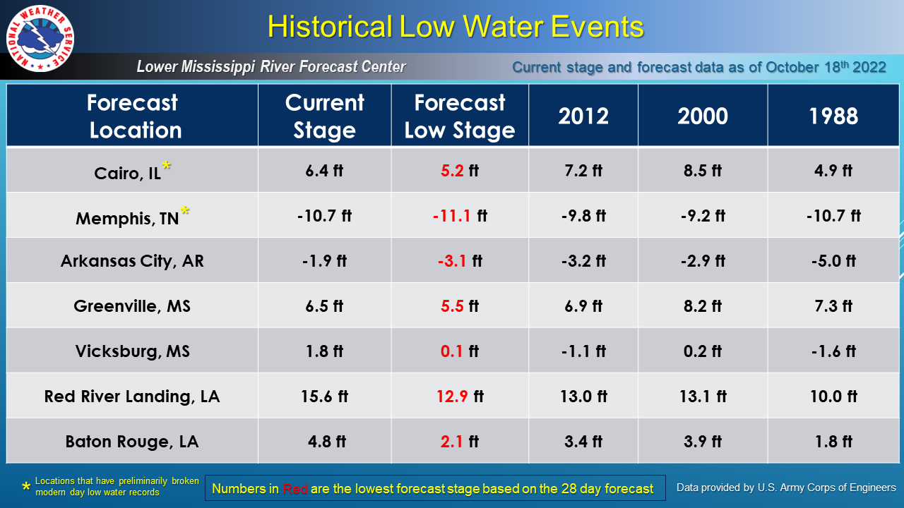 |
| October 18, 2022, analysis from the NWS Lower Mississippi River Forecast Center. |
 |
Media use of NWS Web News Stories is encouraged! Please acknowledge the NWS as the source of any news information accessed from this site. |
|

