Overview
|
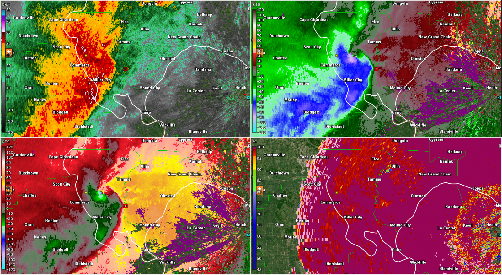
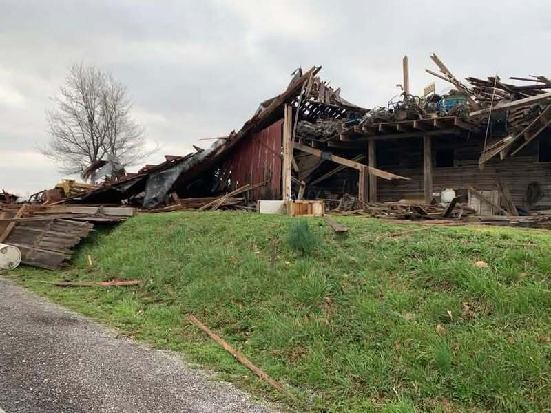
Clusters of storms during the afternoon eventually evolved into a line of storms as they progressed across our region through the evening on March 30th. The primary surface low with this system was located up near Chicago. However, a secondary surface low developed along the cold front as it progressed east across southeast Missouri. This provided an environment supportive of a few tornadoes and we ended up having two EF-1's from this event. Both of these occurred in the early evening, one in Ripley & Butler counties in Missouri and the other across Alexander & Pulaski counties in Illinois. We also had numerous reports of hail with these storms, ranging from quarter to golf ball sized. There was also a good amount of straight line winds with winds in excess of 60 mph producing scattered damage reports across the area. |
Tornadoes
Select a tornado from the table to zoom into the track and view more information. The default table view is limited to 8 tracks, but can be scrolled by a mouse wheel or dynamically expanded. Additionally, the table can fill the entire window by clicking the small circular expanding arrow icon at the very top right of the table and returned to its original size by clicking the button again. The side information panel that opens over the map can be closed using the "X" on the upper right corner of the pop-up. Zoom into the map and click damage points to see detailed information and pictures from the surveys.
|
NOTE: times shown below are local to your device's time zone. |

The Enhanced Fujita (EF) Scale classifies tornadoes into the following categories:
| EF0 Weak 65-85 mph |
EF1 Moderate 86-110 mph |
EF2 Significant 111-135 mph |
EF3 Severe 136-165 mph |
EF4 Extreme 166-200 mph |
EF5 Catastrophic 200+ mph |
 |
|||||
| Tornadoes that fail to impact any ratable structures on the EF-Scale are rated EF-Unknown (EF-U) | |||||
Radar
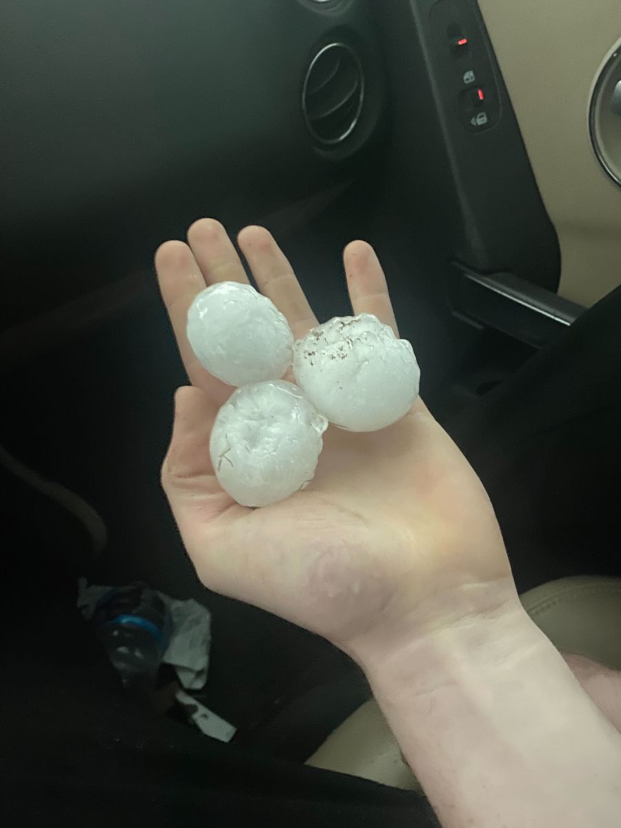
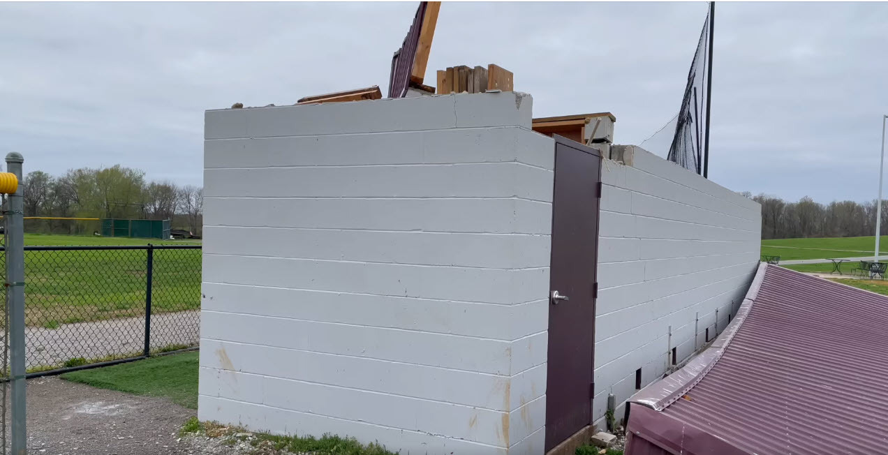
Photos
 |
 |
%20via%20Jason%20Kelley.jpg) |
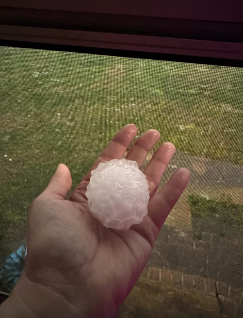 |
| Hail in Bernie, MO courtesy of Beau Bishop | Hail near Du Quoin, IL courtesy of Nick Hausen | Hail in Perry County Missouri (Longtown) courtesy of Jason Kelley | Hail near Qulin, MO courtesy of Melissa Berger |
 |
 |
 |
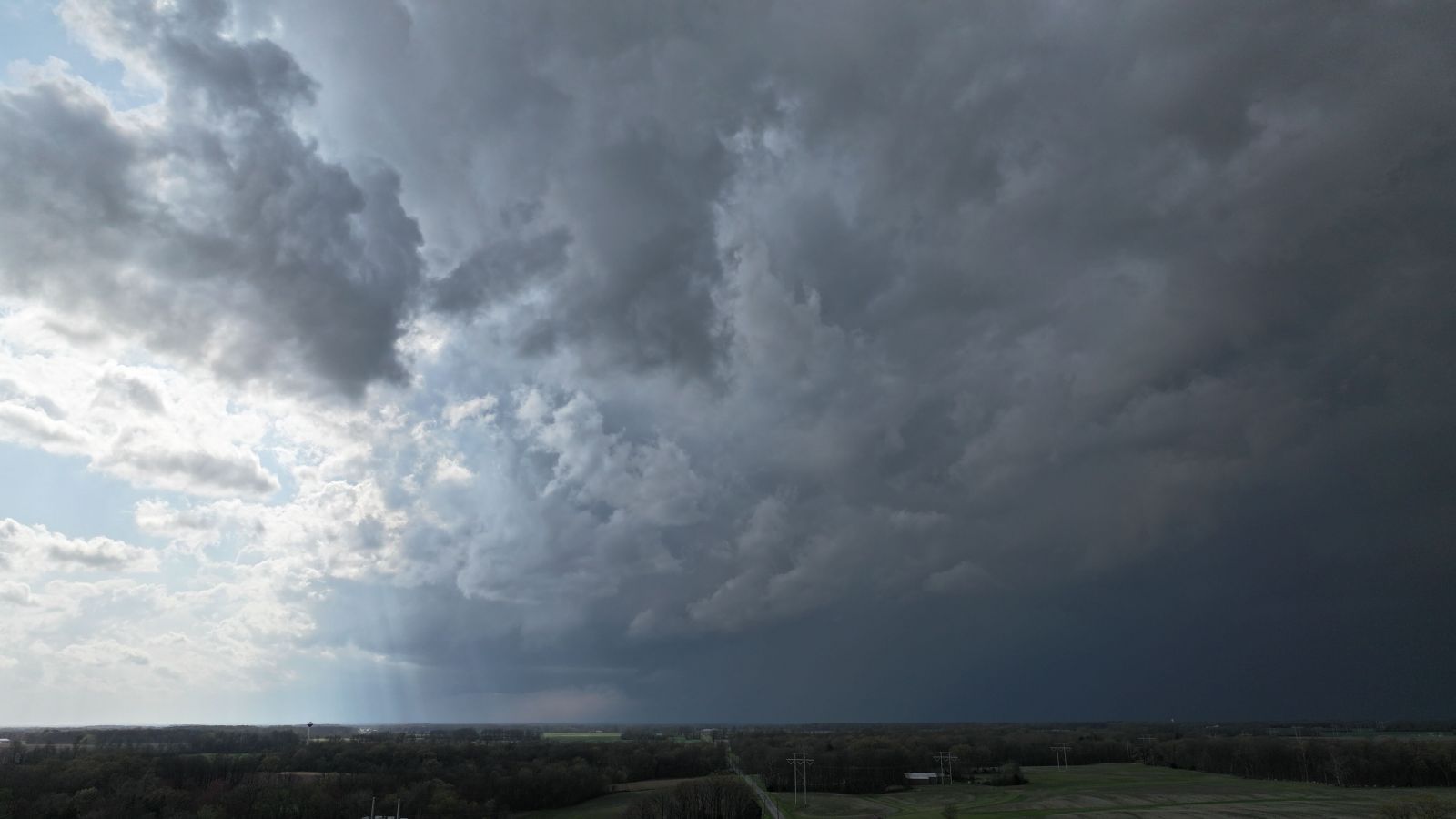 |
| Hail in Murphysboro, IL courtesy of Brian Manwaring | Tornado damage at Shawnee Community College in Pulaski County IL courtesy of Beau Dodson | Wind damage near New Grand Chain, IL courtesy of Kristy Ulrigh | Drone view of storms near Christopher, IL courtesy of Justin Hilliard |
 |
Media use of NWS Web News Stories is encouraged! Please acknowledge the NWS as the source of any news information accessed from this site. |
|

