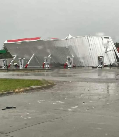
Overview
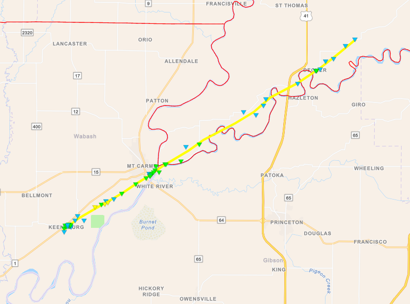
A Mesoscale Convective Vortex, known as an MCV, moved slowly eastward across southern Missouri during the day on Thursday May 19. Ahead of this feature, a strongly unstable airmass developed across our area. Initial storm development occurred in the Wabash River Valley of southeast Illinois around midday and moved into southwest Indiana during the early afternoon. These storms produced large hail up to the size of baseballs. Thereafter, a lull occurred during the mid afternoon before convection associated with the MCV began entering northern portions of southeast Missouri into southwest Illinois during the late afternoon and early evening. Embedded bowing segments lead to pockets of wind damage from near Chester into Perry County Illinois. Thereafter, the storms appeared to show a weakening trend for a few hours, before flaring up again later in the evening. Additional wind damage occurred across the Wabash River Valley into southwest Indiana with this final round of convection. An EF-2 tornado touched down in Wabash County Illinois around 9:30 PM, and produced significant damage around the Mt Carmel, IL area before straddling the White River along the Gibson/Knox County line in Indiana.Tornadoes:
|
Tornado - Mt Carmel, Illinois
|
||||||||||||||||
The Enhanced Fujita (EF) Scale classifies tornadoes into the following categories:
| EF0 Weak 65-85 mph |
EF1 Moderate 86-110 mph |
EF2 Significant 111-135 mph |
EF3 Severe 136-165 mph |
EF4 Extreme 166-200 mph |
EF5 Catastrophic 200+ mph |
 |
|||||
Photos
 |
%20via%20Kate%20Abrell.PNG) |
 |
 |
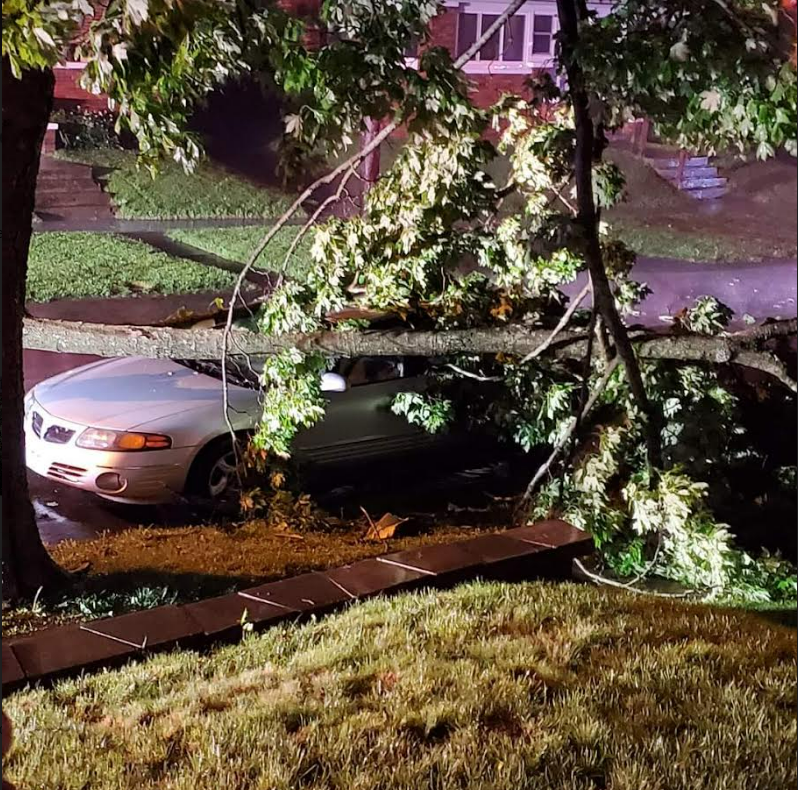
| Large hail at North Posey High School near Poseyville, IN via Ryan Reynolds | Large hail near Fulda, IN (Spencer County) via Kate Abrell | Part of a tree fell on a car in Princeton, IN via Laura Hall | Damage near Chester, IL along MS River via Allen Roth |
Radar
Click here for a radar loop of this event.
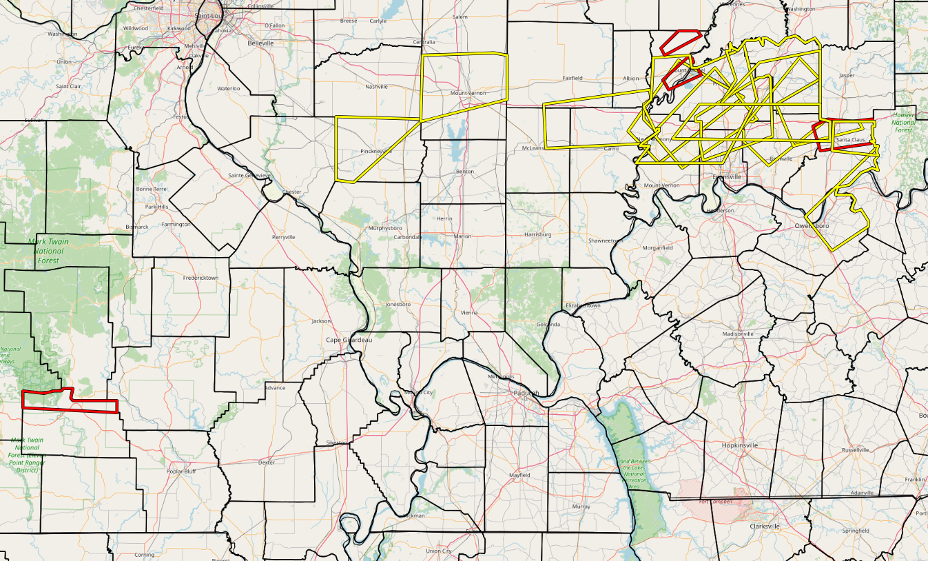
The graphic below displays all Severe Thunderstorm, Tornado, and Flash Flood Warnings issued during the event.
Storm Reports
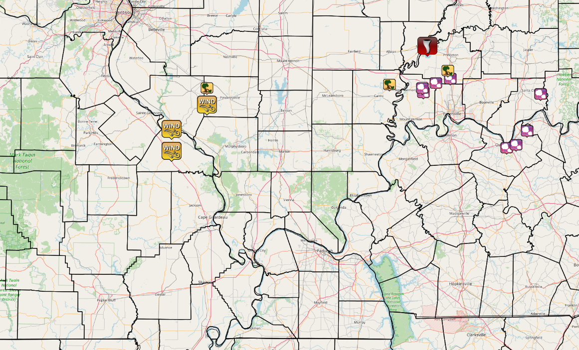 |
| Graphic above displays all Local Storm Reports issued during this event for the NWS Paducah area. |
PRELIMINARY LOCAL STORM REPORT...SUMMARY
NATIONAL WEATHER SERVICE PADUCAH KY
353 AM CDT FRI MAY 20 2022

..TIME...   ...EVENT...      ...CITY LOCATION...     ...LAT.LON...
..DATE...   ....MAG....      ..COUNTY LOCATION..ST.. ...SOURCE....
            ..REMARKS..

0104 PM     HAIL             4 S POSEYVILLE          38.11N 87.79W
05/19/2022  E1.50 INCH       POSEY              IN   PUBLIC


0105 PM     HAIL             2 SSW POSEYVILLE        38.14N 87.80W
05/19/2022  E2.75 INCH       POSEY              IN   PUBLIC

            LATE REPORT. BASEBALL SIZE HAIL OCCURRED AT
            THE NORTH POSEY HIGH SCHOOL. CARS WERE
            DAMAGED.

0108 PM     HAIL             1 SE OWENSBORO          37.75N 87.11W
05/19/2022  M1.00 INCH       DAVIESS            KY   EMERGENCY MNGR


0112 PM     HAIL             3 NW PHILPOT            37.77N 87.03W
05/19/2022  U1.25 INCH       DAVIESS            KY   PUBLIC

            REPORT FROM MPING: HALF DOLLAR (1.25 IN.).

0120 PM     HAIL             2 SE CYNTHIANA          38.17N 87.69W
05/19/2022  E1.25 INCH       POSEY              IN   PUBLIC


0134 PM     HAIL             3 E MACEO               37.86N 86.94W
05/19/2022  E1.75 INCH       DAVIESS            KY   FIRE DEPT/RESCUE


0140 PM     HAIL             HAUBSTADT               38.20N 87.57W
05/19/2022  E1.00 INCH       GIBSON             IN   PUBLIC


0202 PM     HAIL             5 ESE SANTA CLAUS       38.10N 86.83W
05/19/2022  E1.75 INCH       SPENCER            IN   PUBLIC

            CORRECTS PREVIOUS HAIL REPORT FROM 5 ESE
            SANTA CLAUS. LATE REPORT. TIME ESTIMATED
            BASED ON RADAR. GOLF BALL SIZED HAIL BETWEEN
            TOWNS OF FULDA AND NEW BOSTON.

0535 PM     TSTM WND GST     3 NNE LITHIUM           37.87N 89.86W
05/19/2022  M66 MPH          PERRY              MO   AWOS

            CORRECTED LOCATION TO 3 NNE OF LITHIUM FROM
            PREVIOUS TSTM WND GST REPORT FROM 1 E
            PERRYVILLE.

0549 PM     TSTM WND DMG     8 N CUTLER              38.14N 89.57W
05/19/2022                   PERRY              IL   LAW ENFORCEMENT

            TREE REPORTED DOWN ON COLUMBINE RD 2 MILES
            SW OF SWANWICK.

0549 PM     TSTM WND GST     CUTLER                  38.03N 89.57W
05/19/2022  M73 MPH          PERRY              IL   TRAINED SPOTTER


0920 PM     TSTM WND DMG     CROSSVILLE              38.16N 88.07W
05/19/2022                   WHITE              IL   TRAINED SPOTTER

            TREES AND POWER LINES DOWN IN CROSSVILLE.

0936 PM     TORNADO          1 SSE MOUNT CARMEL      38.41N 87.76W
05/19/2022                   WABASH             IL   LAW ENFORCEMENT

            DAMAGE REPORTED TO THE HIGH SCHOOL. MANY
            TREES DOWN. CHECKING ON HOME DAMAGE.
            MULTIPLE TOUCH DOWNS REPORTED PER LAW
            ENFORCEMENT. TRACKED ACROSS THE SOUTHERN
            SIDE OF MOUNT CARMEL.

0952 PM     TSTM WND GST     HAZLETON                38.49N 87.54W
05/19/2022  E60 MPH          GIBSON             IN   TRAINED SPOTTER

            TREE LIMBS DOWN.

1005 PM     TSTM WND DMG      FORT BRANCH            38.25N 87.59W
05/19/2022                   GIBSON             IN   PUBLIC

            POWER OUT AND POSSIBLE ROOF DAMAGE TO HOUSE
            IN FORT BRANCH.

1020 PM     TSTM WND DMG     OAKLAND CITY            38.34N 87.35W
05/19/2022                   GIBSON             IN   TRAINED SPOTTER

            LATE REPORT. TREES AND POWER LINES DOWN IN
            TOWN OF OAKLAND CITY.
 |
Media use of NWS Web News Stories is encouraged! Please acknowledge the NWS as the source of any news information accessed from this site. |
|