Paducah, KY
Weather Forecast Office
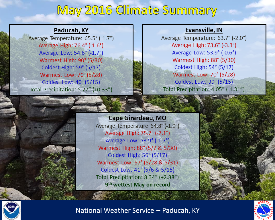
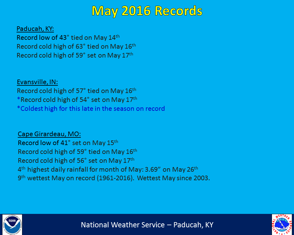
May 2016 featured temperatures that were generally around 2 degrees below normal. Precipitation ranged from well above normal across southeast Missouri to below normal across much of the Evansville Tri-State Area. Cape Girardeau, MO recorded over 3 inches of rain in 1 hour on May 26th, helping to boost them up to the 9th wettest May on record. It was a rather active month in regards to severe weather. Numerous noteworthy events occurred including on May 7th, 10th, 11th, and 26th. The May 11th Mayfield, KY tornado was the area’s first EF3 or stronger tornado since the Brookport, IL tornado on November 17, 2013. A cool spell in the middle of the month resulted in unusually chilly high temperatures with record cold highs being established on May 16th and 17th. The last week of the month saw temperatures rebound to above normal, with summer-like temperatures common. The 1st 90 degree temperature of the year occurred in Paducah on Memorial Day.
| May 2016 Review: Precipitation and Temperature Maps (click to enlarge) |
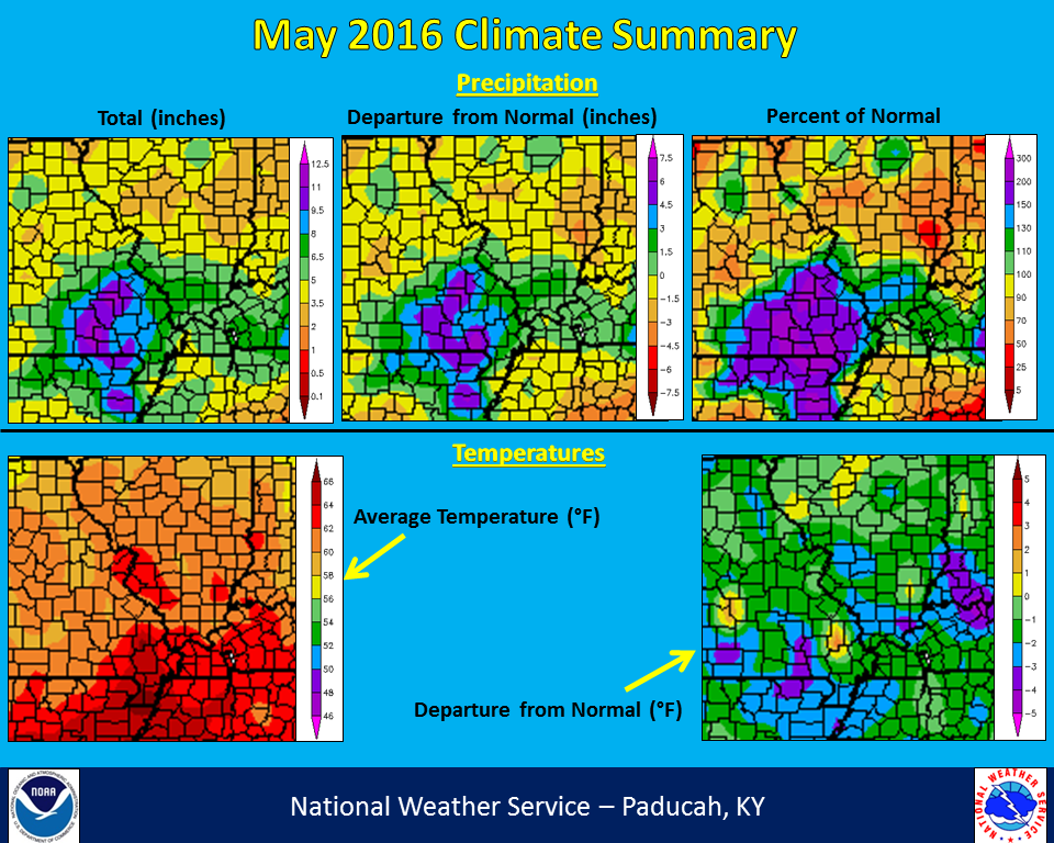 |
| Climate Maps are from the Northeast Regional Climate Center |
FORECASTS
Forecast Discussion
User Defined Area Forecast
Hourly Forecasts
Fire Weather
Activity Planner
LOCAL INFORMATION
Aviation Weather
Our Office
SKYWARN
Items of Interest
Hazardous Weather Support
Local Observations
Weather History
NWS Paducah KY Weekly Partner Briefing
US Dept of Commerce
National Oceanic and Atmospheric Administration
National Weather Service
Paducah, KY
8250 Kentucky Highway 3520
West Paducah, KY 42086-9762
270-744-6440
Comments? Questions? Please Contact Us.