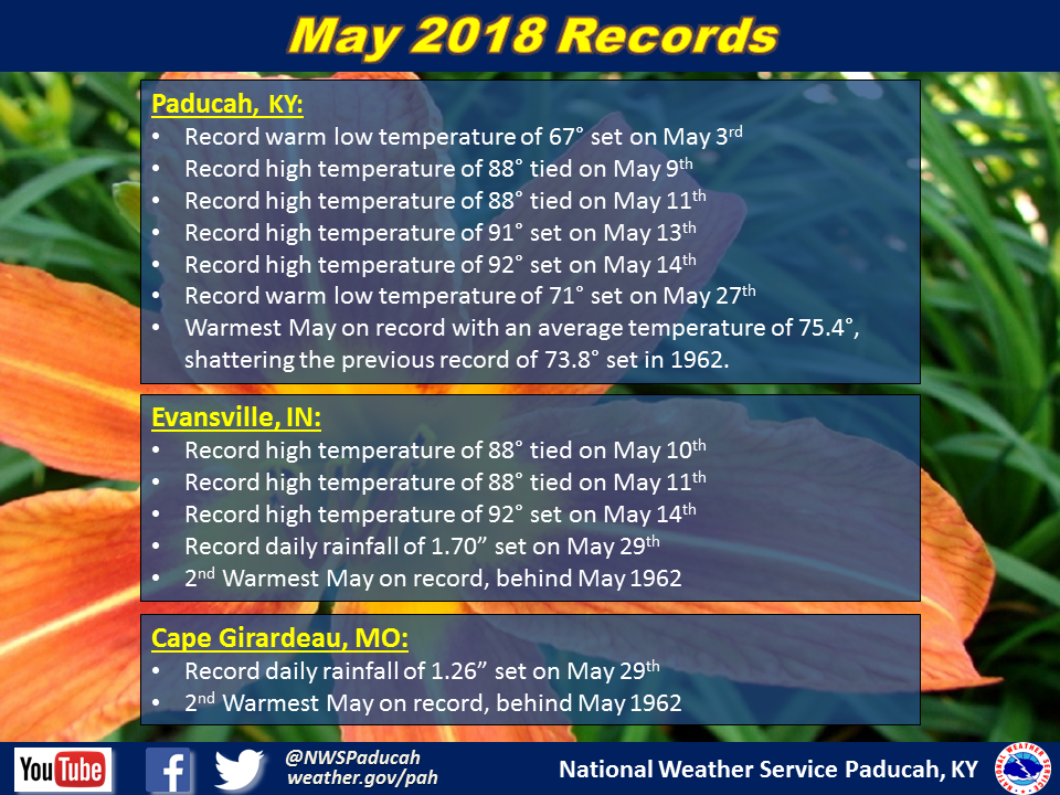
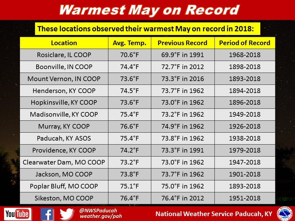
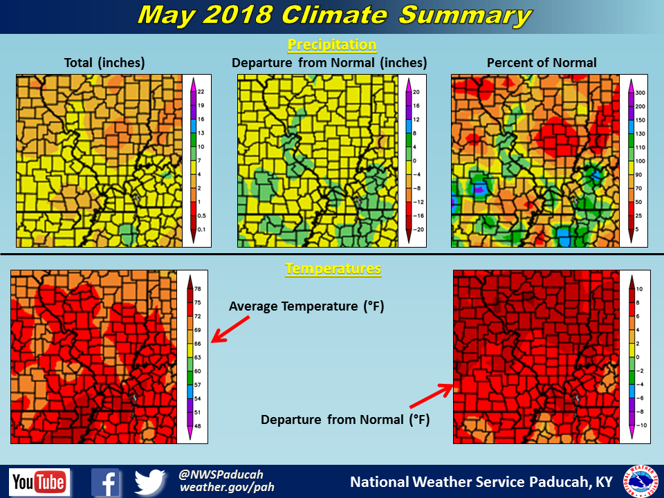
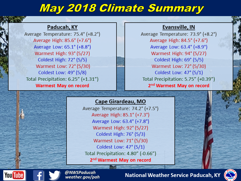
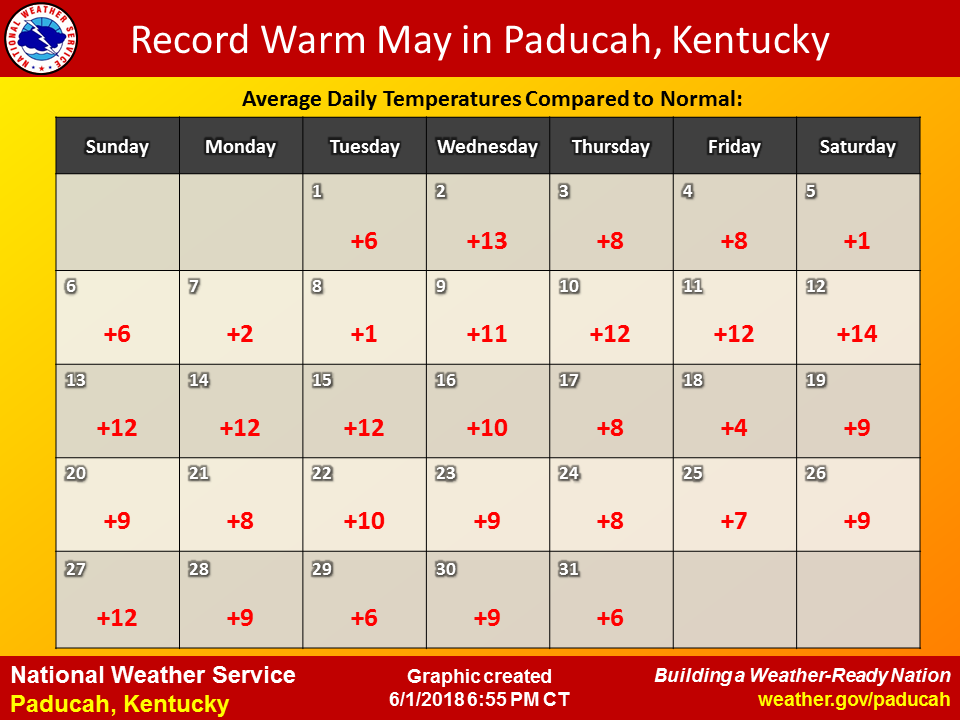
May 2018 Climate Review: Temperatures were well above normal, ranging from 7 to 8 degrees above normal across the region. Paducah, KY observed their warmest May on record, shattering the previous record set back in 1962. Around a dozen other locations across the region also observed their warmest May on record. Cape Girardeau, MO and Evansville, IN finished as the 2nd warmest May on record, both behind 1962. Temperatures were more reminiscent of June with high temperatures consistently in the mid 80s to around 90 degrees. In fact, there have been 32 June's dating back to 1938 that have been colder than May 2018 was in Paducah, KY. In Evansville, IN there have been 37 June's dating back to 1897 that have been colder than May 2018. After a chilly April that felt more like March at times, the switch was flipped on May 1st with all 3 official climate stations registering above normal temperatures every single day of May. Looking back at previous months, it appears the last time Paducah, KY experienced a month in which every day was above normal was back in August 2007.
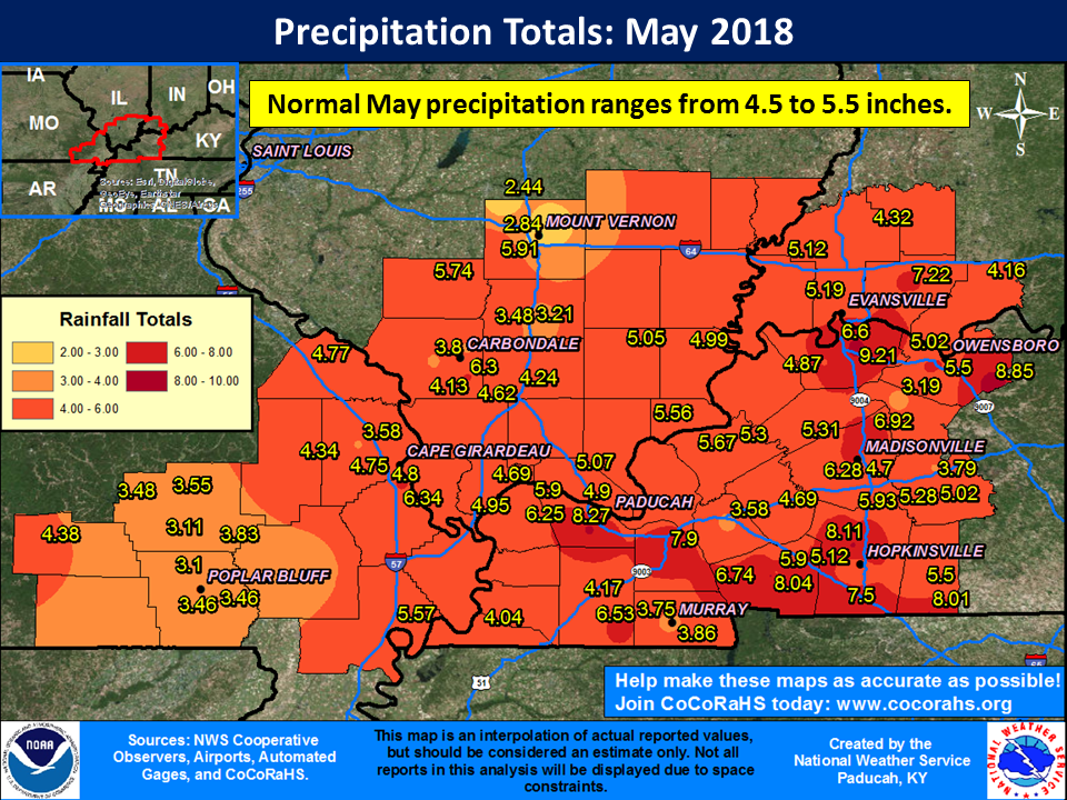
As for rainfall, it varied quite a bit across the region due to the nature of warm season precipitation. Some locations would get dumped on while a couple miles down the road observed very little from an individual shower or storm. Generally though, more areas experienced wetter than normal conditions for May. This was especially true across large sections of western Kentucky and southwest Indiana and into southern Illinois along and south of Route 13. Portions of southeast Missouri and up along the I-64 corridor in Illinois were drier than normal. Parts of Jefferson and Wayne Counties in Illinois picked up less than 3 inches for the month, while many locations across the region observed 5 to 8 inches.
May is typically an active severe weather month in our region, but this year it was fairly quiet. There were several days in which scattered thunderstorms resulted in a few large hail or damaging wind reports. However, the only really active day came on the last day of the month. Several rounds of storms impacted the region on May 31st, with the first causing widespread damaging winds as a line of storms moved through areas of southern Illinois along and north of Route 13 and then into southwest Indiana and northwest Kentucky during the morning and early afternoon hours. Several more waves of storms during the afternoon and evening hours were accompanied by large hail, damaging winds, flooding, and a few tornadoes.
The remnants of Tropical Storm Alberto impacted the region as well (May 28-30), a rare occurrence for so early in the season.
The graphic below is an interpolated rainfall map using actual observations. Please note that there are likely discrepancies in between observations, since the values are estimated based on nearest reports.
| May 2018 Review: Precipitation and Temperature Maps (Click on image to enlarge) |
 |
| Climate Maps are from the Northeast Regional Climate Center |
Every single day of the month finished with above normal temperatures in Paducah, Kentucky. It appears the last time that Paducah experienced a month in which every day was above normal was back in August of 2007.
Monthly Climate Report: Paducah | Evansville | Cape Girardeau