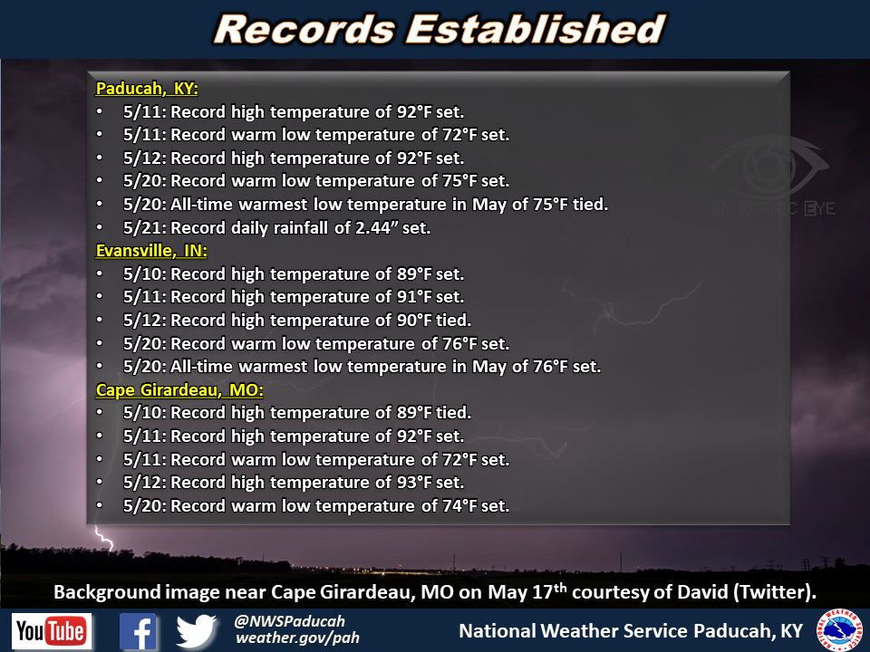
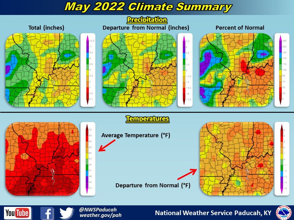
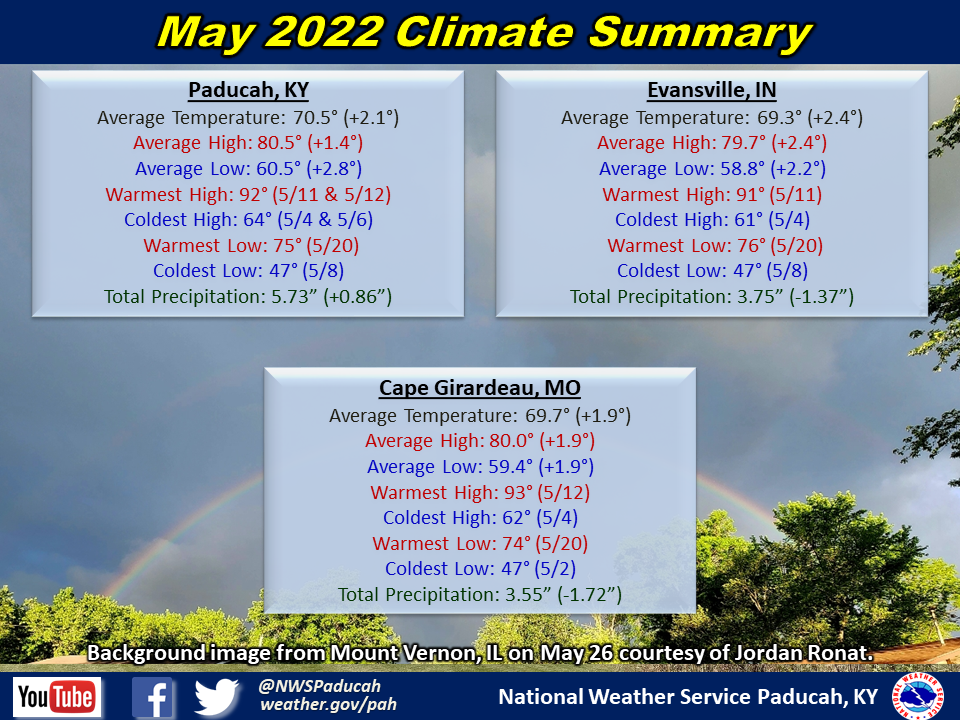
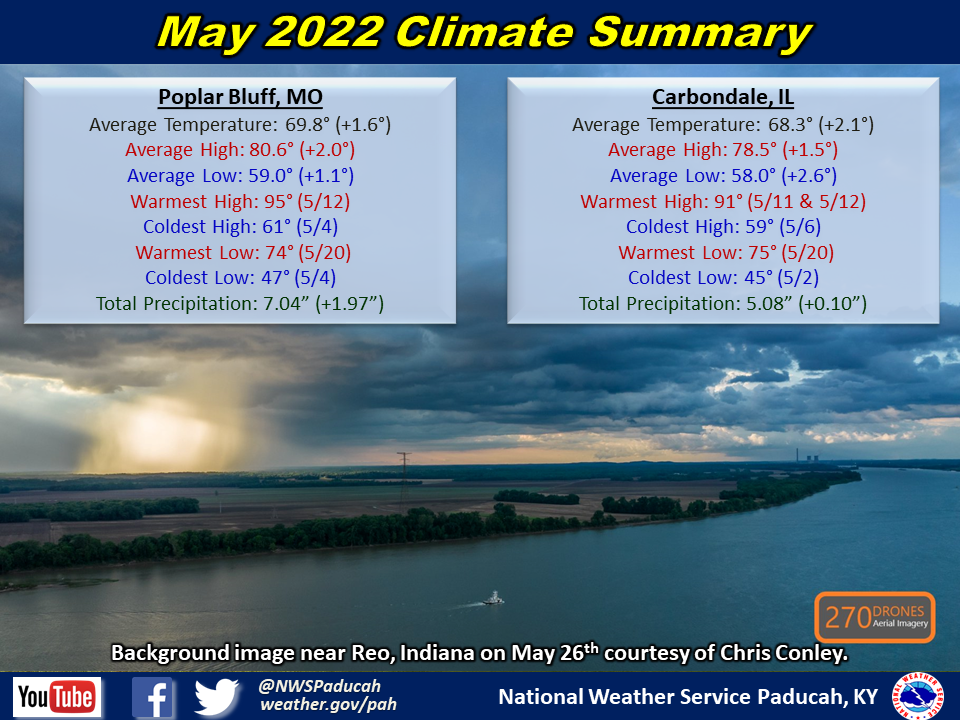
Temperatures averaged around 2 degrees above normal. The first week of the month averaged below normal, concluding with lows falling into the 40s on May 8th. Thereafter, significantly warmer weather arrived with above normal temperatures common from the 9th through the 21st. Numerous record highs were established in the upper 80s to low 90s from May 10-12. Paducah and Evansville also established their warmest low temperatures on record for the month of May of 75 and 76 degrees respectively on May 20th. The pattern flipped during the last 10 days of the month, with readings once again averaging below normal. We did start to warm up again to slightly above normal during the latter half of Memorial Day weekend.
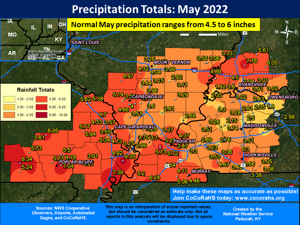
The majority of the region observed a drier than normal May, particularly across much of southern Illinois and western Kentucky. Rainfall deficits of 1 to 3 inches were commonplace, with only 2 to 5" occurring in many areas. Exceptions to the dry month were noted in portions of southwest Indiana north of I-64, far west Kentucky (including Paducah), and across parts of southeast Missouri near the Arkansas border and in the Ozark Foothills. Rainfall amounts exceeded 7" in some of these areas. The highest observed amount was 9.35" at a CoCoRaHS station in Mississippi County Missouri (Anniston, MO 1.9 WNW).
The most notable severe weather event during the month occurred on May 19th, with hail up to baseball size in southwest Indiana and an EF-2 tornado striking the town of Mount Carmel, IL. There were a total of 48 severe thunderstorm and 5 tornado warnings issued during the month. This is slightly below the average for May which is around 70 combined warnings.
| May 2022 Review: Precipitation and Temperature Maps (Click on image to enlarge) |
 |
| Climate Maps are from the Northeast Regional Climate Center |
Monthly Climate Report: Paducah | Evansville | Cape Girardeau | Poplar Bluff | Carbondale