May 2025 Climate Review:
Temperatures finished below normal by 1 to 2 degrees. The diurnal range was less than usual with high temperatures 3 to 4 degrees below normal while lows were actually right near or slightly above normal. The coolest periods were focused around May 3-6 and 23-27 when high temperatures were routinely in the 60s or low 70s and overnight lows fell into the 40s or low to mid 50s. The warmest stretch was from May 11-20 when high temperatures reached the low to mid 80s many of these days. Record warm low temperatures were observed on May 15th at 4 of our 5 long term climate stations with readings only falling into the low 70s. This was the first May since 2003 in which temperatures failed to exceed 85 degrees in Paducah and Cape Girardeau. Typically we average around 6 days above 85 degrees in May.
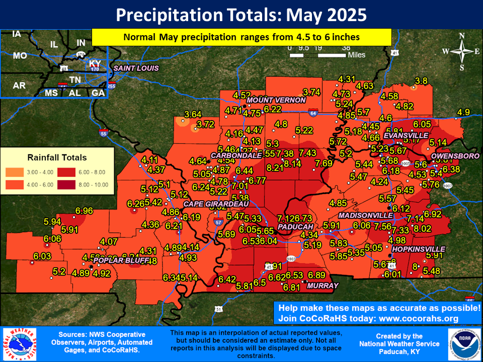
Precipitation was near normal or drier than normal across northern portions of southeast Missouri, and much of southern Illinois. Much of this area received anywhere from 3.5 to 6 inches. Meanwhile, it was a wetter than normal May across portions of southeast Missouri near the Arkansas border, across much of western Kentucky, and a decent chunk of southwest Indiana. There was also a smaller corridor which finished wetter than normal along the Route 13 corridor in southern Illinois. Amounts in these areas ranged from 5 to 8 inches, or anywhere from 0.5 to 3 inches wetter than normal. The highest observed amount in our forecast area was 8.74” at a CoCoRaHS station in Newburgh, Indiana (Newburgh 0.3 SE).
A significant severe thunderstorm and tornado outbreak occurred on the afternoon and evening of May 16th. Large hail ranging from golf ball to softball sized occurred in several locations along with 10 tornadoes (7 of which were strong, rated EF-2 or stronger). An EF-4 tornado struck southern Williamson County Illinois (south of Marion), which was the strongest tornado to impact our forecast area since the December 10, 2021 violent long-track tornado that struck western Kentucky. We also had two EF-3 tornadoes with this event, one that hit north of Sikeston, Missouri and another that touched down just south of Morganfield, Kentucky. Another severe thunderstorm event impacted the region on May 20th, which came in two separate waves. The first occurred during the overnight hours early on the 20th with the second happening in the afternoon. Two tornadoes occurred with this event, including an EF-1 that hit the north side of Cape Girardeau just after 1 AM. There were also scattered reports of wind damage and a few minor flooding reports.
The graphic below is an interpolated monthly rainfall map using actual observations. Please note that there are likely discrepancies in between observations, since the values are estimated based on nearest reports.
| May 2025 Review: Precipitation and Temperature Maps (Click on image to enlarge) |
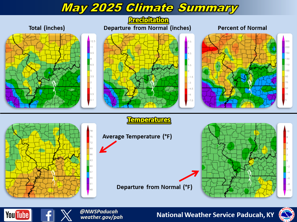 |
| Climate Maps are from the Northeast Regional Climate Center |
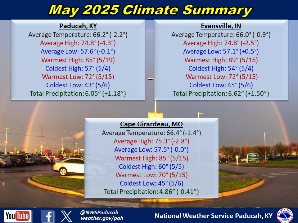
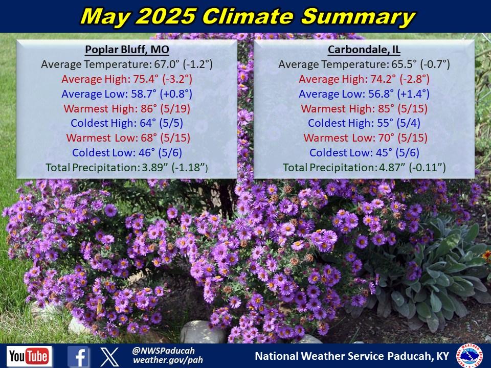
Monthly Climate Report: Paducah | Evansville | Cape Girardeau | Poplar Bluff | Carbondale


