Paducah, KY
Weather Forecast Office
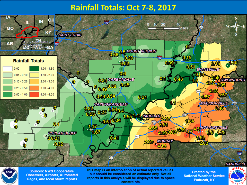
Overview
A frontal boundary moved through on October 7th, resulting in showers and thunderstorms developing along it. The front stalled over western Kentucky during the evening hours before slowly lifting back north overnight. This was due to the remnants of Hurricane Nate lifting northward towards our area. The heaviest rain occurred across western Kentucky associated with the frontal boundary. However, rain associated with the remnants of Nate moved north through the eastern half of the area during the morning and afternoon hours of October 8th, causing additional heavy rain to fall.
 |
Media use of NWS Web News Stories is encouraged! Please acknowledge the NWS as the source of any news information accessed from this site. |
|
FORECASTS
Forecast Discussion
User Defined Area Forecast
Hourly Forecasts
Fire Weather
Activity Planner
LOCAL INFORMATION
Aviation Weather
Our Office
SKYWARN
Items of Interest
Hazardous Weather Support
Local Observations
Weather History
NWS Paducah KY Weekly Partner Briefing
US Dept of Commerce
National Oceanic and Atmospheric Administration
National Weather Service
Paducah, KY
8250 Kentucky Highway 3520
West Paducah, KY 42086-9762
270-744-6440
Comments? Questions? Please Contact Us.