Overview
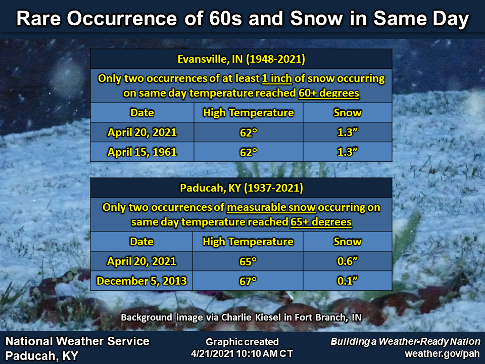
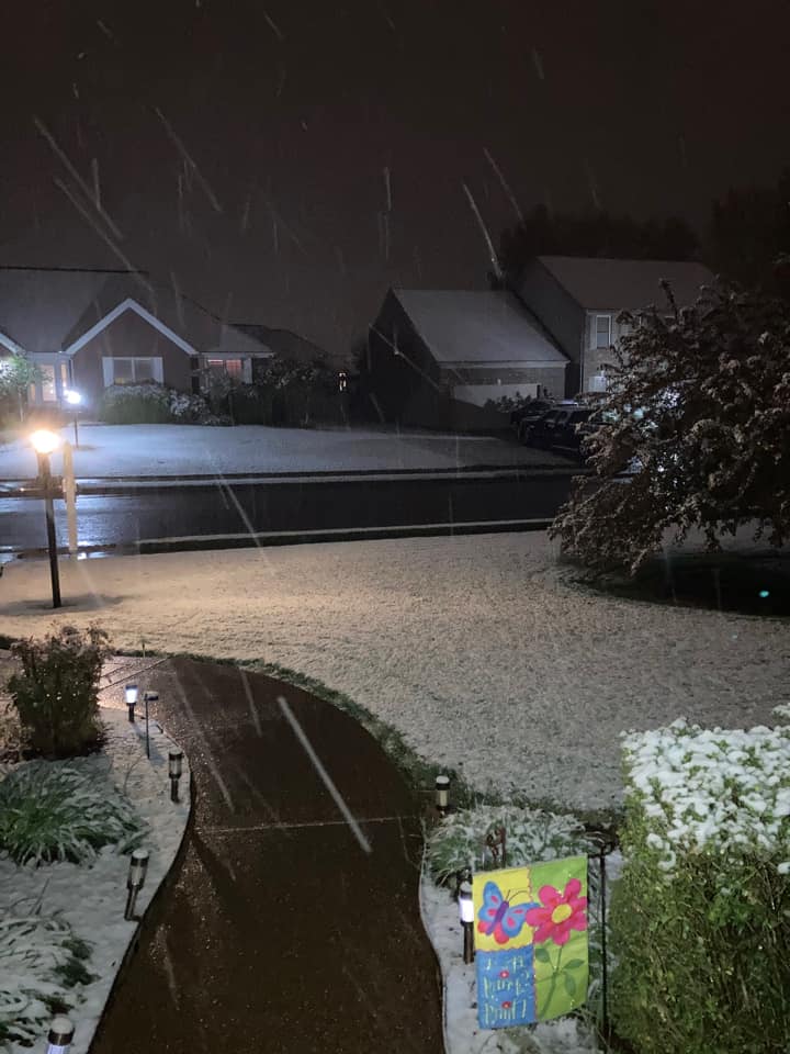
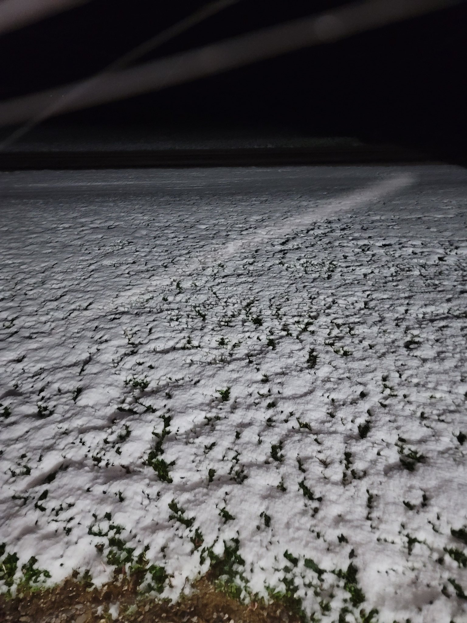
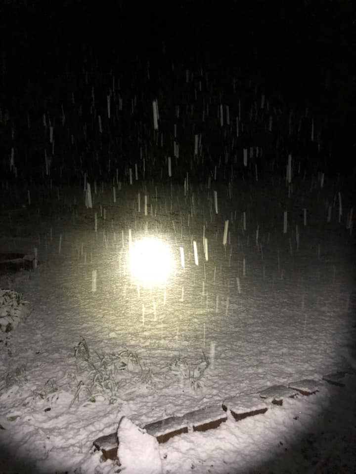
A strong cold front pushed through the region during the afternoon. Temperatures rapidly dropped 25+ degrees within 3 to 4 hours. In Paducah, it was 63 degrees at 4 PM, and by shortly after 7 PM it was snowing. This was a rare snow event for this late in the season. In fact, it was the latest measurable snow on record in Paducah and Evansville (dating back to 1937 and 1948 respectively). Behind the front, a band of rain quickly switched over to snow within 1 or 2 hours of starting at most locations. Despite the warm ground and air temperatures, the snow came down at a moderate to heavy clip to allow accumulations on grassy and elevated surfaces. Most of the region received anywhere from a light dusting to up to a half inch of accumulation. A few locations across southwest Indiana and western Kentucky picked up 1 to 1.5" during the evening. On the morning after, temperatures dropped below freezing across portions of the region. Cape Girardeau, MO set a record low of 29 degrees on April 21. Poplar Bluff, MO tied their record low of 31 degrees on April 21, previously set in 1940. This was tied for the 4th latest freeze on record in Poplar Bluff, dating back to 1897. The city hadn't recorded temperatures below freezing this late in the season since 1944, when they dropped to 31 degrees on May 7.Climate
 |
 |
Photos (Click images to enlarge)
 |
 |
 |
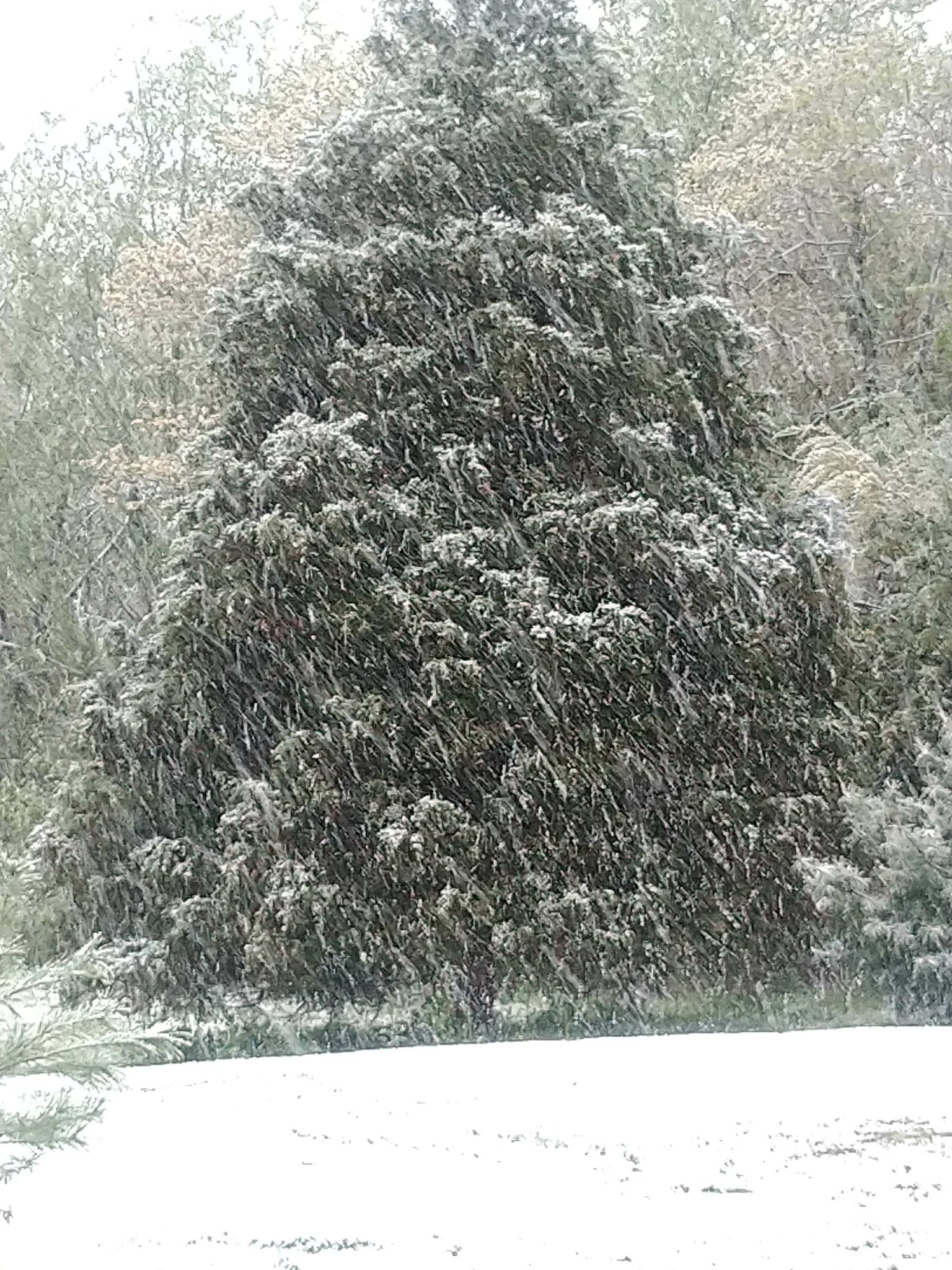 |
| Evansville, IN via Trevor Michels | Santa Claus, IN via Donnie Robinson | Masonville, KY via Audrey Fulkerson | Jackson, MO via Brian Blankenship |
Snow Amounts/Storm Reports
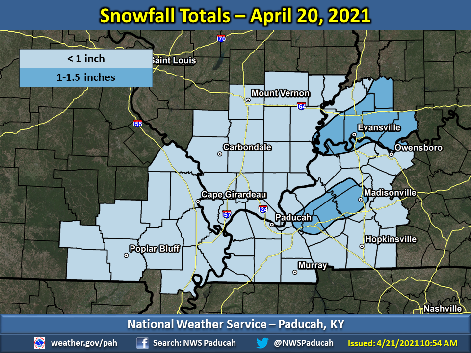 |
PRELIMINARY LOCAL STORM REPORT...SUMMARY
NATIONAL WEATHER SERVICE PADUCAH KY
1049 AM CDT WED APR 21 2021

..TIME...   ...EVENT...      ...CITY LOCATION...     ...LAT.LON...
..DATE...   ....MAG....      ..COUNTY LOCATION..ST.. ...SOURCE....
            ..REMARKS..

0638 AM     SNOW             2 NNE EDDYVILLE         37.10N 88.07W
04/21/2021  M1.4 INCH        LYON               KY   COCORAHS

            COCORAHS STATION KY-LY-2 EDDYVILLE KY 2 NNE.

0100 AM     SNOW             2 NW MELODY HILL        38.04N 87.53W
04/21/2021  M1.3 INCH        VANDERBURGH        IN   OFFICIAL NWS OBS

            OFFICIAL SNOWFALL TOTAL AT EVANSVILLE
            AIRPORT. LATEST MEASURABLE SNOWFALL ON
            RECORD DATING BACK TO JANUARY 1948.

0700 AM     SNOW             4 WNW ROCKPORT          37.90N 87.12W
04/21/2021  M1.3 INCH        SPENCER            IN   COCORAHS

            COCORAHS STATION IN-SP-4 ROCKPORT 4.0 WNW.

0915 PM     SNOW             2 NW MELODY HILL        38.04N 87.53W
04/20/2021  M1.2 INCH        VANDERBURGH        IN   OFFICIAL NWS OBS

            1.2 INCHES OF SNOWFALL MEASURED AT THE
            EVANSVILLE REGIONAL AIRPORT. SNOW DEPTH 0.8
            INCHES AT TIME OF OBSERVATION.

0600 AM     SNOW             1 NE MOUNT VERNON       37.95N 87.88W
04/21/2021  M1.0 INCH        POSEY              IN   CO-OP OBSERVER

            CO-OP OBSERVER STATION MTVI3 MOUNT VERNON
            IN.

0700 AM     SNOW             6 WNW EVANSVILLE        38.02N 87.64W
04/21/2021  M1.0 INCH        VANDERBURGH        IN   COCORAHS

            COCORAHS STATION IN-VN-9 EVANSVILLE IN 5.9
            WNW.

0800 AM     SNOW             2 SSE JUNCTION          37.70N 88.23W
04/21/2021  M1.0 INCH        GALLATIN           IL   COCORAHS

            COCORAHS STATION IL-GL-4 JUNCTION 1.7 SSE.

0645 AM     SNOW             1 SW SANTA CLAUS        38.10N 86.94W
04/21/2021  M0.8 INCH        SPENCER            IN   COCORAHS

            COCORAHS STATION IN-SP-2 SANTA CLAUS IN 1
            WSW.

0600 AM     SNOW             1 ENE PETERSBURG        38.50N 87.26W
04/21/2021  M0.7 INCH        PIKE               IN   COCORAHS

            COCORAHS STATION IN-PK-1 PETERSBURG IN 1
            ENE.

0100 AM     SNOW             2 SE HEATH              37.07N 88.77W
04/21/2021  M0.6 INCH        MCCRACKEN          KY   OFFICIAL NWS OBS

            OFFICIAL SNOWFALL TOTAL FOR PADUCAH, KY
            MEASURED AT NWS PADUCAH. LATEST MEASURABLE
            SNOWFALL ON RECORD DATING BACK TO 1937.

0645 AM     SNOW             3 SW DARMSTADT          38.06N 87.62W
04/21/2021  M0.6 INCH        VANDERBURGH        IN   COCORAHS

            COCORAHS STATION IN-VN-40 EVANSVILLE 6.7 NW.

0855 PM     SNOW             2 W NEWBURGH            37.95N 87.45W
04/20/2021  E0.5 INCH        WARRICK            IN   TRAINED SPOTTER

            REPORTED 1/2 INCH ON CARS.

0900 PM     SNOW             2 SE HEATH              37.07N 88.77W
04/20/2021  M0.5 INCH        MCCRACKEN          KY   OFFICIAL NWS OBS

            0.5 INCHES OF SNOWFALL MEASURED AT NWS
            PADUCAH. SNOW DEPTH OF A TRACE AT TIME OF
            MEASUREMENT.

0929 PM     SNOW             GOREVILLE               37.56N 88.98W
04/20/2021  E0.5 INCH        JOHNSON            IL   PUBLIC

            RELAYED BY MEDIA.

0952 PM     SNOW             EDDYVILLE               37.09N 88.07W
04/20/2021  E0.5 INCH        LYON               KY   TRAINED SPOTTER

            RELAYED BY MEDIA.

0956 PM     SNOW             4 S MARION              37.27N 88.08W
04/20/2021  E0.5 INCH        CRITTENDEN         KY   PUBLIC


1158 PM     SNOW             2 SE HEATH              37.07N 88.77W
04/20/2021  M0.5 INCH        MCCRACKEN          KY   CO-OP OBSERVER

            CO-OP OBSERVER STATION PDHK2 WEST PADUCAH KY
            2 W.

0700 AM     SNOW             9 W EVANSVILLE          37.99N 87.72W
04/21/2021  M0.5 INCH        POSEY              IN   COCORAHS

            COCORAHS STATION IN-PS-6 MOUNT VERNON IN
            10.6 ENE.

0700 AM     SNOW             7 WNW DIX               38.47N 89.07W
04/21/2021  M0.5 INCH        JEFFERSON          IL   COCORAHS

            COCORAHS STATION IL-JF-8 WALNUT HILL IL 1
            WSW.

0900 PM     SNOW             1 W RIDGWAY             37.80N 88.28W
04/20/2021  E0.4 INCH        GALLATIN           IL   PUBLIC


0600 AM     SNOW             10 SSW MOUNT VERNON     37.80N 87.98W
04/21/2021  M0.3 INCH        POSEY              IN   CO-OP OBSERVER

            CO-OP OBSERVER STATION ULDI3 3.3 NW
            UNIONTOWN.

0700 AM     SNOW             HENDERSON               37.83N 87.58W
04/21/2021  M0.2 INCH        HENDERSON          KY   COCORAHS

            COCORAHS STATION KY-HS-1 HENDERSON KY 0.4
            SSW.

0700 AM     SNOW             1 WNW ROUND KNOB        37.26N 88.76W
04/21/2021  M0.2 INCH        MASSAC             IL   COCORAHS

            COCORAHS STATION IL-MC-1 ROUND KNOB IL 1
            WNW.

0800 AM     SNOW             4 NW MOUNT CARMEL       38.45N 87.83W
04/21/2021  M0.2 INCH        WABASH             IL   COCORAHS

            COCORAHS STATION IL-WB-3 MOUNT CARMEL 4.2
            NW.

0929 PM     SNOW             GRAND RIVERS            37.00N 88.24W
04/20/2021  E0.1 INCH        LIVINGSTON         KY   PUBLIC

            MEASURED ON ELEVATED SURFACES.

0700 AM     SNOW             3 NW POSEYVILLE         38.20N 87.82W
04/21/2021  M0.1 INCH        POSEY              IN   COCORAHS

            COCORAHS STATION IN-PS-1 POSEYVILLE IN 2.8
 |
Media use of NWS Web News Stories is encouraged! Please acknowledge the NWS as the source of any news information accessed from this site. |
|

