Overview
A wintry mix of snow and sleet spread across the region during the afternoon and evening hours on January 11th. This was in response to surface low pressure that developed across the TX/OK region. This low would then move eastward and be located over the Missouri Bootheel by early evening on the 12th. Warmer temperatures at the surface and aloft began to move into southeast Missouri and far southern Kentucky during the late evening and early overnight hours on the 11th, with precipitation beginning to change over to rain. By later morning, any lingering precipitation had changed over to rain across the entire region. The heaviest snowfall amounts from this system remained northwest of our region across central portions of Missouri and Illinois. However, there were significant travel impacts during the evening hours and into the overnight hours in our region, as snow covered roads led to numerous accidents. Portions of I-57 and I-64 were even closed for a period of time in southern Illinois.Snow
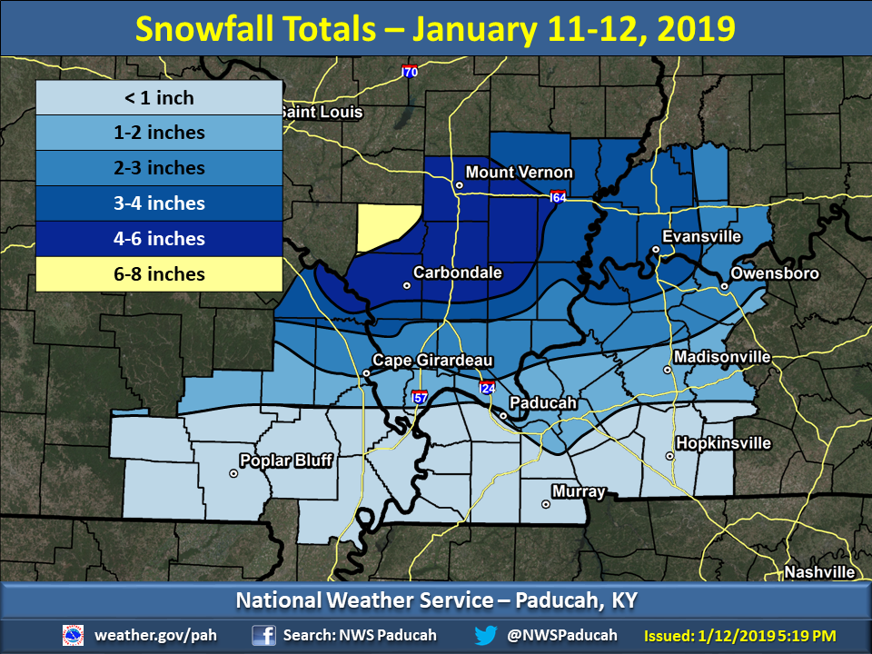
Here are the observed snowfall totals across our region. The bullseye for the event occurred from Perry County Missouri eastward into northern portions of southern Illinois from Carbondale to Mount Vernon and Marion. These locations experienced 4 to 6 inches, with some isolated locations up to 7 inches in Perry County Illinois. Little to no snowfall occurred across our southern counties close to the Arkansas and Tennessee state lines.
The official total in Paducah, KY was 0.6" while Evansville, IN picked up 3.4" at the airport.
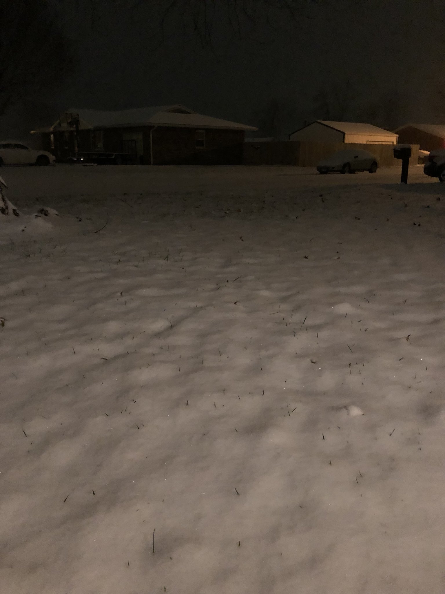
Photos
Here are some pictures sent into us during the storm:
 |
 |
 |
 |
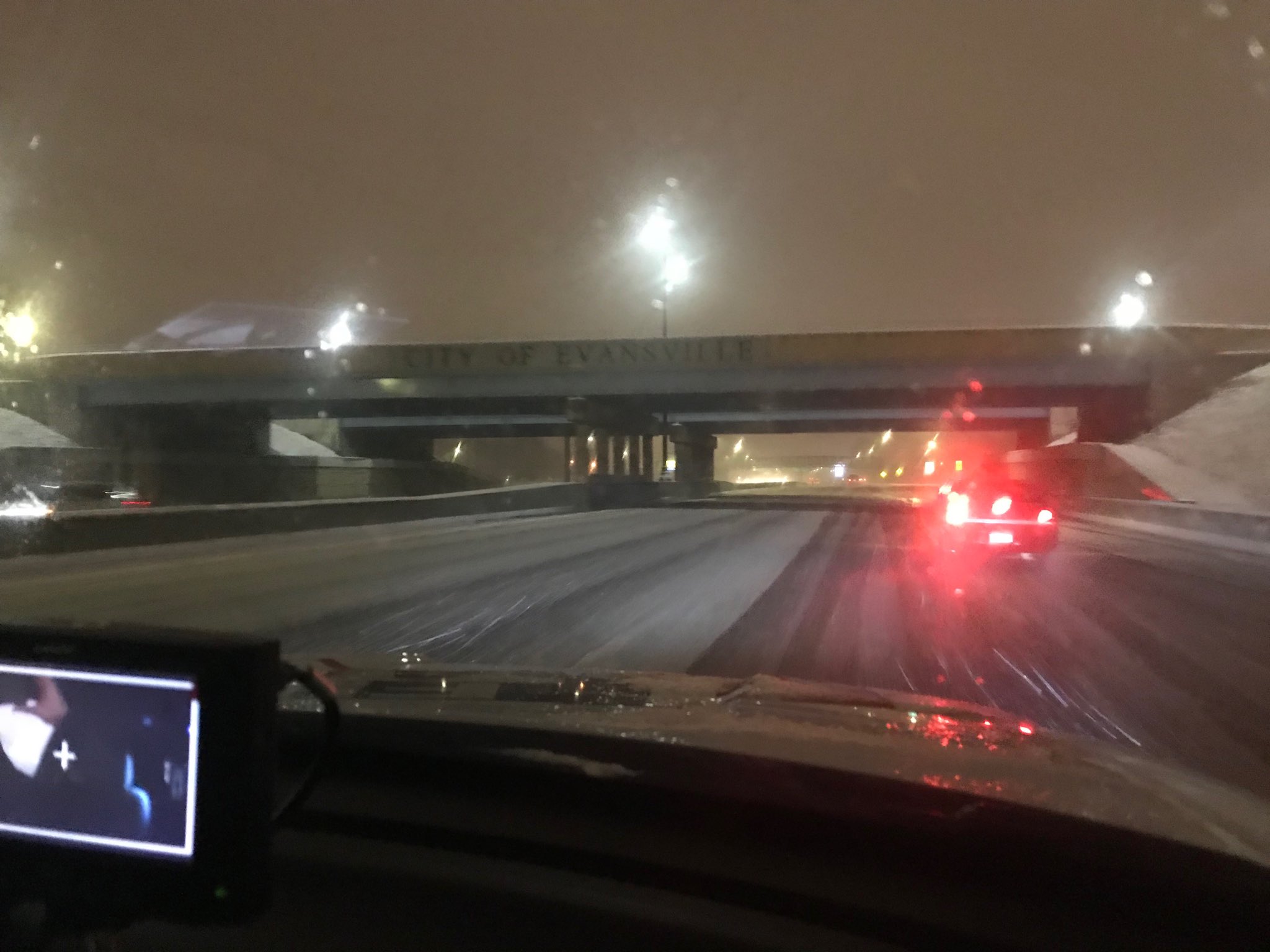
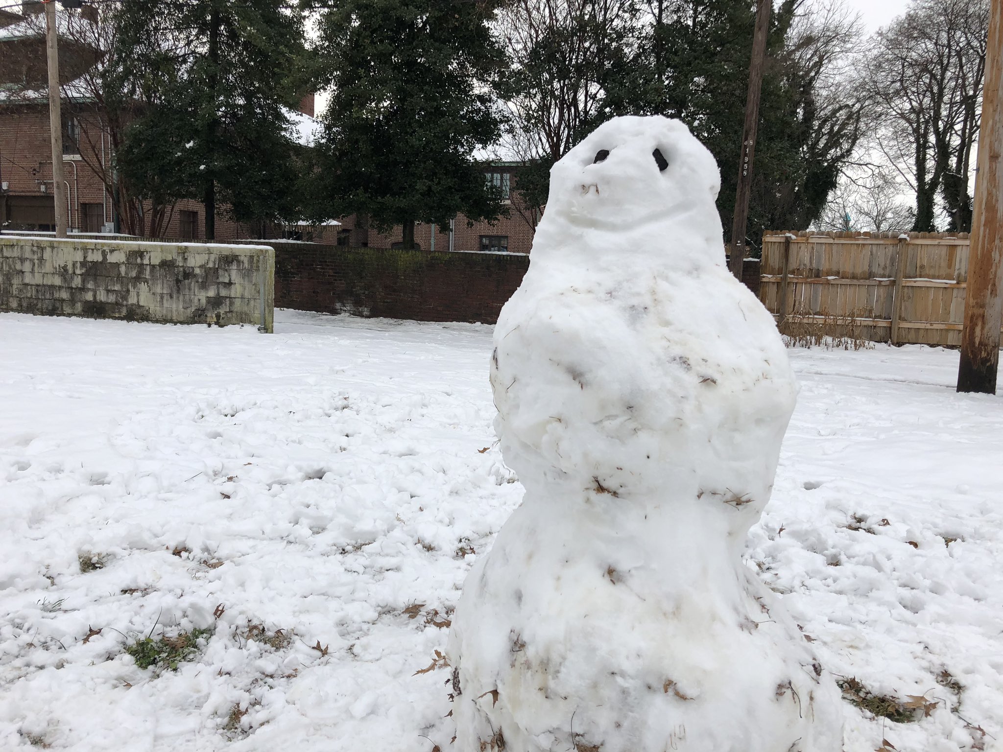
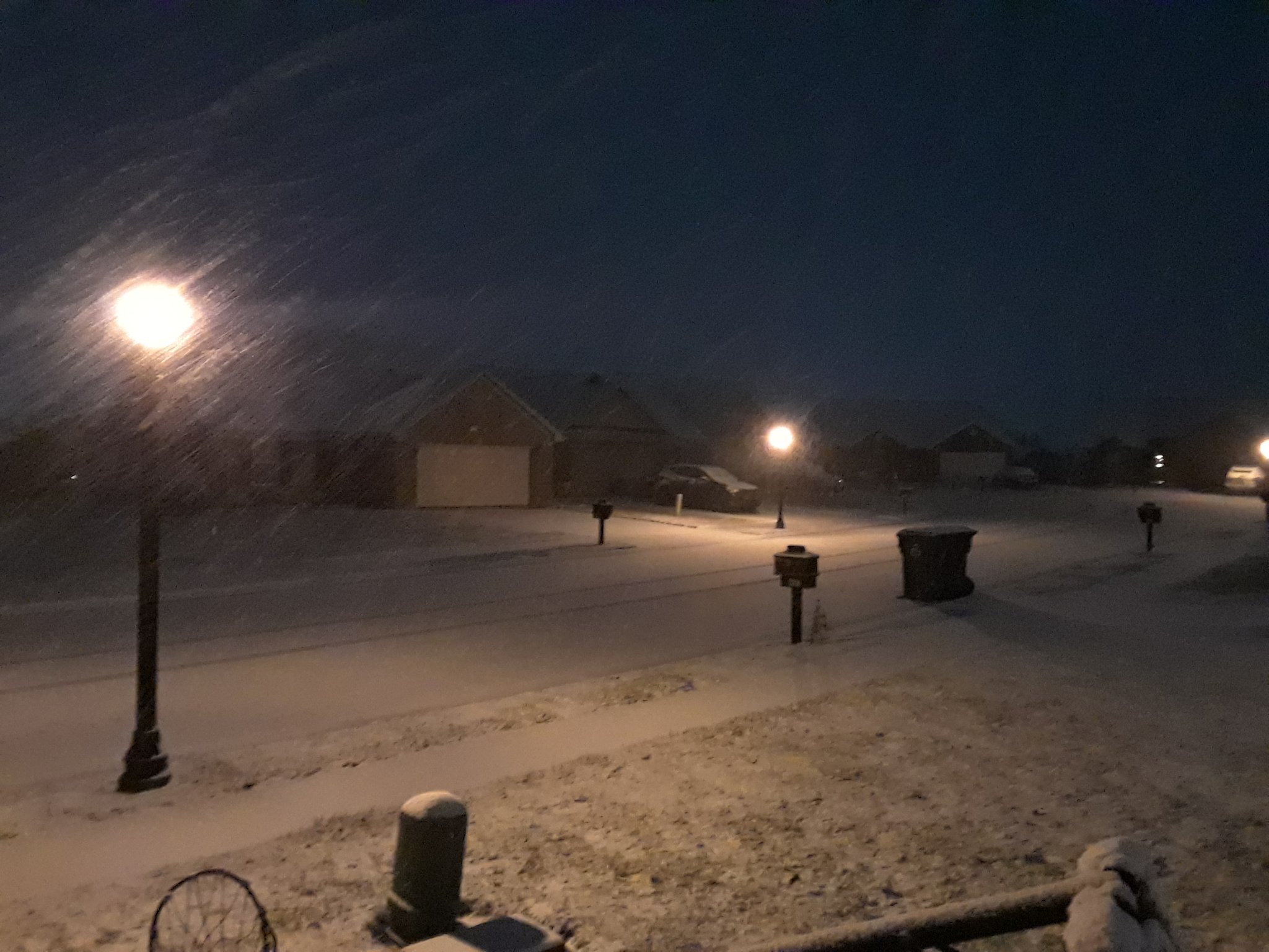
| Snow covered roads in Evansville, IN via Paige Hagan | Snowman - via Cameron Hopman |
Morning after in Marion, IL via Cody Simmerman |
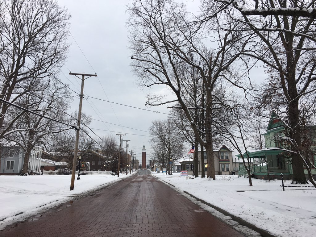
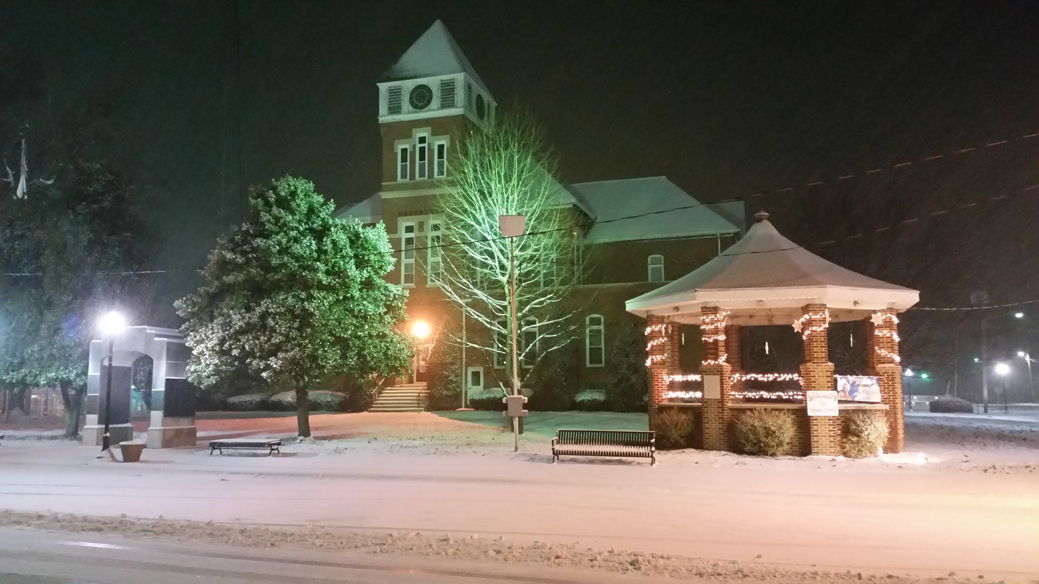
Wayne County IL Courthouse in Fairfield via Derek Dunn |
 |
 |
 |
 |
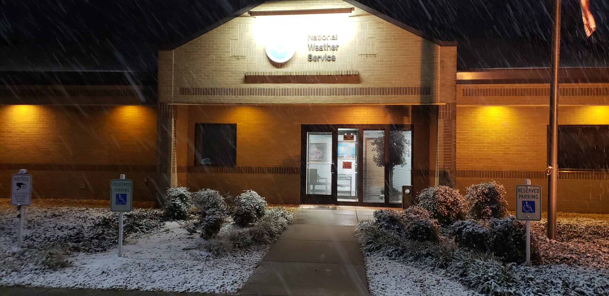
| NWS Paducah office taken during the evening hours. | Perryville, MO area via- Jill Boxdorfer |
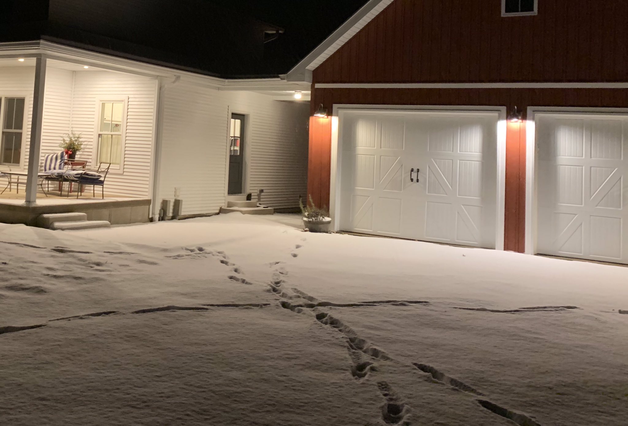
Owensboro, KY area via Tim Crabtree |
Mount Carmel, IL via Jeff Blair |
Storm Reports
Click here for an interactive map of Local Storm Reports
PRELIMINARY LOCAL STORM REPORT...SUMMARY
NATIONAL WEATHER SERVICE PADUCAH KY
1016 AM CST SAT JAN 12 2019

..TIME...   ...EVENT...      ...CITY LOCATION...     ...LAT.LON...
..DATE...   ....MAG....      ..COUNTY LOCATION..ST.. ...SOURCE....
            ..REMARKS..
1000 AM     SNOW             1 NNE BENTON            38.02N 88.91W
01/12/2019  M4.2 INCH        FRANKLIN           IL   COCORAHS
0700 AM SNOW CAVE-IN-ROCK 37.47N 88.17W
01/12/2019 E2.0 INCH HARDIN IL PUBLIC
RELAYED VIA FACEBOOK.
1012 AM SNOW 3 NW POSEYVILLE 38.20N 87.82W
01/12/2019 M3.3 INCH POSEY IN COCORAHS
1011 AM SNOW 1 SW SANTA CLAUS 38.11N 86.94W
01/12/2019 M2.5 INCH SPENCER IN COCORAHS
1004 AM SNOW 5 W WEST FRANKFORT 37.90N 89.02W
01/12/2019 M5.0 INCH FRANKLIN IL CO-OP OBSERVER
IN THE PLUMFIELD COMMUNITY.
0906 AM SNOW MOUNT VERNON 38.32N 88.91W
01/12/2019 M5.0 INCH JEFFERSON IL CO-OP OBSERVER
0902 AM SNOW PERRYVILLE 37.73N 89.87W
01/12/2019 E3.5 INCH PERRY MO PUBLIC
0745 AM HEAVY SNOW 2 NNE MURPHYSBORO 37.79N 89.32W
01/12/2019 M4.1 INCH JACKSON IL COCORAHS
0633 AM SNOW 3 W JONESBORO 37.46N 89.33W
01/12/2019 E2.0 INCH UNION IL PUBLIC
ALONG ROUTE 146 BETWEEN WARE AND JONESBORO
IL.
0547 AM SNOW EVANSVILLE 37.98N 87.54W
01/12/2019 M3.4 INCH VANDERBURGH IN FIRE DEPT/RESCUE
STORM TOTAL AS OF 545 AM. RECORDED ON THE
NORTHSIDE OF TOWN.
0518 AM SNOW PINCKNEYVILLE 38.08N 89.38W
01/12/2019 E7.0 INCH PERRY IL PUBLIC
0300 AM SNOW 5 SW SPOTTSVILLE 37.81N 87.48W
01/12/2019 E3.0 INCH HENDERSON KY PUBLIC
ESTIMATED AT LEAST 3 INCHES OF SNOW IN ZION
KY. RELAYED VIA FACEBOOK.
0200 AM SNOW OWENSBORO 37.76N 87.12W
01/12/2019 E2.5 INCH DAVIESS KY PUBLIC
RELAYED VIA FACEBOOK.
0200 AM SNOW 9 S CARMI 37.96N 88.17W
01/12/2019 E3.5 INCH WHITE IL PUBLIC
AT LEAST 3.5 INCHES. STILL COMING DOWN.
RELAYED VIA FACEBOOK.
0130 AM SNOW PINCKNEYVILLE 38.08N 89.39W
01/12/2019 E7.0 INCH PERRY IL PUBLIC
MEASURED ON FLAT SURFACE (TABLE) ON PATIO.
RELAYED VIA FACEBOOK.
0125 AM SNOW WAVERLY 37.71N 87.81W
01/12/2019 E3.0 INCH UNION KY PUBLIC
ESTIMATED AT LEAST 3 INCHES. REPORTED VIA
FACEBOOK.
0113 AM SNOW PRINCETON 37.11N 87.88W
01/12/2019 E1.5 INCH CALDWELL KY PUBLIC
0102 AM SNOW 1 NNE MADISONVILLE 37.35N 87.50W
01/12/2019 E1.5 INCH HOPKINS KY PUBLIC
NORTH SIDE OF MADIONSVILLE.
0100 AM SNOW FORT BRANCH 38.25N 87.57W
01/12/2019 M3.0 INCH GIBSON IN TRAINED SPOTTER
1259 AM SNOW MOUNT CARMEL 38.42N 87.77W
01/12/2019 E4.0 INCH WABASH IL PUBLIC
1258 AM SNOW 5 WSW EVANSVILLE 37.97N 87.64W
01/12/2019 E4.0 INCH VANDERBURGH IN PUBLIC
1250 AM SNOW 6 W EVANSVILLE 37.99N 87.68W
01/12/2019 M3.7 INCH VANDERBURGH IN TRAINED SPOTTER
SNOWFALL TOTAL. SNOW HAS STOPPED.
1227 AM SNOW 2 N HERRIN 37.83N 89.03W
01/12/2019 M4.0 INCH WILLIAMSON IL NWS EMPLOYEE
1215 AM SNOW DAHLGREN 38.20N 88.68W
01/12/2019 E5.1 INCH HAMILTON IL PUBLIC
1205 AM SNOW 2 N HERRIN 37.83N 89.03W
01/12/2019 M4.0 INCH WILLIAMSON IL NWS EMPLOYEE
1205 AM SNOW 2 N EVANSVILLE 38.01N 87.54W
01/12/2019 M4.0 INCH VANDERBURGH IN NWS EMPLOYEE
1200 AM SNOW PRINCETON 38.36N 87.57W
01/12/2019 E2.0 INCH GIBSON IN PUBLIC
JUST UNDER 2 INCHES AT WRAY RADIO STATION.
1131 PM SNOW HEBBARDSVILLE 37.78N 87.39W
01/11/2019 M2.1 INCH HENDERSON KY TRAINED SPOTTER
1129 PM SNOW 3 SE EVANSVILLE 37.95N 87.52W
01/11/2019 E3.5 INCH VANDERBURGH IN PUBLIC
SNOW IS STILL FALLING MODERATELY ON THE SE
SIDE OF EVANSVILLE, IN. TWO MILES NORTH OF
THE I69 CORRIDOR.
1120 PM SNOW 1 NNW MOUNT VERNON 38.33N 88.92W
01/11/2019 E3.0 INCH JEFFERSON IL TRAINED SPOTTER
1110 PM SNOW 6 S MARION 37.74N 88.93W
01/11/2019 M4.5 INCH WILLIAMSON IL PUBLIC
1100 PM SNOW 2 NNE HENDERSON 37.87N 87.57W
01/11/2019 M3.1 INCH HENDERSON KY BROADCAST MEDIA
1055 PM SNOW RIDGWAY 37.80N 88.27W
01/11/2019 E1.8 INCH GALLATIN IL PUBLIC
1053 PM SNOW DIX 38.44N 88.94W
01/11/2019 M2.5 INCH JEFFERSON IL PUBLIC
1045 PM SNOW 1 E HERRIN 37.80N 89.01W
01/11/2019 M4.3 INCH WILLIAMSON IL COCORAHS
SNOWFALL OVER PAST 5 HOURS. WET SNOW.
1045 PM SNOW DE SOTO 37.82N 89.23W
01/11/2019 M4.7 INCH JACKSON IL COCORAHS
COCORAHS STATION 0.3 ESE OF DE SOTO.
1045 PM SNOW 2 E PHILPOT 37.73N 86.95W
01/11/2019 E2.2 INCH DAVIESS KY PUBLIC
1045 PM SNOW 4 W NEWBURGH 37.95N 87.47W
01/11/2019 M2.9 INCH VANDERBURGH IN TRAINED SPOTTER
NEAR ANGEL MOUNDS. STILL MODERATE TO HEAVY
SNOW AT REPORT.
1038 PM SNOW AVA 37.89N 89.50W
01/11/2019 E5.0 INCH JACKSON IL PUBLIC
1030 PM SNOW MOUNT CARMEL 38.42N 87.76W
01/11/2019 M3.0 INCH WABASH IL TRAINED SPOTTER
1020 PM SNOW WADESVILLE 38.11N 87.79W
01/11/2019 E2.0 INCH POSEY IN PUBLIC
AT LEAST 2 INCHES OF SNOW. STILL SNOWING.
1020 PM SNOW CENTRAL CITY 37.30N 87.13W
01/11/2019 E1.0 INCH MUHLENBERG KY PUBLIC
1015 PM SNOW DAHLGREN 38.20N 88.68W
01/11/2019 E4.0 INCH HAMILTON IL PUBLIC
MEASURED SNOWFALL SO FAR IS 4 INCHES STILL
SNOWING LIGHTLY; HAD EASED UP SIGNIFICANTLY
LAST HOUR BUT IS BEGINNING TO PICKUP AGAIN
SLIGHTLY.
1015 PM SNOW METROPOLIS 37.16N 88.72W
01/11/2019 M1.3 INCH MASSAC IL NWS EMPLOYEE
ROADS WET, BUT NOT SNOW COVERED. GRASSY AND
ELEVATED AREAS SNOW COVERED.
1006 PM SNOW TAMAROA 38.14N 89.23W
01/11/2019 E5.0 INCH PERRY IL BROADCAST MEDIA
1002 PM SNOW THOMPSONVILLE 37.92N 88.76W
01/11/2019 M5.0 INCH FRANKLIN IL TRAINED SPOTTER
1000 PM SNOW 2 NNE HENDERSON 37.87N 87.57W
01/11/2019 M2.7 INCH HENDERSON KY BROADCAST MEDIA
1000 PM SNOW GOREVILLE 37.56N 88.97W
01/11/2019 E2.0 INCH JOHNSON IL PUBLIC
1000 PM SNOW 6 W EVANSVILLE 37.99N 87.68W
01/11/2019 M2.9 INCH VANDERBURGH IN TRAINED SPOTTER
0936 PM SNOW GALATIA 37.85N 88.61W
01/11/2019 E4.0 INCH SALINE IL PUBLIC
0933 PM SNOW 2 WNW JACKSON 37.39N 89.69W
01/11/2019 M2.8 INCH CAPE GIRARDEAU MO TRAINED SPOTTER
0931 PM SNOW 1 NNE PADUCAH 37.08N 88.63W
01/11/2019 M1.1 INCH MCCRACKEN KY NWS EMPLOYEE
REPORTED BY OFF-DUTY NWS EMPLOYEE.
0930 PM SNOW GOLCONDA 37.37N 88.49W
01/11/2019 E3.0 INCH POPE IL PUBLIC
0930 PM SNOW KUTTAWA 37.06N 88.11W
01/11/2019 E2.0 INCH LYON KY TRAINED SPOTTER
0930 PM SNOW 2 NNE MADISONVILLE 37.36N 87.50W
01/11/2019 E1.0 INCH HOPKINS KY PUBLIC
ABOUT AN INCH ON DECK. ROADS ARE COVERED
INCLUDING PARKWAY.
0930 PM SNOW 3 ESE GOREVILLE 37.53N 88.92W
01/11/2019 M3.0 INCH JOHNSON IL TRAINED SPOTTER
REPORT NEAR EXIT 7 ON I-24 ALONG TUNNEL HILL
ROAD.
0929 PM SNOW NEW COLUMBIA 37.31N 88.78W
01/11/2019 E2.5 INCH MASSAC IL PUBLIC
0920 PM SNOW ALTENBURG 37.64N 89.58W
01/11/2019 E4.0 INCH PERRY MO EMERGENCY MNGR
0915 PM SNOW 2 W OWENSBORO 37.76N 87.14W
01/11/2019 E1.0 INCH DAVIESS KY TRAINED SPOTTER
REPORTED OFF HWY 56 2 MILES WEST OF
OWENSBORO.
0910 PM SNOW MOUNT CARMEL 38.42N 87.76W
01/11/2019 M2.1 INCH WABASH IL TRAINED SPOTTER
ROADS ARE COVERED. MODERATE SNOW AT THIS
TIME.
0905 PM SNOW COBDEN 37.54N 89.26W
01/11/2019 E2.8 INCH UNION IL PUBLIC
0900 PM SNOW 2 NNE HENDERSON 37.86N 87.57W
01/11/2019 M2.1 INCH HENDERSON KY BROADCAST MEDIA
0855 PM SNOW BUCKNER 37.98N 89.02W
01/11/2019 E5.0 INCH FRANKLIN IL PUBLIC
0853 PM SNOW NEWBURGH 37.95N 87.41W
01/11/2019 M1.5 INCH WARRICK IN PUBLIC
LIGHT TO MODERATE SNOW FALLING WITH ALL
ROADS SNOW COVERED.
0852 PM SNOW 4 W NEWBURGH 37.95N 87.47W
01/11/2019 M1.9 INCH VANDERBURGH IN TRAINED SPOTTER
NEAR ANGEL MOUNDS. SNOWING MODERATE TO HEAVY
AT TIME OF REPORT.
0845 PM SNOW 4 SE MARION 37.74N 88.94W
01/11/2019 E4.0 INCH WILLIAMSON IL PUBLIC
0837 PM SNOW 5 S CARBONDALE 37.70N 89.22W
01/11/2019 E4.0 INCH JACKSON IL PUBLIC
0837 PM SNOW BELLE PRAIRIE CITY 38.22N 88.55W
01/11/2019 E2.3 INCH HAMILTON IL TRAINED SPOTTER
0833 PM SNOW MARION 37.73N 88.93W
01/11/2019 M3.3 INCH WILLIAMSON IL BROADCAST MEDIA
0830 PM SNOW 2 WSW EVANSVILLE 37.97N 87.57W
01/11/2019 M1.4 INCH VANDERBURGH IN PUBLIC
MEASURED AT WEVV IN DOWNTOWN.
0824 PM SNOW VIENNA 37.42N 88.88W
01/11/2019 M2.0 INCH JOHNSON IL LAW ENFORCEMENT
MEASURED AT THE SHERIFFS OFFICE. ROADS VERY
SLICK. AT LEAST 10-15 VEHICLES HAVE SLID OFF
THE ROAD.
0821 PM SNOW DUQUOIN 37.99N 89.34W
01/11/2019 E5.0 INCH PERRY IL PUBLIC
0815 PM SNOW 6 W EVANSVILLE 37.99N 87.54W
01/11/2019 M1.2 INCH VANDERBURGH IN TRAINED SPOTTER
0813 PM SNOW EDDYVILLE 37.08N 88.08W
01/11/2019 E1.0 INCH LYON KY TRAINED SPOTTER
MAINLY ON ELEVATED SURFACES.
0800 PM SNOW HENDERSON 37.84N 87.58W
01/11/2019 M1.2 INCH HENDERSON KY BROADCAST MEDIA
0755 PM SNOW MOUNT CARMEL 38.42N 87.76W
01/11/2019 M1.1 INCH WABASH IL TRAINED SPOTTER
0747 PM SNOW 3 W NEWBURGH 37.95N 87.46W
01/11/2019 M1.0 INCH VANDERBURGH IN TRAINED SPOTTER
0745 PM SNOW 2 E CHRISTOPHER 37.97N 89.02W
01/11/2019 M4.0 INCH FRANKLIN IL TRAINED SPOTTER
0730 PM SNOW ELDORADO 37.82N 88.44W
01/11/2019 E2.0 INCH SALINE IL PUBLIC
0730 PM SNOW 5 SSW MOUNT VERNON 38.25N 88.95W
01/11/2019 M3.3 INCH JEFFERSON IL COCORAHS
SNOW IN THE PAST 6.5 HOURS.
0730 PM SNOW MOUNT VERNON 38.32N 88.91W
01/11/2019 M2.0 INCH JEFFERSON IL PUBLIC
SNOW MEASURED ON THE NORTH SIDE OF MT.
VERNON. ROADS VERY SLICK.
0715 PM SNOW DE SOTO 37.82N 89.23W
01/11/2019 M3.5 INCH JACKSON IL COCORAHS
3.5 INCHES IN PAST 3 HOURS. COCORAHS
LOCATION 0.3 ESE OF DE SOTO. MODERATE SNOW
FALLING AT THIS TIME.
0715 PM SNOW MARION 37.33N 88.08W
01/11/2019 E1.0 INCH CRITTENDEN KY DEPT OF HIGHWAYS
0700 PM SNOW 4 SSE MCBRIDE 37.78N 89.81W
01/11/2019 E3.0 INCH PERRY MO TRAINED SPOTTER
0654 PM SNOW DU QUOIN 38.01N 89.24W
01/11/2019 M4.0 INCH PERRY IL EMERGENCY MNGR
0653 PM SNOW CAPE GIRARDEAU 37.31N 89.55W
01/11/2019 M1.8 INCH CAPE GIRARDEAU MO BROADCAST MEDIA
0609 PM SNOW 1 SE CARBONDALE 37.72N 89.21W
01/11/2019 M2.5 INCH JACKSON IL TRAINED SPOTTER
CORRECTS PREVIOUS SNOW REPORT FROM 1 SE
CARBONDALE.
0604 PM SNOW AVA 37.89N 89.50W
01/11/2019 E2.5 INCH JACKSON IL PUBLIC
0550 PM SNOW MARION 37.74N 88.94W
01/11/2019 M1.0 INCH WILLIAMSON IL PUBLIC
0500 PM SNOW DU QUOIN 38.01N 89.24W
01/11/2019 E1.5 INCH PERRY IL PUBLIC
 |
Media use of NWS Web News Stories is encouraged! Please acknowledge the NWS as the source of any news information accessed from this site. |
|

