Overview
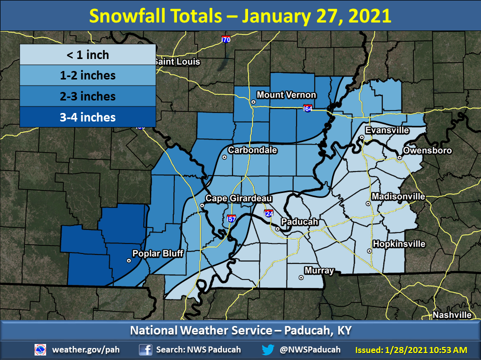
Snow began in southeast Missouri during the early to mid morning hours, before spreading eastward across the rest of the region through the early afternoon. Highest amounts were focused across the Ozark Foothills of southeast Missouri, aided by the earlier start time of the snow and colder air and ground temperatures. Further east, the snow began around midday or early afternoon, when air and ground temperatures had already warmed well above freezing. This made it difficult for snow to accumulate, and what did manage to stick melted rather quickly after the snow ended for areas of western Kentucky, far southern Illinois, and parts of southwest Indiana.Snow
Here are the observed snowfall totals from yesterday's event, based on reports we have received. Courtesy of the warm ground temperatures, snow melted pretty quickly after it stopped in many areas. Highest amounts were focused across the Missouri Ozark Foothills, where 3 to 4 inch amounts were reported in the Poplar Bluff and Van Buren areas. In Paducah we officially observed 0.7” and in Evansville 0.4”. Click here for an interactive map of reported amounts.
 |
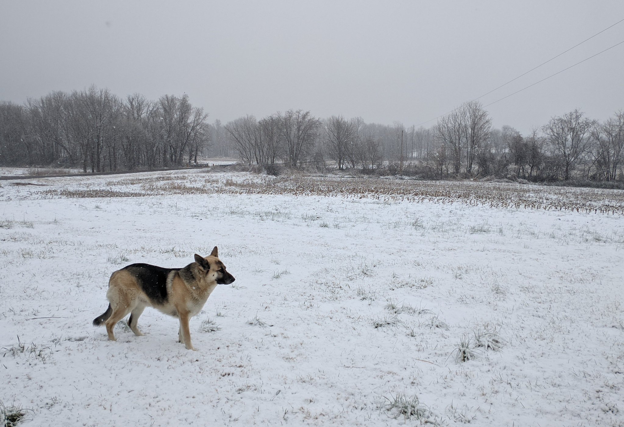
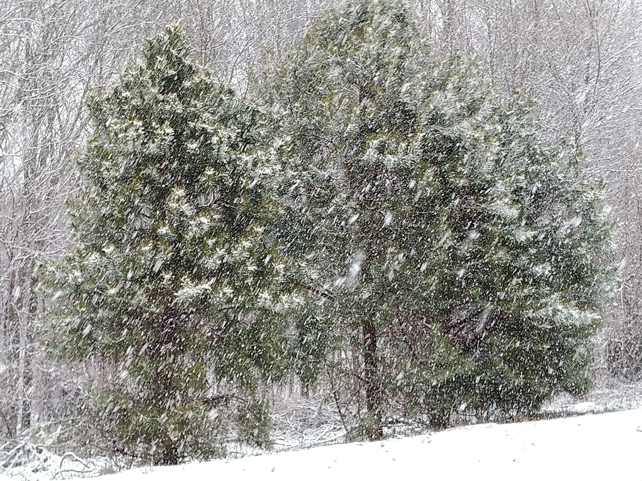
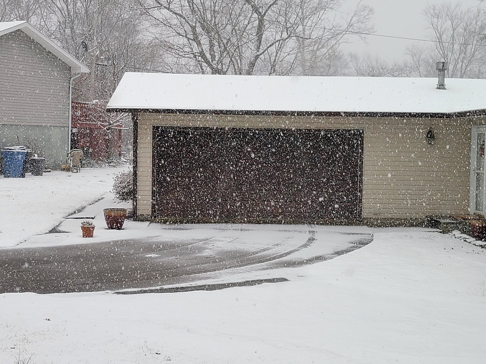
Photos
 |
 |
 |
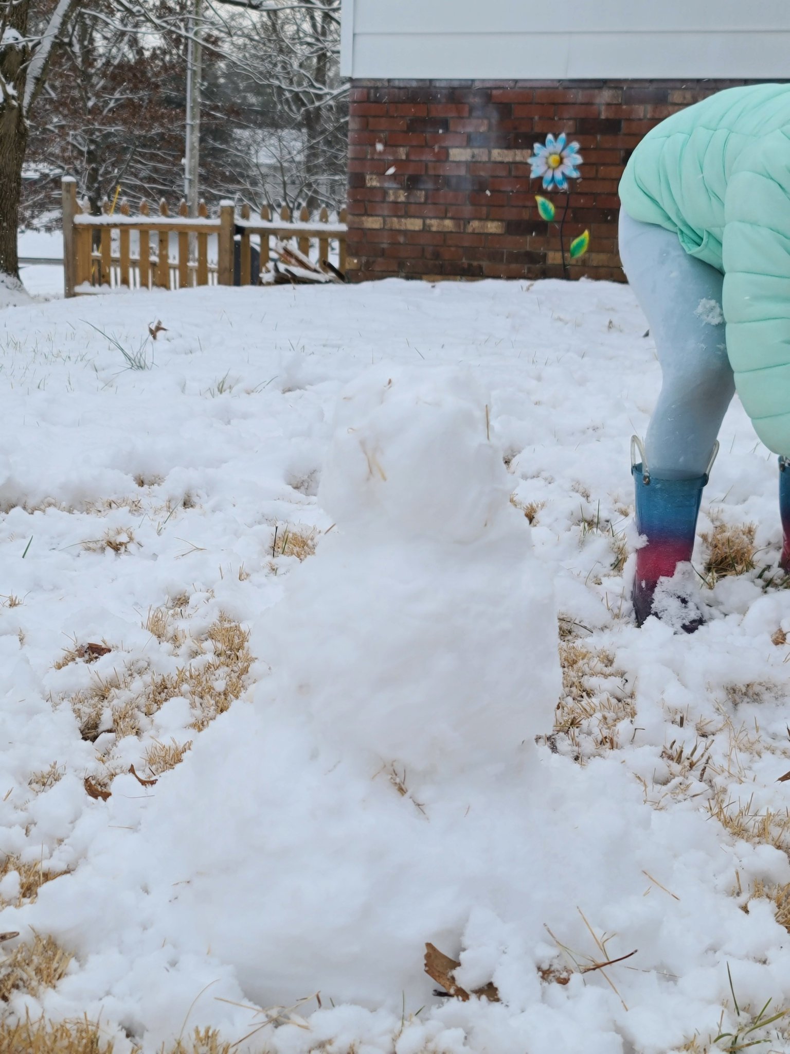 |
| Ballard County KY courtesy of Michael Copeland | Jackson, MO courtesy of Brian Blankenship | Mount Vernon, IL courtesy of Jordan Ronat | Mount Vernon, IL courtesy of Jordan Ronat |
Storm Reports
PRELIMINARY LOCAL STORM REPORT...SUMMARY
NATIONAL WEATHER SERVICE PADUCAH KY
1103 AM CST THU JAN 28 2021

..TIME...   ...EVENT...      ...CITY LOCATION...     ...LAT.LON...
..DATE...   ....MAG....      ..COUNTY LOCATION..ST.. ...SOURCE....
            ..REMARKS..

0700 AM     SNOW             2 SE PATTERSON          37.17N 90.52W
01/28/2021  M2.5 INCH        WAYNE              MO   COCORAHS

            COCORAHS STATION MO-WY-1 PATTERSON MO 2.0
            SE.

1149 AM     SNOW             DUDLEY                  36.80N 90.09W
01/27/2021  M2.0 INCH        STODDARD           MO   TRAINED SPOTTER

            1 TO 1.5 INCHES IN THE PAST 40 MINUTES.

0700 AM     SNOW             1 E SCOTT CITY          37.22N 89.52W
01/28/2021  M1.5 INCH        SCOTT              MO   COCORAHS

            STORM TOTAL SNOWFALL. COCORAHS STATION
            MO-SC-5 SCOTT CITY MO 0.9 E.

0700 AM     SNOW             8 WSW GRANDIN           36.80N 90.97W
01/28/2021  M3.7 INCH        RIPLEY             MO   COCORAHS

            COCORAHS STATION MO-RP-7 DONIPHAN MO 14.5
            NW.

0443 PM     SNOW             DONIPHAN                36.62N 90.82W
01/27/2021  M2.0 INCH        RIPLEY             MO   BROADCAST MEDIA

            CORRECTS PREVIOUS SNOW REPORT FROM DONIPHAN
            FOR SOURCE OF REPORT. PUBLIC REPORTED AND
            RELAYED TO NWS THROUGH MEDIA.

1137 AM     SNOW             5 NNW OXLY              36.67N 90.71W
01/27/2021  M3.2 INCH        RIPLEY             MO   TRAINED SPOTTER


0700 AM     SNOW             2 WNW PERRYVILLE        37.73N 89.92W
01/28/2021  M1.0 INCH        PERRY              MO   CO-OP OBSERVER

            STORM TOTAL SNOWFALL. CO-OP OBSERVER STATION
            PRRM7 PERRYVILLE MO WATER PLANT.

0805 AM     SNOW             4 N VAN BUREN           37.07N 91.01W
01/28/2021  M3.5 INCH        CARTER             MO   PUBLIC

            STORM TOTAL SNOWFALL. RELAYED VIA FACEBOOK.

1043 AM     SNOW             ELLSINORE               36.93N 90.75W
01/27/2021  E3.0 INCH        CARTER             MO   TRAINED SPOTTER

            ROADS ARE SNOW COVERED.

1015 AM     SNOW             VAN BUREN               37.00N 91.01W
01/27/2021  M2.8 INCH        CARTER             MO   EMERGENCY MNGR


0731 AM     SNOW             2 N CAPE GIRARDEAU      37.34N 89.54W
01/28/2021  M1.3 INCH        CAPE GIRARDEAU     MO   COCORAHS

            STORM TOTAL SNOWFALL. COCORAHS STATION
            MO-CG-13 CAPE GIRARDEAU MO 2 N.

0133 PM     SNOW             JACKSON                 37.38N 89.65W
01/27/2021  M1.5 INCH        CAPE GIRARDEAU     MO   TRAINED SPOTTER

            SNOW ENDED. ROADS SNOW COVERED.

0103 PM     SNOW             2 W CAPE GIRARDEAU      37.31N 89.58W
01/27/2021  M2.3 INCH        CAPE GIRARDEAU     MO   BROADCAST MEDIA

            CORRECTS PREVIOUS SNOW REPORT FROM 2 W CAPE
            GIRARDEAU.

1202 PM     SNOW             POPLAR BLUFF            36.76N 90.41W
01/27/2021  M3.5 INCH        BUTLER             MO   EMERGENCY MNGR


0402 PM     SNOW             2 SE HEATH              37.07N 88.77W
01/27/2021  M0.7 INCH        MCCRACKEN          KY   OFFICIAL NWS OBS

            MOST SNOW HAS MELTED, STILL SEEING SOME
            FLURRIES.

0700 AM     SNOW             HENDERSON               37.83N 87.58W
01/28/2021  M0.2 INCH        HENDERSON          KY   COCORAHS

            STORM TOTAL SNOWFALL. COCORAHS STATION
            KY-HS-1 HENDERSON KY 0.4 SSW.

0700 AM     SNOW             4 N BELL CITY           36.59N 88.51W
01/28/2021  M1.0 INCH        GRAVES             KY   COCORAHS

            STORM TOTAL SNOWFALL. COCORAHS STATION
            KY-GV-4 FARMINGTON 5.6 S.

0700 AM     SNOW             3 NNW CROFTON           37.09N 87.50W
01/28/2021  M0.1 INCH        CHRISTIAN          KY   CO-OP OBSERVER

            STORM TOTAL SNOWFALL. CO-OP OBSERVER STATION
            CRFK2 CROFTON 3 N.

0234 PM     SNOW             MURRAY                  36.61N 88.31W
01/27/2021  M0.3 INCH        CALLOWAY           KY   CO-OP OBSERVER

            ROADS JUST WET.

0700 AM     SNOW             1.25 SSE LA CENTER      37.06N 88.97W
01/28/2021  M1.3 INCH        BALLARD            KY   TRAINED SPOTTER

            RELAYED VIA TWITTER. STORM TOTAL SNOWFALL.

0700 AM     SNOW             NEWBURGH                37.94N 87.40W
01/28/2021  M0.5 INCH        WARRICK            IN   COCORAHS

            STORM TOTAL SNOWFALL. COCORAHS STATION
            IN-WK-25 NEWBURGH 0.3 SE.

0700 AM     SNOW             2 SE CHANDLER           38.02N 87.35W
01/28/2021  M1.0 INCH        WARRICK            IN   COCORAHS

            STORM TOTAL SNOWFALL. COCORAHS STATION
            IN-WK-22 BOONVILLE IN 4.5 WSW.

0715 AM     SNOW             3 SW DARMSTADT          38.06N 87.62W
01/28/2021  M1.0 INCH        VANDERBURGH        IN   COCORAHS

            STORM TOTAL SNOWFALL. COCORAHS STATION
            IN-VN-40 EVANSVILLE 6.7 NW.

0700 AM     SNOW             6 W DARMSTADT           38.07N 87.69W
01/28/2021  M0.8 INCH        VANDERBURGH        IN   COCORAHS

            STORM TOTAL SNOWFALL. COCORAHS STATION
            IN-VN-31 EVANSVILLE IN 10 NW.

0700 AM     SNOW             6 WNW EVANSVILLE        38.02N 87.64W
01/28/2021  M0.7 INCH        VANDERBURGH        IN   COCORAHS

            STORM TOTAL SNOWFALL. COCORAHS STATION
            IN-VN-9 EVANSVILLE IN 5.9 WNW.

1003 PM     SNOW             5 SE EVANSVILLE         37.93N 87.48W
01/27/2021  M0.4 INCH        VANDERBURGH        IN   TRAINED SPOTTER

            0.4" IN ANGEL MOUNDS, MAINLY ON GRASS, WET
            ROADS.

0715 AM     SNOW             1 SW SANTA CLAUS        38.10N 86.94W
01/28/2021  M1.4 INCH        SPENCER            IN   COCORAHS

            STORM TOTAL SNOWFALL. COCORAHS STATION
            IN-SP-2 SANTA CLAUS IN 1 WSW.

0700 AM     SNOW             4 WNW ROCKPORT          37.90N 87.12W
01/28/2021  M0.6 INCH        SPENCER            IN   COCORAHS

            STORM TOTAL SNOWFALL. COCORAHS STATION
            IN-SP-4 ROCKPORT 4.0 WNW.

0700 AM     SNOW             3 NW POSEYVILLE         38.20N 87.82W
01/28/2021  M1.5 INCH        POSEY              IN   COCORAHS

            STORM TOTAL SNOWFALL. COCORAHS STATION
            IN-PS-1 POSEYVILLE IN 2.8 NW.

0700 AM     SNOW             9 W EVANSVILLE          37.99N 87.72W
01/28/2021  M1.1 INCH        POSEY              IN   COCORAHS

            STORM TOTAL SNOWFALL. COCORAHS STATION
            IN-PS-6 MOUNT VERNON IN 10.6 ENE.

0700 AM     SNOW             1.4 ENE PETERSBURG      38.50N 87.26W
01/28/2021  M1.8 INCH        PIKE               IN   COCORAHS

            STORM TOTAL SNOWFALL AT COCORAHS STATION
            IN-PK-1.

0800 AM     SNOW             1 SW CRAINVILLE         37.74N 89.08W
01/28/2021  M1.5 INCH        WILLIAMSON         IL   COCORAHS

            STORM TOTAL SNOWFALL. COCORAHS STATION
            IL-WM-14 , IL.

0103 PM     SNOW             CARTERVILLE             37.76N 89.08W
01/27/2021  E1.0 INCH        WILLIAMSON         IL   PUBLIC


1000 AM     SNOW             CARMI                   38.09N 88.17W
01/28/2021  M2.8 INCH        WHITE              IL   CO-OP OBSERVER

            STORM TOTAL SNOWFALL.

0800 AM     SNOW             4 NW MOUNT CARMEL       38.45N 87.83W
01/28/2021  M1.0 INCH        WABASH             IL   COCORAHS

            STORM TOTAL SNOWFALL. COCORAHS STATION
            IL-WB-3 MOUNT CARMEL 4.2 NW.

0700 AM     SNOW             MOUNT CARMEL            38.42N 87.77W
01/28/2021  U1.8 INCH        WABASH             IL   TRAINED SPOTTER

            STORM TOTAL OF 1.75 INCHES. RELAYED VIA
            TWITTER.

0700 AM     SNOW             1 SSE COBDEN            37.52N 89.25W
01/28/2021  M1.8 INCH        UNION              IL   COCORAHS

            STORM TOTAL SNOWFALL. COCORAHS STATION
            IL-UN-6 COBDEN IL 0.8 SSE.

0155 PM     SNOW             2 E WARE                37.45N 89.37W
01/27/2021  M1.8 INCH        UNION              IL   PUBLIC


0700 AM     SNOW             2 N PINCKNEYVILLE       38.10N 89.38W
01/28/2021  M1.2 INCH        PERRY              IL   CO-OP OBSERVER

            STORM TOTAL SNOWFALL. CO-OP OBSERVER STATION
            PNKI2 PINCKNEYVILLE IL 2 N.

0225 PM     SNOW             CUTLER                  38.03N 89.57W
01/27/2021  M2.5 INCH        PERRY              IL   TRAINED SPOTTER


0117 PM     SNOW             DU QUOIN                38.01N 89.24W
01/27/2021  E1.0 INCH        PERRY              IL   TRAINED SPOTTER

            ROADS COVERED.

0700 AM     SNOW             3 WNW HAMLETSBURG       37.16N 88.50W
01/28/2021  M0.4 INCH        MASSAC             IL   COCORAHS

            STORM TOTAL SNOWFALL. COCORAHS STATION
            IL-MC-3 BROOKPORT IL 7 ENE.

0152 PM     SNOW             METROPOLIS              37.16N 88.72W
01/27/2021  M0.5 INCH        MASSAC             IL   NWS EMPLOYEE

            ELEVATED SURFACES COVERED, ROADS JUST WET.

0800 AM     SNOW             4 NW BONNIE             38.25N 88.95W
01/28/2021  M1.8 INCH        JEFFERSON          IL   COCORAHS

            STORM TOTAL SNOWFALL. COCORAHS STATION
            IL-JF-10 MOUNT VERNON 5.2 SSW.

0800 AM     SNOW             2 SW MOUNT VERNON       38.30N 88.94W
01/28/2021  M2.4 INCH        JEFFERSON          IL   PUBLIC

            STORM TOTAL SNOWFALL. RELAYED VIA FACEBOOK.

0323 PM     SNOW             MOUNT VERNON            38.32N 88.91W
01/27/2021  M2.0 INCH        JEFFERSON          IL   TRAINED SPOTTER


0700 AM     SNOW             1 W CARBONDALE          37.72N 89.24W
01/28/2021  M1.5 INCH        JACKSON            IL   COCORAHS

            STORM TOTAL SNOWFALL. COCORAHS STATION
            IL-JK-24 CARBONDALE IL 1.2 W.

0800 AM     SNOW             2 SW THOMPSONVILLE      37.90N 88.78W
01/28/2021  M2.0 INCH        FRANKLIN           IL   CO-OP OBSERVER

            STORM TOTAL SNOWFALL. CO-OP OBSERVER STATION
            WFRI2 1.5 SW THOMPSONVILLE.

0730 AM     SNOW             1 NNE BENTON            38.02N 88.91W
01/28/2021  M2.0 INCH        FRANKLIN           IL   COCORAHS

            STORM TOTAL SNOWFALL. COCORAHS STATION
            IL-FK-6 BENTON IL 1 NE.

0800 AM     SNOW             1 SW TAMMS              37.23N 89.28W
01/28/2021  E1.1 INCH        ALEXANDER          IL   PUBLIC

            STORM TOTAL SNOWFALL. RELAYED VIA FACEBOOK.
 |
Media use of NWS Web News Stories is encouraged! Please acknowledge the NWS as the source of any news information accessed from this site. |
|

