Spring Seasonal Summary (March 1st through May 31st): Wondering what happened to spring this year? We are too. Maybe we drew the wrong card from the community chest...
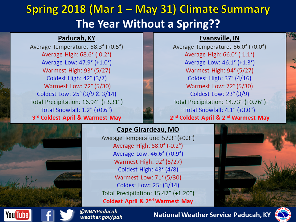
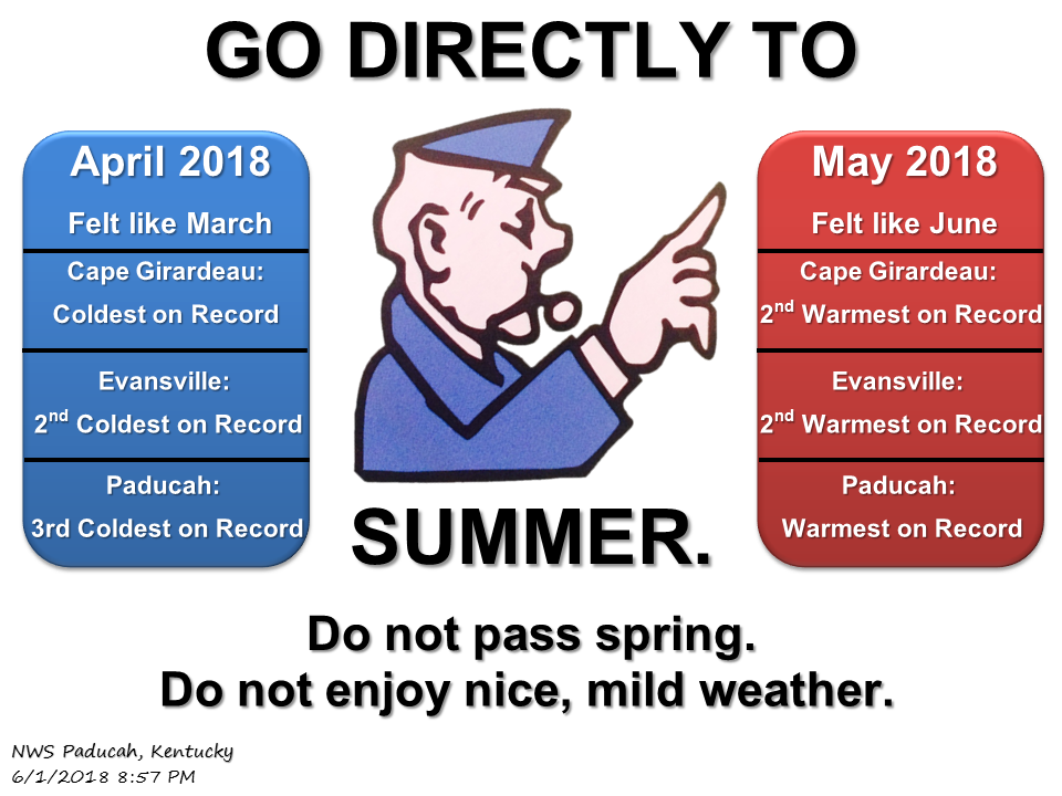
Despite temperatures averaging near normal across the Heartland for the season, this spring was anything but normal when you look at the individual months. March was the only month that was anywhere near what you would typically expect, with temperatures averaging slightly below normal. As we progressed into April, many of the days felt like we were still in March! In fact, it was one of the coldest April’s on record across the area, with some locations experiencing their coldest April on record. We even had measurable snow in April for the first time since 1983 for several communities. Then May 1st came, and temperatures suddenly warmed up quite abruptly! A flip in the weather pattern resulted in above normal temperatures occurring on every single day of the month of May. The end result was one of the warmest May’s on record across the region. Paducah was one of many cities that experienced their warmest May on record. It literally felt more like you would expect in June! So essentially we flipped the switch and went straight from March to June, skipping April and May and all the nice mild weather that typically occurs in those months. 2018: The year without a spring? It sure felt like it!
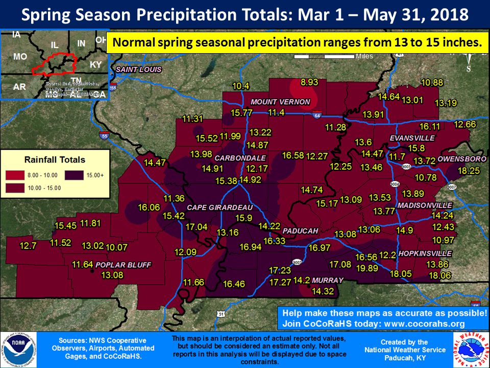
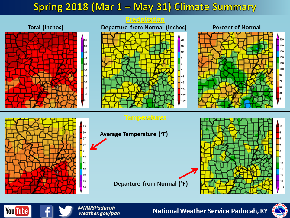
As far as precipitation, it was generally a wet spring for a large portion of the region. This was particularly the case from Perry and Jackson County Illinois southeastward into the Jackson Purchase area of western Kentucky and also across much of southwest Indiana and into far northwest Kentucky. There were some locations that were drier than normal, including across much of the Missouri Ozark Counties (Carter, Ripley, Wayne) and up along the I-64 corridor in Illinois. Portions of Wayne and Jefferson Counties in Illinois observed less than 10 inches for the season, compared to many locations observing 14 to 17 inches.
Seasonal snowfall was generally above normal across the region. Many locations even observed measurable snow in April for the first time since 1983, including Paducah.
 |
| Spring 2018 Review: Precipitation and Temperature Maps (CLICK TO ENLARGE IMAGE) |
 |
| Climate Maps are from the Northeast Regional Climate Center |