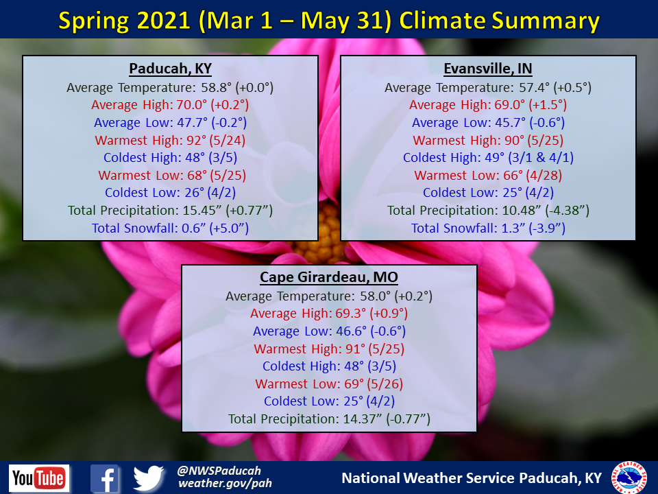
Spring 2021 Climate Summary: Temperatures averaged near normal. We started the spring on a warm note with temperatures averaging 5 to 6 degrees above normal in March. April finished near to slightly below normal and then May finished with temperatures around 3 degrees below normal.
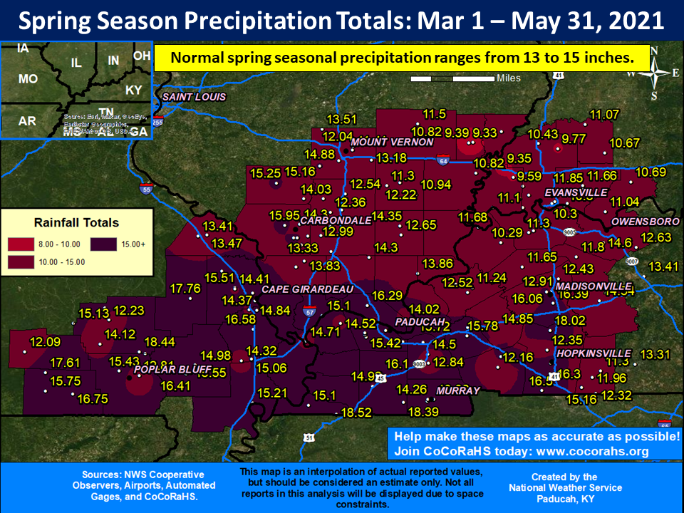
Spring precipitation was wetter than normal across a large chunk of the region. This included much of southeast Missouri, western Kentucky, and areas along and west of I-57 in southern Illinois. Many locations received 1 to 4 inches above their normal spring precipitation totals. The Evansville Tri-state area into the Wabash River Valley and far northwest Kentucky were the exception to the wet conditions, with seasonal precipitation deficits of 1 to 4 inches common in these areas.
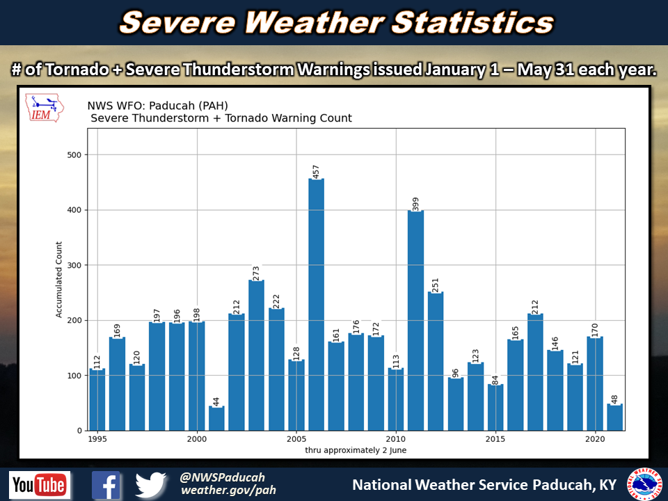
Spring 2021 experienced an abnormally low amount of severe thunderstorms. We have only issued 48 combined severe thunderstorm and tornado warnings so far this year. The only year since 1995 that we issued fewer warnings through June 1st was back in 2001, when 44 were issued up to this point. Typically, we average around 150 to 180 warnings issued each year through June 1st.
The graphic below is an interpolated rainfall map using actual observations. Please note that there are likely discrepancies in between observations, since the values are estimated based on nearest reports.
| Spring 2021 Review: Precipitation and Temperature Maps (Click on image to enlarge) |
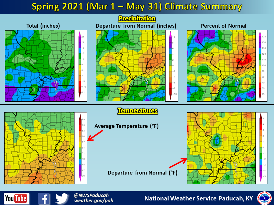 |
| Climate Maps are from the Northeast Regional Climate Center |