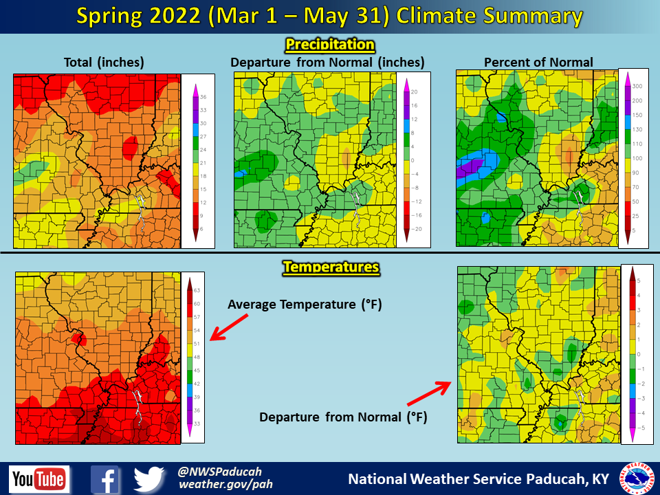
Spring 2022 Climate Summary: Temperatures averaged around 1 degree above normal. The warmest months compared to normal were March and May, both of which averaged above normal by around 1.5 to 2 degrees. Meanwhile, April finished 1 to 2 degrees below normal.
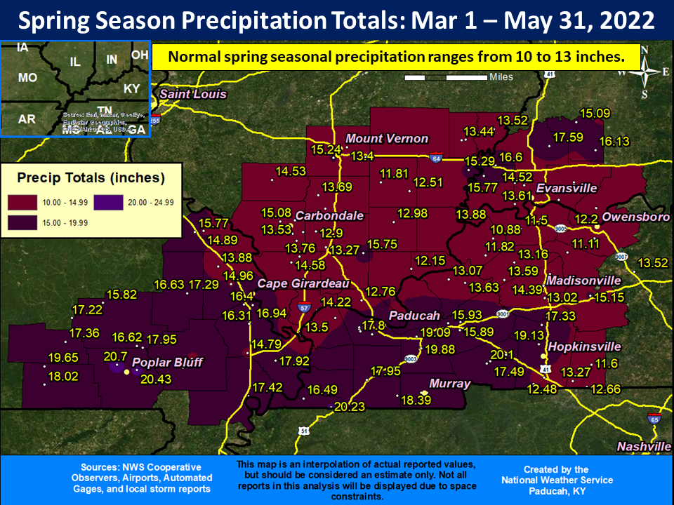
Precipitation was wetter than normal across much of western Kentucky, southeast Missouri, and parts of southwest Indiana along and north of I-64. The wettest corridor was confined to counties along the Arkansas and Tennessee border which observed amounts of 4 to 6 inches above normal. Meanwhile, much of southern Illinois, far northwest Kentucky, and locations near the Ohio River in southwest Indiana registered precipitation amounts that were near or slightly drier than normal. March tended to be the wettest month compared to average across the northern half of the region, while April was the wettest across southern portions of the region. Meanwhile, May was the driest month compared to average for a decent chunk of the region. The highest amount observed during the season was 20.70" at a CoCoRaHS station 4.2 miles northwest of Poplar Bluff, MO.
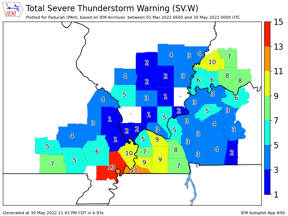
We issued a combined total of 118 severe thunderstorm and tornado warnings for our 58 county forecast area during the spring. This was a bit below the average number of 155 warnings for the spring season.
The graphic below is an interpolated rainfall map using actual observations. Please note that there are likely discrepancies in between observations, since the values are estimated based on nearest reports.
| Spring 2022 Review: Precipitation and Temperature Maps (Click on image to enlarge) |
 |
| Climate Maps are from the Northeast Regional Climate Center |
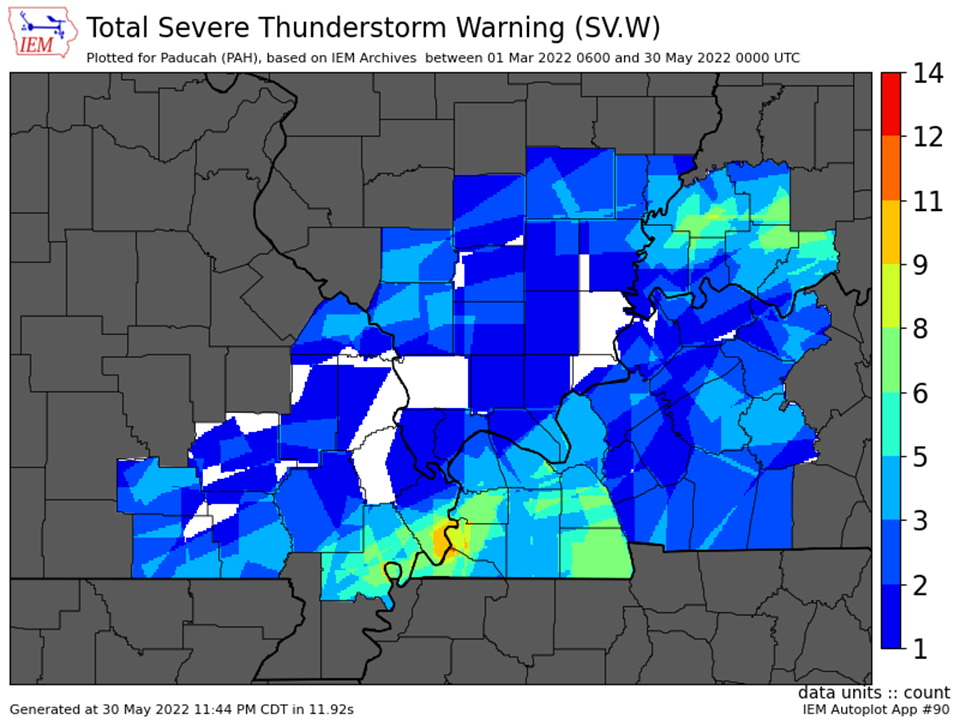
| Severe Thunderstorm Warnings - County Based | Severe Thunderstorm Warnings - Polygon Based |
 |
 |
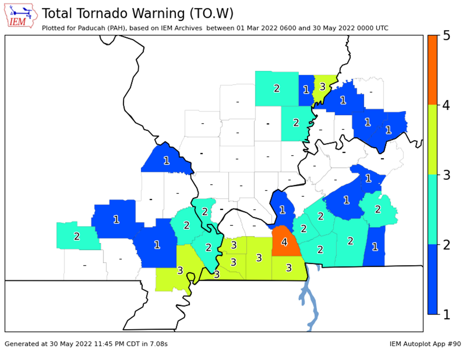
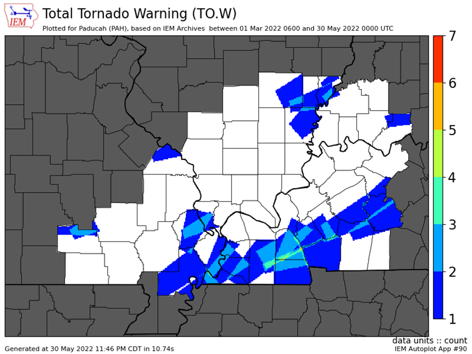
| Tornado Warnings - County Based | Tornado Warnings - Polygon Based |
 |
 |

