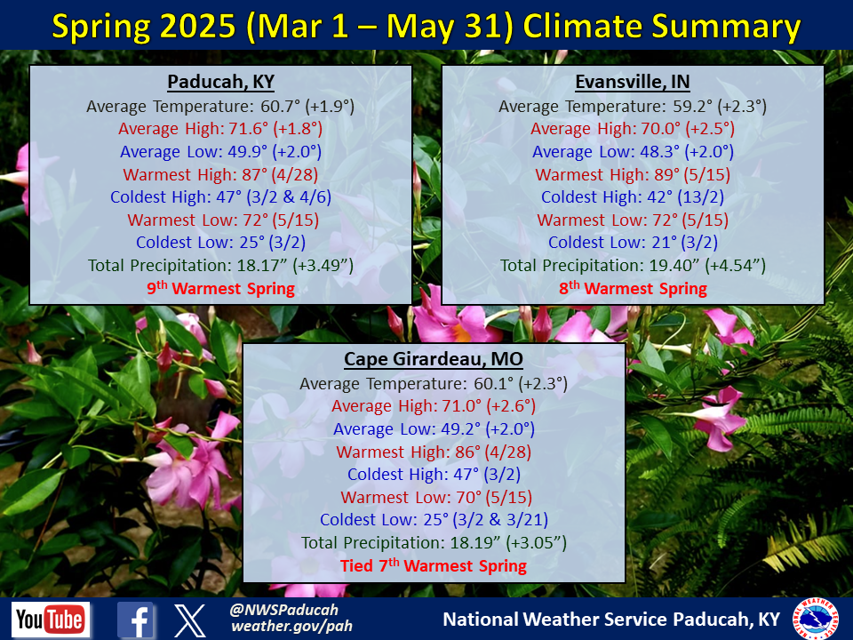
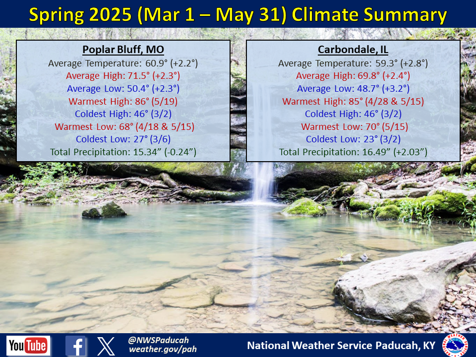
Spring 2025 Climate Summary:
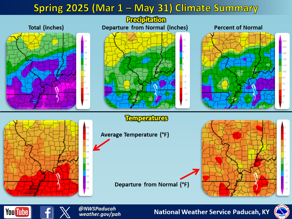
Temperatures averaged above normal by 2 to 2.5 degrees. This resulted in a top 10 warmest spring in Paducah, Evansville, and Cape Girardeau. Both March and April averaged above normal, while May was below normal. Several locations registered a top 5 warmest March as temperatures were 5 to 6 degrees above normal. April averaged about 2 to 3 degrees above normal. We then flipped the switch with temperatures 1 to 2 degrees below normal in May.
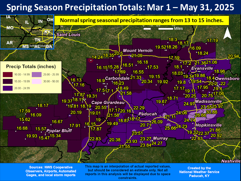
Precipitation finished much wetter than normal across our 4 state region. Most locations observed amounts anywhere from 15 to 25 inches, which was 2 to 10 inches above normal. A few locations exceeded 25 inches across west Kentucky. The highest observed amount in our forecast area was 30.86” at a CoCoRaHS station in Muhlenberg County (Greenville 6.2 WSW).
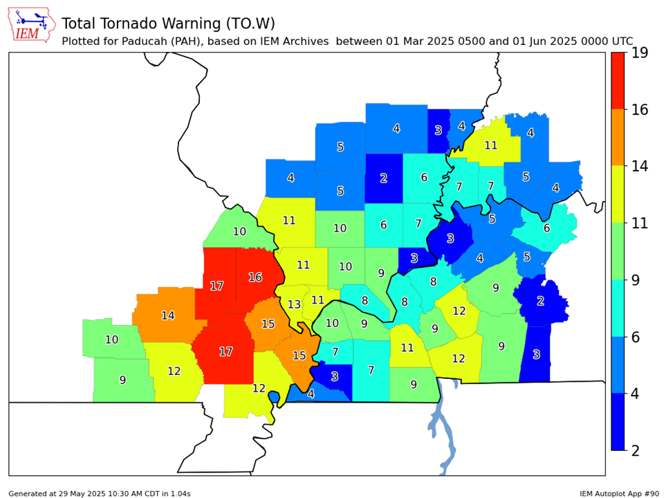
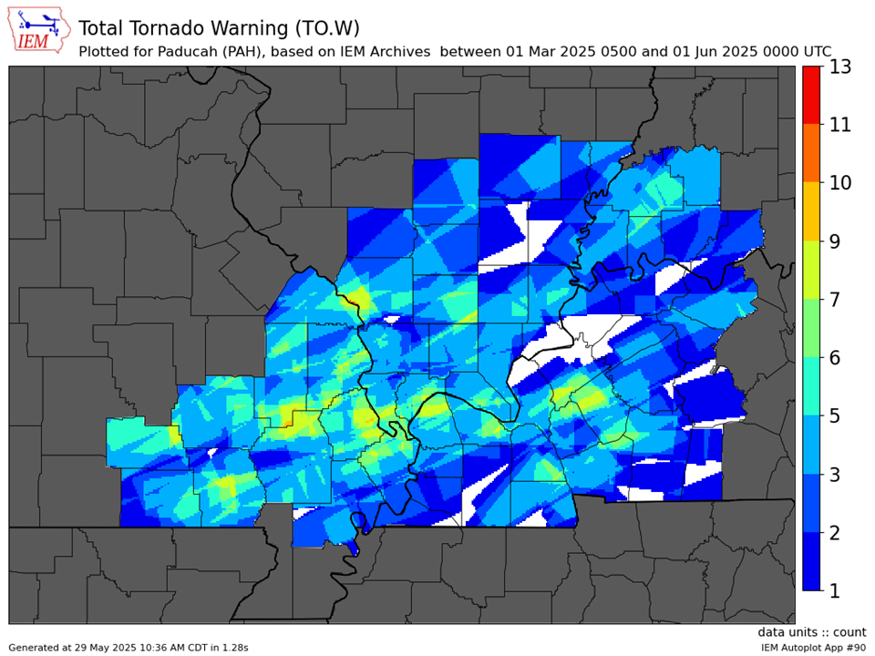
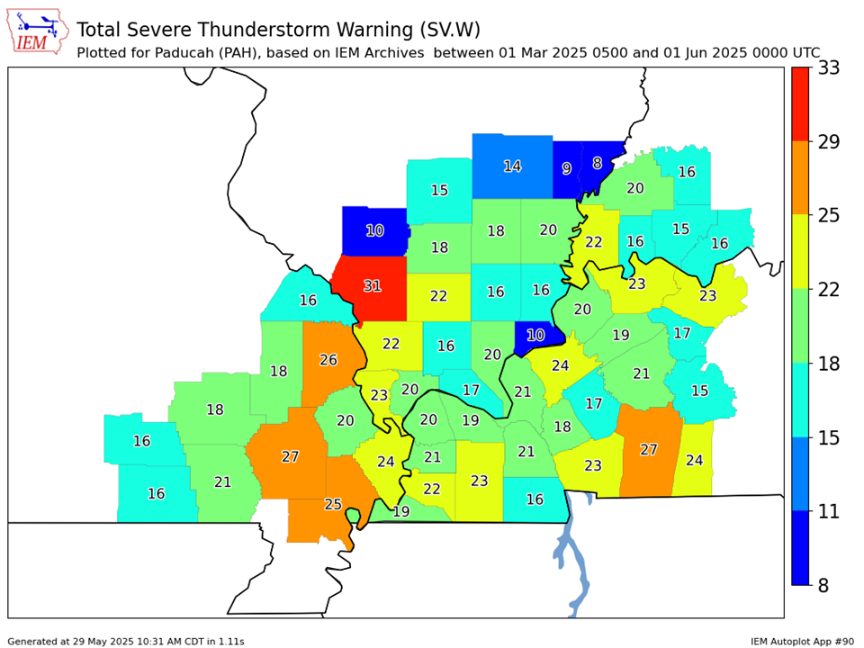
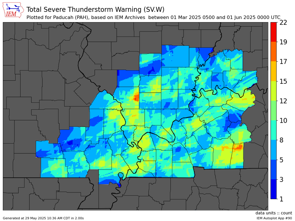
It was a very active spring severe weather season with several tornado outbreaks (March 14-15, April 2, and May 16) impacting our region. There were a total of 54 tornadoes that touched down from March through May with a mind boggling 557 miles of tornado tracks across our 58 county area. This shattered the previous annual record for most miles of tornado tracks which was 449 miles set in 2011. We issued a combined 462 warnings (Severe, Tornado, and Flash Flood) during the spring season. This surpassed the 452 warnings we issued in spring 2006 for the most in a single season in our office history (dating back to 1995).
The graphic below is an interpolated rainfall map using actual observations. Please note that there are likely discrepancies in between observations, since the values are estimated based on nearest reports.
|
Spring 2025 Review: Precipitation and Temperature Maps (Click on image to enlarge) |
 |
| Climate Maps are from the Northeast Regional Climate Center |
| Severe Thunderstorm Warnings - County Based | Severe Thunderstorm Warnings - Polygon Based |
 |
 |
| Tornado Warnings - County Based | Tornado Warnings - Polygon Based |
|
|
|