Spring 2026 Climate Summary:
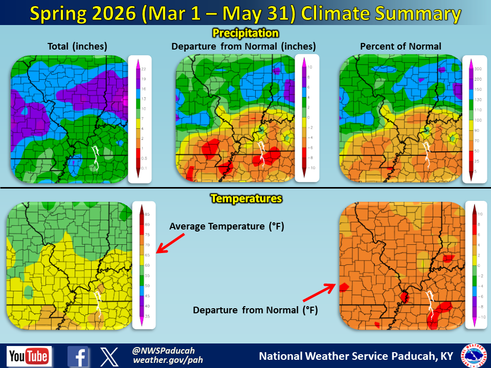
Temperatures averaged well above normal by 4.5 to 5.5 degrees. It was the 2nd warmest Spring season on record at all 5 of our official climate stations, finishing about 1 degree cooler than 2012 at all of them. March was one of our top 5 warmest on record and this was followed by many locations experiencing their warmest April on record. We finally had a pattern switch in May which led to temperatures about 0.5 to 1.5 degrees cooler than normal. Evansville observed a rare feat as their warmest temperature of the spring season (88 degrees) was actually in March (although it was tied again in May).
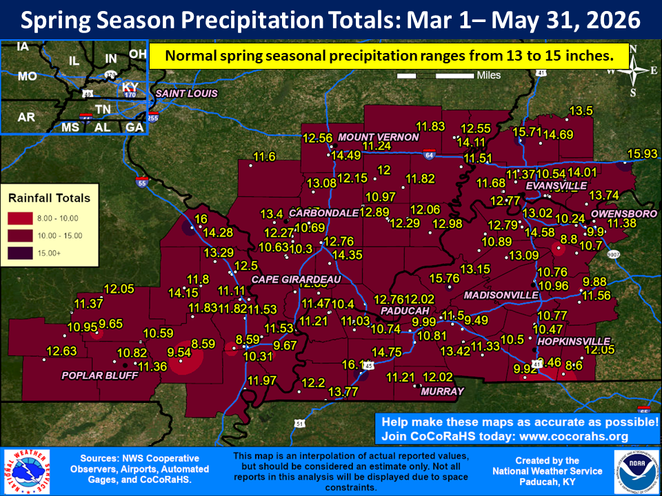
Precipitation was drier than normal across the vast majority of our region with amounts generally ranging from 9 to 14”, which was roughly 1 to 6” below normal. The dryness was most pronounced across southeast Missouri, where widespread deficits of over 5” were observed and localized departures up to 7 or 8” were realized in Ripley and Carter counties. The highest observed amount in our forecast area was at the Kentucky mesonet station in Graves County (Mayfield 6 SW) which received 16.11”. A corridor of much wetter conditions was observed just off to our north across central portions of Missouri, Illinois, and Indiana, but there was a sharp cutoff in amounts as you entered our area. Parts of Jefferson County Illinois and Gibson/Pike Counties Indiana were a few exceptions which managed to receive near to slightly above normal precipitation. We entered the spring season with moderate to severe drought in place across much of the region (mainly the western two thirds of the area) and we ended it with moderate to severe drought continuing across the southern two thirds of the region. Some improvement occurred across much of southern Illinois and the northern few counties in southeast Missouri, while deterioration occurred across west Kentucky. At the peak we had 27% of our forecast area in extreme drought (D3) from late April into mid May. This was confined to areas closer to the Arkansas and Tennessee borders.
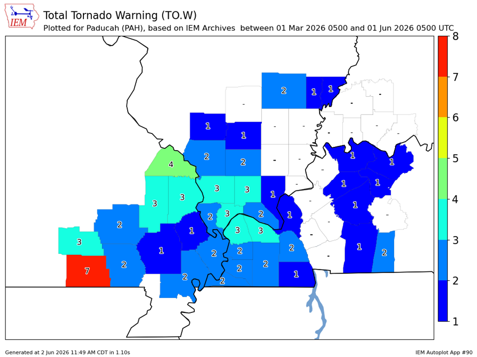
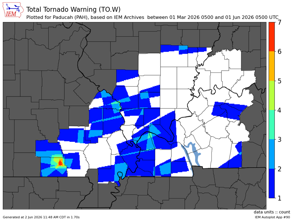
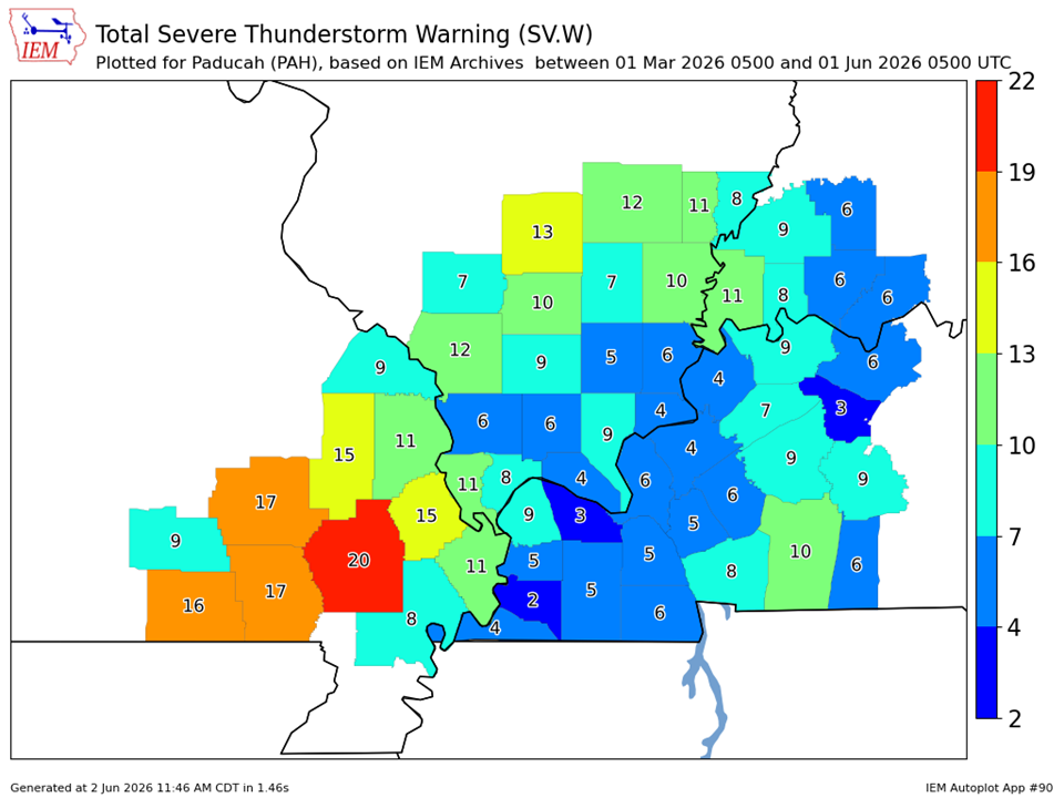
We issued a combined total of 180 severe thunderstorm, tornado, and flash flood warnings, which was very close to an average spring season (185 warnings). It was certainly much quieter than the past 2 years though, and most of our events were in March and April. May was extremely quiet until we had some severe storms on the 31st. We ended up with only 27 warnings issued in May which was our 4th fewest since 1995. We had several events in March and April which produced a few tornadoes, some really large hail (golf ball to baseball sized) and scattered instances of wind damage. These events occurred on March 7, March 15, April 16, and April 27-28.
|
Spring 2026 Review: Precipitation and Temperature Maps (Click on image to enlarge) |
 |
| Climate Maps are from the Northeast Regional Climate Center |


Seasonal Climate Report: Paducah | Evansville | Cape Girardeau | Poplar Bluff | Carbondale
| Severe Thunderstorm Warnings - County Based | Severe Thunderstorm Warnings - Polygon Based |
 |
 |
| Tornado Warnings - County Based | Tornado Warnings - Polygon Based |
|
|
|