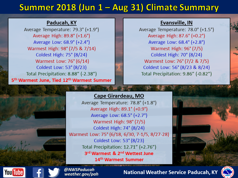
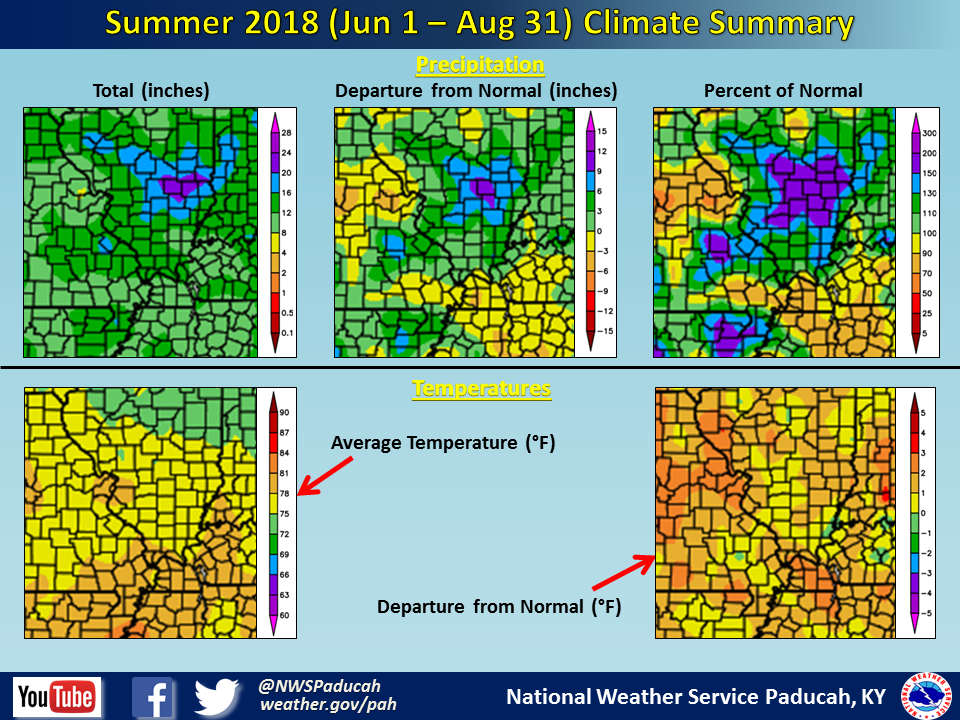
Summer Seasonal Summary (June 1st through August 31st): Temperatures finished above normal by 1.5 to 2 degrees across the region. Summer warmth got off to an early start in May, and continued through June and the first 20 days of July. Finally a break in the oppressive heat and humidity came during the latter part of July. Although there were many days in the 90s in August, the humidity was slightly lower, helping to ease how uncomfortable it felt. June finished as the 3rd Warmest in Cape Girardeau, MO and 5th Warmest in Paducah, KY. The seasonal average temperature was approximately 2 to 3 degrees warmer than it was back in Summer 2017, but still cooler than in 2016.
Humidity levels were quite high this summer, especially during June and July. In Paducah, we finished the summer season with 34 days of dewpoints reaching at least 75 degrees, which is generally considered oppressive and miserable. This was the 3rd highest number of days since 2002, only behind 2010 (40 days) and 2016 (42 days). Remember it’s not all about the heat, but also the humidity! So when factoring in the high humidity, this probably was one of our top 10 most uncomfortable summers on record, dating back to 1938.
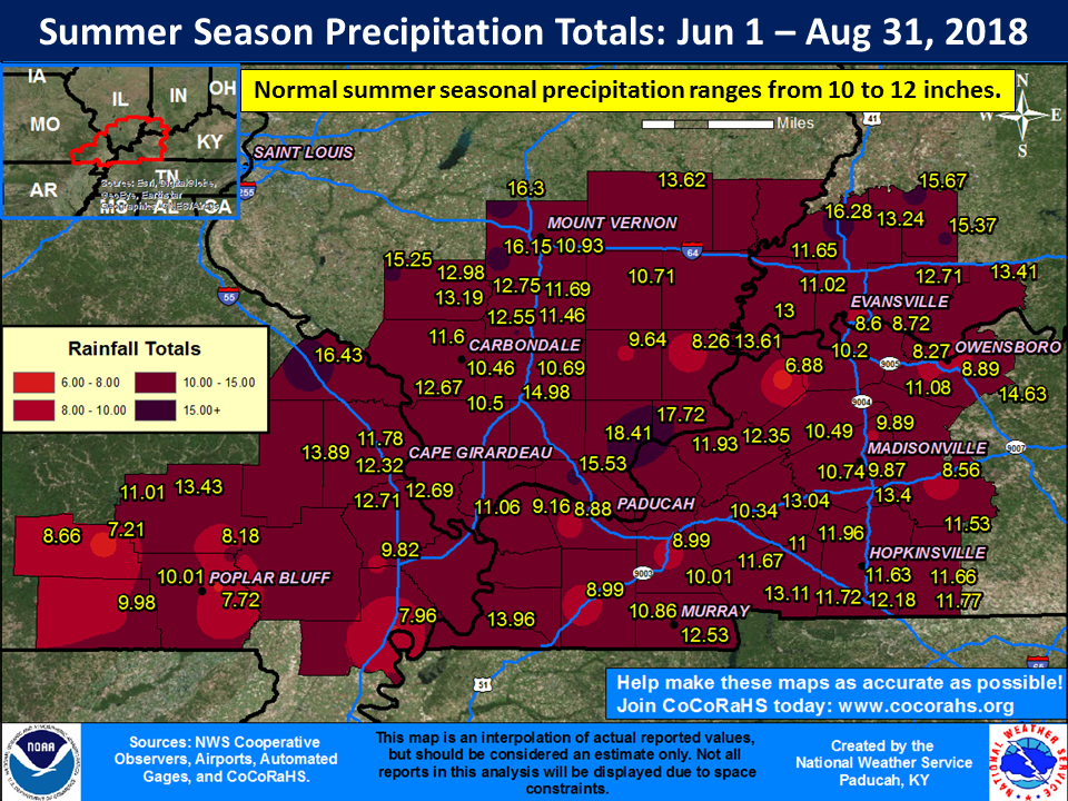
As is common with summertime precipitation it varied quite a bit across the region. This is largely due to the scattered nature of convective precipitation in the warm season. Northern parts of southeast Missouri (northern Wayne through Perry Counties), much of southwest Illinois (Jackson through Wayne Counties), and some areas of western Kentucky east of the Lakes region finished the summer wetter than normal. One of the hardest hit areas was Perry County Missouri, with 16.43” observed at the Perryville COOP station. Another zone of heavier precipitation was focused in portions of Massac, Pope and Hardin Counties in Illinois, with a CoCoRaHS station near Golconda, IL observing 18.41”! On the flip side, a drier than normal summer was observed across southern portions of southeast Missouri (Ripley and Butler east to New Madrid County), much of the Jackson Purchase area of western Kentucky, portions of southeast Illinois (Johnson to White Counties), and western portions of southwest Indiana (Gibson and Posey Counties). The most pronounced dryness was across portions of Carlisle, McCracken, Graves, and Hickman Counties in Kentucky, where radar estimates showed less than 7 inches occurring for the entire summer! Unfortunately we don’t have any observation stations within the driest areas to verify just how dry it was.
 |
| Summer 2018 Review: Precipitation and Temperature Maps (CLICK TO ENLARGE IMAGE) |
 |
| Climate Maps are from the Northeast Regional Climate Center |