Paducah, KY
Weather Forecast Office
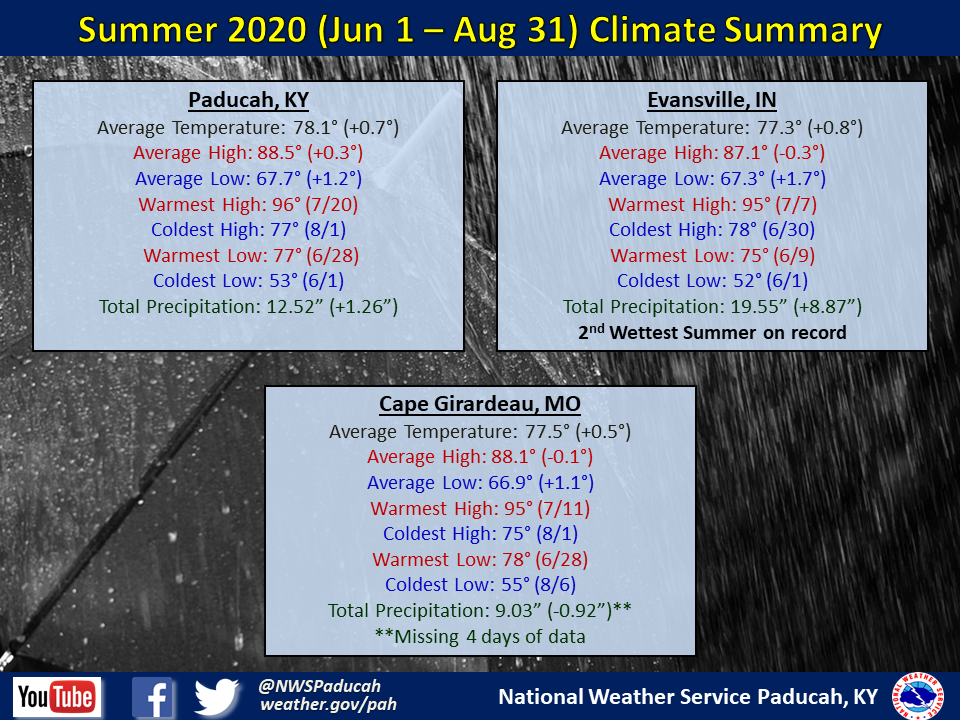
Summer 2020 Climate Summary: Temperatures averaged slightly above normal by around 0.5 to 1 degree. The warmest month compared to normal was July with temperatures over 2 degrees above normal. June was slightly above normal. We flipped the pattern in August and ended up finishing slightly below normal.
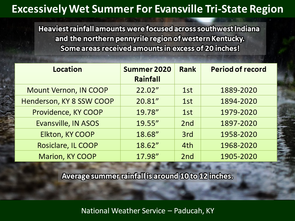
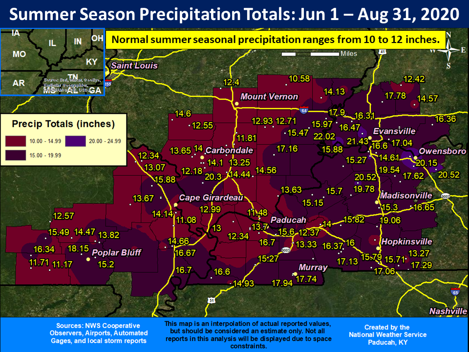
It seems like we are on constant repeat cycle with the wetter than normal conditions, and summer 2020 was no different. Most areas picked up between 12 and 20 inches of rain, with some localized higher amounts over 20 inches! These amounts were generally 2 to 10+ inches above normal for the summer season. The highest observed total was 23.77 inches from a CoCoRaHS station 3.4 miles northwest of Owensboro, KY. Evansville finished as their 2nd wettest summer on record, and was only 0.28” away from the 1977 record. We had several missing days of data from the official observing station at the airport in Cape Girardeau, MO. Several CoCoRaHS stations in the Cape Girardeau area recorded 14 to 16 inches of rain.
 |
| Summer 2020 Review: Precipitation and Temperature Maps |
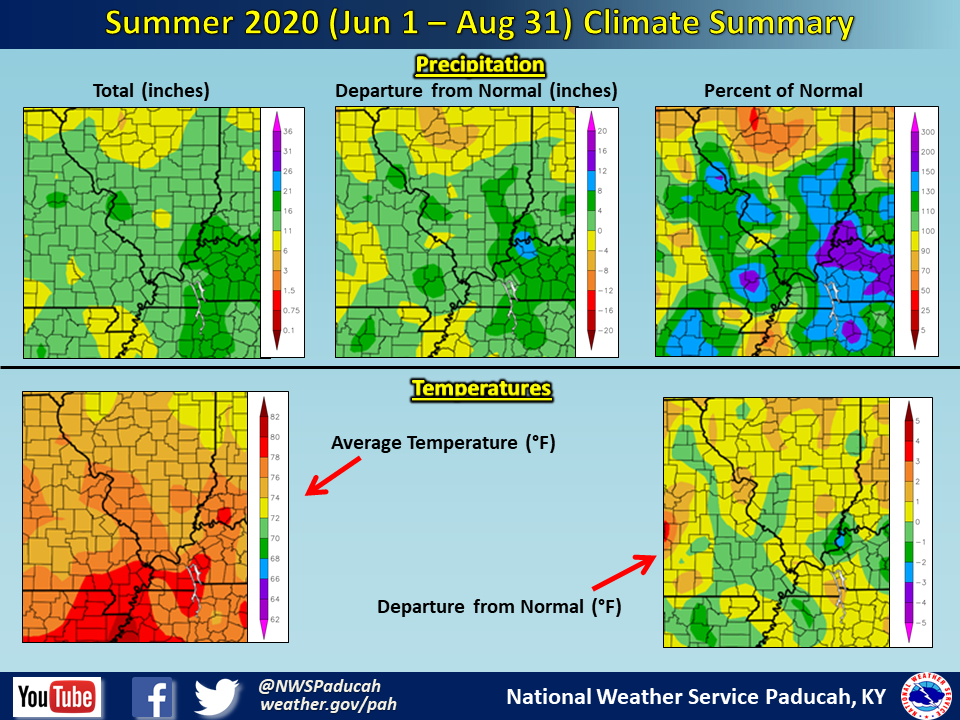 |
| Climate Maps are from the Northeast Regional Climate Center |
FORECASTS
Forecast Discussion
User Defined Area Forecast
Hourly Forecasts
Fire Weather
Activity Planner
LOCAL INFORMATION
Aviation Weather
Our Office
SKYWARN
Items of Interest
Hazardous Weather Support
Local Observations
Weather History
NWS Paducah KY Weekly Partner Briefing
US Dept of Commerce
National Oceanic and Atmospheric Administration
National Weather Service
Paducah, KY
8250 Kentucky Highway 3520
West Paducah, KY 42086-9762
270-744-6440
Comments? Questions? Please Contact Us.