Paducah, KY
Weather Forecast Office
|
Event Summaries for the year 2014 |
|||||
| Jan. 5-7 Extreme Cold (pdf document) | Feb. 2 Winter Storm (pdf document) | ||||
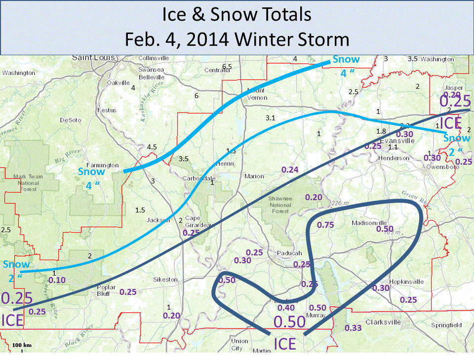
| Feb. 4 Winter Storm (Ice south/snow north) | Feb. 20 Severe Storms (pdf document) | ||||
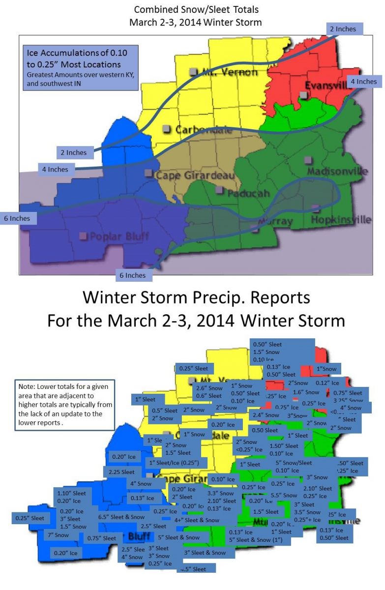
| Mar. 2-3 Major Winter Storm | Apr. 3 Tornadoes (Up to EF-2) | ||||
| May 9 Macroburst (Southwest IN, pdf document) | May 14 Tornado (EF-2, Hopkinsville area) | ||||
| June 4 Macroburst (West KY) | June 7 Macroburst (West KY) | ||||
| Oct. 3 tornadoes (EF-1, West KY) | Oct. 13 tornadoes (EF-1) | ||||
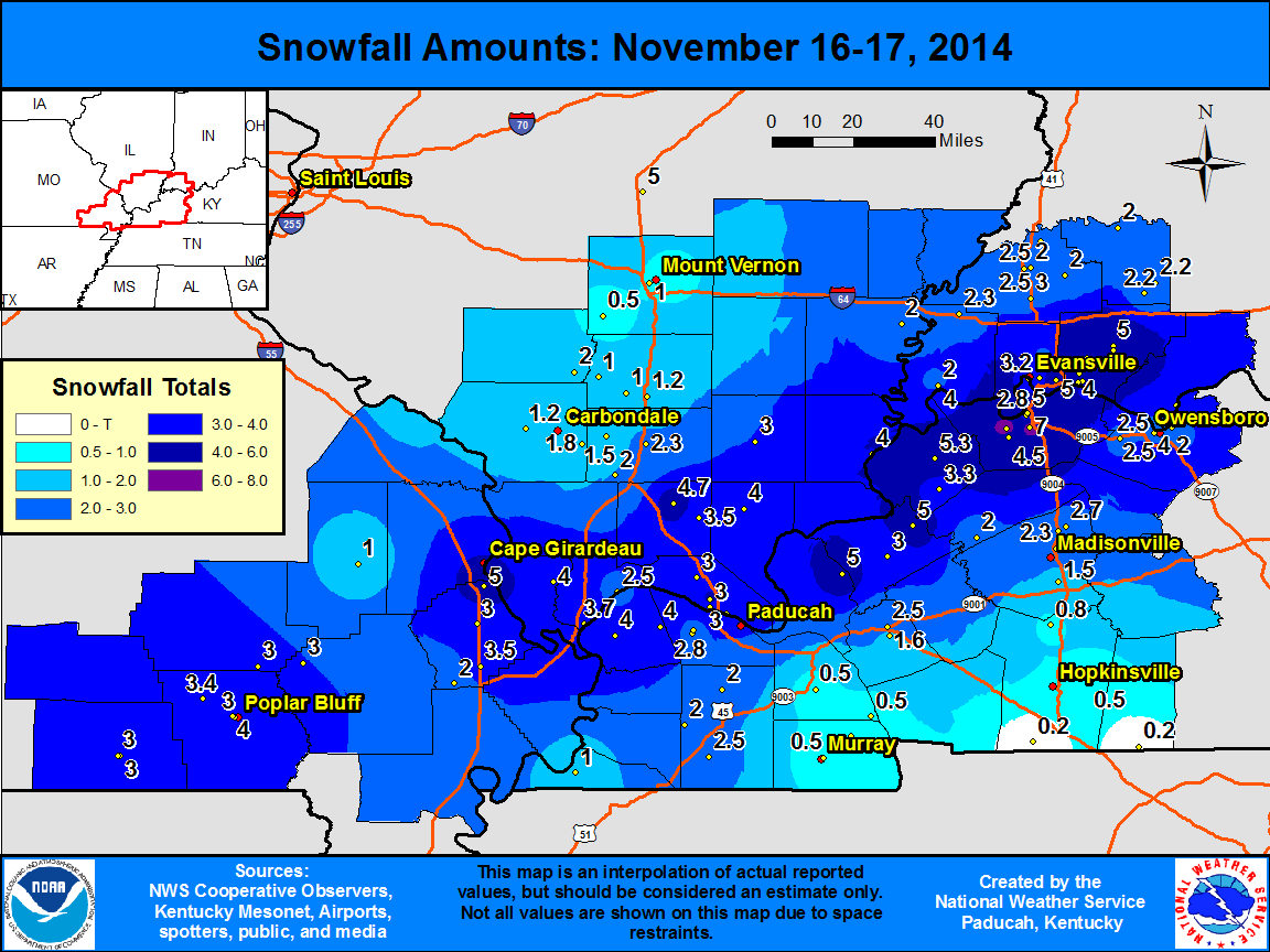
| Nov. 16-17 Snowfall (Map only) | |||||
FORECASTS
Forecast Discussion
User Defined Area Forecast
Hourly Forecasts
Fire Weather
Activity Planner
LOCAL INFORMATION
Aviation Weather
Our Office
SKYWARN
Items of Interest
Hazardous Weather Support
Local Observations
Weather History
NWS Paducah KY Weekly Partner Briefing
US Dept of Commerce
National Oceanic and Atmospheric Administration
National Weather Service
Paducah, KY
8250 Kentucky Highway 3520
West Paducah, KY 42086-9762
270-744-6440
Comments? Questions? Please Contact Us.

