Paducah, KY
Weather Forecast Office
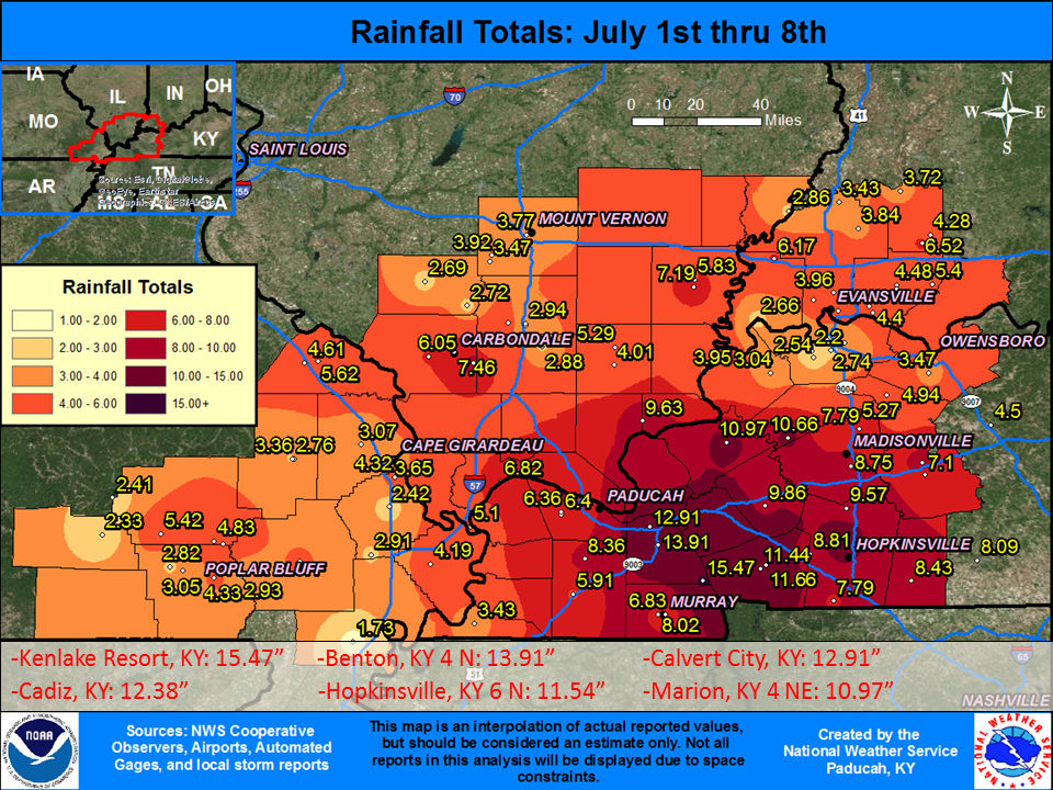
After a dry June, it has been a very wet start to July across the Quad-State region. Amounts of 4 to 8 inches have been common, with a rather broad corridor of 10 to 15 inches from far southeast IL into portions of western KY. Due to the limited reporting stations in southeast IL, the graphic doesn't pick up on the heavy rainfall totals that occurred over portions of Johnson, Pope, Massac, and Hardin Counties. Some locations in these counties also saw upwards of 8-10+ inches. The density of the observation sites is greater over western KY, largely due to the Kentucky Mesonet.
FORECASTS
Forecast Discussion
User Defined Area Forecast
Hourly Forecasts
Fire Weather
Activity Planner
LOCAL INFORMATION
Aviation Weather
Our Office
SKYWARN
Items of Interest
Hazardous Weather Support
Local Observations
Weather History
NWS Paducah KY Weekly Partner Briefing
US Dept of Commerce
National Oceanic and Atmospheric Administration
National Weather Service
Paducah, KY
8250 Kentucky Highway 3520
West Paducah, KY 42086-9762
270-744-6440
Comments? Questions? Please Contact Us.

