Overview
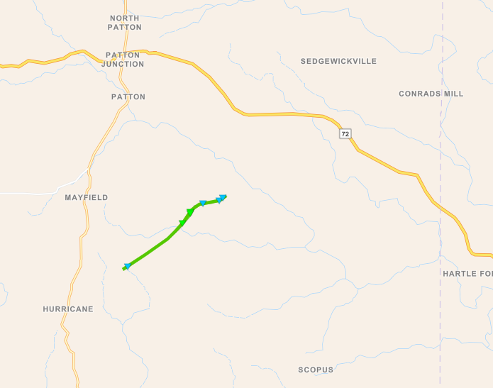
An EF-1 tornado struck near Patton, MO around 2:50 PM on April 28. The tornado was associated with a thunderstorm that occurred on the northern edge of an area of stronger instability that extended southward into the lower Mississippi Valley. A Severe Thunderstorm Watch was in effect for parts of the area.Tornadoes:
|
Tornado - Patton, MO
|
||||||||||||||||
The Enhanced Fujita (EF) Scale classifies tornadoes into the following categories:
| EF0 Weak 65-85 mph |
EF1 Moderate 86-110 mph |
EF2 Significant 111-135 mph |
EF3 Severe 136-165 mph |
EF4 Extreme 166-200 mph |
EF5 Catastrophic 200+ mph |
 |
|||||
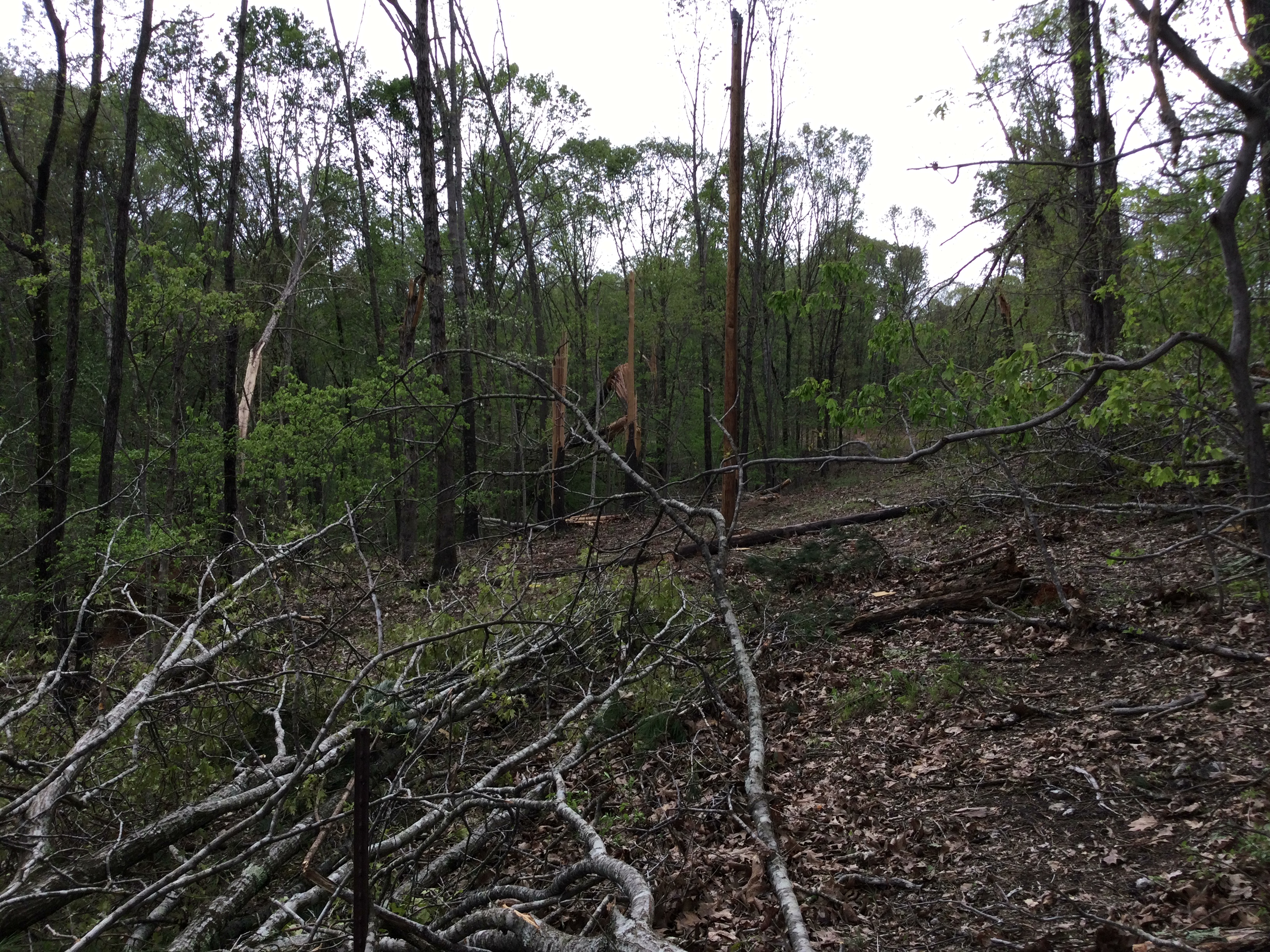
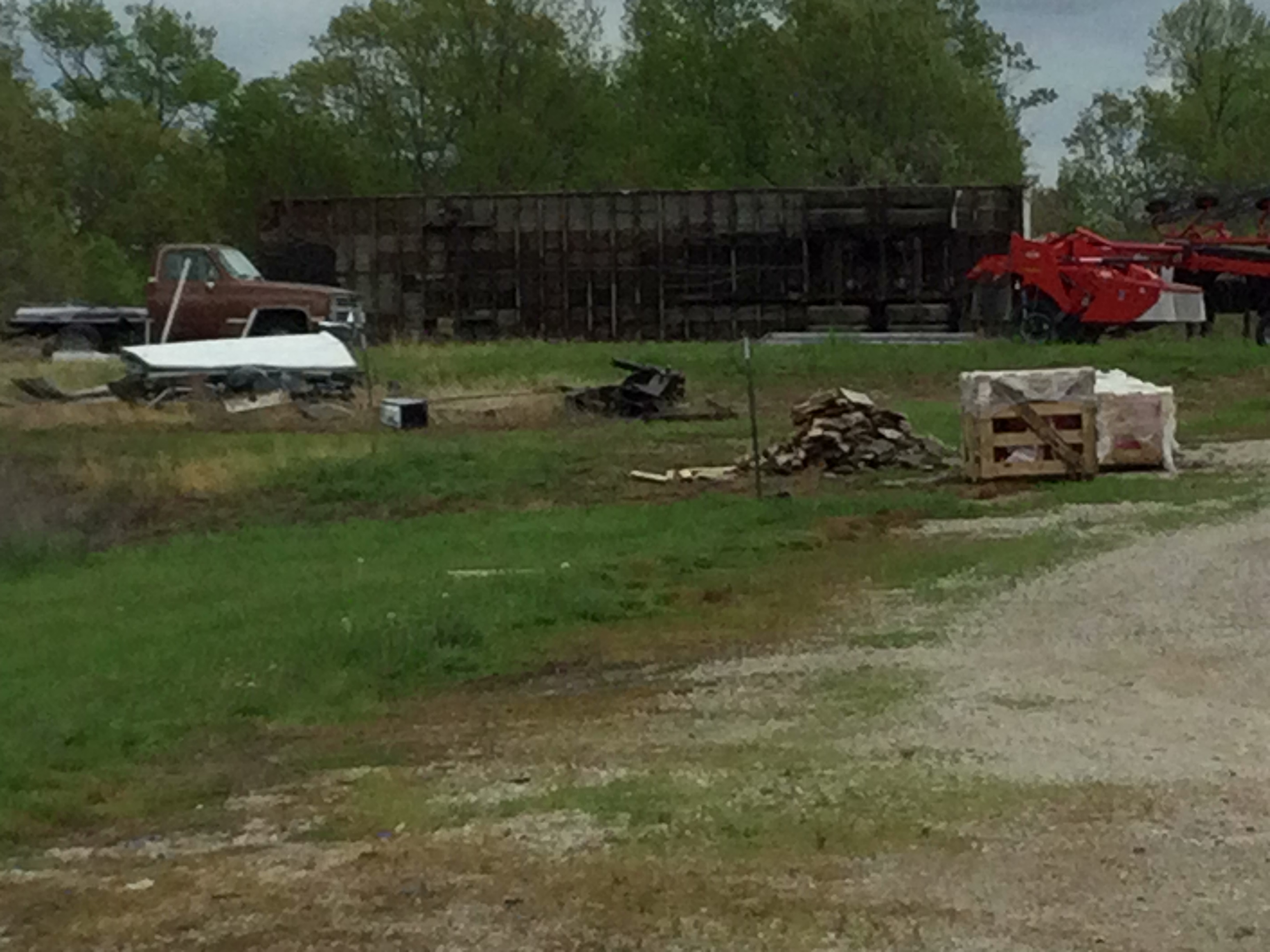
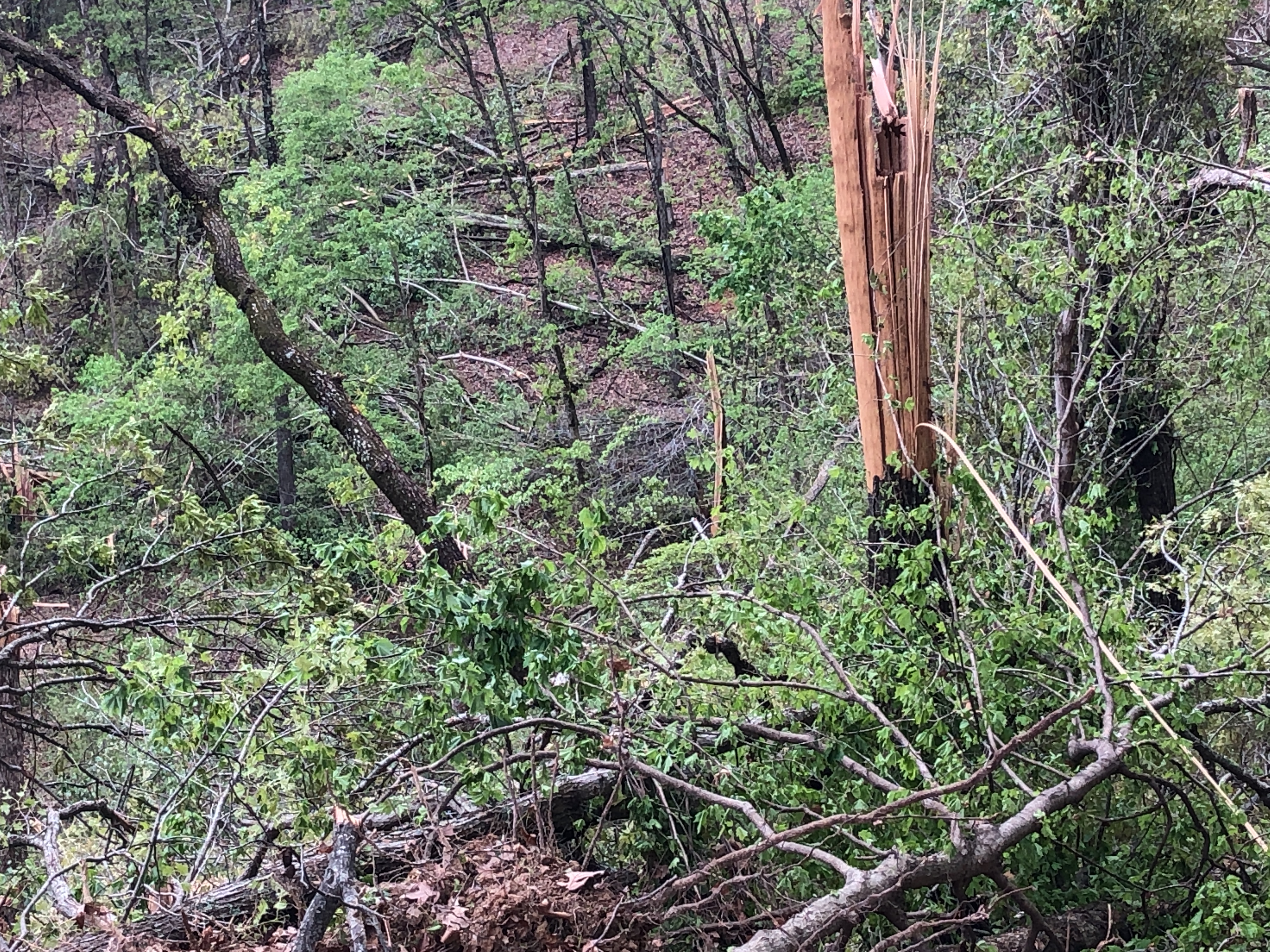
Photos - click for full size
Trees down and semi rolled over
 |
 |
 |
 |
| Tree blowdown (NWS damage surveyor) |
Snapped trees (NWS damage surveyor) |
Semi and trailer rolled (NWS damage surveyor) |
Trees down (NWS damage surveyor) |
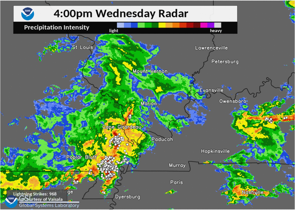
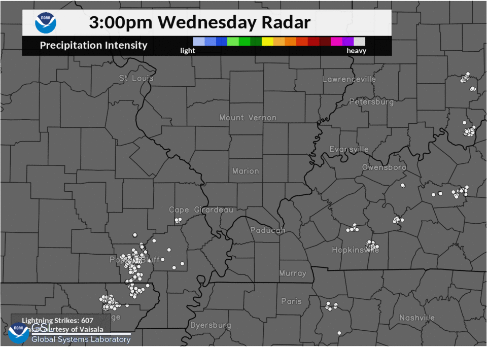
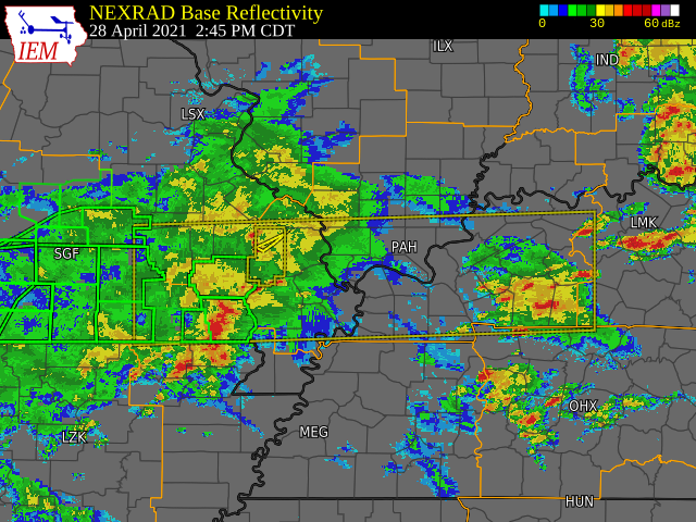
Radar - click for full size
White dots are lightning strikes
 |
 |
 |
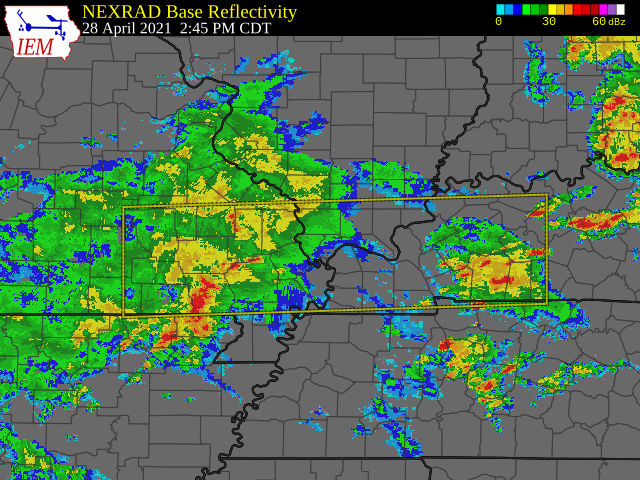 |
| 4 PM Regional Radar with lightning | 3 PM lightning | 2:45 PM Summary of watches & warnings, from Iowa State Univ. | 2:45 PM Radar with Severe T-storm Watch, from Iowa State |
 |
Media use of NWS Web News Stories is encouraged! Please acknowledge the NWS as the source of any news information accessed from this site. |
|