Overview
Clusters of thunderstorms developed during the late afternoon hours. Some of the largest clusters were associated with sporadic gusty winds in the 40 to 60 mph range. By early evening, a few tornadic circulations were observed as storms intensified. A significant tornado occurred in southeast Missouri. In fact this was the strongest tornado in the month of July for our area since 1971. By late evening, storms became widespread, resulting in pockets of flash flooding which continued through the overnight hours.Tornadoes:
|
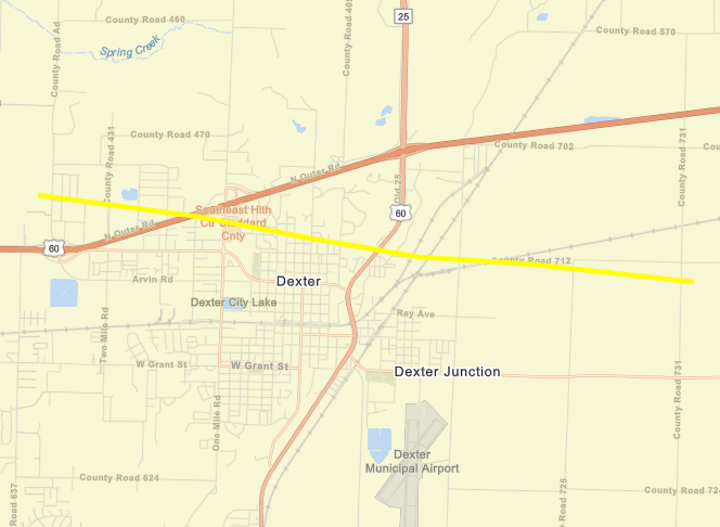
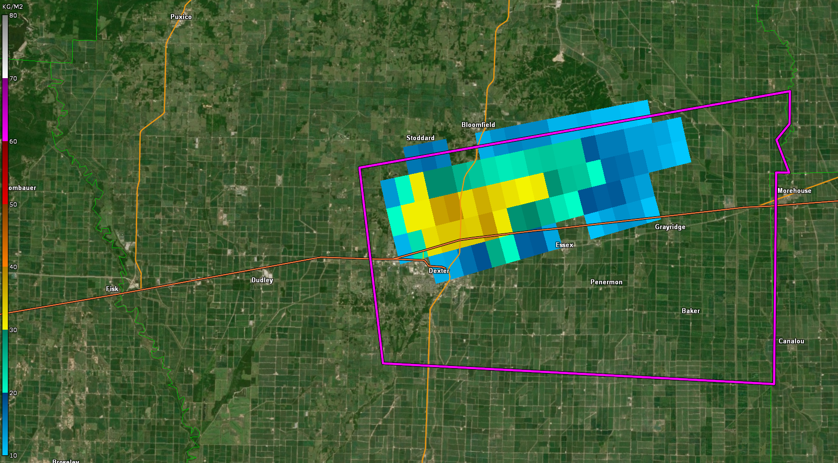
Tornado 1 - DEXTER, MO
|
||||||||||||||||
The Enhanced Fujita (EF) Scale classifies tornadoes into the following categories:
| EF0 Weak 65-85 mph |
EF1 Moderate 86-110 mph |
EF2 Significant 111-135 mph |
EF3 Severe 136-165 mph |
EF4 Extreme 166-200 mph |
EF5 Catastrophic 200+ mph |
 |
|||||
Wind & Hail:
Wind
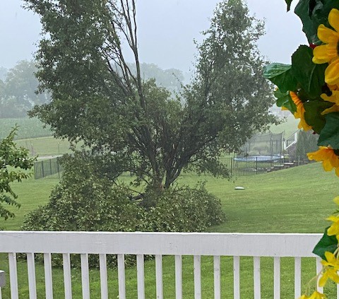
Sporadic reports of strong winds were received. Most of the wind reports were in the 40 to 60 mph range. The most organized storm clusters developed a "gust front" that brought down tree limbs and even a few whole trees.
 |
 |
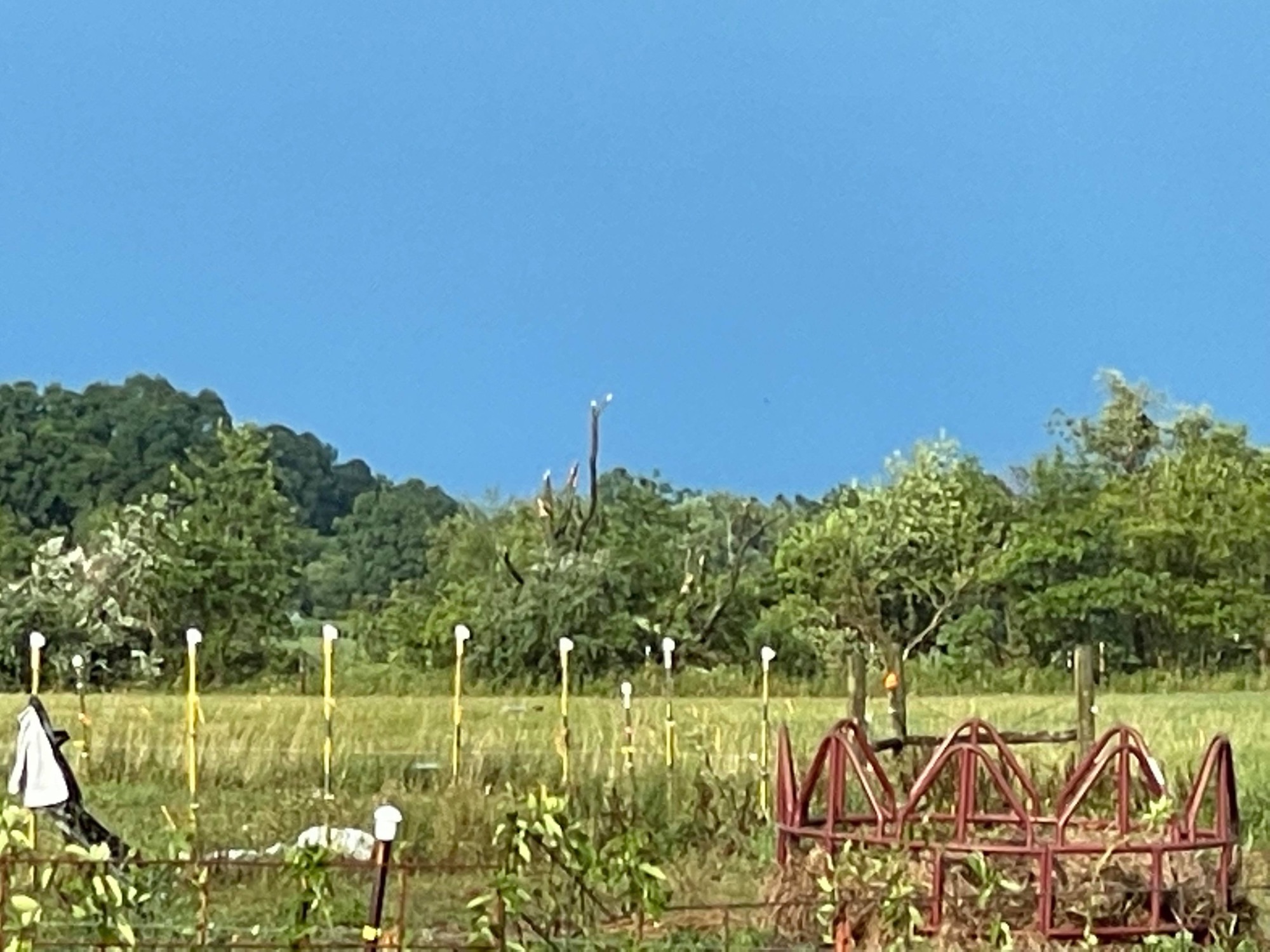 |
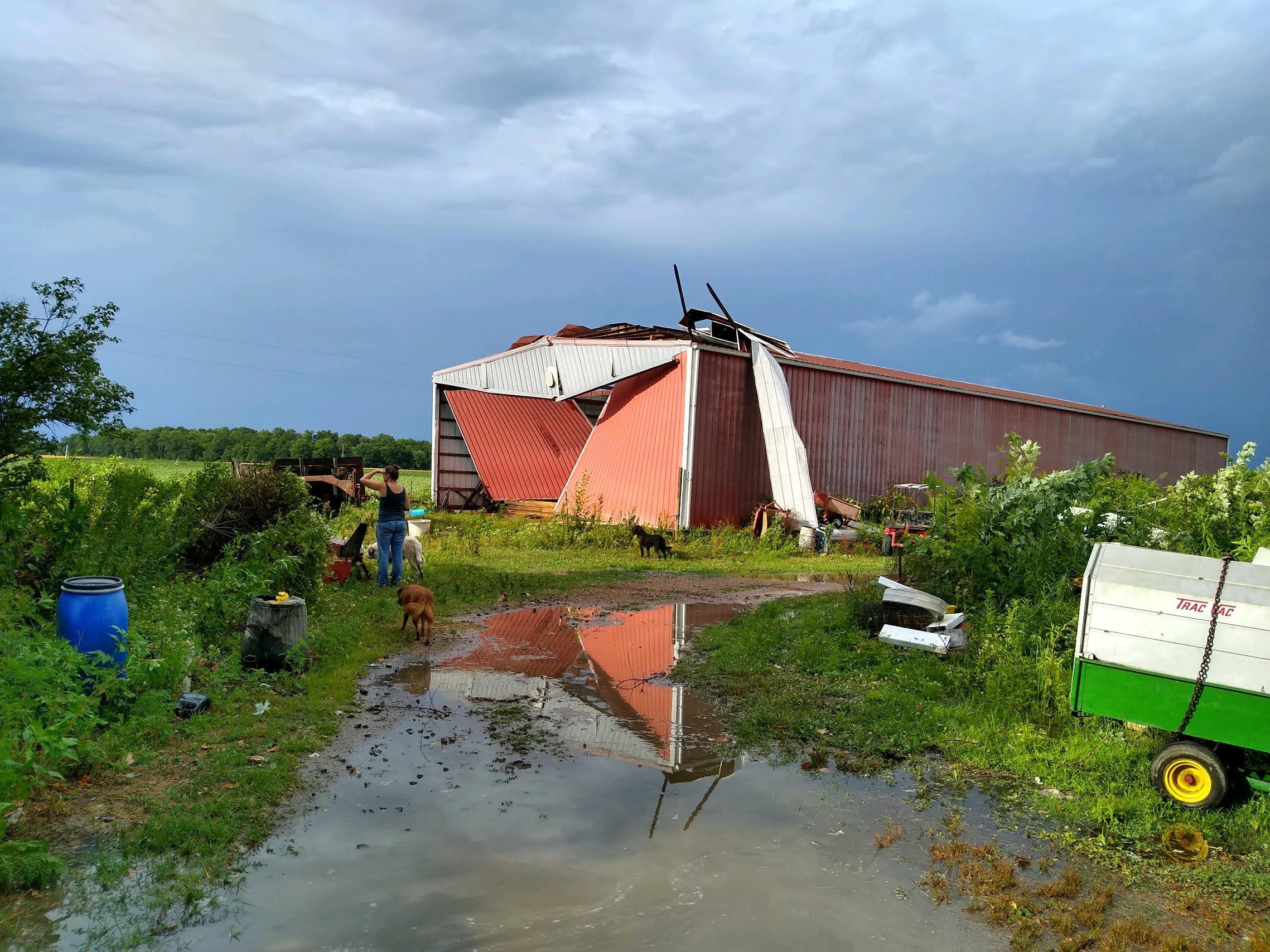
| Tree damage on the north side of Henderson, KY (courtesy Wayne Hart) | Metal building damaged in Vergennes, IL (courtesy Nick Hausen) | Tree damage in Vergennes, IL (courtesy Nick Hausen) |
Hail
Hail was relatively insignificant compared to the tornado, wind, and flooding hazards.
Flooding
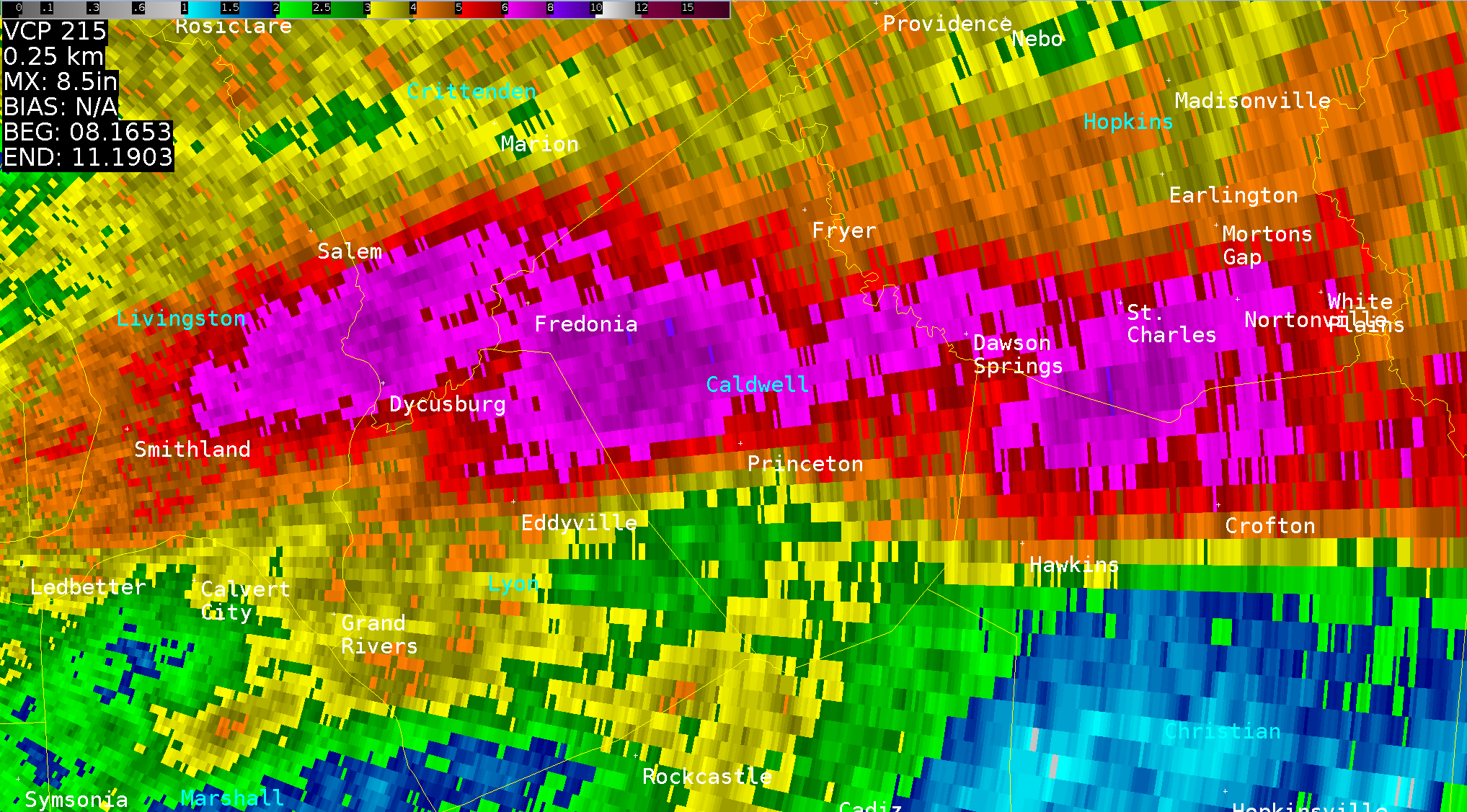
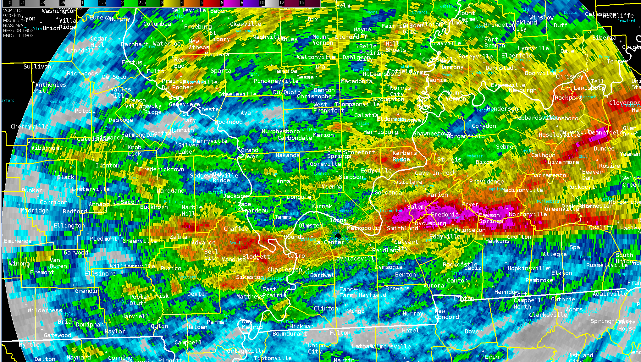
A narrow corridor of excessive rainfall occurred where storms trained across the same areas for several hours. Radar estimated 6 to 9 inches fell in a narrow corridor of west Kentucky from central Livingston and Caldwell Counties eastward across the Christian - Hopkins County border area. There were a few confirmed rainfall measurements of 7-plus inches in southern Crittenden County.
Radar/Photos - (click on photos for full size)
 |
 |
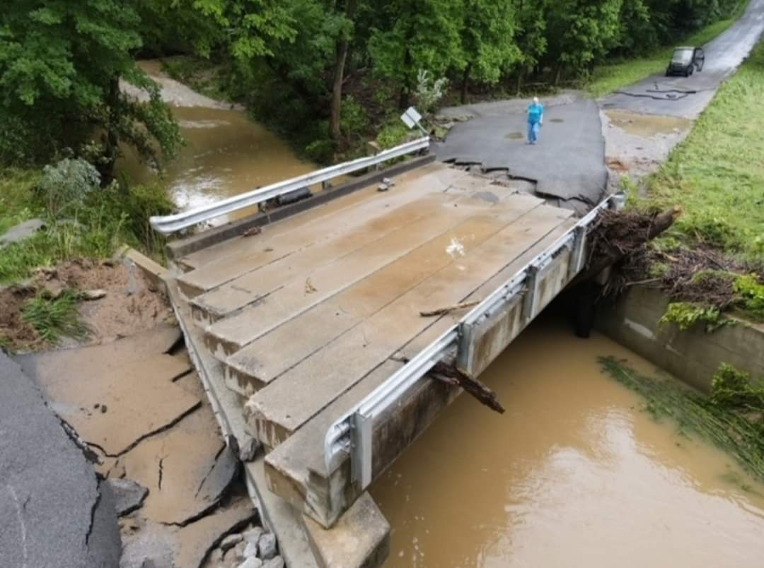 |
| Paducah radar-derived rainfall estimates (purple shading = greater than 6 inches) | Zoomed out version of rainfall graphic | Bridge washout over Dry Fork Creek in Crittenden County, KY (courtesy of Crittenden Press) |
Photos
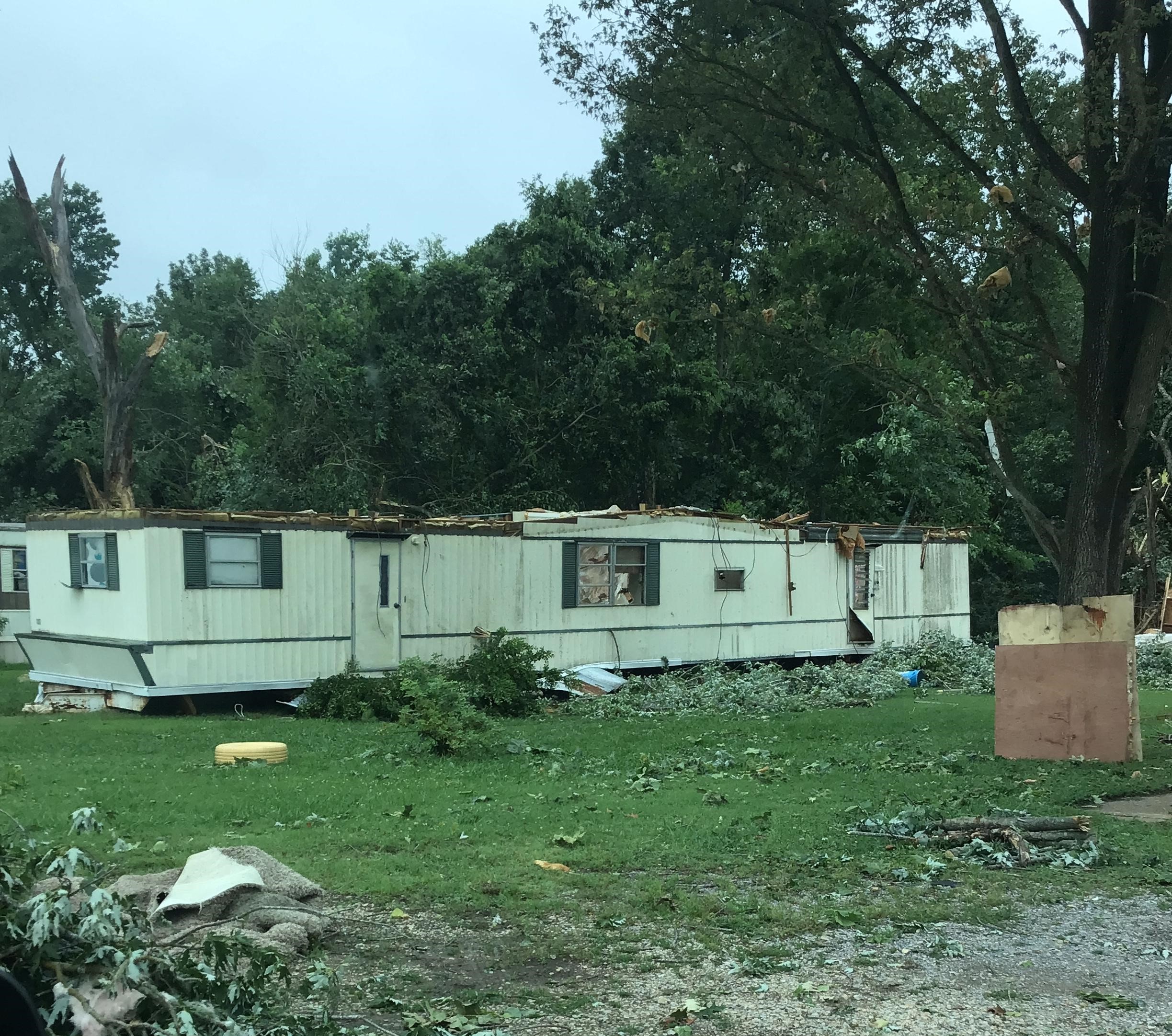
Tornado damage photos...
 |
 |
 |
 |
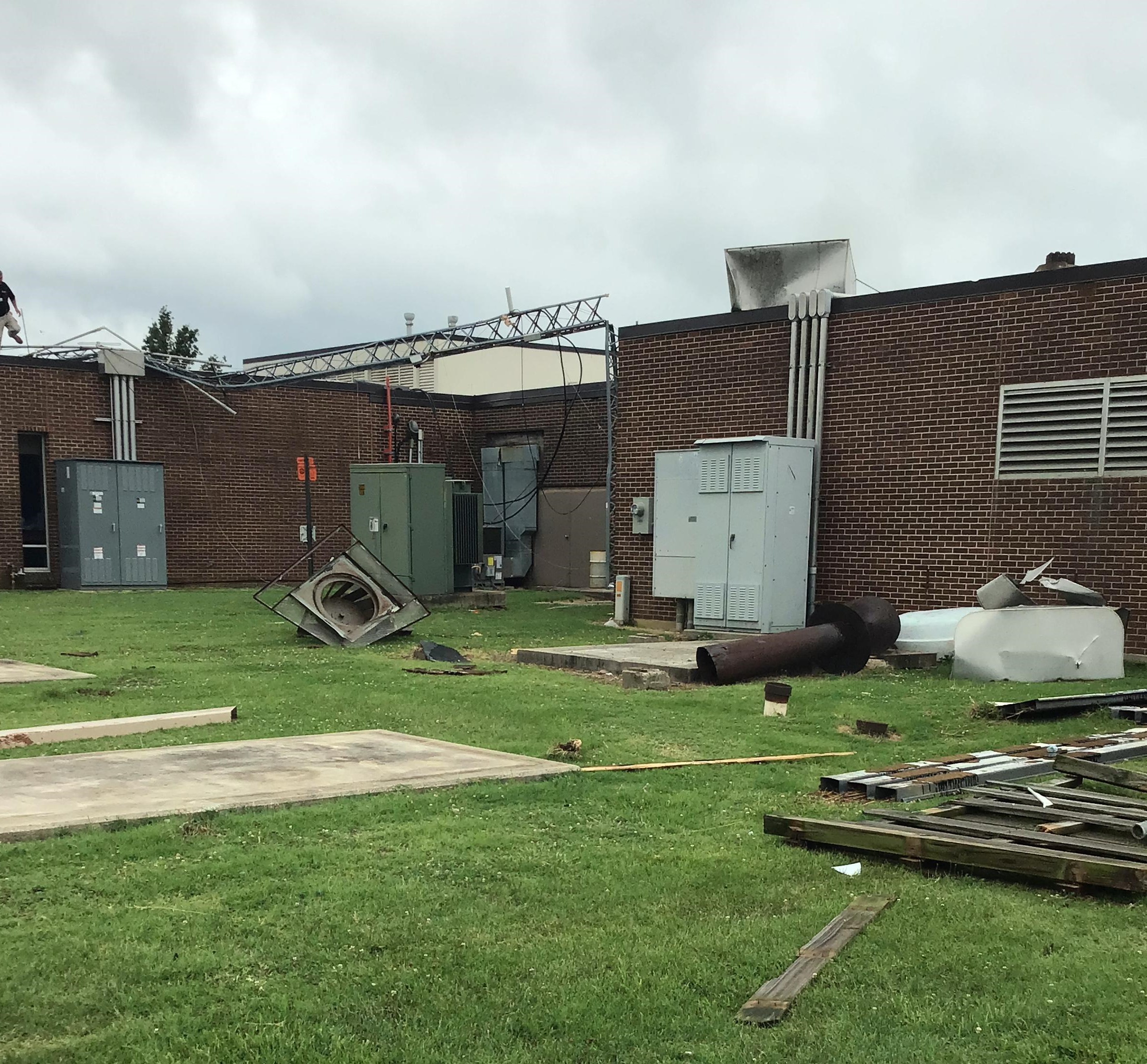
| Rolled mobile home in Dexter (NWS photo) |
Dexter hospital damage (NWS photo) |
Dexter hospital (NWS photo) |
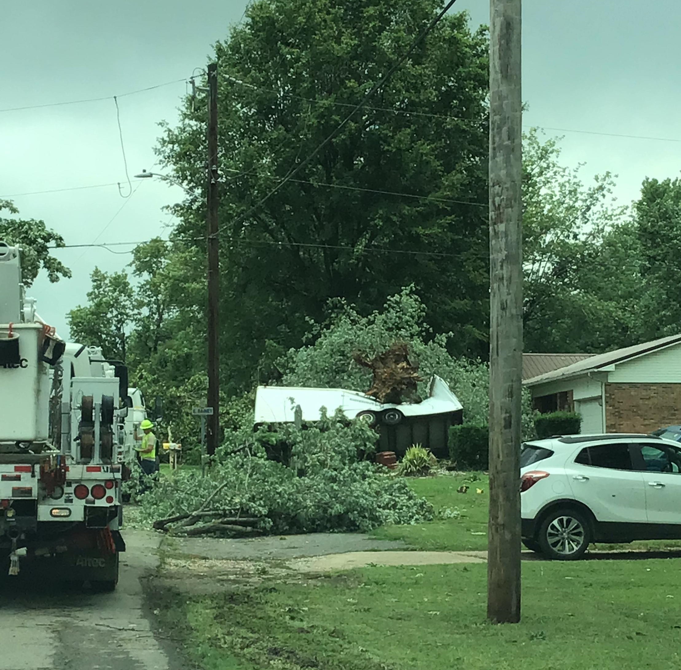
Tree and power lines in Dexter (NWS photo) |
Radar
 |
 |
 |
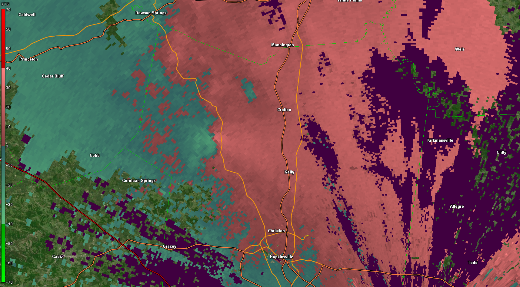 |
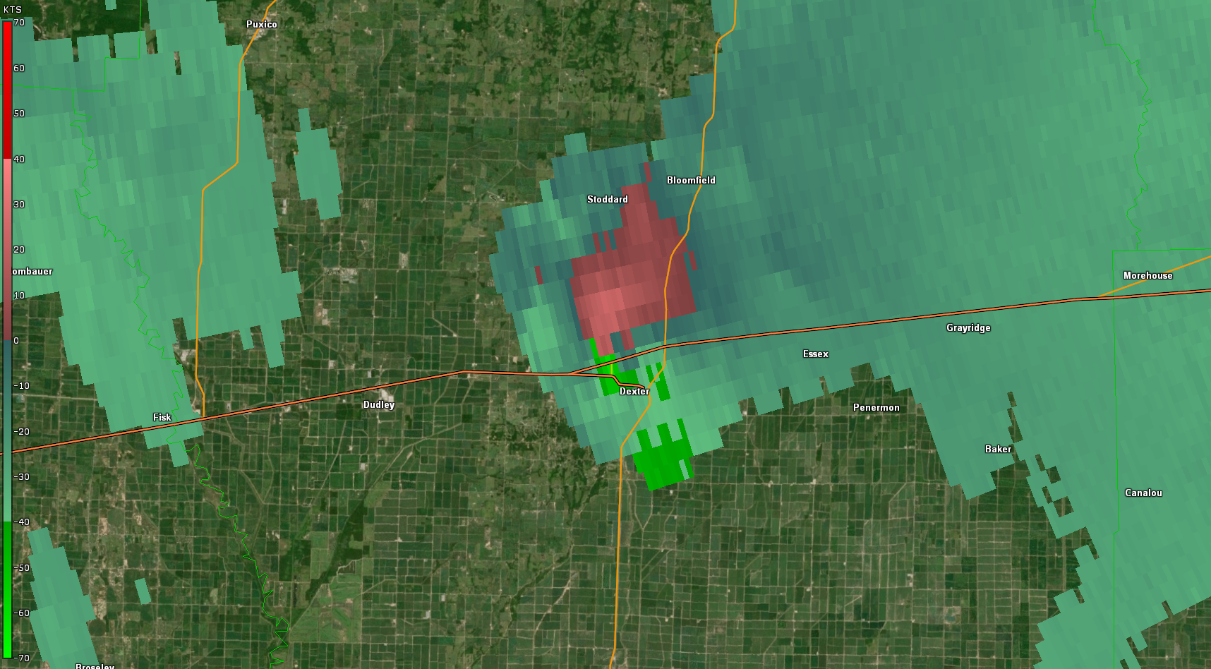
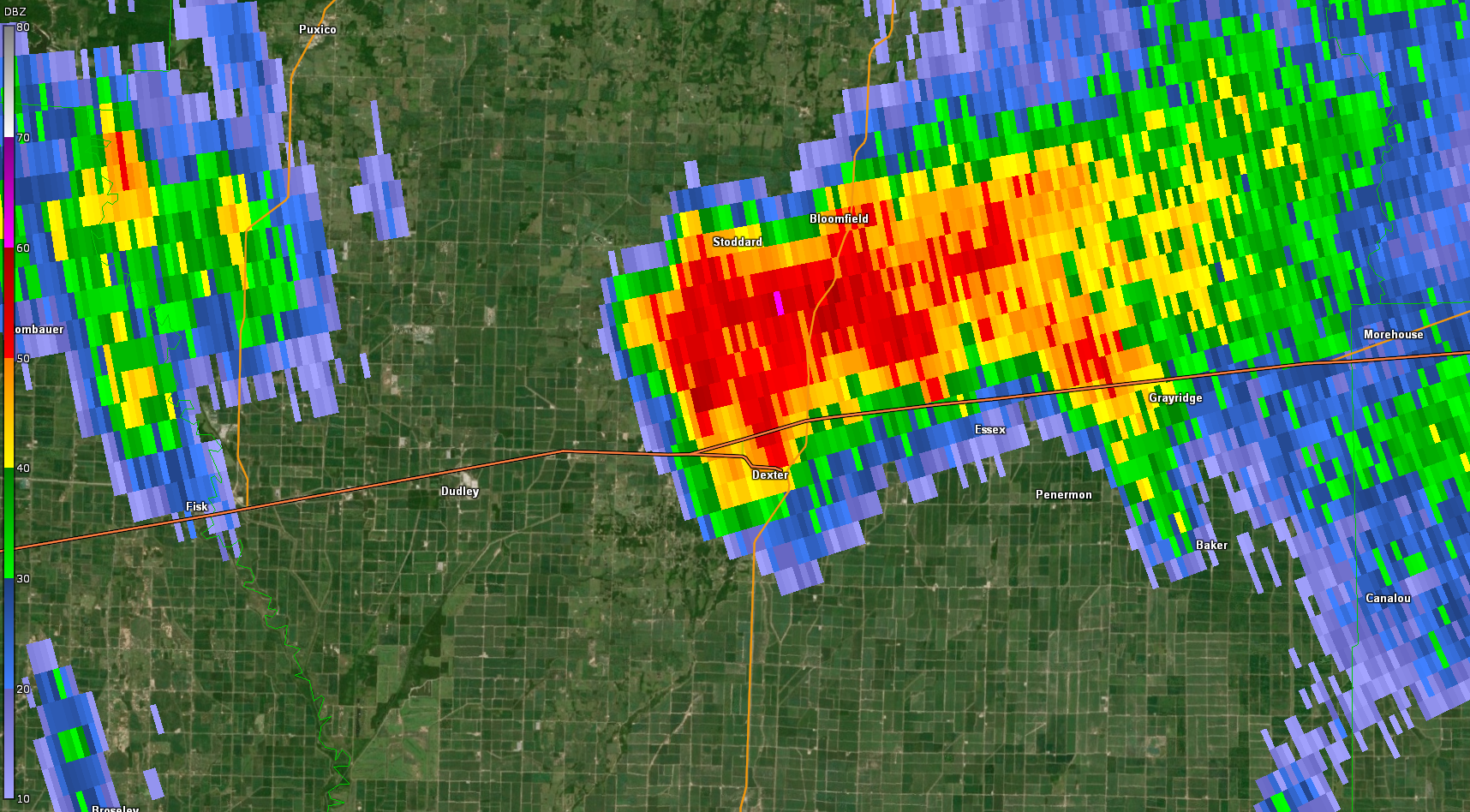
| 8:20 PM Paducah radar storm-relative winds (Dexter tornado) | 8:20 PM Paducah radar lowest level reflectivity (Dexter tornado) | 8:24 PM Paducah radar VIL (Dexter tornado w/ TOR warning polygon) | 7:47 PM Ft Campbell radar storm-relative winds (Crofton, KY storm) |
Storm Reports
PRELIMINARY LOCAL STORM REPORT...SUMMARY
NATIONAL WEATHER SERVICE PADUCAH KY
326 PM CDT SUN JUL 11 2021

..TIME...   ...EVENT...      ...CITY LOCATION...     ...LAT.LON...
..DATE...   ....MAG....      ..COUNTY LOCATION..ST.. ...SOURCE....
            ..REMARKS..

0333 PM     TSTM WND DMG     BROUGHTON               37.93N 88.46W
07/10/2021                   HAMILTON           IL   PUBLIC

            REPORT FROM MPING: 1-INCH TREE LIMBS BROKEN.

0358 PM     TSTM WND DMG     NEW HARMONY             38.13N 87.93W
07/10/2021                   POSEY              IN   911 CALL CENTER

            ONE TREE ON ROADWAY IN NEW HARMONY.

0542 PM     TSTM WND DMG     BUSH                    37.84N 89.14W
07/10/2021                   WILLIAMSON         IL   TRAINED SPOTTER

            TREE COVERING BOTH LANES ON HIGHWAY 149
            NORTH OF HURST IN THE COMMUNITY OF BUSH.

0605 PM     TSTM WND DMG     HERRIN                  37.80N 89.03W
07/10/2021                   WILLIAMSON         IL   TRAINED SPOTTER

            ONE TO TWO INCH TREE LIMBS DOWN. ESTIMATED
            WINDS AT 50 MPH. SPOTTER WAS STILL
            ESTIMATING WINDS AT 30 TO 40 MPH WINDS AT
            TIME OF REPORT.

0609 PM     HAIL             1 N CARBONDALE          37.74N 89.21W
07/10/2021  E0.25 INCH       JACKSON            IL   TRAINED SPOTTER

            SPOTTER ALSO REPORTED PONDING OF WATER ON
            EDGE OF ROAD AFTER A FIVE MINUTE DURATION OF
            HEAVY RAIN. A ONE QUARTER INCH TREE BRANCH
            TORN OFF OF TREE DURING PASSAGE OF WINDS
            ESTIMATED 30-40 MPH.

0610 PM     TSTM WND DMG     1 W FAIRFIELD           38.38N 88.39W
07/10/2021                   WAYNE              IL   EMERGENCY MNGR

            TELEPHONE LINES DOWN. WEIGHTED TABLES AT A
            MEXICAN RESTAURANT BLOWN OVER. TIME
            ESTIMATED FROM RADAR.

0615 PM     TSTM WND DMG     1 NW CHICOPEE           36.99N 91.01W
07/10/2021                   CARTER             MO   LAW ENFORCEMENT

            COUPLE OF LARGE TREES DOWN AND SEVERAL THREE
            TO FOUR INCH LIMBS DOWN. REPORT FROM
            MISSOURI HIGHWAY PATROL.

0723 PM     TSTM WND GST     1 NNW MELODY HILL       38.04N 87.53W
07/10/2021  M44 MPH          VANDERBURGH        IN   ASOS

            AUTOMATED SURFACE OBSERVATION SYSTEM WIND
            REPORT FROM EVANSVILLE REGIONAL AIRPORT.

0732 PM     FLOOD            3 W NEWBURGH            37.95N 87.46W
07/10/2021                   VANDERBURGH        IN   TRAINED SPOTTER

            STREET FLOODING IN ANGEL MOUNDS AREA. ALSO,
            REPORTED 30-40 MPH WINDS AT TIME OF REPORT.
            STORM TOTAL RAINFALL FOR THE DAY SO FAR WAS
            2.6 INCHES.

0805 PM     TSTM WND GST     3 WSW OWENSBORO         37.75N 87.16W
07/10/2021  M40 MPH          DAVIESS            KY   AWOS

            MEASURED WIND GUST AT OWENSBORO-DAVIESS
            COUNTY AIRPORT.

0823 PM     FUNNEL CLOUD     1 NNW DEXTER            36.81N 89.97W
07/10/2021                   STODDARD           MO   LAW ENFORCEMENT

            REPORT FROM DEXTER POLICE DEPARTMENT OF
            FUNNEL CLOUD NEARING THE GROUND NEAR HIGHWAY
            60 NORTH OF THE SOUTHEAST HEALTH CENTER IN
            STODDARD COUNTY. REPORT RELAYED BY THE
            MISSOURI STATE HIGHWAY PATROL TROOP E.

0826 PM     TSTM WND DMG     1 ESE SCOTT CITY        37.22N 89.52W
07/10/2021                   SCOTT              MO   EMERGENCY MNGR

            REPORT OF NUMEROUS POWER LINES DOWN. TREE ON
            HOME. TIME ESTIMATED BY RADAR.

0832 PM     TORNADO          3 NW DEXTER             36.82N 89.99W
07/10/2021                   STODDARD           MO   EMERGENCY MNGR

            TORNADO REPORTED ON THE GROUND AT TIME OF
            REPORT.

0840 PM     TSTM WND GST     3 W CENTRAL CITY        37.30N 87.18W
07/10/2021  M43 MPH          MUHLENBERG         KY   MESONET

            REPORT FROM KENTUCKY MESONET OBSERVATION
            SITE.

0849 PM     FUNNEL CLOUD     1 N ESSEX               36.83N 89.86W
07/10/2021                   STODDARD           MO   EMERGENCY MNGR


0903 PM     TSTM WND DMG     1 NNE PADUCAH           37.09N 88.63W
07/10/2021                   MCCRACKEN          KY   PUBLIC

            TWO TREES DOWN. ALONG WITH POWER LINES.
            REPORTED RELAYED BY MEDIA.

0904 PM     TSTM WND DMG     7 ESE CROFTON           37.01N 87.36W
07/10/2021                   CHRISTIAN          KY   911 CALL CENTER

            TREES DOWN.

0922 PM     HEAVY RAIN       3 W NEWBURGH            37.95N 87.46W
07/10/2021  M2.80 INCH       VANDERBURGH        IN   TRAINED SPOTTER

            STORM TOTAL RAINFALL (SO FAR) IN THE LAST 15
            HOURS IN THE ANGEL MOUNDS AREA OF
            EVANSVILLE.

0922 PM     HEAVY RAIN       3 W NEWBURGH            37.95N 87.46W
07/10/2021  M2.80 INCH       VANDERBURGH        IN   TRAINED SPOTTER

            STORM TOTAL RAINFALL (SO FAR) IN THE LAST 15
            HOURS IN THE ANGEL MOUNDS AREA OF
            EVANSVILLE.

1103 PM     TSTM WND DMG     LA CENTER               37.08N 88.97W
07/10/2021                   BALLARD            KY   PUBLIC

            TREE DOWN ON A HOUSE.

1115 PM     TSTM WND DMG     KEVIL                   37.08N 88.89W
07/10/2021                   BALLARD            KY   PUBLIC

            LARGE TREE LIMBS DOWN FROM BARLOW TO
            LACENTER AND KEVIL STARTING AT 11:03. POLE
            SNAPPED AND WIRES DOWN AS WELL.

1220 AM     TSTM WND GST     2 E HICKMAN             36.57N 89.15W
07/11/2021  M48 MPH          FULTON             KY   MESONET

            WIND REPORT FROM KENTUCKY MESONET
            OBSERVATION SITE.

0226 AM     TSTM WND DMG     4 NW PEMBROKE           36.82N 87.41W
07/11/2021                   CHRISTIAN          KY   PUBLIC

            TREES DOWN.

0300 AM     FLASH FLOOD      SALEM                   37.26N 88.23W
07/11/2021                   LIVINGSTON         KY   DEPT OF HIGHWAYS

            LATE REPORT. SEVERAL ROADS CLOSED DUE TO
            WATER OVER THEM THROUGHOUT LIVINGSTON
            COUNTY. THIS INCLUDED U.S. 60 ON THE EAST
            EDGE OF SALEM BETWEEN KY 133 AND LOLA ROAD.
            U.S. 60 WAS ALSO CLOSED NEAR KY 137 BETWEEN
            SMITHLAND AND BURNA.

0300 AM     FLASH FLOOD      MARION                  37.34N 88.08W
07/11/2021                   CRITTENDEN         KY   DEPT OF HIGHWAYS

            LATE REPORT. SEVERAL ROADS WERE CLOSED DUE
            TO WATER OVER THEM IN CRITTENDEN COUNTY.
            THIS INCLUDED KY 855 NORTH OF FRANCES
            BETWEEN KY 70 AND U.S. 60. ALSO, KY 902 WAS
            CLOSED NEAR THE CRITTENDEN-CALDWELL COUNTY
            LINE.


&&

$$
 |
Media use of NWS Web News Stories is encouraged! Please acknowledge the NWS as the source of any news information accessed from this site. |
|